Map: Taylor Valley State Forest - North

Download a High Resolution JPEG Image of the Taylor Valley State Forest - North or an Adobe Acrobat Printable PDF of the Taylor Valley State Forest - North.

Bookmark my free Interactive GPS Map for your phone:
https://andyarthur.org/ny
... shows your location as a blue dot in relationship to campsites, trails, state land. This online map requires cell service, won't work in remote country, so also bring a paper map.
Free Download of New & Historical USGS 1:24k Topograpic Maps
Interactive maps with backcountry and roadside camping: New York, Pennsylvania, West Virginia & Vermont. List of NYS DEC Lean-Tos and Firetowers.
Google Spreadsheet with Roadside, Primitive and Pay Campsites
More about Taylor Valley State Forest...
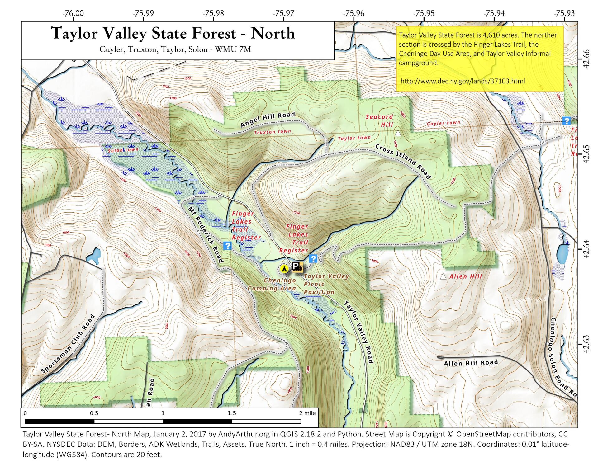
Taylor Valley State Forest (Cortland #2), formerly known as Seacord Hill, encompasses 4,638 acres and is located in the towns of Cuyler, Solon, Taylor, and Truxton in the middle of Cortland County. It is a popular area for family based recreational activities such as hunting, hiking, snowmobiling, bird watching, nature viewing, picnicking and camping.
The Chinango Day Use and Camping Area are also located in the forest and provide many users with a rustic environment in which they can experience the joys of camping, picnicking, and getting back in touch with nature. The Day Use Area has a pavilion with two picnic tables as well as three barbeque pits. The Camping Area, located across the road from the Day Use Area, provides primitive drive-up camping opportunities.
http://www.dec.ny.gov/lands/37103.html
Maps and Interactives
Taylor Valley State Forest – North
Taylor Valley State Forest
... photos, maps and other content from from Taylor Valley State Forest.