Map: St. Regis Mountain Trail
Download a High Resolution JPEG Image of the St. Regis Mountain Trail or an Adobe Acrobat Printable PDF of the St. Regis Mountain Trail.

Bookmark my free Interactive GPS Map for your phone:
https://andyarthur.org/ny
... shows your location as a blue dot in relationship to campsites, trails, state land. This online map requires cell service, won't work in remote country, so also bring a paper map.
Free Download of New & Historical USGS 1:24k Topograpic Maps
Interactive maps with backcountry and roadside camping: New York, Pennsylvania, West Virginia & Vermont. List of NYS DEC Lean-Tos and Firetowers.
Google Spreadsheet with Roadside, Primitive and Pay Campsites
More about Saint Regis Mountain...
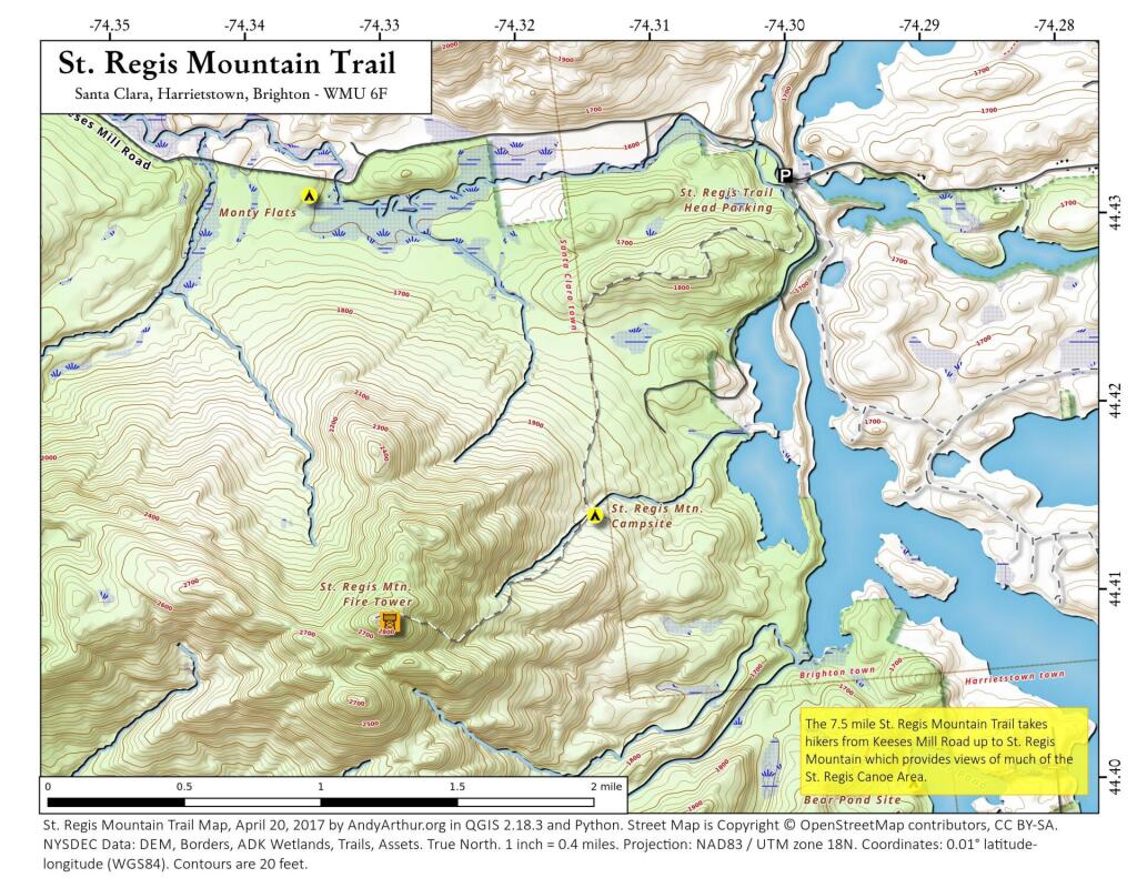
Follow Rte. 30 to Paul Smiths. Just north of the intersection of Rtes. 30 & 86 in Paul Smiths, turn onto the Keese Mills Road. The trailhead is located approximately 2.5 miles down the Keese Mills Road. This is a popular hike through a mixed hardwood forest to a south-facing rocky summit and an abandoned fire tower. The summit views encompass myriad lakes and the distant High Peaks.
5 miles including return trip... moderately difficult.
... photos, maps and other content from from Saint Regis Canoe Area.