Map: Spruce Mountain Trail
Download a High Resolution JPEG Image of the Spruce Mountain Trail or an Adobe Acrobat Printable PDF of the Spruce Mountain Trail.

Bookmark my free Interactive GPS Map for your phone:
https://andyarthur.org/ny
... shows your location as a blue dot in relationship to campsites, trails, state land. This online map requires cell service, won't work in remote country, so also bring a paper map.
Free Download of New & Historical USGS 1:24k Topograpic Maps
Interactive maps with backcountry and roadside camping: New York, Pennsylvania, West Virginia & Vermont. List of NYS DEC Lean-Tos and Firetowers.
Google Spreadsheet with Roadside, Primitive and Pay Campsites
More about Spruce Mountain Fire Tower...
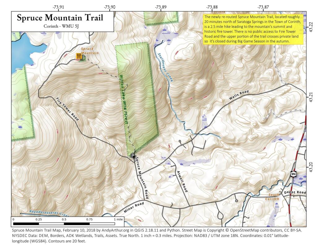
Spruce Mountain's rehabilitated fire tower and new trail in the town of Corinth, Saratoga County are open for public use, Department of Environmental Conservation (DEC) Acting Commissioner Marc Gerstman announced today. From the top of the 5 ½ story fire tower, the public can enjoy views of Vermont, Gore Mountain and the southern Adirondacks. The 2.4-mile round-trip trail traverses through wooded gentle terrain with an elevation change of approximately 1,000 feet.
http://www.dec.ny.gov/press/103635.html
... photos, maps and other content from from Spruce Mountain Fire Tower.