Map: Split Rock Wild Forest
Download a High Resolution JPEG Image of the Split Rock Wild Forest or an Adobe Acrobat Printable PDF of the Split Rock Wild Forest.

Bookmark my free Interactive GPS Map for your phone:
https://andyarthur.org/ny
... shows your location as a blue dot in relationship to campsites, trails, state land. This online map requires cell service, won't work in remote country, so also bring a paper map.
Free Download of New & Historical USGS 1:24k Topograpic Maps
Interactive maps with backcountry and roadside camping: New York, Pennsylvania, West Virginia & Vermont. List of NYS DEC Lean-Tos and Firetowers.
Google Spreadsheet with Roadside, Primitive and Pay Campsites
More about Split Rock Wild Forest...
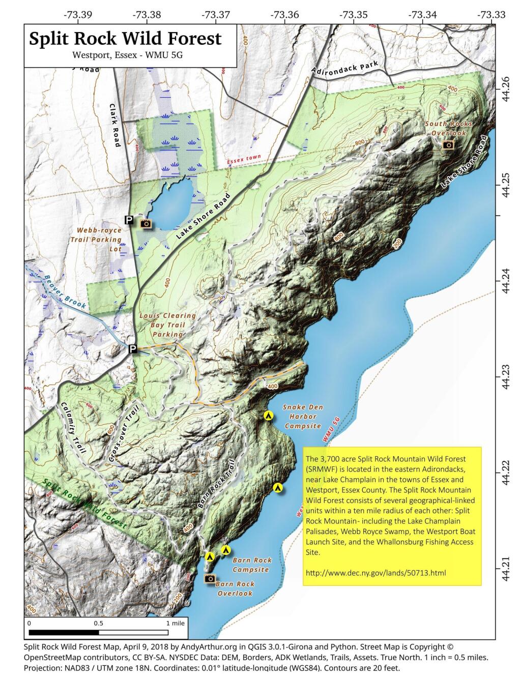
The 3,700-acre Split Rock Wild Forest is part of the Adirondack Forest Preserve. Located in the eastern foothills of the Adirondack Mountains along the shore of Lake Champlain, it comprises the largest tract of undeveloped Lake Champlain shoreline in New York.
The wild forest is named for Split Rock Mountain, the main feature of the area. The Lake Champlain Palisades and Webb Royce Swamp are within its boundaries. The trail system provides many scenic views of Lake Champlain and the Green Mountains of Vermont. The Westport Boat Launch Site, located in the Hammond Pond Wild Forest, is the nearest location to launch on the lake and access the shoreline campsites on Split Rock Wild Forest.
http://www.dec.ny.gov/lands/50713.html
Maps and Interactives
Split Rock Wild Forest
Split Rock Point
... photos, maps and other content from from Split Rock Wild Forest.