Map: Smith Road
Download a High Resolution JPEG Image of the Smith Road or an Adobe Acrobat Printable PDF of the Smith Road.

Bookmark my free Interactive GPS Map for your phone:
https://andyarthur.org/ny
... shows your location as a blue dot in relationship to campsites, trails, state land. This online map requires cell service, won't work in remote country, so also bring a paper map.
Free Download of New & Historical USGS 1:24k Topograpic Maps
Interactive maps with backcountry and roadside camping: New York, Pennsylvania, West Virginia & Vermont. List of NYS DEC Lean-Tos and Firetowers.
Google Spreadsheet with Roadside, Primitive and Pay Campsites
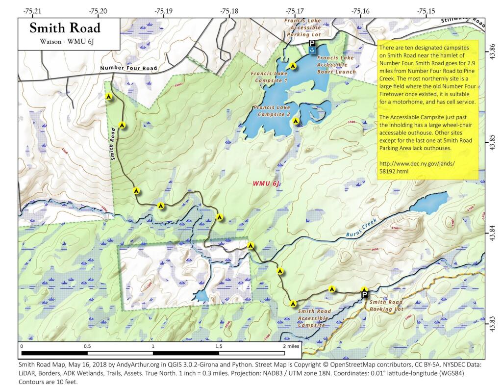
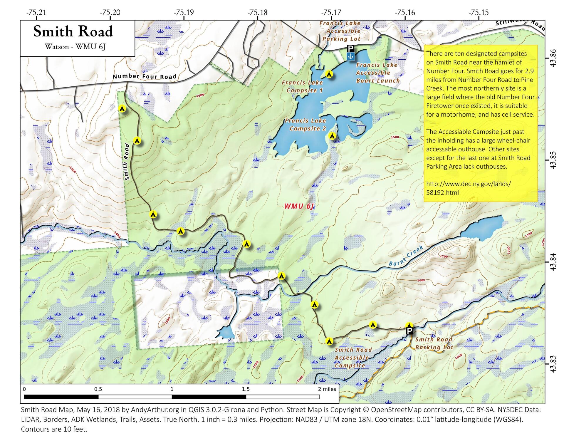
More about Smith Road...
Smith Road is the closest road to Lowville in the Independence River Wild Forest, and is 12 miles east of Watson on Number Four Road. Offers roadside camping over 4 miles of road that wander through the Independence River Wild Forest. The first campsite, which is located at the site of the former ranger's cabin and firetower (both relocated to the Lowville Demostration Forest), offers cellphone service, in an open field setting. Other campsites along the road are heavily wooded.
... photos, maps and other content from from Smith Road.