Search Results for: map sly pond

Sly Pond

The remote Sly Pond is one of the highest bodies of water in Adirondack Park at an elevation of 2,872 feet. It was once infamous for being a marker of how acidic Adirondack lakes had become by the eighties, with the DEC recording in 1980 the pond having an acidity of 3.54 which is about as "acidic as a dill pickle".

https://www.upi.com/Archives/1981/05/10/Acid-rain-damages-are-reported-in-Northeast-Canada-Far-WestNEWLNNew-York-suit-tries-to-prove-source-was-Midwest-plants/1857358315200/

Warren Generating Station 1993

Warren Generating power station is a retired 84-megawatt (MW) coal-fired power station in Warren, the state of Pennsylvania, United States.

The current use of the Site includes the Warren Combustion Turbine (CT) facility owned by Warren Generation LLC.  The CT is a 57-megawatt natural gas- and distillate fuel oil-fired electric generating station, which consists of one operational simple-cycle CT and ancillary equipment and systems. Fuel for the CT is delivered by pipeline (natural gas) and tanker truck (oil). 

The Site previously had housed two coal-fired 42-megawatt steam electric generation units (Units 1 and 2), which were installed in 1948 and 1949, respectively, and retired in September 2002. Since the units’ retirement in 2002, all coal has been removed from the Site. 

Historically two on-site landfills were utilized: the North Disposal area, located northwest of the power generation facilities, was closed in 1984 via capping with native soils; and the South Disposal area, located west of the power generation facilities, was closed 2003 via capping with native soils. Waste materials placed in these landfills consisted of fly ash, bottom ash, and pyrites.  The South Disposal Area was operated under Solid Waste Permit No. 300858.  The Ash Pond Nos. 1 & 2 were closed in 2002-200 3. 

https://www.dep.pa.gov/About/Regional/NorthwestRegion/Community-Information/Pages/Warren-Generating-Station.aspx

Site Map

🌲🌲 Our Public Lands 🌳🌲

Interactive maps with backcountry and roadside camping: New York, Pennsylvania, West Virginia & Vermont.
List of NYS DEC Lean-Tos with map coordinates. List of NYS DEC Firetowers with map coordinates and more information.
Google Spreadsheet with Roadside, Primitive and Pay Campsites

Explore the Finger Lakes Trail, Long Path, Northville-Placid Trail and Long Trail/Appalachian in Vermont.
Catskill Park Mountain Peaks, Hudson Valley & Long Island Peaks, Peaks Over 3000 ft Elevation, Highest Peaks in Adirondacks, Interactive Map of All Named Summits in NYS, Blaze Colors in Catskill Park, Trailhead Parking Coordinates and Addresses in the Catskills.

Browse USGS Topo Quads as PDF πŸ†• by State Lands or County. You can Bulk Download New & Old USGS Topograpic Maps.

Links to various NY State Land Websites πŸ†•. Get latest GIS Data from state Web Services.

β›ΊπŸŒ² Camp πŸŒ²πŸ•

Moose River PlainsCampsite Listing, Maps and photos of state’s largest free camping area.
Piseco-Powley RoadCampsite Listing, Maps and photos of 15 mile dirt road with camping.
Catskill Park Primitive CampsitesAn overview of free camping locations in Catskill Park.
Burnt-Rossman Forest, Cattaraugus County, East Branch Sacandaga River, Finger Lakes National Forest, Madison County, Pennsylvania, Vermont and West Virigina.

Campsite Coordinates for Bog River Flow / Lows Lake, Hudson River SMA (Buttermilk Falls), Lake Lila, Oswegathie River, Nine-Corner Lake, Pharaoh Lake Wilderness, Saranac River Campsites, Stillwater Lake, Schoharie County, and Sugar Hill State Forest.

Overview of Camping Areas in the Catskills, Green Mountains, Southern Adirondacks, Central Adirondacks, Northern Adirondacks, Allegheny National Forest and Penna. DCNR Motorized Campsites and the Monongahela National Forest West Virginia.

Free Campsite Overview Maps: Adirondack – North Country, Catskills, Central NY, Finger Lakes, Western NY. Interactive Map.

Places I camped in 2023, 2022, 2021 and 2020.

🏞 πŸ›Ή Bicycle Trails and “Blackie” My Mountain Bike 🚲 🚢

Finally bought a mountain bike, after chewing over a mountain vs commuter bike. Really enjoying riding my bike to work and when it rains there is always a bike rack to safely take it back home. One way to get to adventures at Thacher Park is the Nature Bus.

Empire Trail – KMZ and Interactive Map. Parking along it.

More Trailways with KMZ files including the Albany County Rail Trail, Black Diamond Trail, Catharine Valley Trail, Catskill Scenic Trail, Fonda, Johnstown & Gloversville Rail Trail, Genesee Valley Trail, Link Trail.

🦌🌲 Hunt πŸ¦ƒπŸΏ

Wildlife Management Units (Deer)KMZ Map shows the WMU boundaries.

Summer 2019 Aerial Photographs of WMUs

KMZ Maps of Deer Harvest Density by Town: 2019, 2018, 2017, 2016. By WMU 2017, 2016, 2015.

KMZ Maps of Buck Harvest Density by Town: 2019, 2018, 2017, 2016. By WMU 2017, 2016

2016 -2019 Deer and Buck Harvest by TownKMZ Spreadsheet with FIPS codes for making your own calculations.

🎣🐑 Fish 🐟🐠

Parking and Access to Trout StreamsAn interactive, downloadable KMZ Map.
Lakes with DEC Contour MapsA KMZ Map links to Contour Maps for Fishing.

πŸŒ¨πŸ” Sled & Wheel πŸš™β„

State Truck Trails Over A Half MileDirt roads to explore in the backcountry.
NYS Statewide Snowmobile Trail SystemState trails on public and private lands.

πŸ“‰πŸ“Š Learn πŸ’΅πŸ“ˆ

Interactive Maps of NY CensusExplore and download KML files.
Charts and Interactive DiagramsFrom population to pollution control.
Andy Arthur GitHubGit my R and Python scripts used to make maps and diagrams.
Use ArcPullR to Get Geospatial DataSuper easy way to connect to get GIS data in R from government servers.
GDAL Opens E00 FilesMost open source programs nowadays can open common geospatial formats.
NY Building FootprintsWhere to find on the internet for making maps.
WMS and ArcMap ServicesDownloadable CSV file listing services used on the blog.
2022 US Census Population EstimatesRed states, south continue to gain population.
2020 Cartogram of State Population

πŸ’³ πŸ› Property Taxes πŸ πŸ’Έ

Properties in Albany Pine Bush Study Area, Excel Files: Various Tax Rolls, Find coordinates and political districts, Look Up State Tax Records and a Script for Processing RPTL 1520 PDFs. Match NY SWIS Codes to FIPS Codes and GEOID

πŸš—πŸš— Big Red πŸš—πŸš—

Big RedPhotos and Videos of my lifted truck with its camper shell. Big Red’s Dual Battery Setup for Camp Power, Video Tour and Diagram. Big Red is getting old. What is next? I’ve thought about going carless for a while to save money and reduce pollution. Or maybe going bigger? Or smaller? Five dollar gas sucks.

πŸ”₯🌲 Off-Grid Living 🏠🀠

I am seriously thinking about building an off-grid house. I have a first draft. I need to learn CAD! I have a road map towards buying land and building. I concede might have to live with long commute and give up traveling and camping. I need to be strong.

Why off grid? Well, I’m not into contemporary society. I want to own land, but not be called a landowner, and a cabin, not hooked to electrical grid, farm, raise pigs for food and burn my own trash. I’m saving for a better tomorrow, hoping to make the leap to another freer state. Having acreage is important. Cornfields aren’t bad neighbors. Maybe though my vision has grown smaller and more local. More on off-grid living.

I am 16 years into my career and have made some significant progress in my life. I love my job. But I do wonder on all the things I’m missing out but saving sure makes me high. Maybe it will be different when I own my own land — the end of goal of all this saving.

2020 into 2021 during the pandemic was a year of remote work. It was a struggle not having internet at home, worked a lot out of my truck. But I worked remotely from Horseshoe Lake which was super cool.

Generally I like the idea of owning land in a red state, particularly Idaho, Iowa, Pennsylvania, West Virginia, Wisconsin — and Midwest more generally. But I may settle for New York – it’s all about the f-ing money!

πŸ’»πŸ‘¨β€πŸ’» Open Source πŸ—ΊοΈπŸ“

I use open source software and public sources of data for the blog. Quantum GIS (QGIS), GDAL/ogr2ogr, PyQGIS, GeoPANDAS, R Studio and Leaflet for map making, Arduino and ESP32 microprocessors, Ubuntu Linux and XFCE Window Manager. I’ve recently gotten interested in machine learning.

I avoid using commercial software like Microsoft Windows and do not have home internet or television. If you don’t use commercial software and use your brain, fears of computer viruses are overblown. I deleted most of my social media accounts.

Creating Digital Surface Models using LiDAR Point Clouds.

πŸ“ŠπŸ—Ί R Statistical Programming πŸ“œπŸ‘¨β€πŸ«

The R programming language and RStudio are powerful tools for statistical analysis, making maps and charts. Many of the blog posts and analysis I do are in R, ggplot not only makes great charts but also maps using tidycensus. Generally, R is better then Python for geospatial work.

Use IDW Interpolation to fill in missing Census data, Zonal Histograms for land cover, load WMS Aerial Photography in R, find mountain peaks, save Census shapefiles using tigris quickly, pull NY Election Night Results using Selenium. Fast reverse Geocoding in PostGIS. Working with PDFs in R. Fix a common error starting rselenium/wdman. Make data-filled calendars. R is wonderful and weird, learn it!

πŸΌπŸ”’ Python and Pandas πŸ’»πŸ

Querying state property database, political enrollments, PL 94-171 Census files, calculating population statistics, what address is a district in, converting old districts to new districts, Shapefiles missing Projection information in QGIS.

Learn to code for free modern HTML, Javascript, Python and SQL at freeCodeCamp and web development at the Odin Project.

🐴 🐘 Politics 🦁 🐍

Crunched Election Results with Turnout for Albany County: November 2023, 2022, 2021, 2020, 2019 and Primaries June 2019, Pres/June 2020, June 2021, June 2022, Aug 2022, June 2023.

Albany County Races converted to the new 2023 EDs using Super EDs and Code: 2022, 2021, 2020, 2019 and Primaries June 2019, Pres/June 2020, June 2021, June 2022, Aug 2022.

Above Election Results as zipped Excel files.

Albany County Legislature Districts 2024 Maps

Maps Comparing 2017 and 2023 Albany County Election Districts and a Crosswalk Table Showing the Proposition of Voting Age Population in New and Old EDs

Maps of 2022 NYC Assembly Races, NYS Assembly Races, NY Senate Races, Governor’s Race in Erie County and Statewide. Partisan shift in governor race between 2010 and 2018.

A comparison of Democratic Performance 2022 Assembly Districts to those proposed in 2023 by the IRC. Here is latest 4/20/23 IRC Maps, showing ADP and how they change from existing Assembly districts. Most towns upstate, outside of cities, are quite red. Using LATFOR data with R to calculate Average Democratic Performance.

You can scrape employee salary data from SeeThroughNY using R. Other useful investigative resources.

I often think politics is for losers. I’m into the politics of statistical analysis and reading history books.

I believe strongly in the first amendment, second amendment, oppose gun restrictions and I support de-funding the police in favor of lower-cost technology and civilian employees. Maybe use red flag laws for voting to stop dangerous voters? And the media should stop promoting mass-shootings, even if it’s super profitable for all involved. They should tax the media when it promotes violence. I think some people are much too paranoid in politics. How elections are rigged under law to benefit incumbents. But vote, it’s the best option and inexpensive.

Yeah for the third parties! I voted for Larry Sharpe for Governor and Jo Jergenson for President but my views are complicated and often vote for Democrats, after voting Jill Stein Green Party in 2016.

Generally, I think Biden has been a good change over DJT and glad the Trump era is over and are glad prosecutors and grand jurors are holding him responsible by indicting him for many serious felonies. I don’t think Trump can win in 2024, as nothing has changed politically from 2020.

I think rural people should be left alone and not worship government workers or have parades for them. I am no fan of Donald Trump, his speeches are bad, I don’t like Trump’s embrace of radical environmentalists, but do admire the homemade roadside monuments to DJT.

I don’t toke. But whatever. There are too many transit authorities.

🌲🌳The Earth 🌎 🐸

Why I oppose wilderness areas and parks. It’s trendy to be green these days, but is eco-marketing good for the planet? I visited the Mount Storm Coal Plant and Corridor H.

I worry about a lot about overly-aggressive Climate Change Action, and Undermining Environment Laws for Climate Action. I think we should all admit we are Addicted to Fossil Fuels. These days, urban recycling has become a joke, when it’s still an option at all. It’s better to just buy less shit and avoid the alure of Costcos. I really don’t like how aging radicals have become industrial solar salespeople.

Big bucks are coming to state-designated disadvantaged communities under the CLCP. Which counties and political districts are in line for the the most pork? Interactive map.

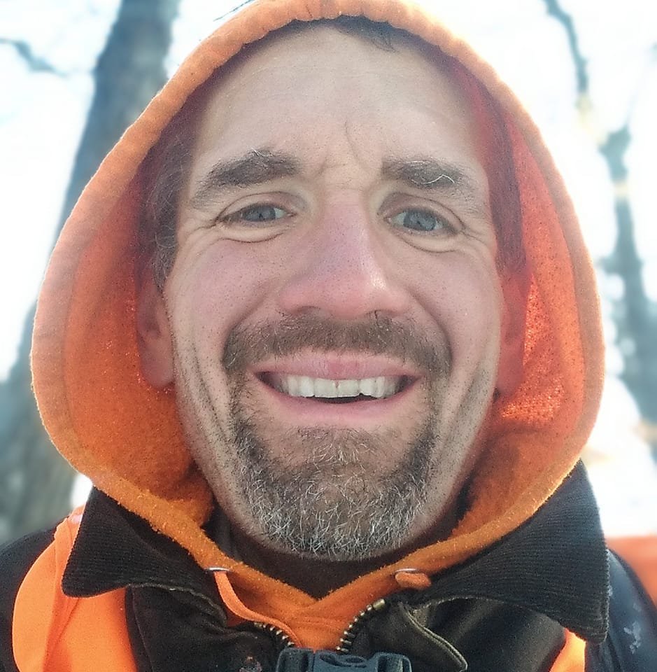
I’m a big of farmers who are essentially Living Off the Earth and think Rednecks are Noble Savages. Dairy Farming are key to our rural landscape. I’d trust a farmer or a hunter in a pile of guts he’s butchered over any ivory-tower scientist.

πŸŒŽπŸ”† Industrial Solar 🌞 🏭

Hundreds of multi-acre industrial solar farms are being built in our state. How bad is solar for the environment? We should ask tough questions. Interactive of recently built solar farms, proposed facilities. List of proposed industrial solar facilities. See how the Greenville Solar Farm changed the landscape.

πŸ’³ πŸ’ΈSaving Money πŸ’° πŸ’·

I am not a fan of ESG Investing as it’s not well diversified. I prefer index-funds and other tax-advantaged ways of saving. Why I am concerned about saving enough for retirement, even though I’m in my late 30s. We as a nation should save more, consume less. I like the idea of carbon tax to replace capital gains taxes to discourage consumption.

πŸ₯¦ 🍎Mission Fifty & Being Healthier 🏠🧠

I am now officially in my 40s! I am building to a better life in my 50s, which means getting up early, walking a lot, saying no to cake and yes to more fruit. In many ways, the forties are an awesome time to be alive.

And eating healthy for less without losing sleep over arsenic. And I don’t think we should subsidize unhealthy habits. How I got started in eating healther. Meals are too focused on meat and carbs due to how we describe them, maybe I eat too many bananas in the office, what to eat while camping, worry more about salt then GMOs, eat more beans. Do spend extra for farmers market peaches, especially doughnut peaches and plums. Consider ethnic supermarkets. Thinking about how to make a healthier macaroni and cheese, spinach-mackeral-pasta salad, quick-cook biscuits and whole-wheat bread. That said, too many recipes are junk food crap. Okay in moderation is not okay. The fact that I’m thinner is not a sign I’m dying.

A few years back I decided to explore my mental illness with therapy, thinking about why I have so much anxiety and how many of my values are rational or just thinking too much rednecks’ burn barrels and how much of a throwaway society we live in. Do I want to change?

I’ve learned to care less about the world, and focus more on myself. Maybe I am happier as I am now, saving and investing a lot towards owning my own land, where I don’t have to deal with all the bullshit of modern life.

Mission Fifty: Getting to the point where I own my own land. 🚜
Healthy Eating 🍎 / Growing My Wealth πŸ’°
Healthy Thoughts πŸ’­ / Enjoying Life πŸ˜ƒ

Questions, comments? Feel free to email me at andy@andyarthur.org.

You do your thing, I’ll do mine.

I use GNU open source software.
Plus I like buck goats,
because they’re real macho men
spraying their beards with goat urine.

March is upon us. Get out, enjoy it, be safe with fire and burning shit, and remember soon enough black flies are waiting.” – Andy Arthur

Return to the Top

Laugh a bit and learn how your data is used on this blog: Privacy Policy

This blog is Β© Copyright 1997-2023 Andy Arthur.org, please share using the Creative Commons Attribution 3.0 License.

Categories:

Moose River Plains Maps (September 2011)

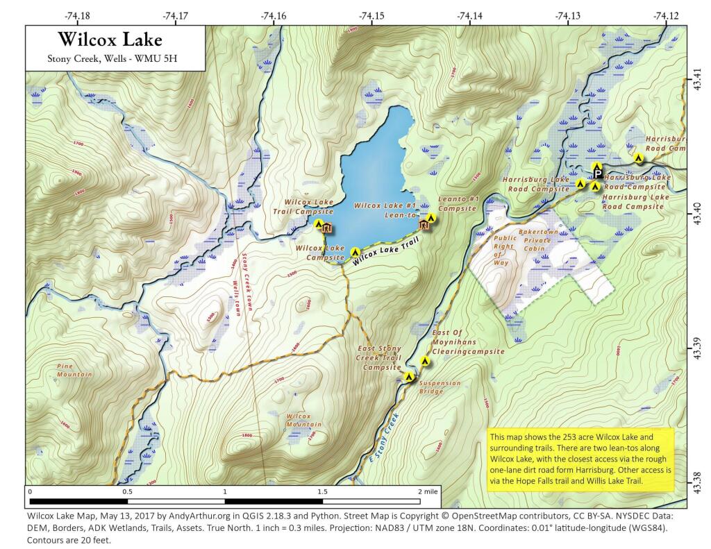
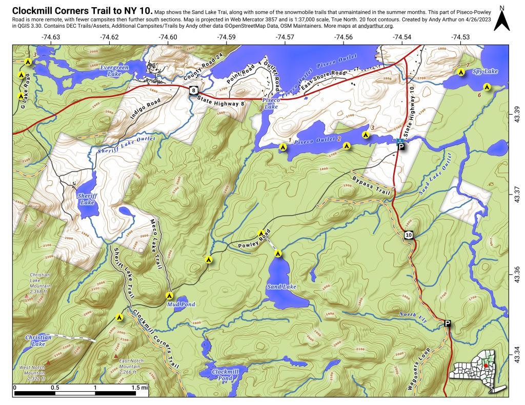
This past week, I decided to re-do the Moose River Plains Maps I had previously rendered in QGIS. I got some new data from the DEC, and wanted to simply the existing maps by taking off Wilderness Boundaries, and other details not of particular interest to hikers, campers, and kayakers. I also removed campsites that are in process of being removed or relocated under the finalized Unit Plan for the area. Be aware that the elevation on these maps is metric, as that’s what the NYSDOT Topographic Maps use in this region.

Click on any of the maps to display the high resolution version, that you can download and save, or print. Laser printers are great, especially for the Cedar River Flow Maps, as they’ll keep the ink from the running. All of these maps are free for you to use and distribute as they are based on public data. If you have ideas on how to improve these maps or seek similar maps of the area of other trails or locations, please feel free to contact me at andy@andyarthur.org.

There is no charge to camp here, however if you plan on staying more then 3 nights, you will have to a get a free permit from the forest ranger. Most campsites offer picnic tables, fireplaces or rings, and outhouses. Moose River Plains are all back country dirt roads, with a speed limit of 15 MPH, and there are some rough sections on the roads. As of September 2011, all of the roads shown on these maps are open.

Moose River Plains Camping Area.

Roads are red, hiking trails are black dotted lines on the map. All of the campsites in pink shaded area (“Moose River Plains Camping Area”) offer vehicle accessible camping including RVs and other tow-behind campers. The campsites outside of the “Camping Area” — specifically those on Otter Brook Road — will in the future be reserved for tent camping (most with vehicle accessability) except during Big Game Season when campers will be allowed at all sites. Most of the other trails with campsites on them offer wheelchair or mountain bike accessiability, as they tend to be gravel paths.

 Clouds Closing In On The Catskills

Moose River Plains Campsites.

Note: Campsites are numbered starting from the east, as you are coming from Cedar River Flow, heading towards Limekiln Lake. Many campsites have been closed or added over the year, and that’s why there are many gaps in the numbering system.

 Almost To Bus Stop

Beautiful day

 Summer Evening

muni-pop-percent

 Canastota Gorge

 Almost To Bus Stop

Cedar River Flow and Wakely Dam.

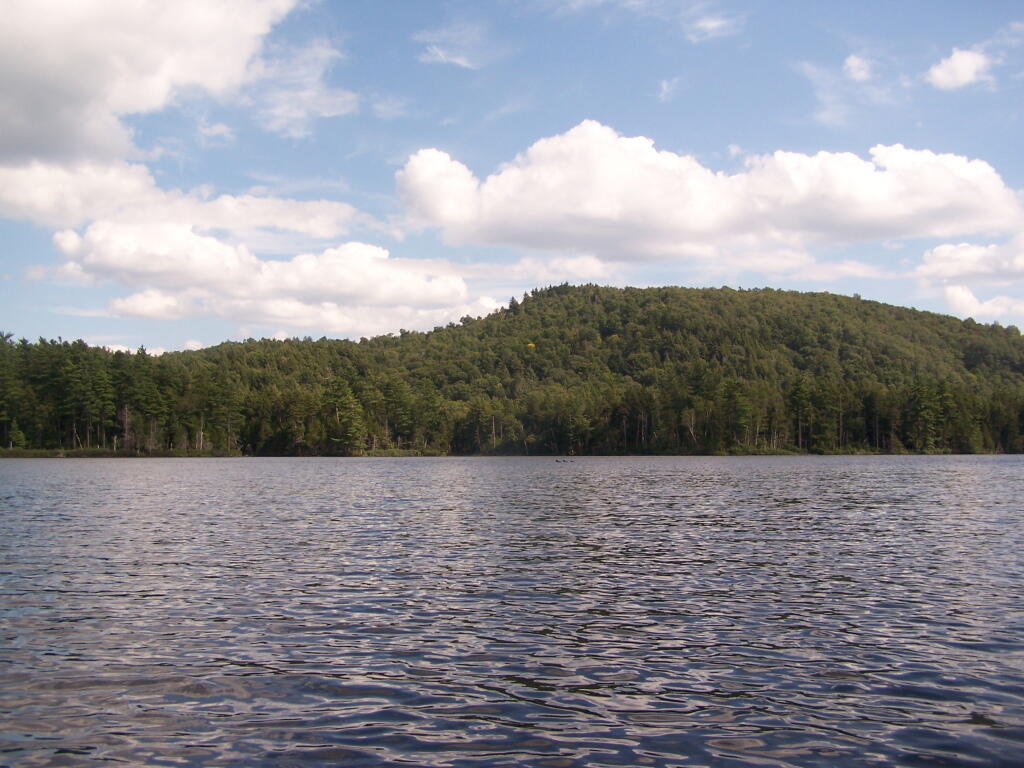
Cedar River Flow is a popular destination at Moose River Plains. In many ways it’s the gateway to Moose River Plains, as you reach Wakely Dam, which holds back the waters of Cedar River Flow as one of your first destinations heading West on Cedar River-Limekiln Lake Road from Indian Lake.

The Cedar River Flow is a popular lake for canoeing and kayaking. There are several designated and undesignated campsites along Cedar River Flow, with the designated ones shown on the map. There are also a handful of campsites, closely grouped together at Wakely Dam. The Cedar River is navigable for several miles upstream, and some people will paddle to the Lean-To on Sucker Brook Trail.

Cedar River-Limekiln Lake Road

 Winter

Wakely Pond and Wakely Dam Areas.

Along the Northville-Placid Trail near Wakely Pond there are several designated tent campsites. A map of Wakely Pond-Wakely Dam Areas, and the rapids downstream of the Cedar River Flow.

 Wilcox Lake

Wakely Mountain Firetower.

By far one of the most popular destinations in the area is the Wakely Mountain Fire Tower. It offers truly spectular views of Moose River Plains, Blue Ridge Wilderness, West Canada Wilderness, Fulton Chain of Lakes, and even the High Peaks.

Same-Sex Households by Congressional District

Other Popular Hikes.

 Blueberries

Duck

Clockmill Corners to NY 10

Kayaking Mountain Pond, Aug 14

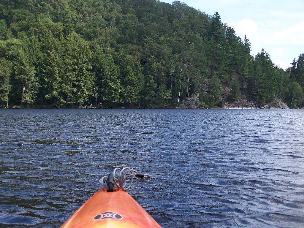
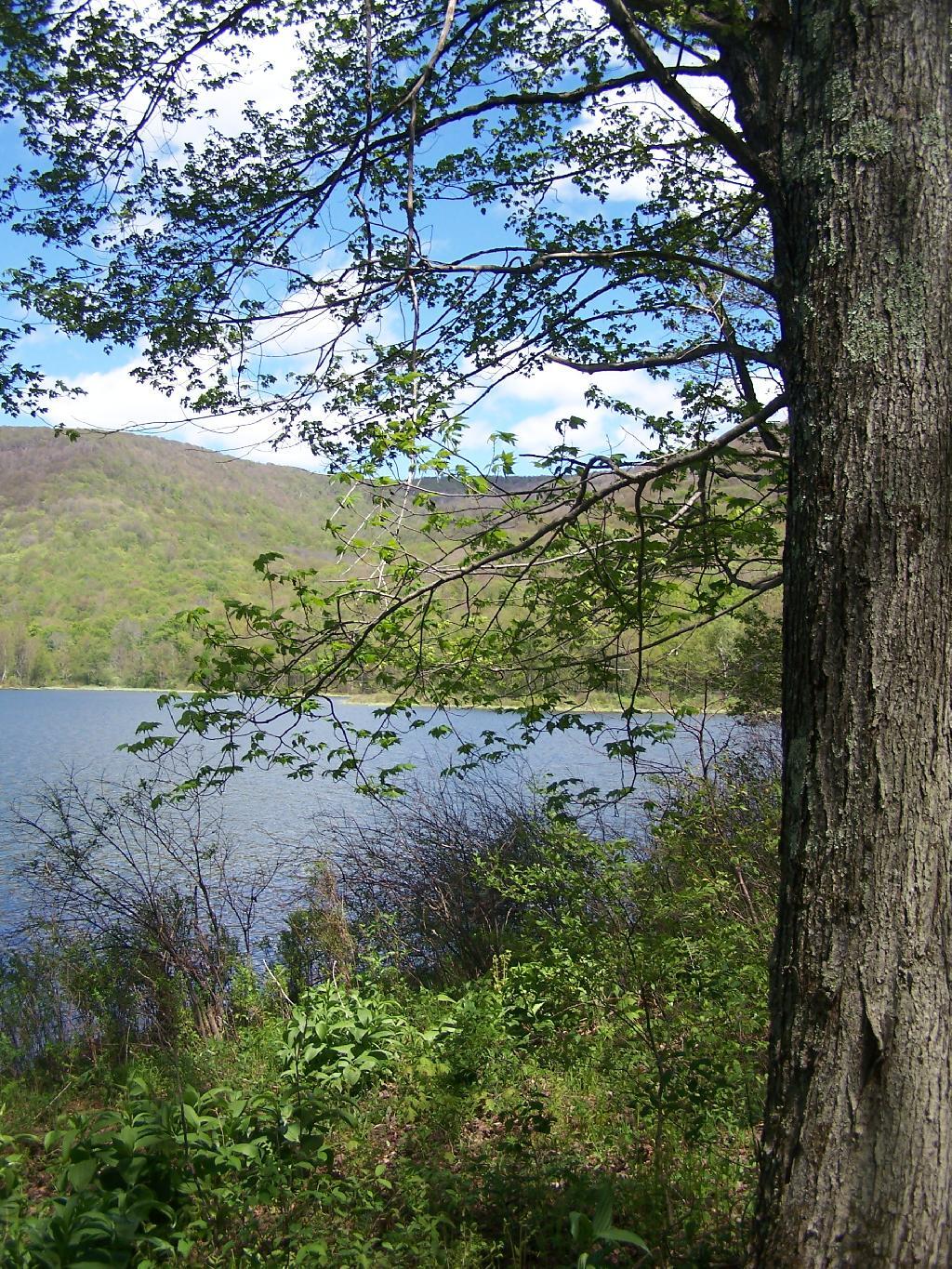
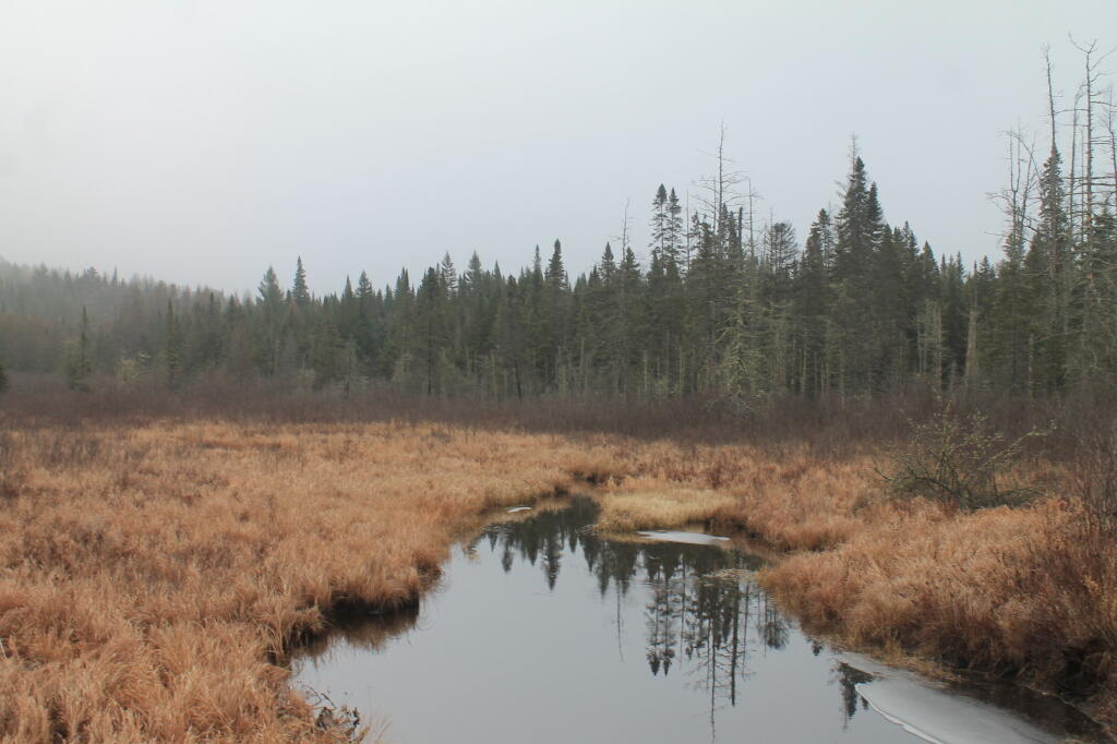
Mountain Pond is located about 2 miles North of Paul Smiths College on an old routing of NY 30. It is a mile long, has catch and release fishing, and good place for some solitude and flat water paddling. It is in Debar Mountain Wild Forest, with 2 large campsites on the pond, 3 smaller ones on or near the pond, and 10 other along Mountain Pond Road. It’s little used due to it’s remote location, and easy to even get one of the large sites on the lake on the weekends.

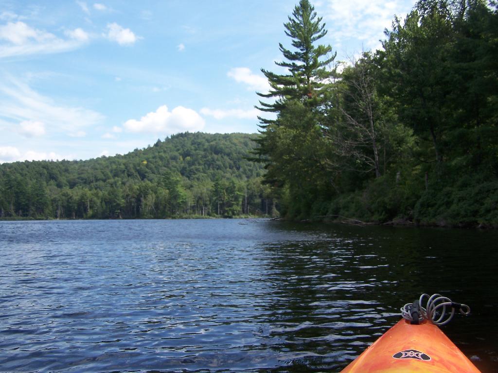
Paddling. Just paddling along Mountain Pond in the kayak.

Paddling

Tall Pine. Lining the edge of Mountain Pond, as I ride around in the kayak.

Tall Pine

Towards Jenkins Mountain. The last hill that makes up Jenkins Mountain is where Mountain Pond gets it’s name from.

Towards Jenkins Mountain

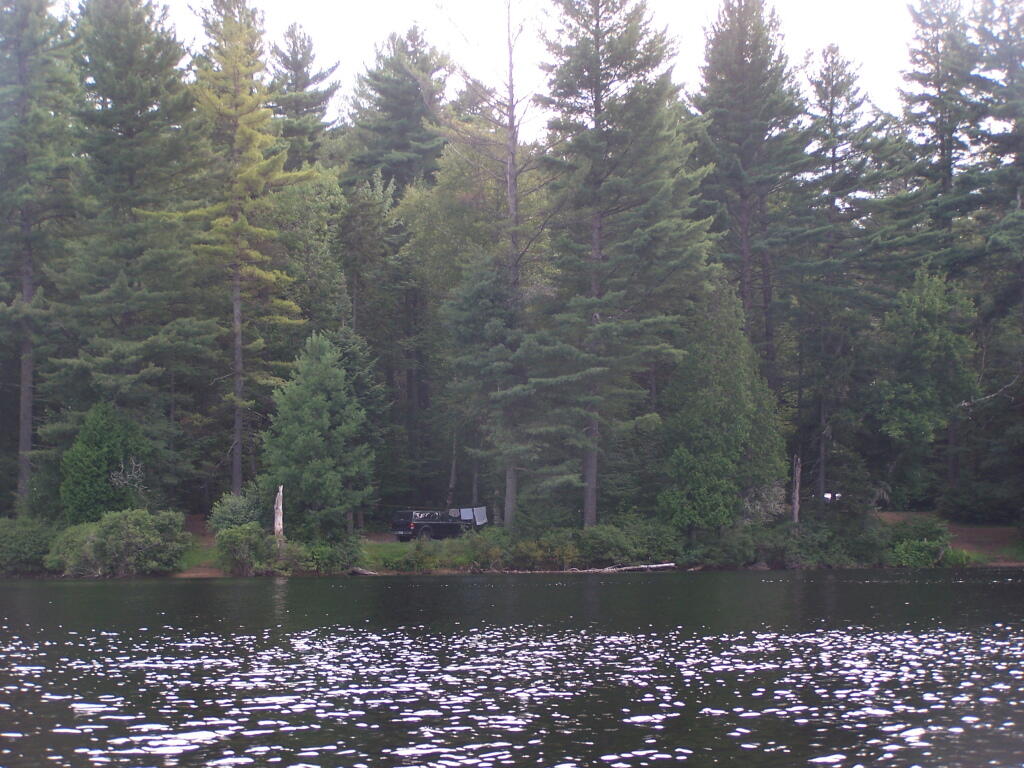
From Southern End of Mountain Pond. This is looking from Campsite 1 at the Southern End of Mountain Pond, looking North. Old NY 30 winds right along the shore of NY 30, the New Routing is about a 1/2 mile away for NY 30.

From Southern End of Mountain Pond

Campsite No 1. This is campsite No 1 at Mountain Pond. It was never used on the Saturday Night I was there, but it looks nice, if not a bit small.

Campsite No. 2

View from Campsite 1. Here my kayak is parked at Campsite 1, where I got out for a stretch. Looking south at this rather spectacular looking lake on a great day. The lake winds back and forth, for about a mile.

View from Campsite in Evening

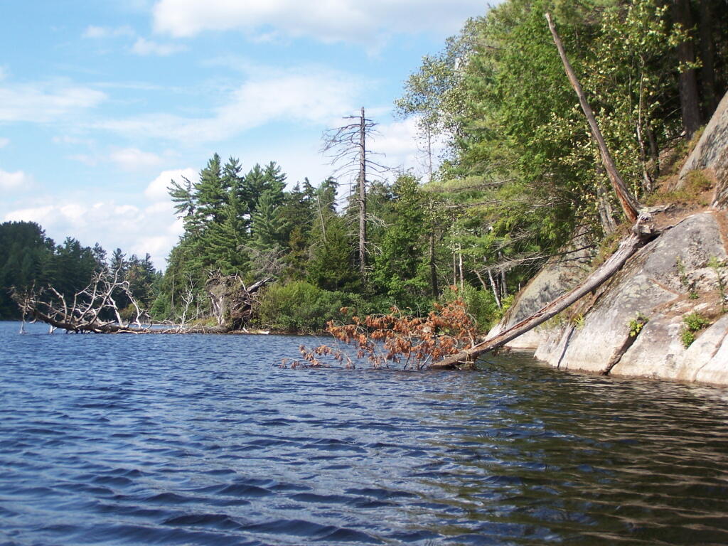
Along Edge of Pond. This is looking at the eastern, more mountainess shore of Mountain Pond.

Along Edge of Alder Pond

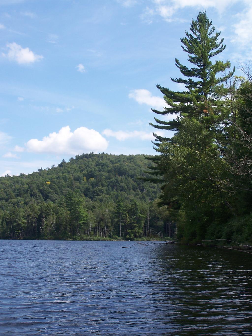
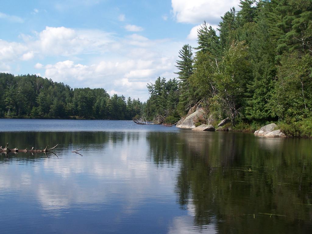
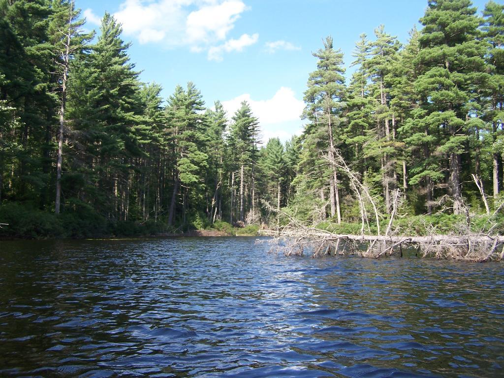
Central Part of Lake. On the left is the western shore, by where NY 30 runs. It is a beautiful, if not humongous lake with lots of shoreline and bys.

Central Part of Lake

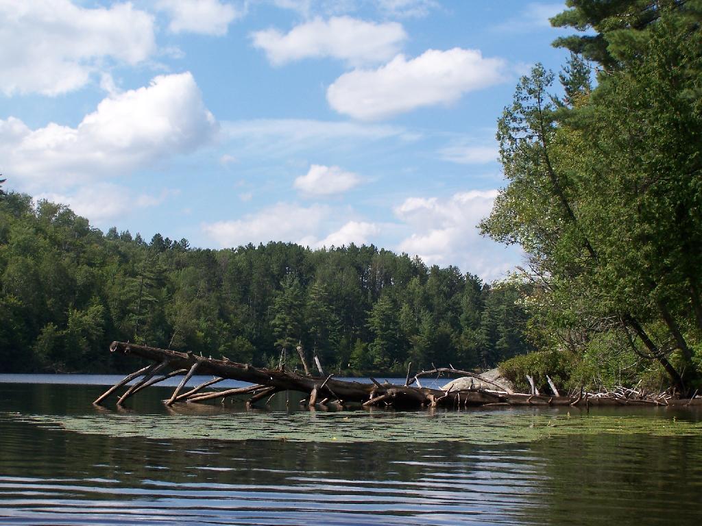
Many Downed Trees. There where many downed trees that had fallen into the lake, from the often steep eastern edge of mountain pond. Campsites are on the other side of the lake, and they all where in good shape.

Many Downed Trees

Northeastern Bay. Here is an Northeastern Bay at Mountain Pond. Not as pretty as farther south with the steep rock ledges against the lake, but still a classic Adirondack Lake.

Northeastern Bay

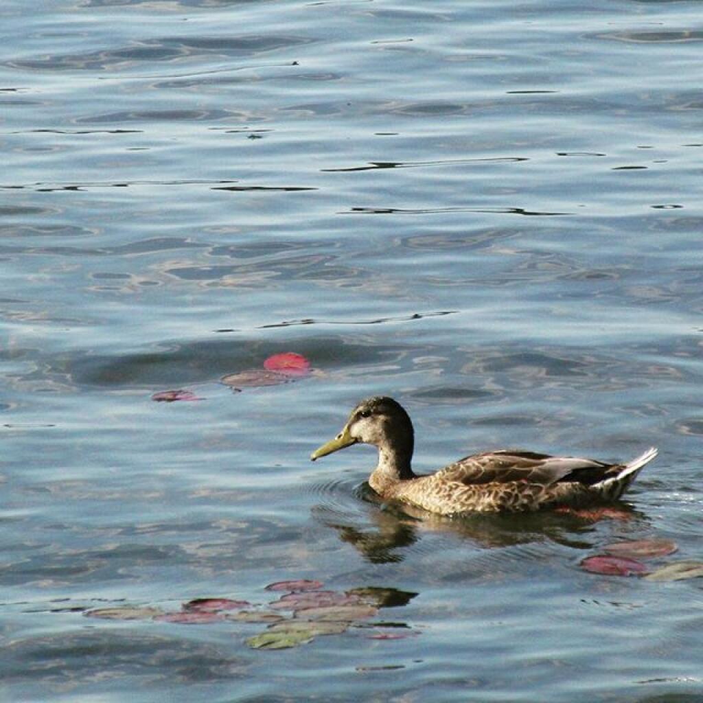
Loons. While this picture is somewhat in shadow, there where loons on Mountain Pond. They were not all that noisy, compared to Polliwog Pond or especially Mason Pond, where they howled quite bit more in the evening.

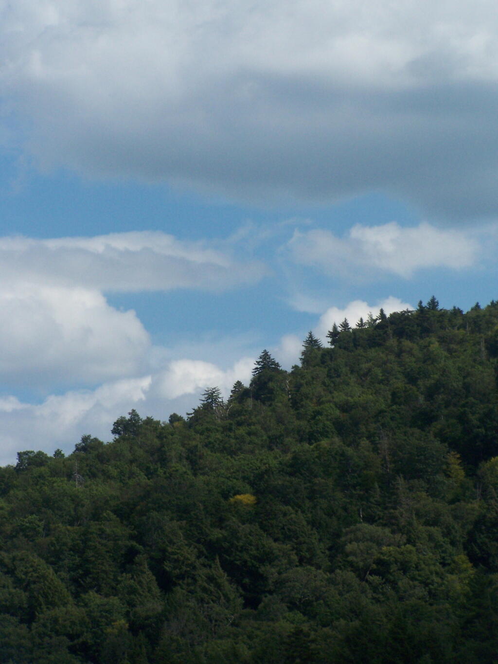
Mountain. This is the Mountain at Mountain Pond. It’s not much more then a hill, because Jenkins Mountain has largely petered out before reaching here, but it’s still a lot higher then surrounding elevation.

Mountain

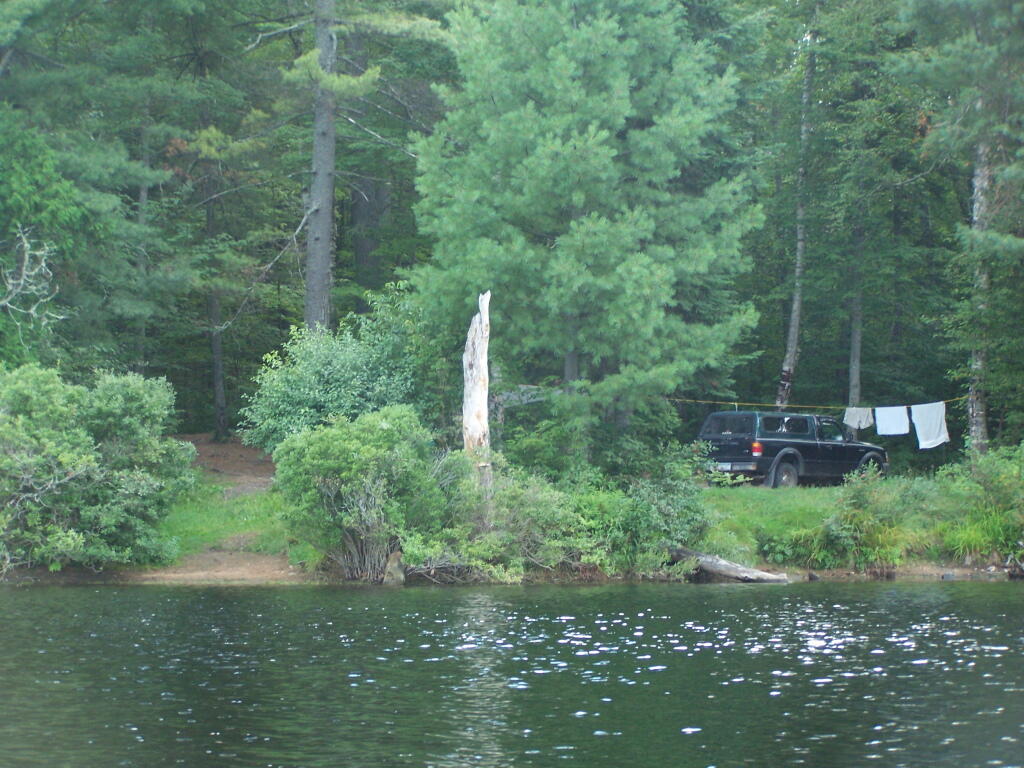
Campsites No 4 and No 5. As I had previously noted, Campsites 4 and 5 where pretty close to one an another. Nobody ended up staying at No 5, although somebody parked there for a while to go paddling.

Music

Treeline. This is the tree line towards the top of Mountain Pond, on this rather beautiful day for sure.

 Treeline

Campsite No 4. This was taken from the lake. It was great to be right on the lake, at this very remote Adirondack Pond.

Campsite No 4

Here is a map of the pond.

List of Addresses of Where the Long Path Crosses Roads

One of the challenges is to find places where the Long Path leaves the public roads. Using OpenStreetMap data I created a line intersection of the Long Path against public roads, then with some hand editing made sure only to include off-road trail sections when they meet public roads. Then I ran it against the state’s reverse geocoding service to add street addresses so you can use it with your phone or car GPS.

Street City ZIP lat lng
2824 Touareuna Rd Amsterdam 12010 42.9305966 -74.0868265
3699 W Glenville Rd Amsterdam 12010 42.9197609 -74.0783142
933 Hoffmans Hill Rd Schenectady 12302 42.9171703 -74.069787
699 Wolf Hollow Rd Schenectady 12302 42.9041371 -74.0744891
400 Mabie Ln Schenectady 12306 42.8584106 -74.0317499
119 Old Crawford Rd Schenectady 12306 42.8536279 -74.0250397
3001 Lower Gregg Rd Schenectady 12306 42.8465301 -74.029289
4632 Mariaville Rd Schenectady 12306 42.8231332 -74.0648912
294 Judith Ln Delanson 12053 42.8115677 -74.1163012
1442 Lake Rd Delanson 12053 42.8094393 -74.1284678
2535 Lake Rd Delanson 12053 42.8038552 -74.1438824
845 Bozenkill Rd Altamont 12009 42.7228851 -74.0888376
774 Bozenkill Rd Altamont 12009 42.7210610000358 -74.0833765001164
215 Old Stage Rd East Berne 12059 42.6814314 -74.0545106
5 Hailes Cave Rd Voorheesville 12186 42.6557304 -74.019139
649 Thacher Park Rd Voorheesville 12186 42.6489495 -74.0063475
150 Bush Dr East Berne 12059 42.6386064 -74.0150703
263 Treadlemire Rd Berne 12023 42.6291408 -74.2703397
292 Durfee Rd Middleburgh 12122 42.6273097 -74.2884482
197 Treadlemire Rd Berne 12023 42.6236946 -74.2741212
1050 Cotton Hill Rd Berne 12023 42.6212871 -74.2488514
96 Saw Mill Rd East Berne 12059 42.612683 -74.041551
121 Stage Rd East Berne 12059 42.604945 -74.0423173
182 Stage Rd East Berne 12059 42.603515 -74.046072
524 Helderberg Trl East Berne 12059 42.6032471 -74.0485744
619 Joslyn School Rd East Berne 12059 42.59829 -74.051772
1250 Canady Hill Rd Middleburgh 12122 42.5976577 -74.2377904
171 M T Path Middleburgh 12122 42.5976285 -74.3243928
792 Pleasant Valley Rd Warnerville 12187 42.5969852 -74.4358042
164 Irish Hill Rd East Berne 12059 42.5967723 -74.1111937
268 Lawton Hollow Rd Berne 12023 42.5954718 -74.2318034
617 Cole Hill Rd East Berne 12059 42.59463 -74.0951211
21 Irish Hill Rd East Berne 12059 42.5936846 -74.1061466
106 Mullberry Ln Middleburgh 12122 42.5904363 -74.3507145
3984 State Route 30 Middleburgh 12122 42.5889397 -74.3616479
313 Willsie Rd East Berne 12059 42.5878654 -74.1074344
620 Woodstock Rd Westerlo 12193 42.5864761 -74.0667513
3671 State Route 30 Middleburgh 12122 42.5848137 -74.3898311
304 Mallon Rd Warnerville 12187 42.5836864 -74.4368558
765 Bradt Hollow Rd Berne 12023 42.5826143 -74.20655
705 Patria Rd Warnerville 12187 42.5792491 -74.4468548
824 Gifford Hollow Rd Berne 12023 42.5769462 -74.1226055
467 High Point Rd Middleburgh 12122 42.5767564 -74.2104551
797 Gifford Hollow Rd Berne 12023 42.5741187 -74.1400203
761 Gifford Hollow Rd Berne 12023 42.5716012 -74.1344628
74 Beaver Rd Berne 12023 42.5678925 -74.1759941
467 High Point Rd Middleburgh 12122 42.5669749 -74.2029449
131 Patria Rd Warnerville 12187 42.5651591 -74.4613942
74 Beaver Rd Berne 12023 42.5648224 -74.1827641
854 Sickle Hill Rd Berne 12023 42.5619996991664 -74.1654766243059
484 Ravine Rd Berne 12023 42.5617094 -74.1512759
1233 Sawyer Hollow Rd Richmondville 12149 42.5589555 -74.4869896
766 Rossman Hill Rd West Fulton 12194 42.5510553 -74.4913793
1458 Burnt Hill Rd West Fulton 12194 42.5374204 -74.4819581
162 Huckleberry Kingdom Rd West Fulton 12194 42.5303225 -74.4777372
739 Cole Hollow Rd West Fulton 12194 42.518244 -74.4800406
116 Duck Pond Rd West Fulton 12194 42.5071693 -74.4829103
1632 Westkill Rd North Blenheim 12131 42.4851592 -74.4845538
1819 Westkill Rd Summit 12175 42.4779248 -74.4619016
1942 Westkill Rd North Blenheim 12131 42.4722731 -74.4551777
137 Creamery Rd North Blenheim 12131 42.4710068 -74.4605158
1670 State Route 30 North Blenheim 12131 42.4665802 -74.461879
1022 State Route 30 Gilboa 12076 42.4292935 -74.4724883
382 Stryker Rd Gilboa 12076 42.4136072 -74.4633121
214 Champlin Rd Gilboa 12076 42.3801688 -74.3755645
1022 Cunningham Rd Durham 12422 42.375758 -74.232817
6 Cunningham Rd Windham 12496 42.3751153999999 -74.2326722
698 S Mountain Rd Gilboa 12076 42.3737269 -74.3152619
937 Cunningham Rd Durham 12422 42.37314 -74.223946
277 Bluebird Rd Gilboa 12076 42.3702253 -74.2873087
283 Pangman Rd Gilboa 12076 42.369517 -74.4174038
295 Bluebird Rd Gilboa 12076 42.3685677 -74.2893322
124 Jennie Notch Rd Hensonville 12439 42.3289038 -74.1881716
530 Old Rd Hensonville 12439 42.320343 -74.187498
3 Cross Rd Windham 12496 42.3128558 -74.1898532
3622 Route 23A Palenville 12463 42.1768042 -74.036803
3664 Route 23A Palenville 12463 42.1766161 -74.0374648
3667 Route 23A Palenville 12463 42.1764158 -74.0369105
3525 Route 23A Palenville 12463 42.1761367 -74.0305116
414 Malden Ave Palenville 12463 42.1751342 -74.0314163
327 Malden Ave Palenville 12463 42.1740101 -74.0280332
2504 Platte Clove Rd Elka Park 12427 42.1331569 -74.0854672
2425 Platte Clove Rd Elka Park 12427 42.1331288 -74.0826962
25 Lane St Phoenicia 12464 42.0789625 -74.3192493
5636 Route 28 Phoenicia 12464 42.070796 -74.302315
359 Peekamoose Rd Grahamsville 12740 41.91677185 -74.4378855
415 Peekamoose Rd Grahamsville 12740 41.9149657 -74.4291244
197 Trails End Rd Kerhonkson 12446 41.884025 -74.36059
559 Upper Cherrytown Rd Kerhonkson 12446 41.864115 -74.346321
1054 Berme Rd Kerhonkson 12446 41.753416 -74.339492
5113 State Route 52 Ellenville 12428 41.6928347 -74.3935542
327 S Gully Rd Ellenville 12428 41.6781297 -74.3708664
440 S Gully Rd Ellenville 12428 41.6777944 -74.371414
11 VFW Rd Wurtsboro 12790 41.5752303 -74.4670939
762 South Rd Wurtsboro 12790 41.5341248 -74.5139809
99 County Road 61 Otisville 10963 41.4982235 -74.5530519
113 County Road 61 Otisville 10963 41.4967773 -74.5531814
507 State Route 211 Cuddebackville 12729 41.4802135 -74.555461
303 County Road 61 Otisville 10963 41.4760327 -74.5536354
2005 Guymard Tpke Otisville 10963 41.4265857 -74.5963229
1 Blue Flag Ln Cuddebackville 12729 41.426566 -74.5965342
545 County Road 50 New Hampton 10958 41.4121656 -74.3941192
38 Echo Lake Rd New Hampton 10958 41.4121500424313 -74.3787396591536
114 Hartley Rd Goshen 10924 41.409093 -74.371953
46 Six And One Half Station Rd Goshen 10924 41.4012238 -74.3590345
316 W Main St Goshen 10924 41.3998401 -74.3340928
84 Green St Goshen 10924 41.3993471 -74.322592
76 South St Goshen 10924 41.3939593 -74.3226989
1032 Mountain Rd Port Jervis 12771 41.3926953 -74.5986846
225 Knoell Rd Goshen 10924 41.3798692 -74.2964613
102 Chester Heights Dr Chester 10918 41.3640215500303 -74.2718868300712
860 State Route 32 Highland Mills 10930 41.3633416 -74.1052241
3 Greycourt Ave Chester 10918 41.3625334936556 -74.2691966874193
65 Greycourt Ave Chester 10918 41.3618575 -74.2549727
1 Laguardia Rd Chester 10918 41.3590216381678 -74.2397433875007
379 Seven Springs Rd Monroe 10950 41.3560042 -74.1735084
168 Seven Springs Mountain Rd Monroe 10950 41.355365 -74.177706
1214 Craigville Rd Chester 10918 41.3508776 -74.2157511
136 Seven Springs Rd Monroe 10950 41.3504509 -74.1819116
520 State Route 208 Monroe 10950 41.350432 -74.1922682
36 Museum Village Rd Monroe 10950 41.35042 -74.196911
130 Museum Village Rd Monroe 10950 41.346777 -74.198612
64 Park Ave Highland Mills 10930 41.344474 -74.120789
903 Barnes Lake Rd Highland Falls 10928 41.3285733 -74.0783374
277 Estrada Rd Central Valley 10917 41.3238472 -74.1048499
8 Reynolds Rd Highland Falls 10928 41.3205133 -74.0952524
81 Bailey Town Rd Highland Falls 10928 41.3162793 -74.0535806
2216 Seven Lakes Dr Southfields 10975 41.2776354 -74.0961941
1771 Seven Lakes Dr Southfields 10975 41.2356802 -74.102332
105 Johnsontown Rd Stony Point 10980 41.2226273 -74.09728
403 Call Hollow Rd Stony Point 10980 41.218184 -74.0489332
9 Cheesecote Ln Pomona 10970 41.2102991 -74.0442959
7 Lakeview Ct Pomona 10970 41.2091934 -74.0429687
199 Central Hwy Garnerville 10923 41.1921162 -74.004641
1675 Route 202 Pomona 10970 41.1859757 -74.0389189
33 Old Route 202A Pomona 10970 41.1843645 -74.0365253
330 Old Route 304 New City 10956 41.176861 -73.9629335
65 Landmark Dr Congers 10920 41.1745467 -73.9446311
86 Landing Rd Valley Cottage 10989 41.1437105 -73.9124038
582 N Route 9W Nyack 10960 41.1145506 -73.9268341
404 Christian Herald Rd Valley Cottage 10989 41.1089732 -73.9348648
61 Mountainview Ave Nyack 10960 41.0978228 -73.935651
57 Mountainview Ave Nyack 10960 41.0975246 -73.9362947
20 Towt St Nyack 10960 41.0906748 -73.9360351
986 Bradley Pkwy Nyack 10960 41.0861861 -73.9337348
233 South Blvd Nyack 10960 41.0813344 -73.9298696
8 N Tweed Blvd Nyack 10960 41.0764606826772 -73.9297238414169
5 First Class Marsico Ct Blauvelt 10913 41.0662594566299 -73.9421404629506
68 Clausland Mountain Rd Blauvelt 10913 41.0622485 -73.939429
244 Tweed Blvd Nyack 10960 41.0464497 -73.9247046
49 Castle Rd Sparkill 10976 41.0420154 -73.9251767
50 Ash St Piermont 10968 41.0413878 -73.9181724
34 Tate Ave Piermont 10968 41.0404488 -73.917408
30 Castle Rd Sparkill 10976 41.0397679 -73.9235619
13 Paradise Ave Piermont 10968 41.0374884 -73.9158113
70 Woods Rd Palisades 10964 41.01677 -73.908588
4 Prior Ct Palisades 10964 41.0085899 -73.913632
34 Route 9W Palisades 10964 41.0006901 -73.9113535
100 Lawrence Ln Palisades 10964 40.9914837 -73.9064843

Snow flurries around this Tuesday morning 🌨

Up bright and early again this morning. Oatmeal Pancakes at five o’clock with cranberries, shredded oranges and bananas topped with maple syrup and cherries. A good sugar rush to start my day. It’s nice that with the new smoke detector it doesn’t set it off even when I send a big cloud of smoke up overheating the olive oil on griddle. Photo-electric detectors are good if you are annoyed about the alarm going off every time you cook. That and use avocado oil, you’ll produce a lot less smoke if you a bad cook like me.

Good morning! Happy Tuesday. Snow flurries glitter down from the sky as I sip my coffee β˜•, its around 30 degrees in Delmar. ❄ There is a south breeze at 9 mph. πŸƒ. Things will start to thaw out at around 7 am. 🌑️ Going to be decently warm come mid-day, figuring we are in the second half of December. Going to ride to work 🚲, hopefully there won’t be a lot of damage to the rail trail from yesterday’s flooding.

Not a lot cooking up this morning πŸ‘¨‍🍳 besides pancakes. Used up the last of the cranberries with a banana and a whole orange mixed with some whole-wheat flour, egg and some baking soda to make the pancakes, πŸ₯ž topped with cherries and syrup. πŸ’ Last night I enjoyed Cajun 15-bean soup, with lots of carrots and celery, and fresh rye bread, which actually is a mixture of rye and whole-wheat flour, as I don’t have white flour to use with the rye. 🍞 Came out pretty good, very dark in color and rich in flavor as I used red onions. Also some vital wheat gluten was added for texture, and obviously dill weed which is neccessary for rye bread. Maybe the next result is pumpernickel, although I guess in that case it would be truly whole-grain rye, which is pumpernickel not the blend between medium rye (partially refined rye) and whole-wheat. I am happy, and if you don’t like it, don’t break into my apartment and eat my bread.

Today will have a slight chance of snow showers, mixing with rain after 9am, then gradually ending. Partly sunny 🌞, with a high of 38 degrees at 10am. One degree above normal, which is similar to a typical day around December 17th. South wind 9 to 16 mph becoming northwest in the afternoon. Winds could gust as high as 26 mph. Chance of precipitation is 20%. A year ago, we had cloudy skies in the morning with more sun in the afternoon. The high last year was 36 degrees. The record high of 54 was set in 1895. 7.8 inches of snow fell back in 2008.❄

Solar noon 🌞 is at 11:53 am with sun having an altitude of 24° from the due south horizon (-46.8° vs. 6/21). A six foot person will cast a 13.5 foot shadow today compared to 2.2 feet on the first day of summer. The golden hour πŸ… starts at 3:39 pm with the sun in the southwest (230°). πŸ“Έ The sunset is in the west-southwest (238°) with the sun dropping below the horizon at 4:25 pm after setting for 3 minutes and 25 seconds with dusk around 4:56 pm, which is 24 seconds later than yesterday. πŸŒ‡ At dusk you’ll see the First Quarter πŸŒ“ Moon in the south-southeast (157°) at an altitude of 43° from the horizon, 226,942 miles away. πŸš€ The best time to look at the stars is after 5:32 pm. At sunset, look for partly cloudy skies πŸŒƒ and temperatures around 34 degrees. Breezy, 16 mph breeze β›… from the northwest. Tomorrow will have 9 hours and 6 minutes of daytime, a decrease of 9 seconds over today.

Tonight will be partly cloudy 🌀, with a low of 24 degrees at 1am. Two degrees above normal, which is similar to a typical night around December 13th. Maximum wind chill around 21 at 6am; Northwest wind 7 to 13 mph. In 2022, we had mostly clear skies in the evening, which became partly cloudy by the early hours of the morning. It got down to 23 degrees. The record low of -19 occurred back in 1951.

Today in 1974, Nelson Rockefeller is sworn in as Vice President of the United States πŸ‘΄πŸΌ under President Gerald Ford under the provisions of the 25th Amendment to the United States Constitution. πŸ“œ His appointment was controversial, and what should have been a swift confirmation process turned into a protracted and grueling inquiry into the extent of the Rockefeller fortune and its hidden influence. πŸ’΅ Basically he handed a stack of cash to anybody who got in his way as Governor of New York over his 15-odd years in the position. Which is why he always got his way and built so many big things, including the Empire State Plaza and World Trade Center.

Looks like great weather leading up to Christmas 🀢. Saturday, partly sunny, with a high near 37. Sunday, mostly sunny, with a high near 41. Christmas Day — Monday, Partly sunny, with a high near 44. Typical average high for the weekend is 36 degrees. And the days running up to the Christmas holiday will be as follows — Thursday, mostly sunny, with a high near 36. North wind 10 to 13 mph. Friday, sunny, with a high near 33.

After chewing it over for a while, I decided to take off Thursday and Friday to head out to Madison County, likely for four days. πŸ• While I’ll need to camp in two different locations unless I go down to Sherburne to get a permit, I could either go out to Cazenovia or Brookfield or stay part of the week at Cherry Ridge and the rest at the horse camp. Got to watch out for snow, though it doesn’t look like it’s going to be much of a problem though there could be a dusting or even an inch or two after the snow showers come rumbling through today, and it’s not going to be much above freezing in coming week. 🌨 Going to work from home tomorrow I think so I can run to the store mid-day and fill the propane tank and get any other needed supplies for camping. Plan to drive home on Christmas Day for Christmas dinner with the family. πŸŽ„ πŸ‘ͺ πŸŽ…

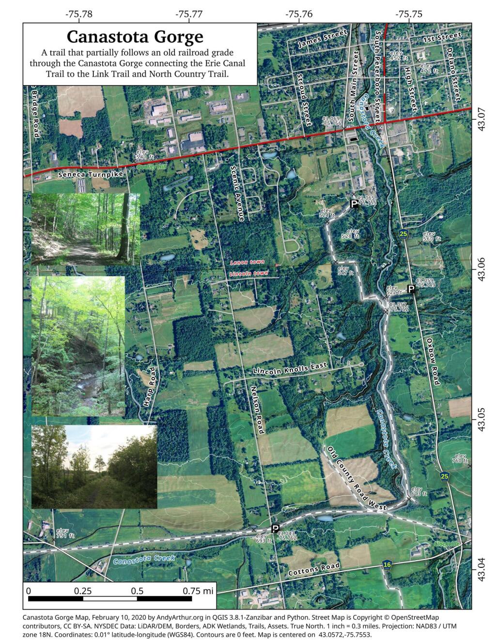
One option I’m seriously looking at is on Friday 🚲 riding more of the Canalway Trail, this time from Canastota up to the area around Rome, maybe Durhamsville depending on the time. I think the trail will be free of snow by then, though Friday might be a bit chilly though sunny and shouldn’t be so bad with gloves on. Or I could hike around Stoney Pond or if I decide to spend time at Charles Baker, then I could ride the roads there. πŸ’­ Off-road bike riding isn’t permitted in the winter, but road-riding is okay per their website. The road up to Cherry Ridge could be icy, though it’s usually plowed but not sanded, except for the campground which isn’t plowed at all. But as of now, they don’t have any more then any dusting per the web cams and snowfall predictions.  β›„ Thought about heading further south to Long Pond State Forest, but that’s quite a ways south and west. West Virginia is too far away for four nights, not to mention they have a ton of now.

I am dipping a bit into my time reserve for time next year, ⏲ not rolling over the maximum into 2024, but when I thought about it some more, it doesn’t matter as I don’t expect I’ll be taking much time off until late April, which will give me several pay periods to build time back up, plus I get 35 hours of personal time (5 days) on the first of the new year. Starting my new position as Director of Data Services, I am not going to want to miss much work πŸ‘” as I have much to learn and I want to put in the long hours, to make a good impression in my new position. Not sure how much comp-time I’ll get to use next summer, 😎 though I think there is definitely a possibility of remote work with my new position that is more about working data and running reports ⌨ then working with people, or so I think. I don’t know, I haven’t started the training yet. πŸ‘¨‍🏫 Things are getting wrapped up at Research it seems for the year, there is a handful of projects outstanding in the Production Book but I’m not worried as the year comes to close.

It will be four nights out camping this week leading into Christmas, πŸ• then I have off Christmas Day to visit with the families and Boxing Day is also a holiday at my company. πŸ˜€ Then it’s three days of work, but I”m thinking of potentially working from home that Friday leading into the New Years Weekend, so I can leave early and set up camp in Rensselaerville and do a three-night trip there through New Years Day. Depends on how much snow we get the second half of next week. ❄️ Really hard to say. Lots of winter camping this year, but it’s been so mild. Come January though I’m not planning anything until at least mid-month with Martin Luther King Day but even that’s uncertain — and as I noted, I’m not sure if I will take any time off from work for trips until April with my new position getting underway. Might be a busy summer too, but I’m thinking at least part of the time I will be able to remote work πŸ‘¨‍πŸ’» so I could extend trips by working part of the time from camp and/or the Speculator and other other libraries.

Looking ahead, next Tuesday is Boxing Day πŸ₯Š when the sun will be setting at 4:29 pm with dusk at 4:59 pm. Days are getting longer. On that day in 2022, we had partly sunny and temperatures between 30 and 16 degrees. Typically, the high temperature is 35 degrees. We hit a record high of 59 back in 1895. Before my time, lol πŸ˜‚.

Untitled