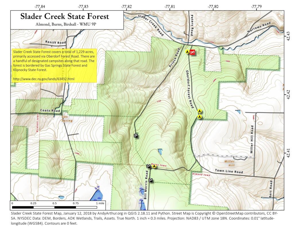
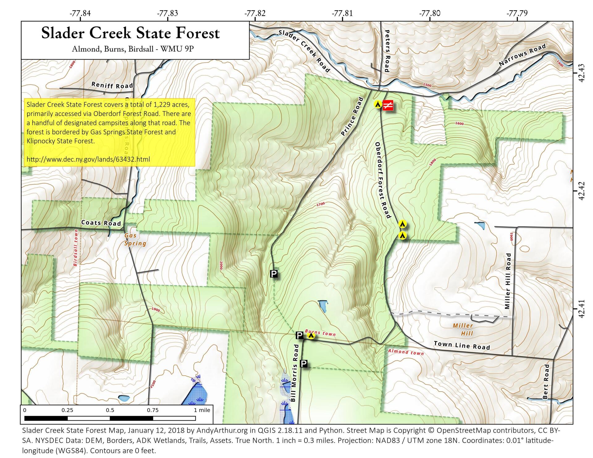
Map: Slader Creek State Forest
Download a High Resolution JPEG Image of the Slader Creek State Forest or an Adobe Acrobat Printable PDF of the Slader Creek State Forest.

Bookmark my free Interactive GPS Map for your phone:
https://andyarthur.org/ny
... shows your location as a blue dot in relationship to campsites, trails, state land. This online map requires cell service, won't work in remote country, so also bring a paper map.
Free Download of New & Historical USGS 1:24k Topograpic Maps
Interactive maps with backcountry and roadside camping: New York, Pennsylvania, West Virginia & Vermont. List of NYS DEC Lean-Tos and Firetowers.
Google Spreadsheet with Roadside, Primitive and Pay Campsites
More about Slader Creek State Forest...
Slader Creek State Forest covers a total of 1,229 acres, including the recent acquisition of a 97-acre inholding. It is just north of Klipnocky State Forest and east of Gas Springs State Forest, near Alfred, Arkport and somewhat near Hornell. There are a handful of designated campsites, primarily deisgned for hunters with pickup truck campers along the dirt roads that dot this area.
http://www.dec.ny.gov/lands/63432.html
... photos, maps and other content from from Allegany County.