Map: Second Pond Trail
Download a High Resolution JPEG Image of the Second Pond Trail or an Adobe Acrobat Printable PDF of the Second Pond Trail.
About Map: Second Pond Trail ....
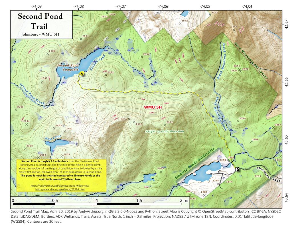
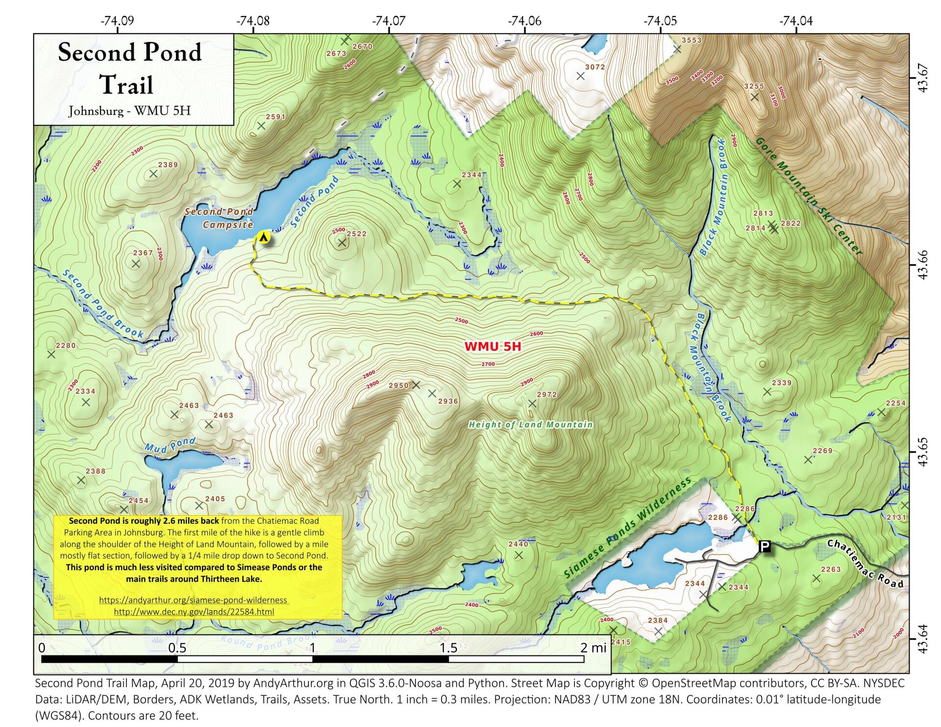
The Second Pond Trail is a 2.5 mile hike back from Chatiemac Lake Road in Bakers Mills. While the trail can be muddy, especially in the spring, this remote lake is good for solitude and brookies.

Bookmark my free Interactive GPS Map for your phone:
https://andyarthur.org/ny
... shows your location as a blue dot in relationship to campsites, trails, state land. This online map requires cell service, won't work in remote country, so also bring a paper map.
Free Download of New & Historical USGS 1:24k Topograpic Maps
Interactive maps with backcountry and roadside camping: New York, Pennsylvania, West Virginia & Vermont. List of NYS DEC Lean-Tos and Firetowers.
Google Spreadsheet with Roadside, Primitive and Pay Campsites
More about Silver Lake Wilderness...
The Silver Lake Wilderness Area, an Adirondack Park unit of the Forest Preserve, is located in the towns of Lake Pleasant, Benson, Wells and Arietta in Hamilton County and is roughly bounded on the north by NY 8 and private lands near Piseco Lake, Oxbow Lake, Hamilton Lake, Sand Lake and Lake Pleasant; on the east by NY 30; on the south generally by the Hamilton County line; and on the west by NY 10, the West Branch of the Sacandaga River and the Piseco Outlet.
The area contains 48 bodies of water covering 569 acres (2.3 km2), 26.5 miles (42.6 km) of foot trails, and 2 lean-tos.
Maps and Interactives
Woods Lake
White House, NY
West River Road (Whitehouse) Campsites
West River Road
West Branch Sacandaga River
White House Campsites – Overlaid On Aerial Photo From 1942
Silver Lake
Second Pond Trail
Sacandaga Primitive Area – Whitehouse Campsites
Gilman Lake
Chub And Trout Lake
Big Eddy Trail
... photos, maps and other content from from Silver Lake Wilderness.