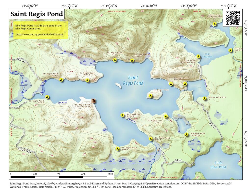
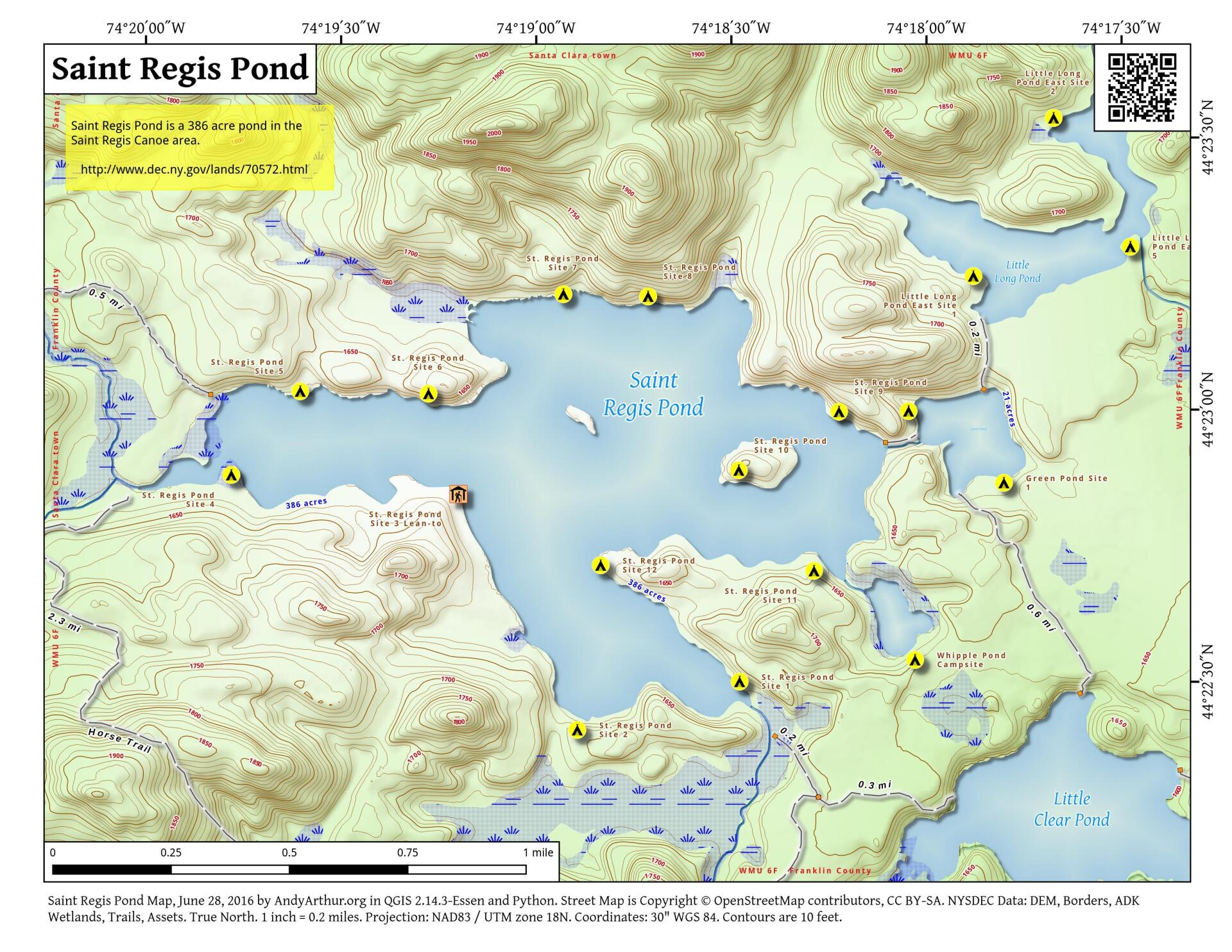
Map: Saint Regis Pond
Download a High Resolution JPEG Image of the Saint Regis Pond or an Adobe Acrobat Printable PDF of the Saint Regis Pond.

Bookmark my free Interactive GPS Map for your phone:
https://andyarthur.org/ny
... shows your location as a blue dot in relationship to campsites, trails, state land. This online map requires cell service, won't work in remote country, so also bring a paper map.
Free Download of New & Historical USGS 1:24k Topograpic Maps
Interactive maps with backcountry and roadside camping: New York, Pennsylvania, West Virginia & Vermont. List of NYS DEC Lean-Tos and Firetowers.
Google Spreadsheet with Roadside, Primitive and Pay Campsites
More about Saint Regis Canoe Area...
Maps and Interactives
Saint Regis Mountain
St. Regis Mountain Trail
Slag And Turtle Ponds
Saint Regis Pond and Little Long Pond
Saint Regis Pond
Long Pond (St. Regis Canoe Area)
Little Green Pond Rat Pond
Little Green And Rat Ponds
Little Clear Pond
Lake Clear
Hoel Pond
... photos, maps and other content from from Saint Regis Canoe Area.