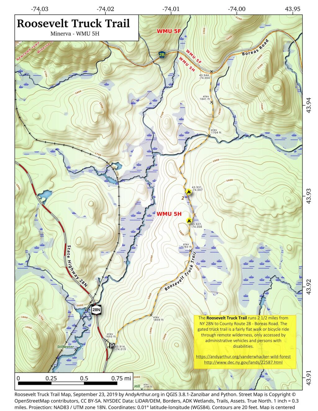
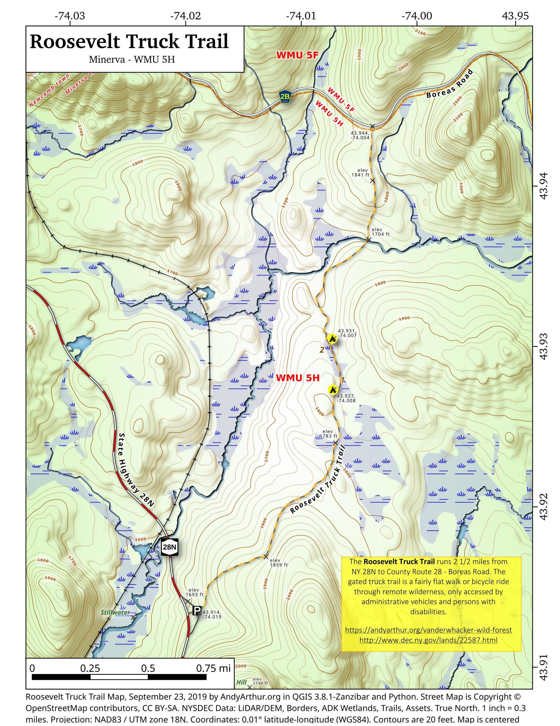
Map: Roosevelt Truck Trail
Download a High Resolution JPEG Image of the Roosevelt Truck Trail or an Adobe Acrobat Printable PDF of the Roosevelt Truck Trail.
About Map: Roosevelt Truck Trail ....
The Roosevelt Truck Trail runs 2 1/2 miles from NY 28N to County Route 28 - Boreas Road. The gated truck trail is a fairly flat walk or bicycle ride through remote wilderness, only accessed by administrative vehicles and persons with disabilities.
https://andyarthur.org/vanderwhacker-wild-forest
http://www.dec.ny.gov/lands/22587.html

Bookmark my free Interactive GPS Map for your phone:
https://andyarthur.org/ny
... shows your location as a blue dot in relationship to campsites, trails, state land. This online map requires cell service, won't work in remote country, so also bring a paper map.
Free Download of New & Historical USGS 1:24k Topograpic Maps
Interactive maps with backcountry and roadside camping: New York, Pennsylvania, West Virginia & Vermont. List of NYS DEC Lean-Tos and Firetowers.
Google Spreadsheet with Roadside, Primitive and Pay Campsites
More about Vanderwhacker Mountain Wild Forest...
Maps and Interactives
Wolf Pond Trail
Vanderwhacker Pond
Stoney Pond Trail (29th Pond)
Roosevelt Truck Trail
Boreas Loop Trail
Vanderwhacker Road Campsites
Stony Pond
Bullet Pond And Horseshoe Pond
Boreas River
Boreas Railroad – Moose Club Way To Northwoods Club Road
Big Pond Trail
... photos, maps and other content from from Vanderwhacker Mountain Wild Forest.
No Comments
Thanks Andy. This map is perfect. We are going to explore the truck trail tomorrow. Trudy