Map: Roosa Gap State Forest - South Parcel

Download a High Resolution JPEG Image of the Roosa Gap State Forest - South Parcel or an Adobe Acrobat Printable PDF of the Roosa Gap State Forest - South Parcel.

Bookmark my free Interactive GPS Map for your phone:
https://andyarthur.org/ny
... shows your location as a blue dot in relationship to campsites, trails, state land. This online map requires cell service, won't work in remote country, so also bring a paper map.
Free Download of New & Historical USGS 1:24k Topograpic Maps
Interactive maps with backcountry and roadside camping: New York, Pennsylvania, West Virginia & Vermont. List of NYS DEC Lean-Tos and Firetowers.
Google Spreadsheet with Roadside, Primitive and Pay Campsites
More about Roosa Gap State Forest...
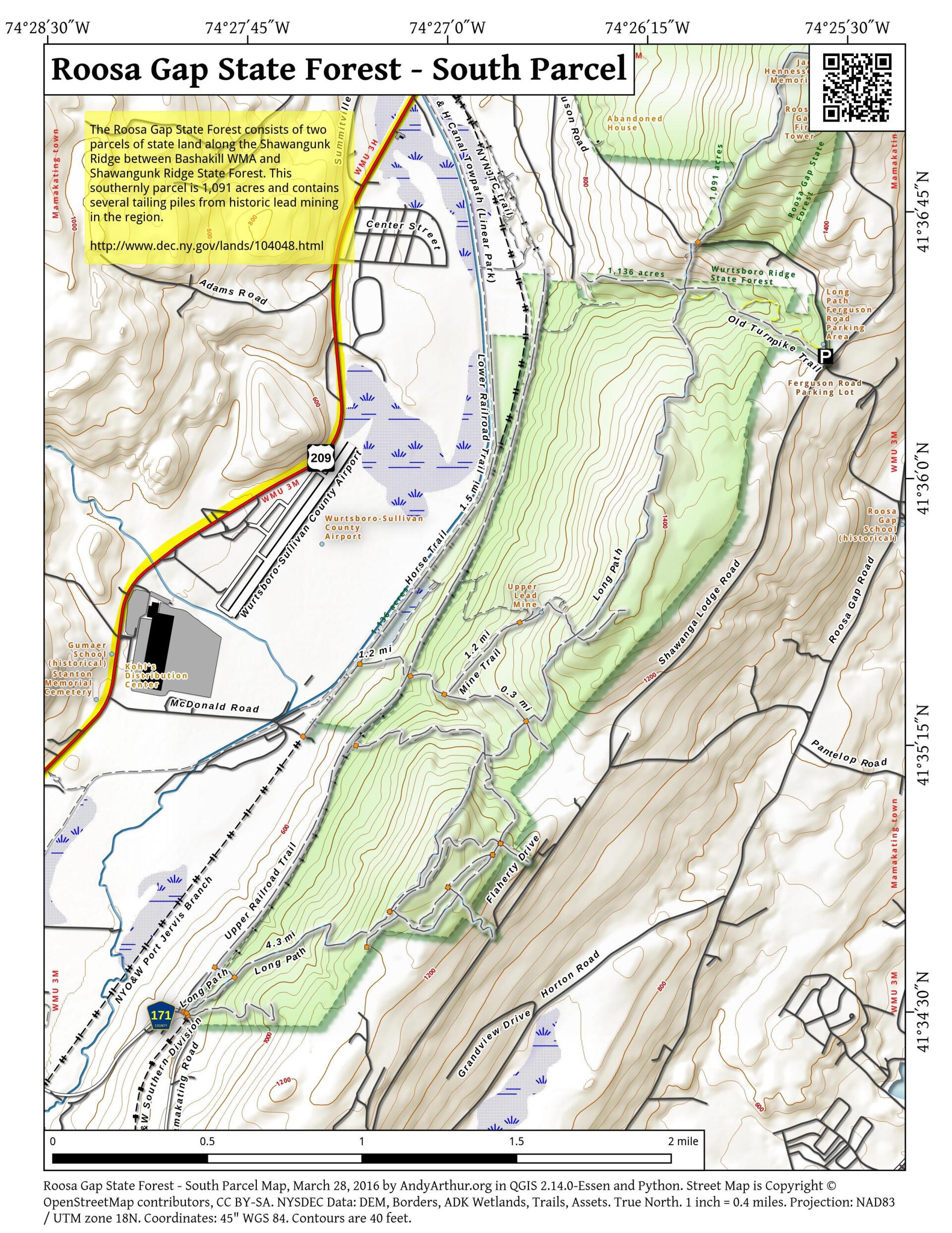
The 680-acre Roosa Gap State Forest features one marked hiking trail that offers spectacular views of the surrounding valley. These features, in addition to its proximity to the village of Wurtsboro and neighboring state lands, make it an ideal destination for people looking for outdoor recreation.
http://www.dec.ny.gov/lands/104048.html
Maps and Interactives
Roosa Gap State Forest – South Parcel
Roosa Gap State Forest
... photos, maps and other content from from Roosa Gap State Forest.