Map: Raymondville State Forest
Download a High Resolution JPEG Image of the Raymondville State Forest or an Adobe Acrobat Printable PDF of the Raymondville State Forest.

Bookmark my free Interactive GPS Map for your phone:
https://andyarthur.org/ny
... shows your location as a blue dot in relationship to campsites, trails, state land. This online map requires cell service, won't work in remote country, so also bring a paper map.
Free Download of New & Historical USGS 1:24k Topograpic Maps
Interactive maps with backcountry and roadside camping: New York, Pennsylvania, West Virginia & Vermont. List of NYS DEC Lean-Tos and Firetowers.
Google Spreadsheet with Roadside, Primitive and Pay Campsites
More about Raymondville State Forest...
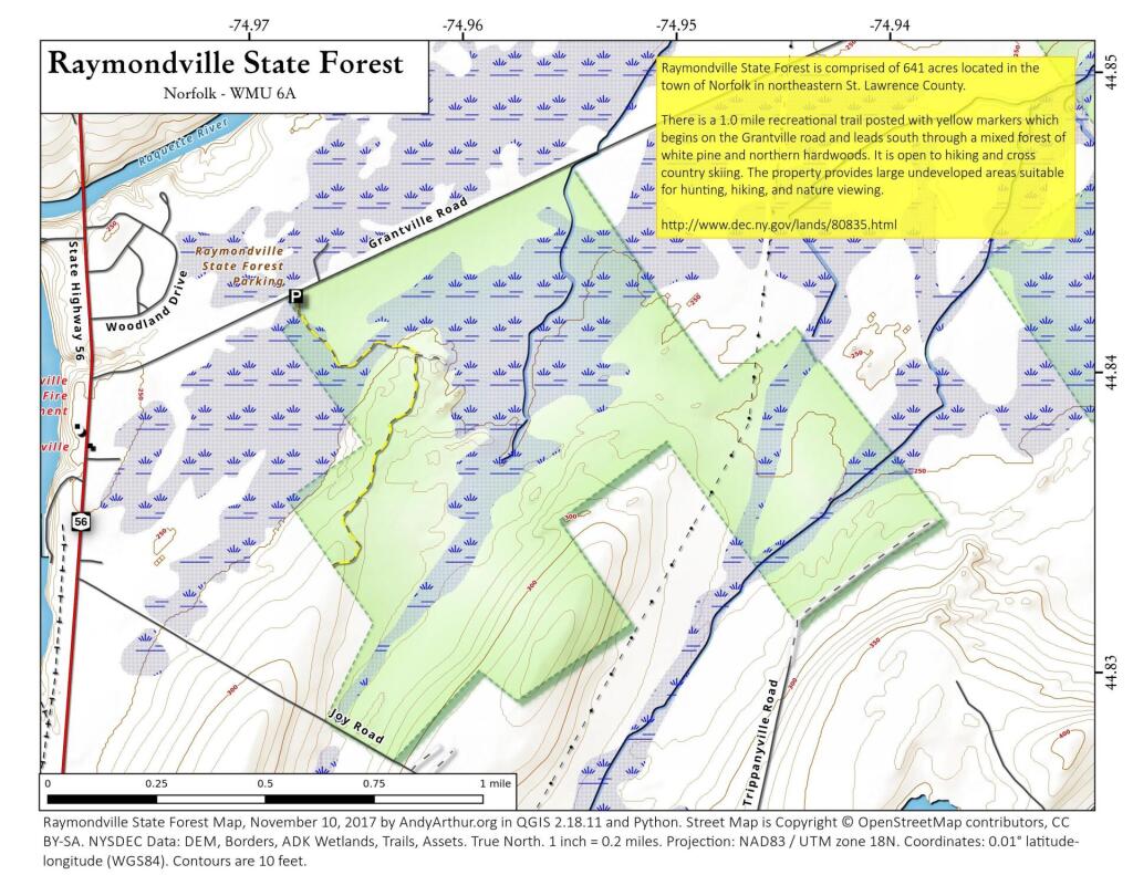
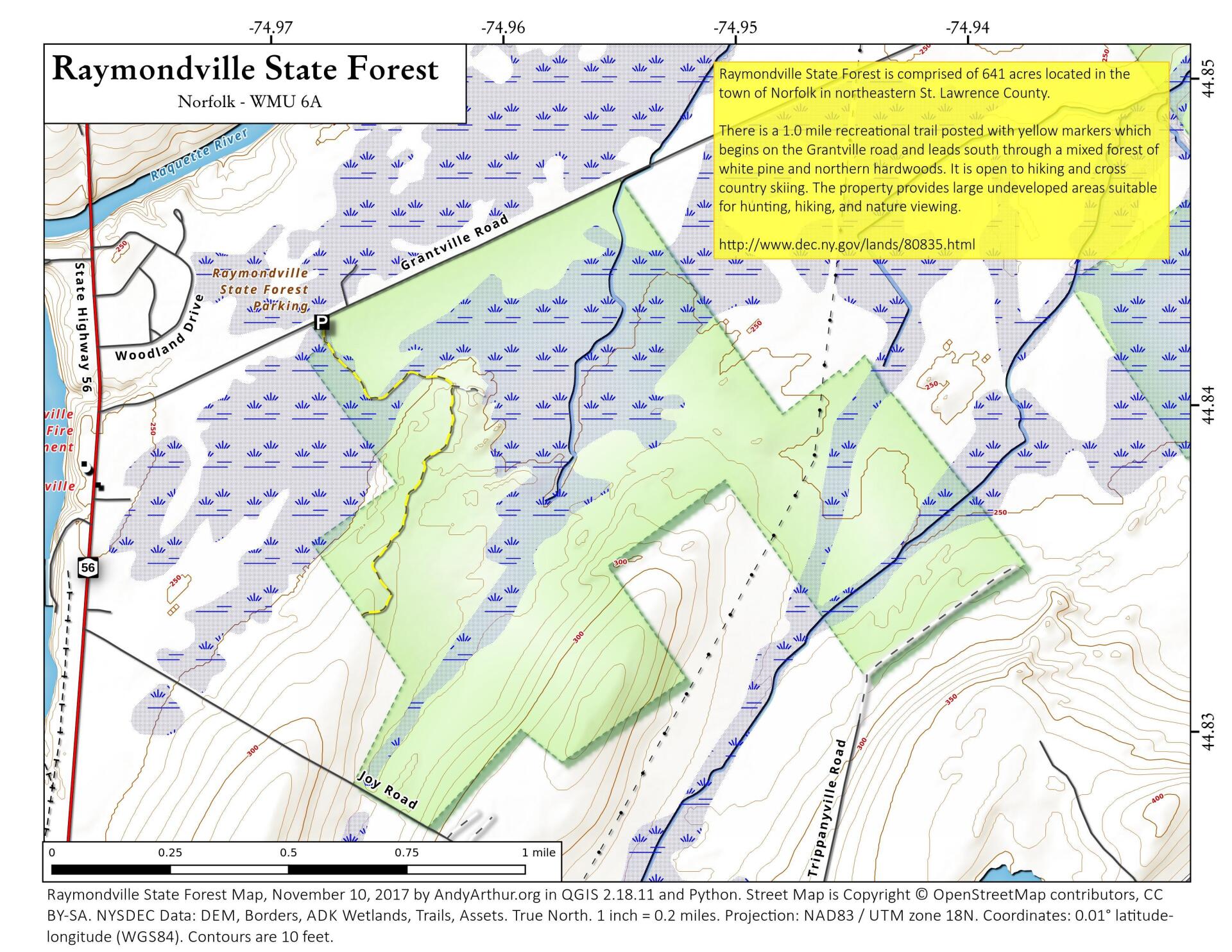
Raymondville State Forest is comprised of 641 acres located in the town of Norfolk in northeastern St. Lawrence County.
There is a 1.0 mile recreational trail posted with yellow markers which begins on the Grantville road and leads south through a mixed forest of white pine and northern hardwoods. It is open to hiking and cross country skiing. The property provides large undeveloped areas suitable for hunting, hiking, and nature viewing.
Camping - There are no designated camp sites on this property. Back country camping is allowed. Camping for more than three nights or in a group of ten or more requires a permit from a Forest Ranger. Camping is prohibited within 150 feet of water, roads or trail.
Hunting and Trapping are permitted on the property in accordance with all game regulations, unless otherwise posted.
Geo-caching is allowed although caches must be marked with the owner's contact information and may not be placed in dangerous or ecologically sensitive locations.
http://www.dec.ny.gov/lands/80835.html
... photos, maps and other content from from St. Lawrence County.