Map: Rattlesnake Hill Wildlife Mangement Area
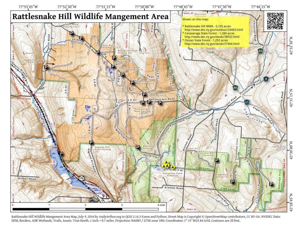
Download a High Resolution JPEG Image of the Rattlesnake Hill Wildlife Mangement Area or an Adobe Acrobat Printable PDF of the Rattlesnake Hill Wildlife Mangement Area.

Bookmark my free Interactive GPS Map for your phone:
https://andyarthur.org/ny
... shows your location as a blue dot in relationship to campsites, trails, state land. This online map requires cell service, won't work in remote country, so also bring a paper map.
Free Download of New & Historical USGS 1:24k Topograpic Maps
Interactive maps with backcountry and roadside camping: New York, Pennsylvania, West Virginia & Vermont. List of NYS DEC Lean-Tos and Firetowers.
Google Spreadsheet with Roadside, Primitive and Pay Campsites
More about Rattlesnake Hill WMA...
The Rattlesnake Hill Wildlife Management Area is a 5,100 acre upland tract, situated approximately eight miles west of Dansville, New York. Roughly two-thirds of the area lies in southern Livingston County, while the remaining third lies in northern Allegany County. The tract was purchased in the 1930's under the Federal Resettlement Administration and is one of several such areas turned over to DEC for development as a wildlife management area.
The area is appropriately named after the Timber Rattlesnake, which may be occasionally found in the more remote sections of the "Hill".
The area offers an interesting blend of upland habitats such as mature woodland, overgrown fields, conifer plantations, old growth apple orchards and open meadows.
The area is inhabited by a variety of game species and is open to public hunting. The white-tailed deer, wild turkey, ruffed grouse, grey squirrel, cottontail rabbit and woodcock are found on the area. An occasional snowshoe hare may be observed adjacent to thick creek bottom brush or conifer plantation habitats.
A number of small marsh units have been developed and provide limited hunting for waterfowl. Some of the area's furbearing species such as mink, beaver and raccoon may be occasionally viewed at these marsh units.
http://www.dec.ny.gov/outdoor/24443.html
... photos, maps and other content from from Rattlesnake Hill WMA.