Search Results for: map powley place
Powley Road
A 3D rendering I made up the other day of Powley Road near Powley Place.
Places I Camped in 2023
While this year was a rainy one, and it rained during many of my trips, I was able to get out for 53 nights in the wilderness — mostly fairly close to home but I also did a trip down to West Virginia in late October with several trips to the Adirondacks, Central New York and summer vacation in the Finger Lakes.
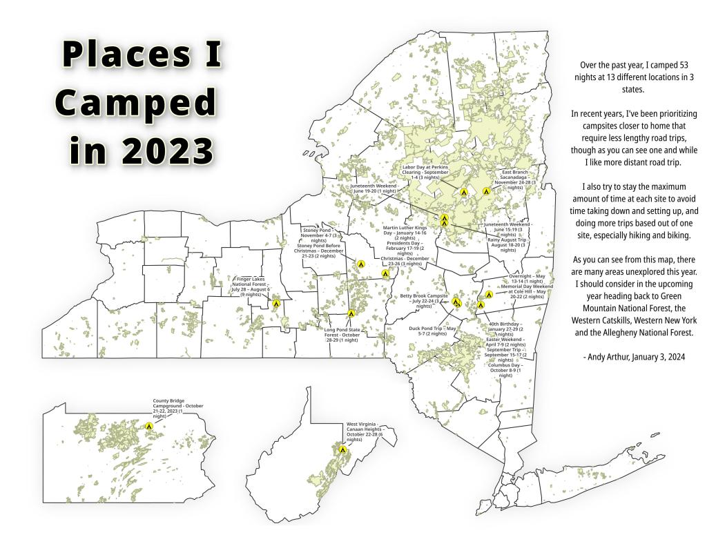
Martin Luther Kings Day – January 14-16 (2 nights)
To start out my camping adventures in 2023, I drove out to Charles Baker State Forest and Brookfield Horse Camp. There wasn’t a lot of snow — just a dusting but it was a fun weekend, topped off by a beautiful sun-full glittery hike up Tassell Hill after a hoar frost. Explored Lost Pond and several of the trails in the middle of state forest.
40th Birthday – January 27-29 (2 nights)
For my fortieth birthday, I took off the Friday leading up to my 40th birthday to cross country ski and winter camp at Rensselaerville State Forest. It was a beautiful weekend with lots of blue skies, sufficient snow for skiing but not so much that was a ton of snowmobiles out on the trails.
Presidents Day – February 17-19 (2 nights)
I decided for Presidents Day Weekend to do another trip out to Charles Baker State Forest and Brookfield Horse Camp. Slightly more snow then last time but again largely a snow-less winter, with some nice days for hikes through the various truck and horse trails. I hiked around much of state forest, especially the more southern part of the forest.
Easter Weekend – April 7-9 (2 nights)
On Good Friday through Easter I camped at at Rensselaerville State Forest. The snow was gone and it was fairly mild though at times it was a bit cool. Spent a fair amount of time walking around and exploring the new OSI Parcel that has been recently added to state forest and is still largely open fields with sweeping views of the Catskill Mountains.
Duck Pond Trip – May 5-7 (2 nights)
The first Friday in May I took a half day from work and headed out to Schoharie County to camp at Duck Pond at Burnt-Rossman Hills State Forest. Originally the plan was to camp two nights at Duck Pond, hiking along the Long Path and exploring the state forest and then on Sunday hiking the Catskill Scenic Trail. That part of the trip changed when driving along Duck Pond Road the low tire pressure light came on I found a pallet nail in my truck tire. I was able to top off the truck tire and then change the tire when I got home and got the nail pulled and plugged. But it wasn’t the best way ever to end a trip early.
Overnight at Cole Hill – May 13-14 (1 night)
After visiting the folks on Mother’s Day Weekend, I decided to do a quick overnight hammock camp on Cole Hill State Forest in Berne. Nothing fancy or formal, it was as much a way to test out sleeping in my hammock with the bug screen. Kind of a chilly night, I took camp down fairly and headed home early in the morning.
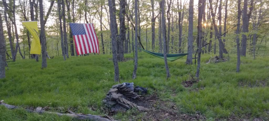
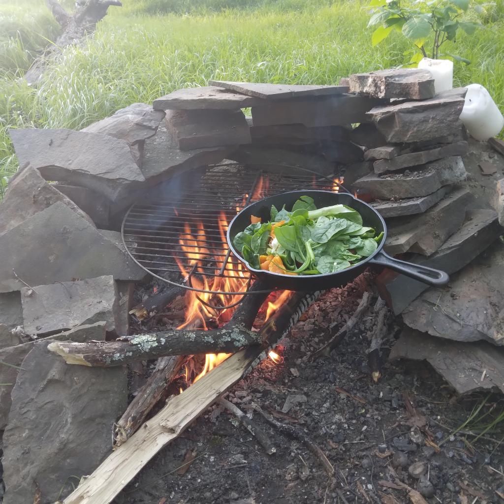
Memorial Day Weekend at Cole Hill – May 20-22 (2 nights)
This year I decided to eschew the Adirondacks and Greene Mountains for Memorial Day Weekend due to the black flies, my desire to look at bicycles, and work I had to do on the Saturday morning leading up to the holiday weekend. I decided to hammock camp again Cole Hill State Forest in Berne. This was a three-day two night trip, so it it gave me a chance to bring more gear up the mountain, set up a more formal camp. Cooked on the fire, hiked around the forest. It was a warm weekend, but I enjoy the solitude, along with having good cell service for listening to podcasts and watching videos.
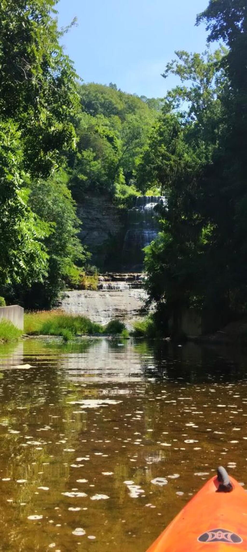
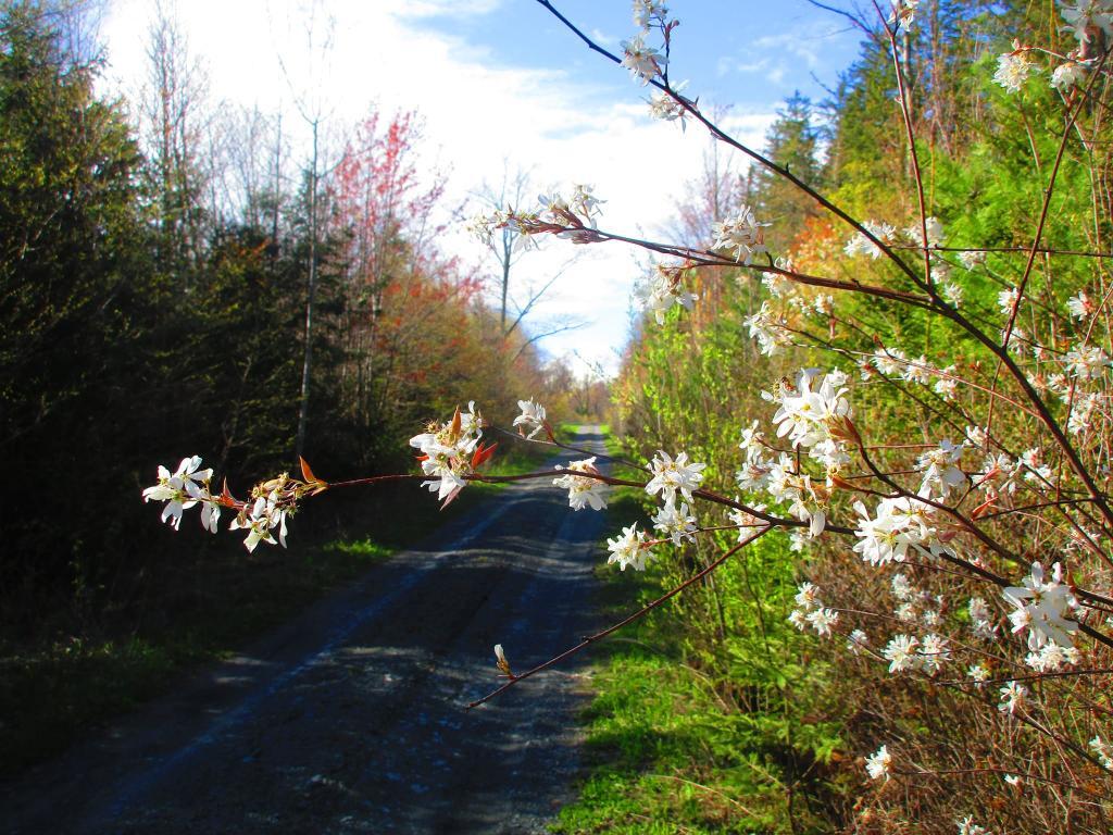
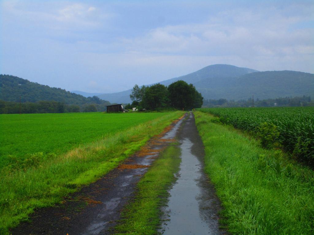
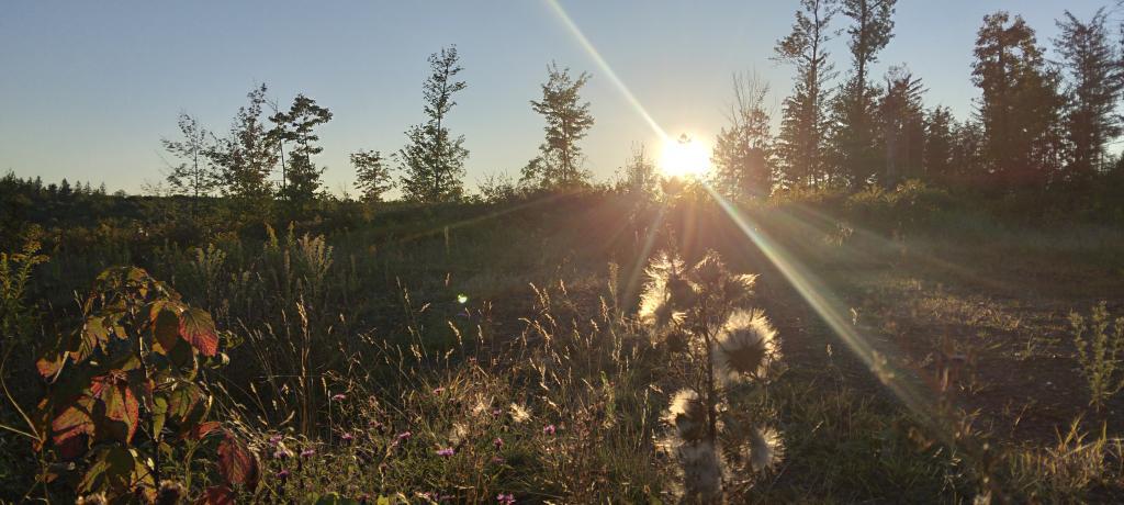
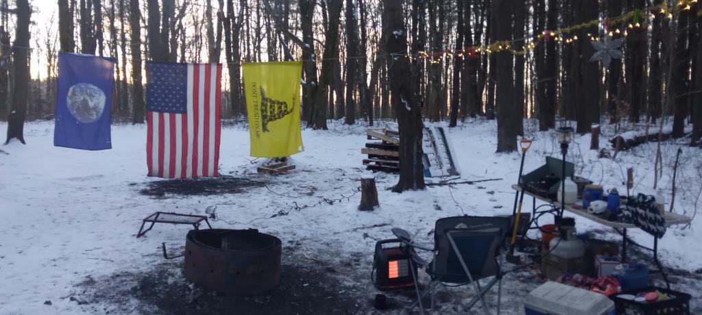
Juneteenth Weekend on Piseco-Powley – June 15-20 (4 nights)
To kick off summer, I did my usual Juneteenth weekend camping trip, tacking on some days on the Juneteenth Holiday Weekend. It was a bit of a cool and rainy weekend to kick off summer, one that would actually be followed by many cool and rainy weekends where I would stay home. Camped at House Pond for the first three nights, spending time down floating in the tube on East Branch while the final night I camped up at Powley Bridge site and kayaked along the East Branch. Really, like often is the case, the best weather was the day I took down camp.
Catskill Scenic Trail Trip – July 22-24 (3 nights)
After several months of researching and visiting various bike shops, I finally got a mountain bike. I decided it would be fun to do as much of the Catskill Scenic Trail as I could before my summer vacation got underway. Actually did quite a bit of riding and hiking that weekend — started out hiking Pratts Rock’s then riding from Grand George to Hobart. Sunday, I rode from Fultonham to Middleburgh on NY 30, doing a quick climb up Vromans Nose, then stopping at the farm market then going to Mine Kill State Park to swim. Monday I rode from Hobart down to Bloomville, getting caught in a major thunderstorm and downpour a few miles north of Bloomville with no shelter in sight. The trail became super boggy, then I went to Mine Kill State Park for one more swim, and then out to folks house for Sunday dinner a day later then usual.
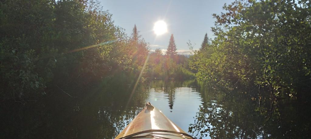
Finger Lakes National Forest – July 28 – August 6 (9 nights)
Every year for nearly a decade and a half I’ve been doing summer vacation out in the Finger Lakes — camping in the National Forest and exploring as much as possible during my days there. The past few years I’ve been driving there on a Friday, to get a better campsite before they’re taken by the weekend campers. This year was no exception. With Blackie, my mountain bike, I did nearly all of the bike trails in the near vicinity, from the Black Diamond Trail to the Cayuta Valley Trail to Dresden – Penn Yan Canal Trail. Kayaked on both Cayuga and Scenic Lakes, swam many days at Watkins Glen State Park and Taughannock State Park, explored the Cornell Campus and Botanical Gardens on my bike. Got some good ice cream at the Spotted Duck, explored the Geneva Waterfront along with the Cayuga-Seneca Canalway. Some rain but compared to the wet summer that was, this was a pretty good week.
Piseco-Powley – House Pond Campsite – August 18-20 (3 nights)
The next few weeks for rainy and by the time I got away for one more long weekend, it promised to be fairly nice weekend but turned out to be fairly cool and cloudy with some rain. Back at the House Pond Campsite, did some swimming in East Branch, but with the mercury in the 60s most of the weekend, I didn’t spend a lot of time in the water. Hardly what I had dreamed when the I planned the weekend. Rode Blackie up to Goldmine Stream Falls and relaxed down by the falls for a bit, also sat down by the swimming hole off of the Old Edick Road Snowmobile Trail, watching the rain fall, bemoaning the wet and cold weather. Still it was good to get away for a bit, and I did do a fair amount of reading in hammock, under the protection of the bug net, as the bugs were bad after such a wet summer.
Labor Day at Perkins Clearing – September 1-4 (3 nights)
I took the Friday off before Labor Day to get a jump on the holiday season travel, and set up camp at the site I really enjoy up at Perkins Clearing overlooking the mountains. Did a fair amount of riding along the various dirt roads of Perkins Clearing, including over to Mason Lake and on Sunday rode most of the way to the Spruce Lake Trailhead, though didn’t make it there in time as I got a bit of a late start as I spent the balance of the day reading and swimming in the Jessup River Bridge swimming hole. Labor Day, I rode around the Spectulator Tree Farm, doing a large loop, through the tree farm, past the north end of Elm Lake, then down to Austin Falls and Old Route 8B. I had hoped to get ice cream, but by the time I got to the ice cream shop they were out of soft-ice cream, and there was a long line. Summer was dragging to a close.
September Trip to Rensselearville State Forest – September 15-17 (2 nights)
With time being fairly tight and the weather only so-so I decided to do a two night trip close to home out in Rennselearville to ride some of the gravel trails, explore the OSI Parcel further and just enjoy an early autumn weekend camping.
Columbus Day at Rensselearville State Forest – October 8-9 (1 night)
Columbus Day Weekend was cold and rainy for the first half of the weekend, but the Sunday heading into Columbus Day was nice, so I decided to head out to Rensselaerville for a quick overnight at the campsite on CCC Road. Leaves were late this year, so not a lot of color, but it still was nice to get away for a night and ride some of the trails around.
West Virginia Trip – October 21-29 (8 nights)
The banner trip of the year was my trip down to West Virigina. While it started and ended in rain, it was a very enjoyable trip with lots of new adventures this year. Camped the balance of the week — 6 nights in Canaan Heights — doing day trips from that area. Overnighted one night driving down at County Bridge Campground in Pennsylvania, and a on the way back camped overnight at Long Pond State Forest in New York. Adventures in West Virginia included hiking at Dolly Sods, mountain biking at night in the sods of Canaan Heights, riding up and hiking to Table Rock, exploring Blackwater Falls State Park on the mountain bike, MonPower Mountain Bike Park, Thomas Rail Grade and the Olson Firetower. Rode part of the Great Allegheny Trail through the Cumberland Passage, and the two sections of the Chesapeake and Ohio Canalway, including the Paw Paw Tunnel.
Stoney Pond – November 4-7 (3 nights)
A little over a week back from West Virginia, I headed out to Madison County to ride the Tassel Hill Mountain Bike Trails at Alfred Woodford, the Chenango Canal Trail in Hamilton and Erie Canalway from Chittenango to Green Lakes State Park and then to Canastota and Wampsville. The first night was cold at Stoney Pond but the subsequent nights were quite pleasant and mild.
![Old Canal Warehouse in Chittenango [Expires November 19 2023]](https://andyarthur.org//data/photo_005914_large.jpg)
Prospect Mountain – East Branch Sacanadaga – Buttermilk Falls/Hudson Special Management Area – November 24-28 (3 nights)
Strangely enough, I had never been up Prospect Mountain. So I decided the day after Thanksgiving (Black Friday) to hike up Prospect Mountain, and then spend the next two nights camping on East Branch of the Sacandaga River. The Saturday and Sunday was fairly cold, so I ended up spending the bulk of day hanging around camp, doing a bit of hiking around Fox Lair. Sunday, evening around 8 PM it started to sleet, then snow, then rain, Monday morning, it turned into a white globby snow, and I ended up taking down camp fairly early after discovering I was out of propane and then spent much of the day exploring the Hudson River Special Management Area – Buttermilk Falls.
Stoney Pond – Charles Baker – December 21-26 (5 nights)
On the days leading up to Christmas I decided to take a second trip to Madison County. I was originally planning to camp two nights at Stoney Pond then two nights at the Charles Baker Horse Camp but my family’s holiday plans were cancelled due to illness in my family, so I ended up staying an extra night at the horse camp, through the day after Christmas. On Friday, I rode the Erie Canalway from Canastota to East Verona, nearly to Rome. On Christmas Day I rode around many of truck trails at Charles Baker with my mountain bike, leaving my face splattered with mud. Many of the days were fairly cold and cloudy, but that’s too be expected in late December. Still it was a special way to spend Christmas.
Piseco-Powley Road Mile Points
This interactive map shows the location of each mile point heading north up Piseco-Powley Road from Stratford in the Adirondacks. It's handy if you trying to locate a trail head or just want to know about how far roughly north things are along the road.
For example, I had no idea that the Lower Powley Bridge is 6 miles north of Stratford -- it always seems like a bit of a trip up that rough road, but it's good to keep in context. Powley Place is 11 miles north, and ultimately the road ends at NY 8 at 18.6 miles further north.
Big Alderbed Lake Trail
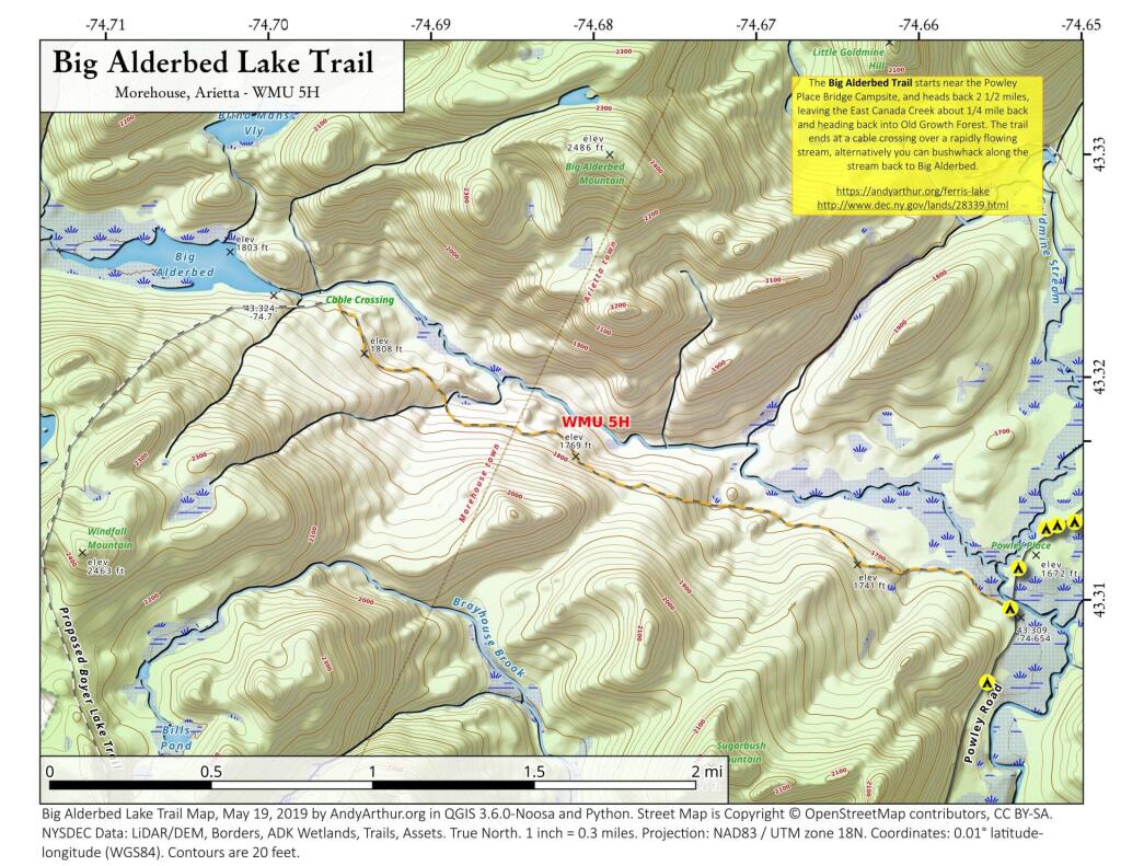
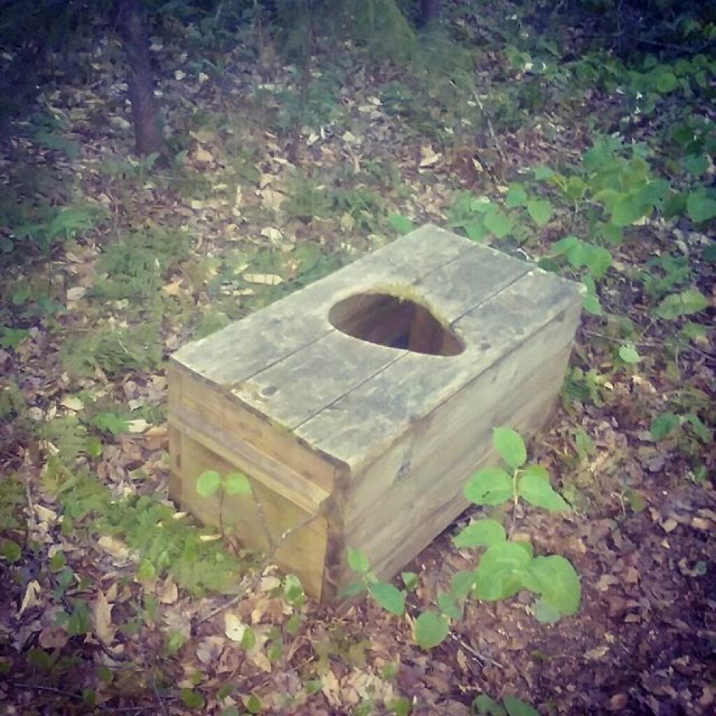
There is an old snowmobile trail/woods road by the Powley Place Bridge, that extends 2.5 miles west to Big Alderbed, that takes you to a wire crossing over the East Branch. The trail follows the East Branch for a short distance, then heads back into an interesting Old Growth Forest with a lot of big trails. To reach Big Alderbed -- which is largely drained wetland due to a failed dam -- you have to bushwhack along the stream to the mouth of the wetland.
Site Map
🌲🌲 Our Public Lands 🌳🌲
Interactive maps with backcountry and roadside camping: New York, Pennsylvania, West Virginia & Vermont.
List of NYS DEC Lean-Tos with map coordinates. List of NYS DEC Firetowers with map coordinates and more information.
Google Spreadsheet with Roadside, Primitive and Pay Campsites
Explore the Finger Lakes Trail, Long Path, Northville-Placid Trail and Long Trail/Appalachian in Vermont.
Catskill Park Mountain Peaks, Hudson Valley & Long Island Peaks, Peaks Over 3000 ft Elevation, Highest Peaks in Adirondacks, Interactive Map of All Named Summits in NYS, Blaze Colors in Catskill Park, Trailhead Parking Coordinates and Addresses in the Catskills.
Browse USGS Topo Quads as PDF 🆕 by State Lands or County. You can Bulk Download New & Old USGS Topograpic Maps.
Links to various NY State Land Websites 🆕. Get latest GIS Data from state Web Services.
⛺🌲 Camp 🌲🏕
Moose River Plains – Campsite Listing, Maps and photos of state’s largest free camping area.
Piseco-Powley Road – Campsite Listing, Maps and photos of 15 mile dirt road with camping.
Catskill Park Primitive Campsites – An overview of free camping locations in Catskill Park.
Burnt-Rossman Forest, Cattaraugus County, East Branch Sacandaga River, Finger Lakes National Forest, Madison County, Pennsylvania, Vermont and West Virigina.
Campsite Coordinates for Bog River Flow / Lows Lake, Hudson River SMA (Buttermilk Falls), Lake Lila, Oswegathie River, Nine-Corner Lake, Pharaoh Lake Wilderness, Saranac River Campsites, Stillwater Lake, Schoharie County, and Sugar Hill State Forest.
Overview of Camping Areas in the Catskills, Green Mountains, Southern Adirondacks, Central Adirondacks, Northern Adirondacks, Allegheny National Forest and Penna. DCNR Motorized Campsites and the Monongahela National Forest West Virginia.
Free Campsite Overview Maps: Adirondack – North Country, Catskills, Central NY, Finger Lakes, Western NY. Interactive Map.
Places I camped in 2023, 2022, 2021 and 2020.

 Bicycle Trails and “Blackie” My Mountain Bike

Finally bought a mountain bike, after chewing over a mountain vs commuter bike. Really enjoying riding my bike to work and when it rains there is always a bike rack to safely take it back home. One way to get to adventures at Thacher Park is the Nature Bus.
Empire Trail – KMZ and Interactive Map. Parking along it.
More Trailways with KMZ files including the Albany County Rail Trail, Black Diamond Trail, Catharine Valley Trail, Catskill Scenic Trail, Fonda, Johnstown & Gloversville Rail Trail, Genesee Valley Trail, Link Trail.
🦌🌲 Hunt 🦃🐿
Wildlife Management Units (Deer) – KMZ Map shows the WMU boundaries.
Summer 2019 Aerial Photographs of WMUs
KMZ Maps of Deer Harvest Density by Town: 2019, 2018, 2017, 2016. By WMU 2017, 2016, 2015.
KMZ Maps of Buck Harvest Density by Town: 2019, 2018, 2017, 2016. By WMU 2017, 2016
2016 -2019 Deer and Buck Harvest by Town – KMZ Spreadsheet with FIPS codes for making your own calculations.
🎣🐡 Fish 🐟🐠
Parking and Access to Trout Streams – An interactive, downloadable KMZ Map.
Lakes with DEC Contour Maps – A KMZ Map links to Contour Maps for Fishing.
🌨🏔 Sled & Wheel 🚙❄
State Truck Trails Over A Half Mile – Dirt roads to explore in the backcountry.
NYS Statewide Snowmobile Trail System – State trails on public and private lands.
📉📊 Learn 💵📈
Interactive Maps of NY Census – Explore and download KML files.
Charts and Interactive Diagrams – From population to pollution control.
Andy Arthur GitHub – Git my R and Python scripts used to make maps and diagrams.
Use ArcPullR to Get Geospatial Data – Super easy way to connect to get GIS data in R from government servers.
GDAL Opens E00 Files – Most open source programs nowadays can open common geospatial formats.
NY Building Footprints – Where to find on the internet for making maps.
WMS and ArcMap Services – Downloadable CSV file listing services used on the blog.
2022 US Census Population Estimates – Red states, south continue to gain population.
2020 Cartogram of State Population
💳 🏛 Property Taxes 🏠💸
Properties in Albany Pine Bush Study Area, Excel Files: Various Tax Rolls, Find coordinates and political districts, Look Up State Tax Records and a Script for Processing RPTL 1520 PDFs. Match NY SWIS Codes to FIPS Codes and GEOID
🚗🚗 Big Red 🚗🚗
Big Red – Photos and Videos of my lifted truck with its camper shell. Big Red’s Dual Battery Setup for Camp Power, Video Tour and Diagram. Big Red is getting old. What is next? I’ve thought about going carless for a while to save money and reduce pollution. Or maybe going bigger? Or smaller? Five dollar gas sucks.
🔥🌲 Off-Grid Living 🏠🤠
I am seriously thinking about building an off-grid house. I have a first draft. I need to learn CAD! I have a road map towards buying land and building. I concede might have to live with long commute and give up traveling and camping. I need to be strong.
Why off grid? Well, I’m not into contemporary society. I want to own land, but not be called a landowner, and a cabin, not hooked to electrical grid, farm, raise pigs for food and burn my own trash. I’m saving for a better tomorrow, hoping to make the leap to another freer state. Having acreage is important. Cornfields aren’t bad neighbors. Maybe though my vision has grown smaller and more local. More on off-grid living.
I am 16 years into my career and have made some significant progress in my life. I love my job. But I do wonder on all the things I’m missing out but saving sure makes me high. Maybe it will be different when I own my own land — the end of goal of all this saving.
2020 into 2021 during the pandemic was a year of remote work. It was a struggle not having internet at home, worked a lot out of my truck. But I worked remotely from Horseshoe Lake which was super cool.
Generally I like the idea of owning land in a red state, particularly Idaho, Iowa, Pennsylvania, West Virginia, Wisconsin — and Midwest more generally. But I may settle for New York – it’s all about the f-ing money!
💻👨💻 Open Source 🗺️📍
I use open source software and public sources of data for the blog. Quantum GIS (QGIS), GDAL/ogr2ogr, PyQGIS, GeoPANDAS, R Studio and Leaflet for map making, Arduino and ESP32 microprocessors, Ubuntu Linux and XFCE Window Manager. I’ve recently gotten interested in machine learning.
I avoid using commercial software like Microsoft Windows and do not have home internet or television. If you don’t use commercial software and use your brain, fears of computer viruses are overblown. I deleted most of my social media accounts.
Creating Digital Surface Models using LiDAR Point Clouds.

 R Statistical Programming

The R programming language and RStudio are powerful tools for statistical analysis, making maps and charts. Many of the blog posts and analysis I do are in R, ggplot not only makes great charts but also maps using tidycensus. Generally, R is better then Python for geospatial work.
Use IDW Interpolation to fill in missing Census data, Zonal Histograms for land cover, load WMS Aerial Photography in R, find mountain peaks, save Census shapefiles using tigris quickly, pull NY Election Night Results using Selenium. Fast reverse Geocoding in PostGIS. Working with PDFs in R. Fix a common error starting rselenium/wdman. Make data-filled calendars. R is wonderful and weird, learn it!

 Python and Pandas

Querying state property database, political enrollments, PL 94-171 Census files, calculating population statistics, what address is a district in, converting old districts to new districts, Shapefiles missing Projection information in QGIS.
Learn to code for free modern HTML, Javascript, Python and SQL at freeCodeCamp and web development at the Odin Project.

 Politics
Crunched Election Results with Turnout for Albany County: November 2023, 2022, 2021, 2020, 2019 and Primaries June 2019, Pres/June 2020, June 2021, June 2022, Aug 2022, June 2023.
Albany County Races converted to the new 2023 EDs using Super EDs and Code: 2022, 2021, 2020, 2019 and Primaries June 2019, Pres/June 2020, June 2021, June 2022, Aug 2022.
Above Election Results as zipped Excel files.
Albany County Legislature Districts 2024 Maps –
Maps Comparing 2017 and 2023 Albany County Election Districts and a Crosswalk Table Showing the Proposition of Voting Age Population in New and Old EDs
Maps of 2022 NYC Assembly Races, NYS Assembly Races, NY Senate Races, Governor’s Race in Erie County and Statewide. Partisan shift in governor race between 2010 and 2018.
A comparison of Democratic Performance 2022 Assembly Districts to those proposed in 2023 by the IRC. Here is latest 4/20/23 IRC Maps, showing ADP and how they change from existing Assembly districts. Most towns upstate, outside of cities, are quite red. Using LATFOR data with R to calculate Average Democratic Performance.
You can scrape employee salary data from SeeThroughNY using R. Other useful investigative resources.
I often think politics is for losers. I’m into the politics of statistical analysis and reading history books.
I believe strongly in the first amendment, second amendment, oppose gun restrictions and I support de-funding the police in favor of lower-cost technology and civilian employees. Maybe use red flag laws for voting to stop dangerous voters? And the media should stop promoting mass-shootings, even if it’s super profitable for all involved. They should tax the media when it promotes violence. I think some people are much too paranoid in politics. How elections are rigged under law to benefit incumbents. But vote, it’s the best option and inexpensive.
Yeah for the third parties! I voted for Larry Sharpe for Governor and Jo Jergenson for President but my views are complicated and often vote for Democrats, after voting Jill Stein Green Party in 2016.
Generally, I think Biden has been a good change over DJT and glad the Trump era is over and are glad prosecutors and grand jurors are holding him responsible by indicting him for many serious felonies. I don’t think Trump can win in 2024, as nothing has changed politically from 2020.
I think rural people should be left alone and not worship government workers or have parades for them. I am no fan of Donald Trump, his speeches are bad, I don’t like Trump’s embrace of radical environmentalists, but do admire the homemade roadside monuments to DJT.
I don’t toke. But whatever. There are too many transit authorities.

 The Earth

Why I oppose wilderness areas and parks. It’s trendy to be green these days, but is eco-marketing good for the planet? I visited the Mount Storm Coal Plant and Corridor H.
I worry about a lot about overly-aggressive Climate Change Action, and Undermining Environment Laws for Climate Action. I think we should all admit we are Addicted to Fossil Fuels. These days, urban recycling has become a joke, when it’s still an option at all. It’s better to just buy less shit and avoid the alure of Costcos. I really don’t like how aging radicals have become industrial solar salespeople.
Big bucks are coming to state-designated disadvantaged communities under the CLCP. Which counties and political districts are in line for the the most pork? Interactive map.
I’m a big of farmers who are essentially Living Off the Earth and think Rednecks are Noble Savages. Dairy Farming are key to our rural landscape. I’d trust a farmer or a hunter in a pile of guts he’s butchered over any ivory-tower scientist.
🌎🔆 Industrial Solar 🌞 🏭
Hundreds of multi-acre industrial solar farms are being built in our state. How bad is solar for the environment? We should ask tough questions. Interactive of recently built solar farms, proposed facilities. List of proposed industrial solar facilities. See how the Greenville Solar Farm changed the landscape.

 Saving Money

I am not a fan of ESG Investing as it’s not well diversified. I prefer index-funds and other tax-advantaged ways of saving. Why I am concerned about saving enough for retirement, even though I’m in my late 30s. We as a nation should save more, consume less. I like the idea of carbon tax to replace capital gains taxes to discourage consumption.

 Mission Fifty & Being Healthier

I am now officially in my 40s! I am building to a better life in my 50s, which means getting up early, walking a lot, saying no to cake and yes to more fruit. In many ways, the forties are an awesome time to be alive.
And eating healthy for less without losing sleep over arsenic. And I don’t think we should subsidize unhealthy habits. How I got started in eating healther. Meals are too focused on meat and carbs due to how we describe them, maybe I eat too many bananas in the office, what to eat while camping, worry more about salt then GMOs, eat more beans. Do spend extra for farmers market peaches, especially doughnut peaches and plums. Consider ethnic supermarkets. Thinking about how to make a healthier macaroni and cheese, spinach-mackeral-pasta salad, quick-cook biscuits and whole-wheat bread. That said, too many recipes are junk food crap. Okay in moderation is not okay. The fact that I’m thinner is not a sign I’m dying.
A few years back I decided to explore my mental illness with therapy, thinking about why I have so much anxiety and how many of my values are rational or just thinking too much rednecks’ burn barrels and how much of a throwaway society we live in. Do I want to change?
I’ve learned to care less about the world, and focus more on myself. Maybe I am happier as I am now, saving and investing a lot towards owning my own land, where I don’t have to deal with all the bullshit of modern life.
Mission Fifty: Getting to the point where I own my own land. 
Healthy Eating / Growing My Wealth
Healthy Thoughts  / Enjoying Life
Questions, comments? Feel free to email me at andy@andyarthur.org.

I use GNU open source software.
Plus I like buck goats,
because they’re real macho men
spraying their beards with goat urine.
Laugh a bit and learn how your data is used on this blog: Privacy Policy
This blog is © Copyright 1997-2023 Andy Arthur.org, please share using the Creative Commons Attribution 3.0 License.
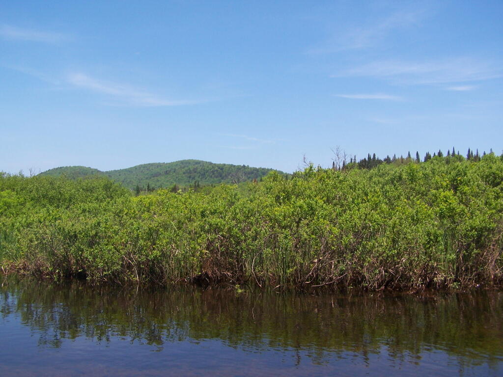
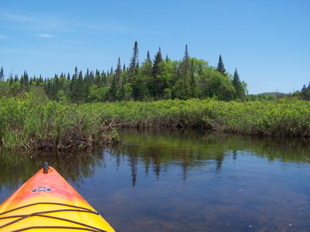
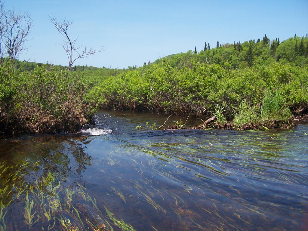
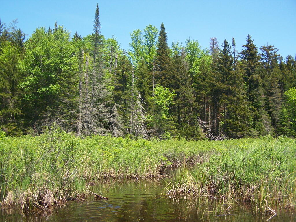
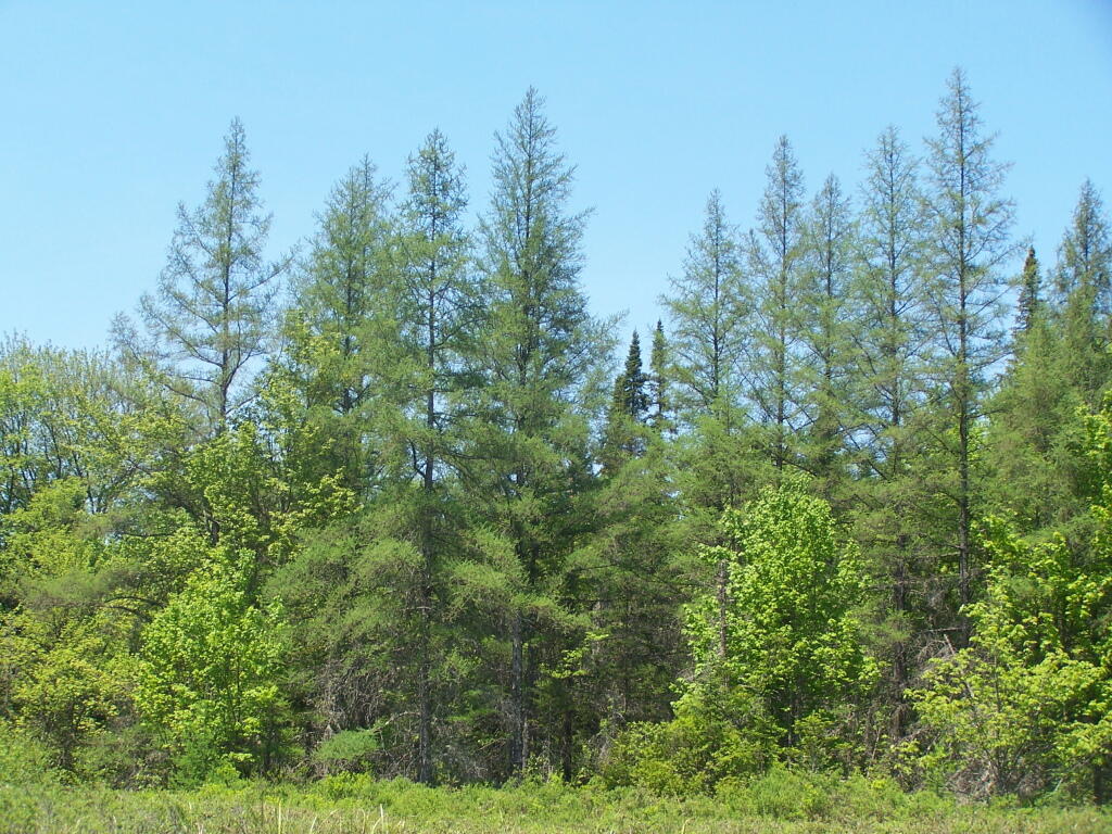
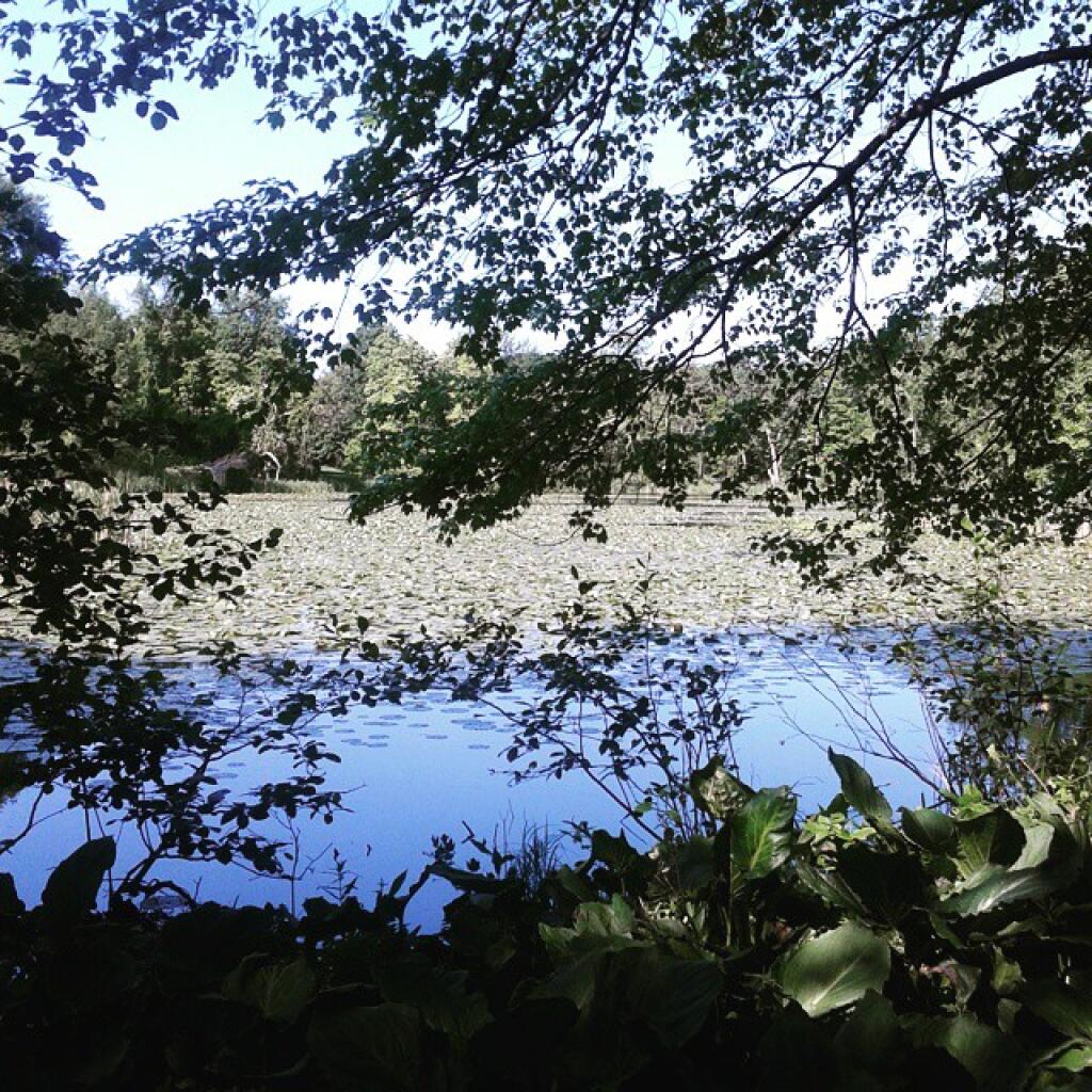
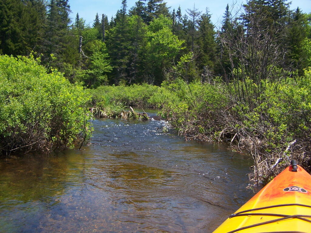
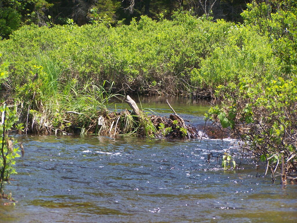
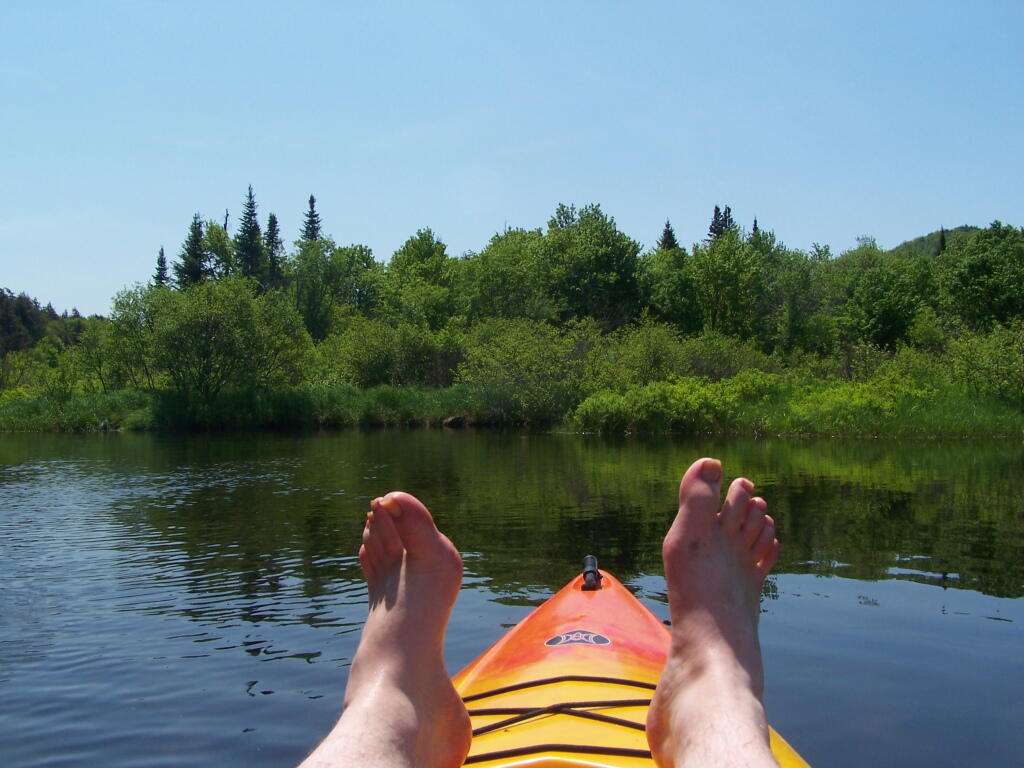
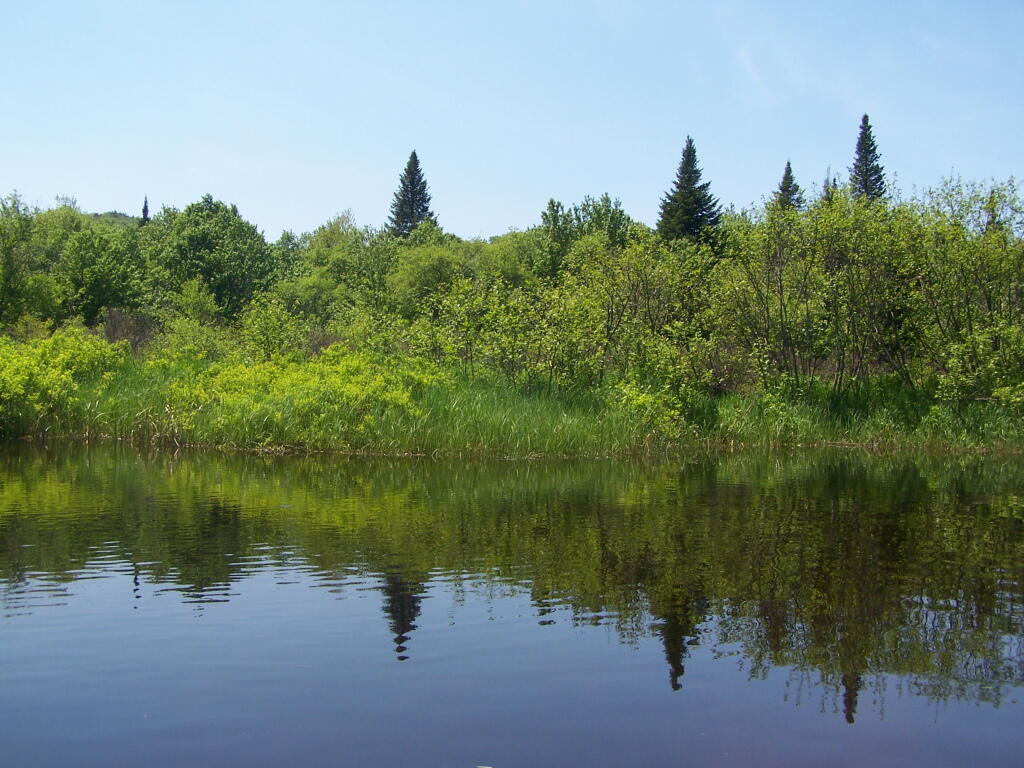
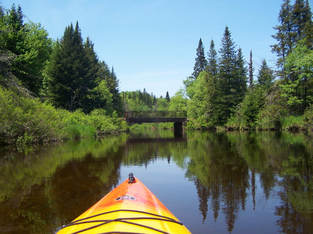
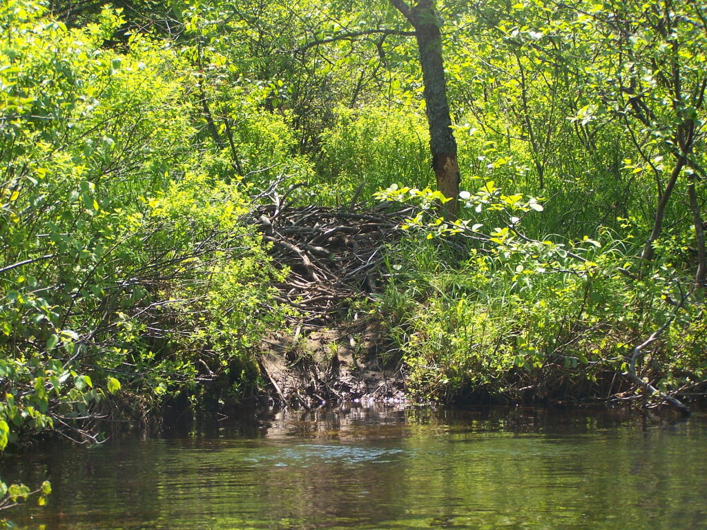
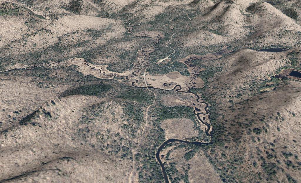
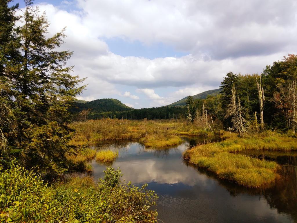
East Canada Creek at Powley Place
Here are two different maps of Powley Place, the portion of the East Canada Creek that is navigable for a couple of miles, bar the beaver dams you’ll either have to portage around or go right over.