Map: Pharaoh Lake Trail

Download a High Resolution JPEG Image of the Pharaoh Lake Trail or an Adobe Acrobat Printable PDF of the Pharaoh Lake Trail.
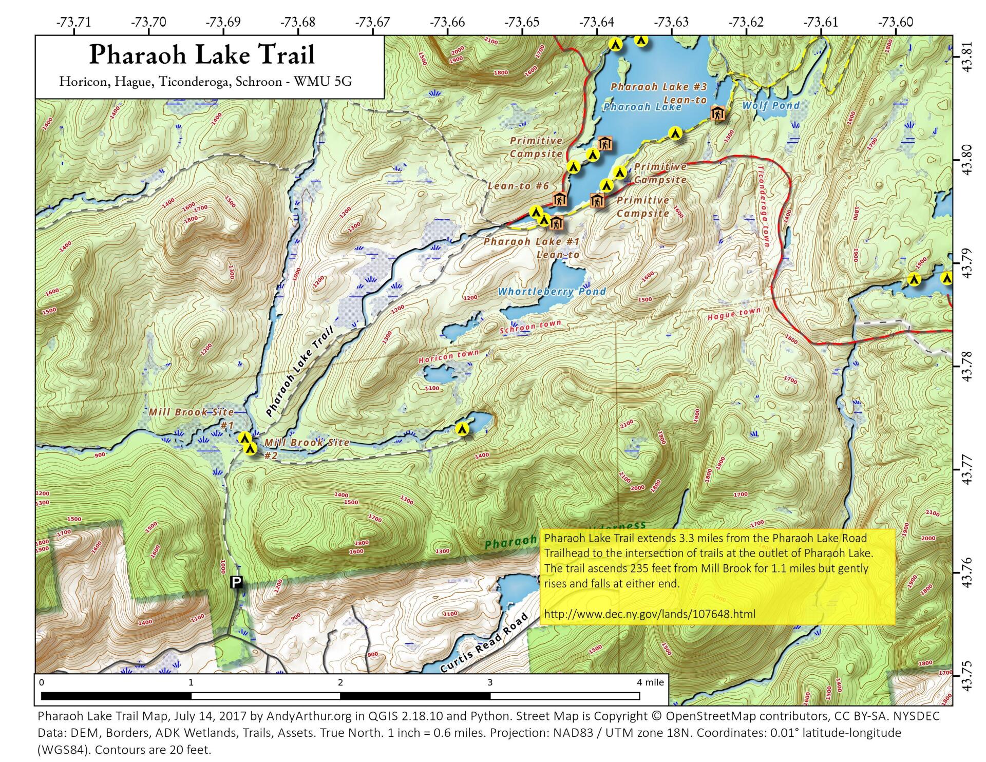
About Map: Pharaoh Lake Trail ....
The most popular way to access Pharoah Lake is via the Pharoah Lake Trail off of Pharoah Road and Beaver Pond Road in Schroon. The Pharaoh Lake Trail extends 3.3 miles from the Pharaoh Lake Road Trailhead to the intersection of trails at the outlet of Pharaoh Lake. There is no access to the north shore at this point, due to the bridge over Pharoah Lake Brook being closed at this time.

Bookmark my free Interactive GPS Map for your phone:
https://andyarthur.org/ny
... shows your location as a blue dot in relationship to campsites, trails, state land. This online map requires cell service, won't work in remote country, so also bring a paper map.
Free Download of New & Historical USGS 1:24k Topograpic Maps
Interactive maps with backcountry and roadside camping: New York, Pennsylvania, West Virginia & Vermont. List of NYS DEC Lean-Tos and Firetowers.
Google Spreadsheet with Roadside, Primitive and Pay Campsites
More about Pharaoh Lake...
Pharaoh Lake is a 441 acre lake that is the center piece for the Pharaoh Lake Wilderness. It is ringed by several campsites and lean-tos and is a short but steep hike away from Pharaoh Lake Mountain, which has some of the best views in the Southeast Adirondacks.
Maps and Interactives
Pharoah Lake
Most of the Pharoah Lake Trail follows an old woods road
Crane Pond
Pharaoh Lake Trail
Pharaoh Lake
... photos, maps and other content from from Pharaoh Lake.