Map: Patria State Forest
Download a High Resolution JPEG Image of the Patria State Forest or an Adobe Acrobat Printable PDF of the Patria State Forest.
About Map: Patria State Forest ....
42.58821912409694,-74.42370652645279
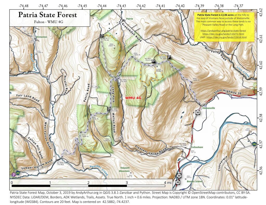
Patria State Forest is 2,136 acres on the hills to the east of Vromans Nose outside of Watsonville. The most common way to access these lands is via Pleasant Valley Road or the Long Path.
https://andyarthur.org/patria-state-forest
https://dec.ny.gov/lands/110272.html
UMP: https://dec.ny.gov/lands/22614.html

Bookmark my free Interactive GPS Map for your phone:
https://andyarthur.org/ny
... shows your location as a blue dot in relationship to campsites, trails, state land. This online map requires cell service, won't work in remote country, so also bring a paper map.
Free Download of New & Historical USGS 1:24k Topograpic Maps
Interactive maps with backcountry and roadside camping: New York, Pennsylvania, West Virginia & Vermont. List of NYS DEC Lean-Tos and Firetowers.
Google Spreadsheet with Roadside, Primitive and Pay Campsites
More about Patria State Forest...
Approximately 2,500 acres of state land in Schoharie County, crossed by Long Path and several snowmobile trails.
... photos, maps and other content from from Patria State Forest.