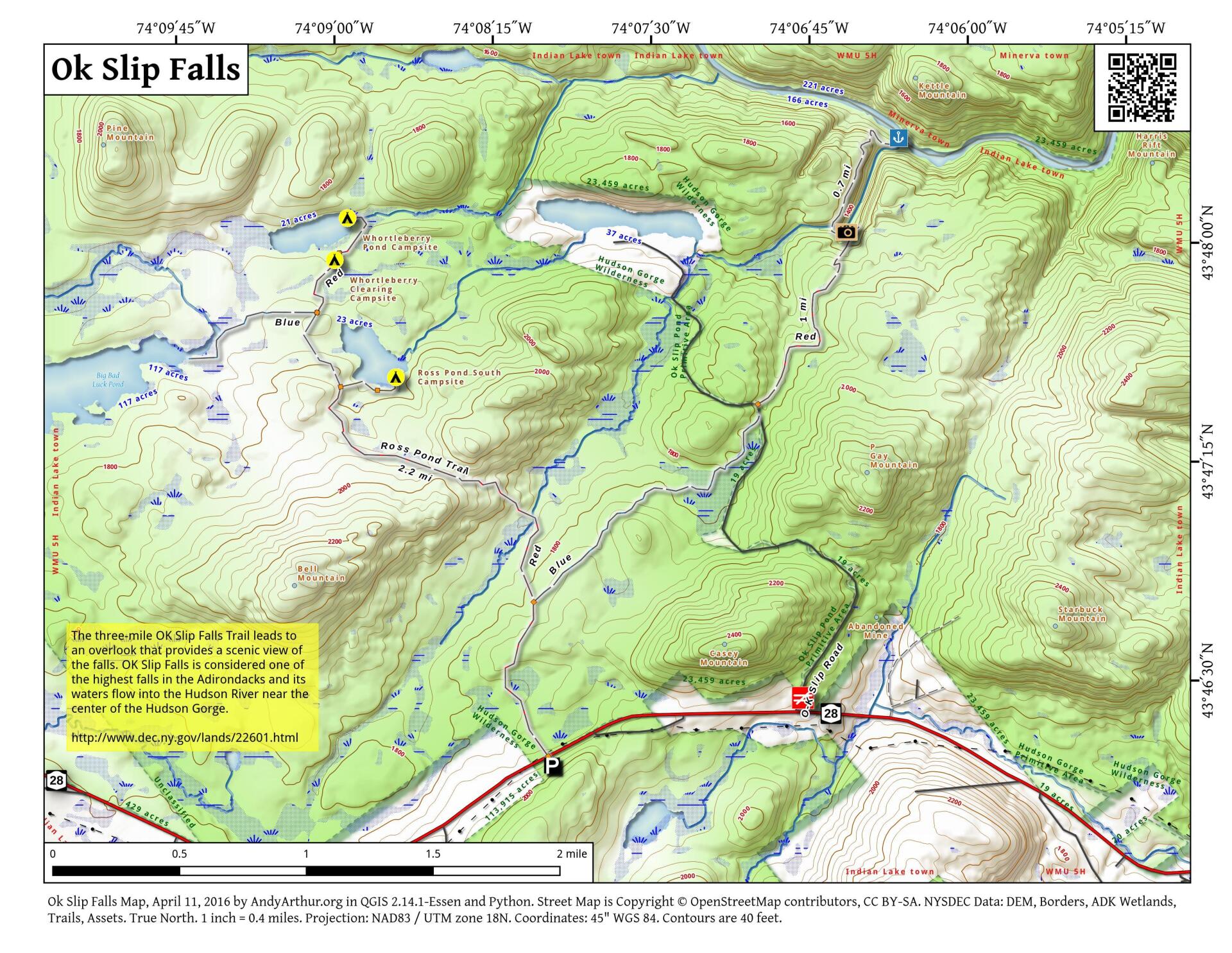
Map: Ok Slip Falls

Download a High Resolution JPEG Image of the Ok Slip Falls or an Adobe Acrobat Printable PDF of the Ok Slip Falls.

Bookmark my free Interactive GPS Map for your phone:
https://andyarthur.org/ny
... shows your location as a blue dot in relationship to campsites, trails, state land. This online map requires cell service, won't work in remote country, so also bring a paper map.
Free Download of New & Historical USGS 1:24k Topograpic Maps
Interactive maps with backcountry and roadside camping: New York, Pennsylvania, West Virginia & Vermont. List of NYS DEC Lean-Tos and Firetowers.
Google Spreadsheet with Roadside, Primitive and Pay Campsites
More about Hudson Gorge Wilderness...
The Hudson Gorge Primitive Area (HGPA) encompasses approximately 17,000 acres of State Forest Preserve in Essex and Hamilton Counties. It is located north of State Route 28 between the hamlets of Indian Lake and North River, near the center of the Adirondack Park.
The steep-sided Hudson Gorge is one of the most spectacular reaches of the Hudson River. Whitewater rafting through the gorge is the most popular recreational activity in the primitive area. With limited foot trail access, the interior of the area offers great opportunities for hiking, camping, hunting, fishing and trapping in a wild setting. Most visitors to the primitive area have been customers of whitewater rafting outfitters, who have led rafting trips between the Lake Abanakee dam on the Indian River to the hamlet of North River on the Hudson, 16 miles away.
http://www.dec.ny.gov/lands/22601.html
Maps and Interactives
Cedar River at Indian River
Upper Hudson Ski Loop Trail
Ok Slip Falls
... photos, maps and other content from from Hudson Gorge Wilderness.