Map: Northwoods Club Road Campsites
Download a High Resolution JPEG Image of the Northwoods Club Road Campsites or an Adobe Acrobat Printable PDF of the Northwoods Club Road Campsites.

Bookmark my free Interactive GPS Map for your phone:
https://andyarthur.org/ny
... shows your location as a blue dot in relationship to campsites, trails, state land. This online map requires cell service, won't work in remote country, so also bring a paper map.
Free Download of New & Historical USGS 1:24k Topograpic Maps
Interactive maps with backcountry and roadside camping: New York, Pennsylvania, West Virginia & Vermont. List of NYS DEC Lean-Tos and Firetowers.
Google Spreadsheet with Roadside, Primitive and Pay Campsites
More about Northwood Club Road...
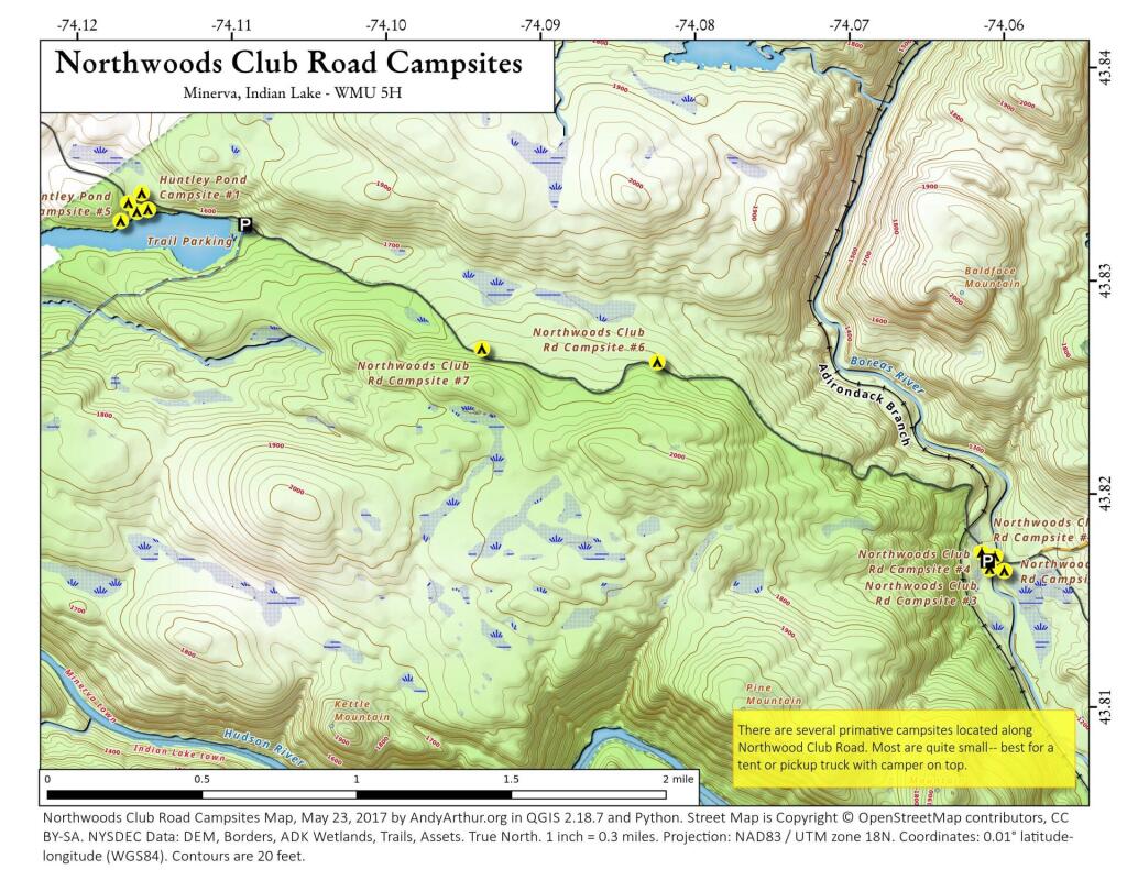
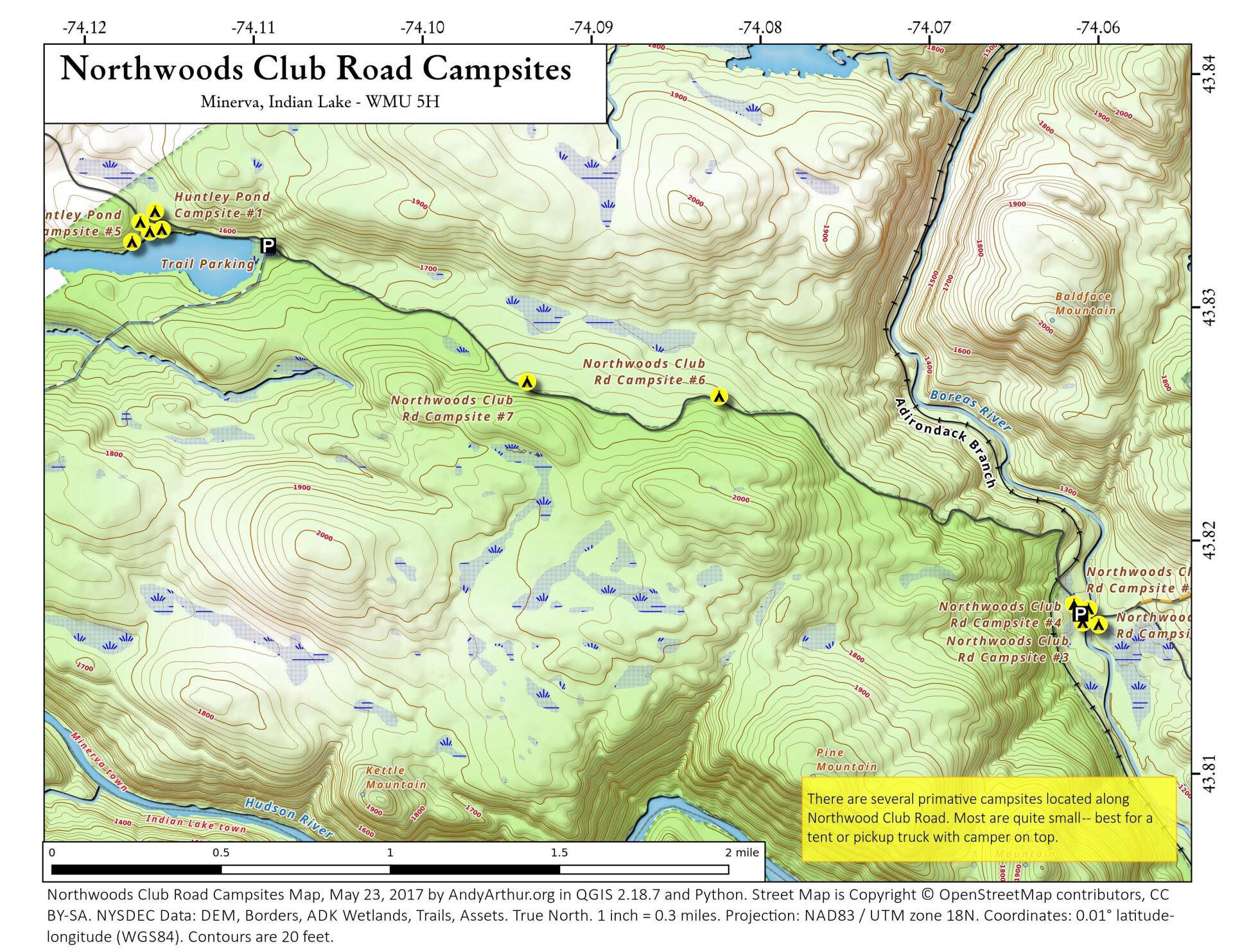
Northwood Club Road in Minerva crosses the Boreas River and has several roadside campsites, and passes by Huntley Pond, the NL Tahawus Railroad (which can be hiked to the Boreas River at Hudson River), and the Blue Ledge on the Hudson tailhead.
Maps and Interactives
Northwood Club Road
Northwoods Club Road Campsites
... photos, maps and other content from from Northwood Club Road.
4 Comments
Need a tent campsite overnight for hunting in November
As long as there isn’t snow/ice on that road, you should be good, but it’s not plowed beyond the start of the forest preserve.
Andy, is this still accurate? Looking at NYSGIS NYS Streets Layer data suggests that the road, well into the Preserve, is classified as “FCC = A41: Local, neighborhood, rural road, city street, unseparated”. The NYS Streets data dictionary (found here: https://gis.ny.gov/system/files/documents/2023/07/streets_data_dictionary.pdf) explains those FCC code designations. It IS a state-wide dataset, and seasonality /limited-use designations of roads is a Town Highway matter, so there could be wide variability in the accuracy of that dataset. I would lvoe to hear it is indeed plowed up to and beyond Huntley Pond (and the Blue Ledges trailhead), though!
I haven’t been up there in about a decade, but I doubt it’s plowed beyond the last house on the road. In the winter it’s baracaded by a simple saw horse and a road closed sign, not physically blocked with a jersey barrier like some roads. I don’t put much faith in the seasonal use code in the Streets database, as the only place it’s widely used is Livingston County.