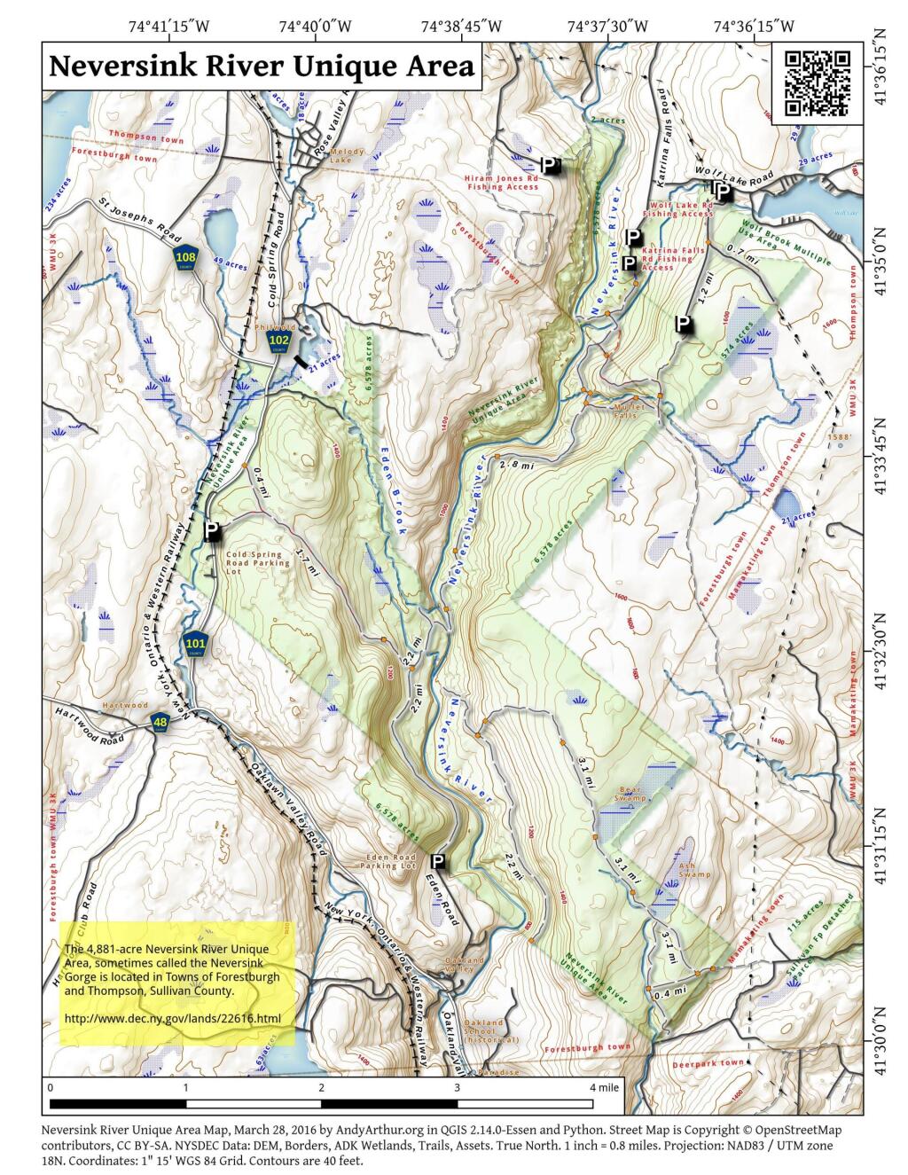
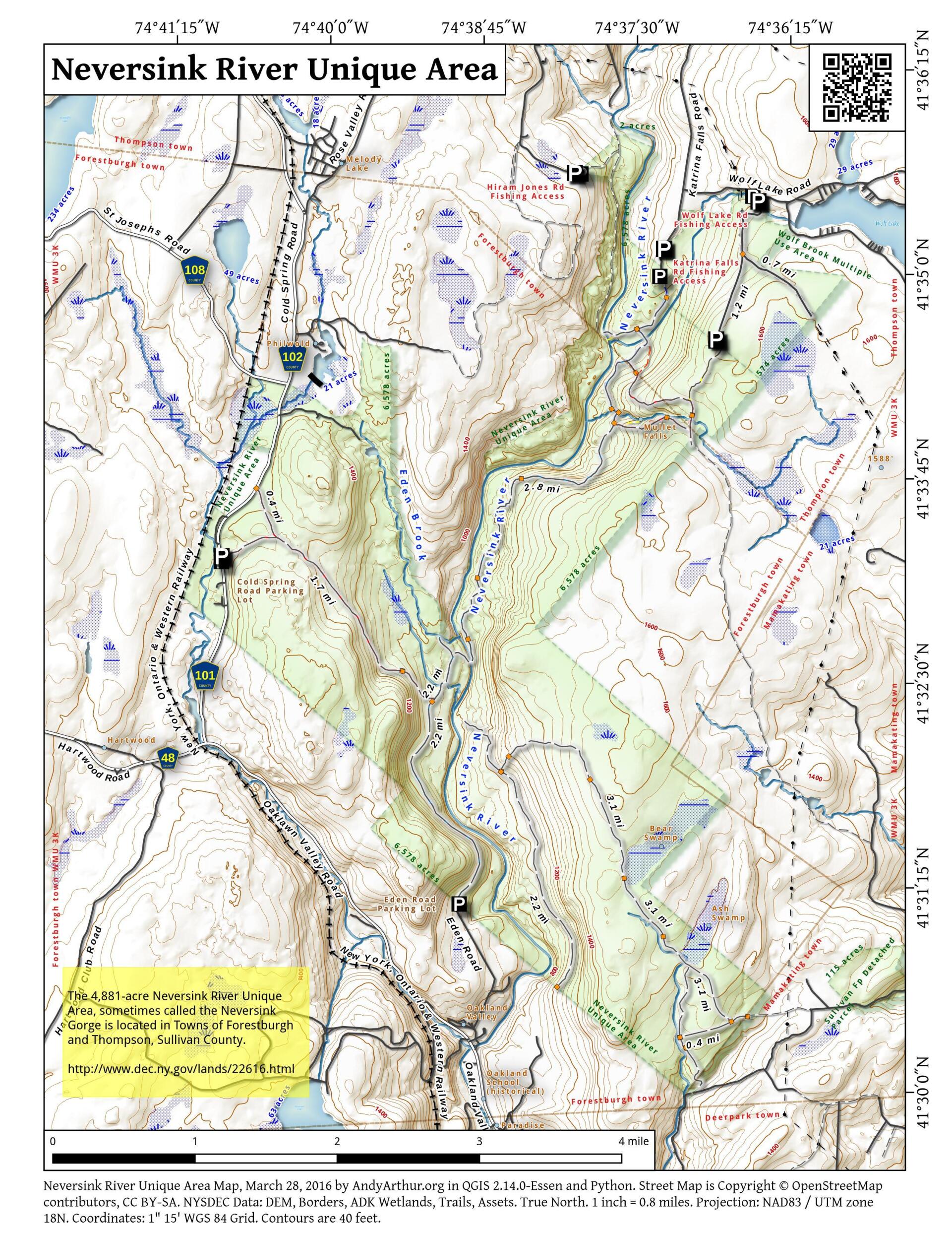
Map: Neversink River Unique Area
Download a High Resolution JPEG Image of the Neversink River Unique Area or an Adobe Acrobat Printable PDF of the Neversink River Unique Area.

Bookmark my free Interactive GPS Map for your phone:
https://andyarthur.org/ny
... shows your location as a blue dot in relationship to campsites, trails, state land. This online map requires cell service, won't work in remote country, so also bring a paper map.
Free Download of New & Historical USGS 1:24k Topograpic Maps
Interactive maps with backcountry and roadside camping: New York, Pennsylvania, West Virginia & Vermont. List of NYS DEC Lean-Tos and Firetowers.
Google Spreadsheet with Roadside, Primitive and Pay Campsites
More about Neversink River Unique Area...
The Neversink River Unique Area Management Unit is in the incorporated Towns of Forestburgh and Thompson, Sullivan County, in southeast New York State. This management unit consists of the 4,881-acre Neversink River Unique Area, sometimes called the Neversink Gorge, and the 585-acre Wolf Brook Multiple Area. All these lands are owned by the People of the State of New York and administered by the NYS Department of Environmental Conservation.
http://www.dec.ny.gov/lands/22616.html
... photos, maps and other content from from Neversink River Unique Area.
3 Comments
Hi Andy,
I’m a NYNJ Trail Alliance volunteer and frequent hiker in the Neversink Unique Area gorge. In the past year I’ve been GPS-locating the numerous ruins of an old logging community called Hackeldam. Now I need to overlay it onto a reference map to make it useful.
Do you have a digital version of the gorge map that would work? Or can you recommend another topographic map that includes the trail system? I’m a newbie but learning as fast as I can.
Thanks very much. You have a great page here.
You can get the trail data and “asset” point data (campsites, parking areas, leantos) from NY GIS/DEC: http://gis.ny.gov/gisdata/inventories/member.cfm?OrganizationID=529
I suggest for making your own maps, you use a free open-source program known as QGIS. https://qgis.org/
While QGIS is a large program once the supporting libraries are installed, it’s a very powerful tool for all forms of map making. It has a bit of a learning curve, but it’s much easier to use then it was years ago, and is a very powerful tool that revivals and some cases beats the commercial ArcGIS.
Thank you for this. Let me give it a try.