Search Results for: map moose river plains campsites no 1 31

Below is a list of lean-tos, campsites, parking areas, and other assets along the Northville – Placid Trail πŸ•οΈ

Link to anΒ  Interactive Map of the Northville Placid Trail.

Type Name Description Coordinates
Hand Launch Ceder River Flow Boat Ramp Hand Carry Launch, Ramp 43.725826369700904, -74.47289916126694
Lean-To Beaver Pond (Aka Cedar Lakes Lean-To #2) Β  43.625969396804386, -74.54927150370021
Lean-To Carry Lean-To Β  43.67874488347091, -74.49549821879448
Lean-To Catlin Bay #1 Lean-To Β  43.99801269269887, -74.39278456108421
Lean-To Cedar Lakes #1 Lean-To Β  43.628125665037935, -74.54047323992656
Lean-To Cold River #2 Lean-To Β  44.14251664317184, -74.13035824291548
Lean-To Cold River #3 Lean-To Β  44.091459278051204, -74.25764175084498
Lean-To Cold River #4 Lean-To Β  44.09139025333258, -74.25573480252505
Lean-To Cold River Lean-To #1 Lean-To Β  44.14272737628489, -74.12984021065587
Lean-To Duck Hole #1 Lean-To Β  44.14162687400988, -74.10693734676616
Lean-To Duck Hole #2 Lean-To Β  44.14167686466829, -74.10654354672256
Lean-To Hamilton Lake Stream #1 Lean-To Β  43.39741359517532, -74.45529759002217
Lean-To Hidden Cove Lean-To Β  44.00265528819394, -74.38648026325164
Lean-To Kelly Point #1 Lean-To Β  44.02880023617087, -74.36730798599064
Lean-To Kelly Point #2 Lean-To Β  44.02870256717196, -74.36713034867948
Lean-To Moose Pond Lean-To Β  44.182843382402666, -74.07364102375995
Lean-To Mud Lake Lean-To Β  43.342671073157994, -74.45629078563864
Lean-To O’neill Flow Lean-To Β  43.875596840936154, -74.36642623697053
Lean-To Ouluska Pass Brook Lean-To Β  44.120221281603584, -74.18744717390932
Lean-To Plumley Point #2 Lean-To Β  44.06559891610762, -74.32761224546002
Lean-To Rodney Point #1 Lean-To Β  44.04140938489936, -74.35014909639557
Lean-To Rodney Point #2 Lean-To Β  44.042976745412616, -74.34933464753136
Lean-To Seward Lean-To Β  44.106244137686204, -74.2091536427719
Lean-To Silver Lake Lean-To Β  43.29193545679836, -74.4237351676776
Lean-To South Lake Lean-To Β  43.58724480971, -74.62157883837274
Lean-To Spruce Lake #1 Lean-To Β  43.52728411257782, -74.6099246975027
Lean-To Spruce Lake #2 Lean-To Β  43.53463062983387, -74.60808580306896
Lean-To Spruce Lake #3 Lean-To Β  43.53712972792447, -74.60820962802477
Lean-To Stephens Pond Lean-To Β  43.818673668554965, -74.42052487172707
Lean-To Tirrel Pond North Lean-To Β  43.887344477557306, -74.37880062606054
Lean-To West Canada Creek Lean-To Β  43.58698761405157, -74.61399797100106
Lean-To West Lake #1 Lean-To Β  43.59316222884976, -74.62688668431306
Lean-To West Stony Creek Lean-To Β  43.22474428954461, -74.26933345717664
Paved Parking Lot Lake Durant Northville Placid Trail Parking Lot Paved, 12 Vehicle Capacity 43.84219550506574, -74.3862742856788
Paved Parking Lot Northville Lake Placid Trail Parking Lot Paved, Good Condition 43.84213270187873, -74.38656792328511
Primitive Tent Site Canary Pond Campsite Β  43.30513256312245, -74.4472062440692
Primitive Tent Site Cedar Lake Dam 1 Β  43.62894580965635, -74.53639939387939
Primitive Tent Site Cedar Lake Dam Tentsite Β  43.62937624507422, -74.53679785644344
Primitive Tent Site Cedar River Flow Tentsite Β  43.70292480315104, -74.48713041165333
Primitive Tent Site Fall Stream Tentsites Β  43.49661052800474, -74.53713112743992
Primitive Tent Site Jessup River Tentsites Β  43.51246207852797, -74.57229710138834
Primitive Tent Site Kelly Point Tentsites Β  44.02910364406153, -74.36670207204214
Primitive Tent Site Moose Pond Tentsites Β  44.18274441156179, -74.07408240028583
Primitive Tent Site Moose River Plains Campsite 01 Live 43.72667672123972, -74.47410026642402
Primitive Tent Site Moose River Plains Campsite 02 Live 43.72665150100841, -74.47331107300782
Primitive Tent Site Moose River Plains Campsite 03 Live 43.725959512295866, -74.47389996564202
Primitive Tent Site Moose River Plains Campsite 04 Live 43.726067692208126, -74.47423264719026
Primitive Tent Site Moose River Plains Campsite 05 Live 43.725563790898704, -74.47417512282912
Primitive Tent Site Moose River Plains Campsite 06 Live 43.72522313374867, -74.47458303719159
Primitive Tent Site Mud Lake Tentsites Β  43.59647433847274, -74.61354076182431
Primitive Tent Site O’neill Flow Tentsite Β  43.87567135918534, -74.3666467203306
Primitive Tent Site Rock Lake Campsite Β  43.265591839994535, -74.41543516012669
Primitive Tent Site Salmon River Tentsites Β  43.907925071619914, -74.38530801916977
Primitive Tent Site Shattuck Clearing Tentsites Β  44.08679657756681, -74.26368397541134
Primitive Tent Site Silver Lake Tent Site Β  43.29112770008321, -74.4240469986026
Primitive Tent Site Spruce Lake Tentsite Β  43.53695545329776, -74.60818912022354
Primitive Tent Site Tirrell Pond North Tentsites Β  43.88594343639596, -74.37834897628142
Primitive Tent Site Trailside Campsite Β  43.2716741112023, -74.43107546264162
Primitive Tent Site Wanika Falls Tentsites Β  44.19944690357389, -74.05663862305364
Primitive Tent Site West Lake Former Caretaker Clearing Tentsites Β  43.59389874347195, -74.62560220247346
Primitive Tent Site Whitehouse Campsite Β  43.373430193527696, -74.43578942968477
Primitive Tent Site Whitehouse Campsite Β  43.37406302094423, -74.43516794694158
Primitive Tent Site Woods Lake Campsite #2 Fire Pit, Water Front Campsite 43.25071034607129, -74.31177480398298
Primitive Tent Site Woods Lake Campsite #3 Fire Ring, Water Front Tentsite, Scenic View 43.250888826581715, -74.31104030228295
Primitive Tent Site Woods Lake Campsite #4 Fire Place, Water Front Campsite, Nice View 43.251811433787196, -74.3092782205918
Unpaved Parking Lot Benson Road Parking Area 8 Vehicle Capacity 43.24745928673895, -74.31187044250609
Unpaved Parking Lot Chubb River Bridge Β  44.2628824981147, -74.01364844250504
Unpaved Parking Lot Moose River Recrieation Area Northville-Placid And Cedar River Trails 43.726457025366315, -74.47386984656715
Unpaved Parking Lot Norhtville Placid Parking-Haskells Rd Β  43.45841038153893, -74.52201705350714
Unpaved Parking Lot Northville Placid Trail Parking Area 6 Car Interior Parking Area 43.21330828950083, -74.2083824784703
Unpaved Parking Lot Northville Placid Trail Route 28n Parking Lot Β  43.97584466308438, -74.39296138679799
Unpaved Parking Lot Tarbell Road Shoulder Parking Lot Β  43.984346733793245, -74.39813014848872
Unpaved Parking Lot Wakely Dam Β  43.72640808237045, -74.47425964611213
Unpaved Parking Lot Wakely Mountain Trailhead Parking Lot 1250 Sq Feet 43.732197733217824, -74.47253968128065
Unpaved Parking Lot Wakely Pond Accessible Fishing Dock Β  43.737643556916666, -74.46542853470272
Unpaved Parking Lot Wakely Pond Accessible Launch Β  43.738042554833534, -74.46399313053813

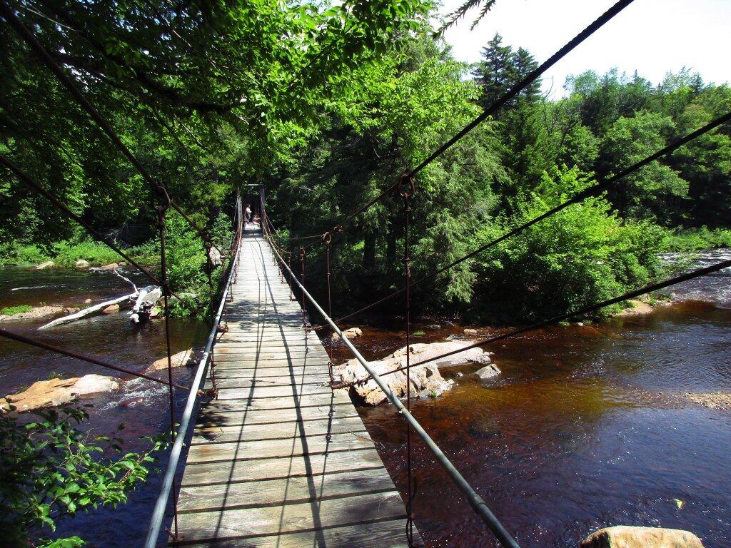
 Whitehouse Suspension Bridge

Locations and Maps of Lean-Tos in NYS

Interactive Map of Lean-Tos

You can get a downloadable, more detailed map with campsites, lean-tos, scenic vistas and trails.

Note: This list is sorted from North to South, and West to East in New York, therefore the farthest North Lean-To in NY State is in the Debar Mountain Wild Forest, and the farthest south one is in David A. Sarnoff Pine Barrens Preserve in Long Island. Location links take you to aerial photos of the Lean-Tos on the free ACME Mapper.

Download or View this Chart on Google Sheets

State Forest LandNameTypeDescriptionLocation
Debar Mtn. Wild ForestDebar Mountian Lean-ToLean-To 44.598926, -74.228592
Debar Mtn. Wild ForestGrass Pond Lean-ToLean-To 44.493389, -74.251194
Taylor Pond Wild ForestNorth Shore Taylor Pond Lean-ToLean-ToManaged By Operations44.4897, -73.861427
Taylor Pond Wild ForestSouth East Taylor Pond Lean-ToLean-ToManaged By Operations44.482888, -73.853777
Taylor Pond Wild ForestNorthwest Shore Taylor Pond Lean-ToLean-ToManaged By Operations44.477689, -73.881283
Taylor Pond Wild ForestPoke-O-Moonshine Summit Lean-ToLean-To 44.399797, -73.514557
Saint Regis Canoe AreaFish Pond Campsite 2Lean-To 44.396133, -74.370421
Saint Regis Canoe AreaFish Pond Campsite 5Lean-To 44.391301, -74.365807
Saint Regis Canoe AreaSt. Regis Pond South Shore Lean-ToLean-ToWithin The Adopt A Lean-To System44.380642, -74.320299
Saint Regis Canoe AreaSt. Regis Pond Campsite 19Lean-To 44.380626, -74.320423
Wolf Lake State ForestBeaver Flow Lean-ToLean-To 44.357822, -75.316001
Mckenzie Mtn. WildernessLoch Bonnie Lean-ToLean-To 44.347347, -73.995669
Mckenzie Mtn. WildernessWhite Face Brook Lean-ToLean-To 44.344217, -73.928647
Wolf Lake State ForestWolf Lake Lean-ToLean-To 44.336323, -75.313886
Saranac Lakes Wild ForestLake Placid Campsite 3Lean-To 44.332595, -73.95668
Saranac Lakes Wild ForestLake Placid Campsite 2Lean-To 44.332296, -73.956626
Wolf Lake State ForestMoon Pond Lean-ToLean-To 44.332276, -75.321172
Saranac Lakes Wild ForestFollensby ClearLean-To 44.325095, -74.349897
Wolf Lake State ForestHuckleberry Lake Lean-ToLean-To 44.324272, -75.333738
Mckenzie Mtn. WildernessPlacid Lean-ToLean-To 44.321456, -74.030786
Saranac Lakes Wild Forest Lean-To 44.309124, -74.18053
Saranac Lakes Wild Forest Lean-To 44.302887, -74.302634
Saranac Lakes Wild Forest Lean-To 44.289835, -74.216869
Saranac Lakes Wild Forest Lean-To 44.286942, -74.289775
Saranac Lakes Wild Forest Lean-To 44.286657, -74.162602
Saranac Lakes Wild Forest Lean-To 44.271712, -74.273283
Saranac Lakes Wild Forest Lean-To 44.265599, -74.24293
Hurricane Mountain Primitive AreaLost Pond/BiesemeyerLean-To 44.26073, -73.710011
Hurricane Mountain Primitive AreaGulf Brook Lean-ToLean-To 44.253097, -73.71796
Saranac Lakes Wild Forest Lean-To 44.228772, -74.375533
High Peaks Wilderness Lean-To 44.198805, -74.31831
Horseshoe Lake Wild ForestEagle Landing Lean-ToLean-To 44.19683, -74.512309
High Peaks Wilderness Lean-To 44.177317, -74.321808
Giant Mountain WildernessGiant Mtn. Lean-ToLean-To 44.175641, -73.722171
Horseshoe Lake Wild Forest Lean-To 44.158907, -74.560725
High Peaks Wilderness Lean-To 44.15683, -74.313308
Cranberry Lake Wild Forest Lean-To 44.1534, -74.884029
High Peaks Wilderness Lean-To 44.147236, -74.318105
Dix Mountain WildernessBouquet Lean-ToLean-To 44.110904, -73.774043
High Peaks Wilderness Lean-To 44.105829, -74.312037
Sargent Ponds Wild Forest Lean-To 44.102744, -74.321863
Sargent Ponds Wild Forest Lean-To 44.082504, -74.333915
Sargent Ponds Wild Forest Lean-To 44.081407, -74.335829
High Peaks Wilderness Lean-To 44.065927, -74.326697
Dix Mountain WildernessLilian Brook Lean-ToLean-To 44.058989, -73.806533
Dix Mountain WildernessSlide Brook Lean-ToLean-To 44.044126, -73.805858
High Peaks Wilderness Lean-To 44.042977, -74.349335
High Peaks Wilderness Lean-To 44.041409, -74.350149
High Peaks Wilderness Lean-To 44.02862, -74.366763
High Peaks Wilderness Lean-To 44.002655, -74.38648
William C. Whitney WildernessLake Lila # 7Lean-To 44.002145, -74.775682
High Peaks Wilderness Lean-To 43.998164, -74.392741
Independence River Wild ForestTrout Pond Lean ToLean-To 43.928489, -74.94487
Sargent Ponds Wild ForestDeerland Carry Lean-To 2Lean-ToFair Condition43.926218, -74.475396
Sargent Ponds Wild ForestDeerland Carry Lean-To 1Lean-ToFair Condition43.925781, -74.475846
Sargent Ponds Wild ForestPinebrook Lean-ToLean-ToFair Condition43.906646, -74.50259
Sargent Ponds Wild Forest Lean-To 43.902847, -74.548063
Blue Mountain Wild ForestNorth End Tirrel Pond Lean-ToLean-To 43.887378, -74.377739
Sargent Ponds Wild Forest Lean-To 43.879414, -74.606052
Blue Mountain Wild ForestO’neil Lean-ToLean-To 43.875096, -74.367316
Sargent Ponds Wild Forest Lean-To 43.871006, -74.628108
Sargent Ponds Wild Forest Lean-To 43.870772, -74.628507
Sargent Ponds Wild Forest Lean-To 43.87072, -74.629172
Sargent Ponds Wild ForestLower Sargents Pond Lean-ToLean-ToFair Condition43.859331, -74.562695
Blue Ridge WildernessBoulderLean-To 43.841564, -74.472689
Sargent Ponds Wild Forest Lean-To 43.836898, -74.535266
Moose River Plains Wild Forest Lean-To 43.831671, -74.661756
Moose River Plains Wild Forest Lean-To 43.831605, -74.661511
Moose River Plains Wild Forest Lean-To 43.831434, -74.660902
Blue Ridge WildernessCascade Pond Lean-ToLean-To 43.829744, -74.436618
Independence River Wild ForestPanther Pond Lean-ToLean-To 43.823535, -75.169312
Blue Ridge WildernessWilson PondLean-To 43.820192, -74.46868
Blue Ridge WildernessStephens PondLean-To 43.818674, -74.420524
Blue Ridge WildernessStephens PondLean-To 43.818674, -74.420525
Sargent Ponds Wild Forest Lean-To 43.817134, -74.64378
Sargent Ponds Wild Forest Lean-To 43.81709, -74.643251
Sargent Ponds Wild Forest Lean-To 43.8162, -74.644668
Blue Ridge WildernessBlue Ridge Lean-ToLean-To 43.80014, -74.610139
Moose River Plains Wild Forest8thlake East Shore Lean-ToLean-To 43.789783, -74.698592
Moose River Plains Wild Forest8th Lake North Shore Lean-ToLean-To 43.780115, -74.704439
Moose River Plains Wild Forest8th Lake Island Lean-ToLean-To 43.779025, -74.704429
Moose River Plains Wild Forest Lean-To 43.75639, -74.717817
Moose River Plains Wild Forest Lean-To 43.750767, -74.734643
Moose River Plains Wild Forest Lean-To 43.747805, -74.744199
Independence River Wild ForestPine Lake Lean-ToLean-To 43.708394, -75.146453
HaderondahMiddle Branch LakeLean-To 43.702926, -75.096002
Siamese Ponds WildernessHour Pond Lean-ToLean-To 43.70112, -74.158221
HaderondahCedar Pond Lean ToLean-To 43.69597, -75.082602
HaderondahMiddle Settlement LakeLean-To 43.685949, -75.098614
West Canada Lakes WildernessColvin Brook Lean-ToLean-To 43.652414, -74.49038
Lake George Wild ForestFive Mile Mountain Lean-ToLean-ToLean-To W/ Privy And Firering43.647336, -73.574534
Black River Wild ForestRemsen Falls Lean-ToLean-To 43.629925, -75.036288
Lake George Wild ForestFifth Peak Lean-ToLean-ToLean-To W/ Privy And Firering43.619313, -73.584112
Black River Wild ForestWoodhull Lake Lean-ToLean-To 43.599885, -75.020382
Lake George Wild ForestBlack Mountain Ponds Lean-ToLean-ToLean-To With Privy And Firering43.59966, -73.533064
West Canada Lakes WildernessPillsbury Lake Lean-ToLean-To 43.596898, -74.531665
Lake George Wild Forest Lean-ToCampsite With Lean-To 13-2743.595821, -73.517951
Lake George Wild Forest Lean-ToCampsite With Lean-To 5-1043.587168, -73.527759
Lake George Wild ForestGreenland Pond LeantoLean-ToLeanto With Privy, Picnic Table And Fire Ring43.577804, -73.51684
Lake George Wild ForestFishbrook Pond North LeantoLean-ToLeanto With Privy, Picnic Table And Fire Ring43.576039, -73.536103
Lake George Wild ForestFishbrook Pond South LeantoLean-ToLeanto With Privy, Picnic Table And Fire Ring43.573872, -73.538477
Black River Wild ForestSand Lake Falls Lean-ToLean-To 43.558914, -75.003058
Black River Wild ForestGull Lake Lean-ToLean-To 43.553747, -75.059378
Black River Wild ForestChub Pond Lean-To #2Lean-To 43.529823, -75.042494
Black River Wild ForestChub Pond Lean-To #1Lean-To 43.524598, -75.043801
West Canada Lakes WildernessT Lake Leant-ToLean-To 43.452718, -74.582282
Silver Lake WildernessHamilton Lake Stream Lean-To 1Lean-To 43.39716, -74.455046
Silver Lake WildernessHamilton Lake Stream Lean-To 2Lean-To 43.397156, -74.455065
Cobb Brook State ForestLeantoLean-To 43.344545, -75.67222
Silver Lake WildernessMud Lake Lean-ToLean-To 43.342671, -74.456291
Deruyter State ForestDeruyter Lean-ToLean-To 42.820185, -75.859105
Morgan Hill State ForestMorgan Hill Lean-ToLean-To 42.767202, -76.011256
Perkins Pond State ForestFlt Lean-ToLean-To 42.642307, -75.743766
Dutch Settlement State ForestLean-ToLean-To 42.629438, -74.267543
Whaupaunaucau StateLeantoLean-To 42.606063, -75.467114
Burnt-Rossman Hills State ForestEminence Lean-ToLean-To 42.543304, -74.488595
Clapper Hollow State ForestClapper Hollow Lean-ToLean-To 42.528201, -74.642004
Tuller Hill State ForestTuller Hill Lean-T0Lean-ToRebuilt In 2002 From Local State Forest Red Pine, Built By Volunteers From Suny Cortland42.512201, -76.120824
Kennedy State ForestFoxfire LeantoLean-To 42.472853, -76.178732
Ludlow Creek State ForestLudlow Creek Lean-ToLean-To8′ X 10′42.445802, -75.701507
Genegantslet State ForestTop Ten Lean-ToLean-To20′ X 20′42.422887, -75.767435
Robinson Hollow State ForestKimme Lean-ToLean-To 42.390596, -76.271801
Sugar Hill State ForestVanzandt Lean-ToLean-To 42.389935, -76.972601
Sugar Hill State ForestThe Twin Lean-To’sLean-ToTwo Lean-To At This Location42.382253, -77.00268
Sugar Hill State ForestTemplar Rd Lean-ToLean-To 42.373082, -76.95548
Sugar Hill State ForestParks Hollow Lean-ToLean-To 42.369463, -77.012608
Huntersfield State ForestLean-ToLean-To 42.355041, -74.346067
Beebe Hill State ForestBeebe Hill Lean-ToLean-To 42.335425, -73.484181
Shindagin Hollow State ForestShindagin Lean-T0Lean-ToScheduled For Replacement In 200442.327644, -76.329036
Danby State ForestBald Hill Lean-ToLean-To 42.327042, -76.490061
Danby State ForestTravor Rd Lean-ToLean-To 42.317642, -76.422544
Harvey Mountain State ForestHarvey Mountain Lean-ToLean-To 42.313988, -73.441495
Burt Hill State ForestOn Finger Lake Trail Lean-ToLean-To 42.313213, -77.566373
Elm Ridge Wild ForestOn Elm Ridge Trail Lean-ToLean-To 42.306134, -74.173598
South Bradford State ForestMoss Hill Lean-ToLean-To 42.289116, -77.118881
Windham Blackhead Range WildernessBatavia Kill Lean-ToLean-To 42.278839, -74.102579
Rusk Mountain Wild ForestJohn Robb Leanto Lean-ToLean-To 42.189374, -74.238696
Rusk Mountain Wild ForestDiamond Notch Lean-ToLean-To 42.16917, -74.256848
Hunter-West Kill Mountain WildernessDevil’s Acre Lean-ToLean-ToGood Condition42.165955, -74.229624
Arctic China State ForestA-40 Lean-ToLean-To 42.158491, -75.362027
Barbour Brook State ForestA-41 Lean ToLean-To 42.152807, -75.31021
  Lean-To 42.135655, -74.16269
Dry Brook Ridge Wild ForestGerman Hollow Road Lean-ToLean-To 42.134527, -74.616198
  Lean-To 42.119518, -74.086575
  Lean-To 42.117719, -74.503199
  Lean-To 42.115031, -74.49075
  Lean-To 42.102787, -74.394826
  Lean-To 42.098467, -74.09079
Big Indian Wildernes AreaRider Hollow Lean-ToLean-To 42.092012, -74.505713
  Lean-To 42.082185, -74.586611
Big Indian Wildernes AreaMckinly Hollow Lean-ToLean-To 42.075339, -74.485857
  Lean-To 42.071935, -74.28035
  Lean-To 42.069751, -74.287449
  Lean-To 42.067368, -74.586988
  Lean-To 42.066913, -74.654635
Big Indian Wildernes AreaShandaken Brook Lean-ToLean-To 42.050274, -74.5106
Delaware Wild ForestCampbell Mountain Trail Lean-ToLean-To 42.048989, -74.927363
  Lean-To 42.048641, -74.645056
  Lean-To 42.039437, -74.594017
  Lean-To 42.027316, -74.335645
Delaware Wild ForestTrout Pond Trail North Lean-ToLean-ToBuilt For Ada42.012942, -74.946392
Delaware Wild ForestTrout Pond Trail South Lean-ToLean-ToBuilt For Ada42.011758, -74.947566
Big Indian Wildernes AreaBiscuit Brook Lean-ToLean-To 42.009105, -74.483852
Delaware Wild ForestPelnor Hollow Trail Lean-ToLean-To 42.005744, -74.867403
Big Indian Wildernes AreaFall Brook Lean-ToLean-To 41.998075, -74.560392
  Lean-To 41.959182, -74.406877
  Lean-To 41.94006, -74.632055
David A. Sarnoff Pine Barrens PreserveInterior Lean- ToLean-To 40.89774, -72.660615

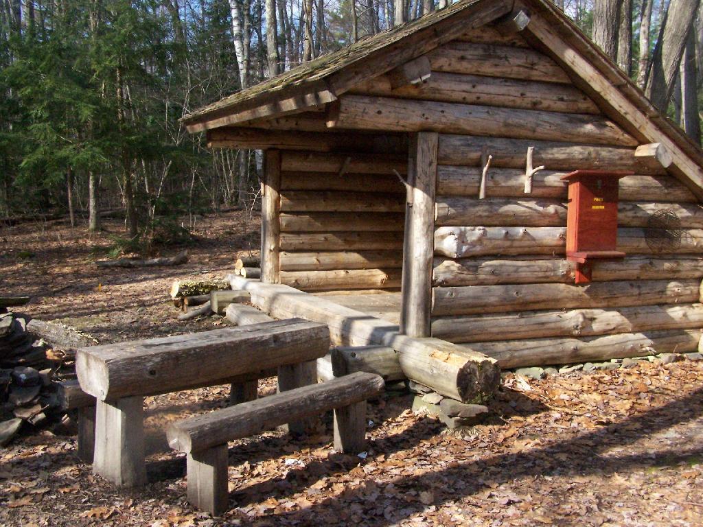
Lean-To Side

NYS Roadside and Primitive Backcountry Campsites and Lean-Tos

Here is a Leaflet/KML/Google Maps overview of Lean-tos and Primitive Campsites in an interactive map for NYS DEC Lands and Finger Lakes National Forest Lean-To data and many of campsites come from the NYS DEC, while additional data has been heads-up digitized based on my own exploration.

Google Sheets with Coordinates: Campsites and Lean-Tos

Helpful Hints: In the upper right corner, use the layer button to switch to US Forest Service Maps for more detail on forest service lands, or use the US Topographic Map DRGs to get traditional topographic maps from the USGS.

Updated on 5/13/2021 Moved Pennsylvania, West Virginia and Vermont campsites to a separate maps.

Updated on 3/14/2021 Incorporated additional data found on DEC ARC Map Server at gisservices.dec.ny.gov, adding 81 additional NY State campsites not found on this map.

Updated on 1/31/2021 Fixed overlaps between NYS DEC data and heads up-digitized campsites by myself. Also, re-created all the points in Speculator Tree Farm/Perkins Clearing by geo-referencing and plotting the official map to add campsites to correct locations.

Note: This was not available for a number of years due to the limitations of Google Maps, however since switching to Leaflet, it has made it possible to load in a larger number of points.

Here are the primitive campsites dataset broken into KML files πŸ• that are less then 1,000 points per file that are more friendly with Google Earth and similar services:

Catskills, Central NY, Western NY - generally campsites South of the Mohawk River / Erie / Barge Canal, extended east by an imaginary line to the Vermont - Massachusetts border.

Southern Adirondacks and Tug Hill - generally campsites North of the Mohawk River / Erie / Barge Canal but South of NY 177 (Tug Hill) to NY 26 to Moose River Road to NY 28 to NY 28N to Blue Ridge Road to Johnson Pond Road to NY 74 to Ticonderoga. Includes Tug Hill, Black River WF, Moose River Plains, Wilcox Lake WF, Hammond Pond WF, Vanderwhacker, Cheney Pond, and Pharaoh Lake WF.

North Adirondacks and Tug Hill - generally campsites North of NY 177 (Tug Hill) to NY 26 to Moose River Road to NY 28 to NY 28N to Blue Ridge Road to Johnson Pond Road to NY 74 to Ticonderoga. Includes White Hill SF, Grass River, Pigeon Lake, Ha-De-Ron-Dah, Sargent Ponds, Blue Lake, High Peaks, Five Ponds, Watsons Triangle, St. Regis Canoe, McKenzie, Debar Mnt, Taylor Pond, Valcour Island, Deer River, Brasher Falls, Hammond Pond WF (North of NY 78)

Lean-Tos - DEC lean-tos are in a separate file.

I Can Help You Make a Map

Geographic Information Services (GIS)MapsCartography πŸ—Ί

I am an amateur cartographer who designs maps and does a wide variety geospatial analysis using free and open-source geographic information software (GIS) and public sources of data to design quality maps, graphs, charts and datasets. I am looking for new and interesting projects to improve my skills, make connections and expand my portfolio.

Are you looking for my personal blog with it’s hiking, camping and outdoor recreation maps, along with a variety of charts, photos, and stories? Please visit andyarthur.org.

Mapping Avaliable

  • Tax/Property Mapping
  • High Resolution Aerial Photography
  • Recreational Maps – Hunting, Camping, Hiking
  • Georeference addresses using State Address Mapping service, plot them on a map
  • Wetlands, Topographic Contours, Land Cover
  • Compare historical aerial photos or maps to current photography
  • Web mapping using leaflet (HTML/Javascript file to embed on a website or use at home)

Example maps can found below.

Services Available

  • A list of property owners within 1,000 feet of a proposed development
  • How many cars per day pass a business?
  • How many people who live within 5 miles of a business or park?
  • How many African Americans and Hispanics live within 10 miles of Albany Pine Bush?
  • What are wealthiest election districts?
  • How many people ride public transit in a neighborhood?
  • How much of an area is wetland or farm field?
  • How big an interchange?
  • What is the average slope and elevation of an area or trail?

Example data can found below.

Pricing and Cost

For most projects, there is no fee. I am looking for experience, references, mentors and connections in the geospatial community.

If you have a large project, let’s talk about it. I might be willing to do it for free, if it’s something really interesting
or important like fighting suburban sprawl and pollution. I don’t a business or taxes set up, so I can’t really charge at this point.

How to get started?

Please send me an email describing the mapping or data project in as much detail as possible.

My email is andy@andyarthur.org

Data Avaliable

  • US Census – 2019 American Community Survey, 2020 US Census
  • NYS Tax and Assessment Rolls (2020)
  • NYSDOT Traffic Counts and Road Data
  • Historical Aerial Photography (primarily 1952, but earlier and later exist)
  • ArcGIS REST/Services and WMS Services from state and local agencies
  • LiDAR Elevation Profiles
  • USGS Topographic Maps, historic and modern – with overlays if requested
  • Data Repositories like CUGIR, DataNY.gov and NYSGIS
  • Recreation data from NYSDEC

Software Used

  • Quantum GIS (QGIS) including 3D Mapping
  • Geodata Abstraction Library (GDAL, ogr2ogr)
  • Python, including the data-science libraries PANDAS and GeoPANDAS
  • LeafletJS Web Mapping Services

Geographies Avaliable

  • Primary Capital Region and also much of New York State, also some for Pennsylvania, Vermont, West Virginia
  • State, county, municipal, school districts – Most data sets
  • Parks, highways, buffer (distance to) – Most data sets
  • Election districts – Roughly 75% of NYS counties
  • Census Tract or Blockgroup – 2019 American Community Survey
  • Tabulation Block – 2020 US Census

Are printed maps avaliable at this time?

Not currently. I can send you a file based on your specifications to print at your local print shop.

How long do mapping projects take?

Depends on complexity of the project. Many projects only take minutes, however if a project requires georeferencing, data cleaning, or custom shapes or layouts, it might take significantly longer. More revisions lead to better quality output.

Do you make maps professionally?

No! This is just a hobby. But I’m interested in expanding my skills. I do a lot of mapping for my blog and in support of community organizations like Save the Pine Bush.

Are my maps of good quality?

Thats for you to decide. I don’t have formal education in map making, and I don’t have professional tools. But do take a look at the work I’ve done below.

Examples of Maps


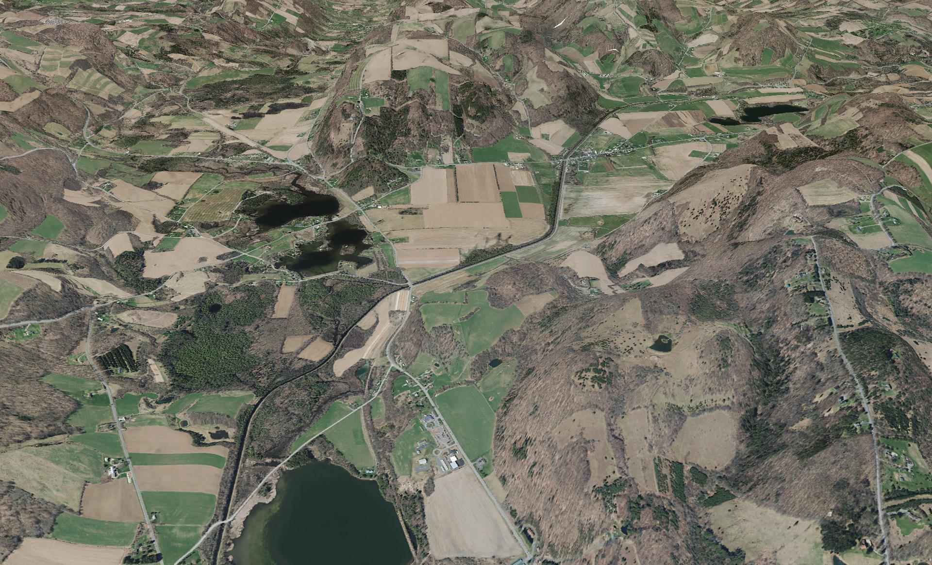
This shows a 3D rendering of the Buckville Canal north of Hamilton


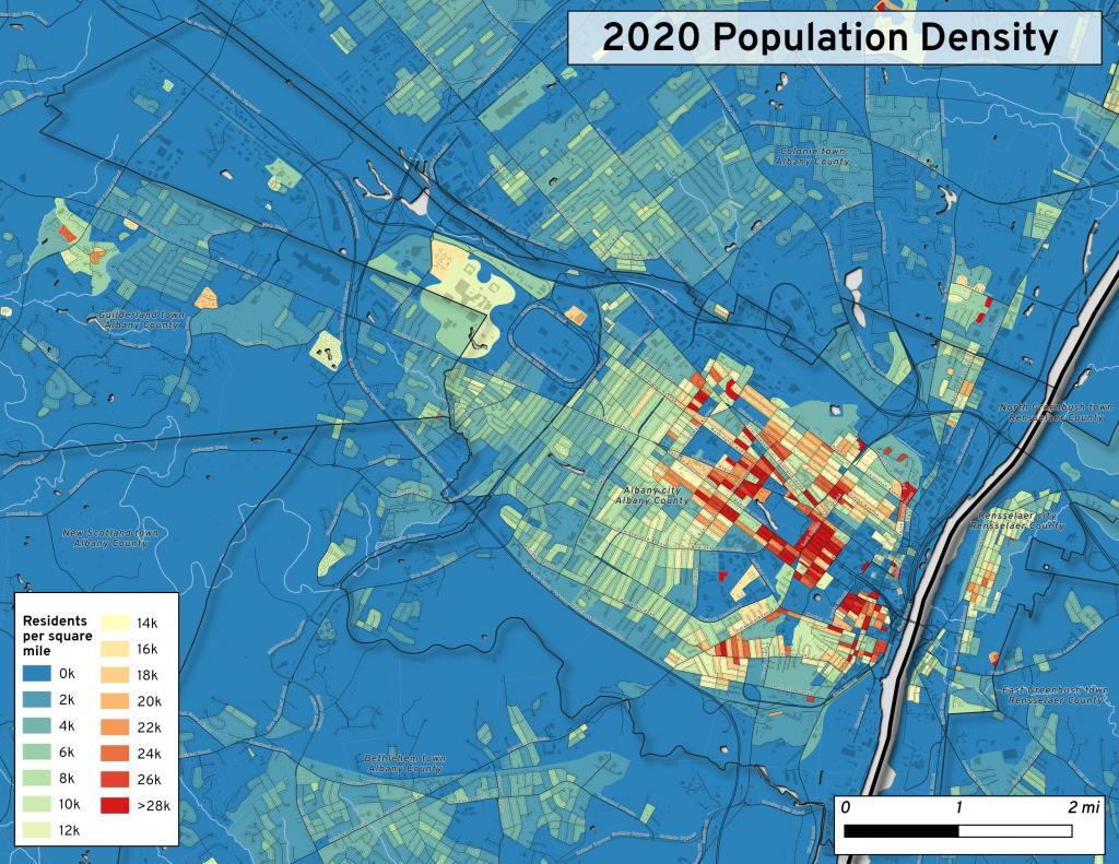
This map shows the use of 2020 PL 94-171 data to calculate population density in City of Albany.


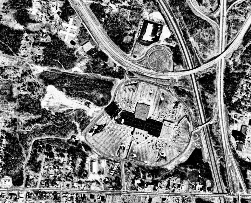
This 1985 aerial photo shows Crossgates Mall prior to it’s expansion.


This GIF image shows the change in unemployment during Coronavirus panademic.

This image shows hiking trails near Brooktrout, Falls Pond and Deep Lake.


Peebles Island, a Comparison 1952


3D Interactive of campsites at Moose River Plains.


Sample tax map in Albany.


Election results – 2020 Presidential Election, Onondoga County.


Map showing where sparklers are legally sold in New York.


Downtown Plattsburgh 1866 Beers (1866 Beers vs. 2020 OSM)


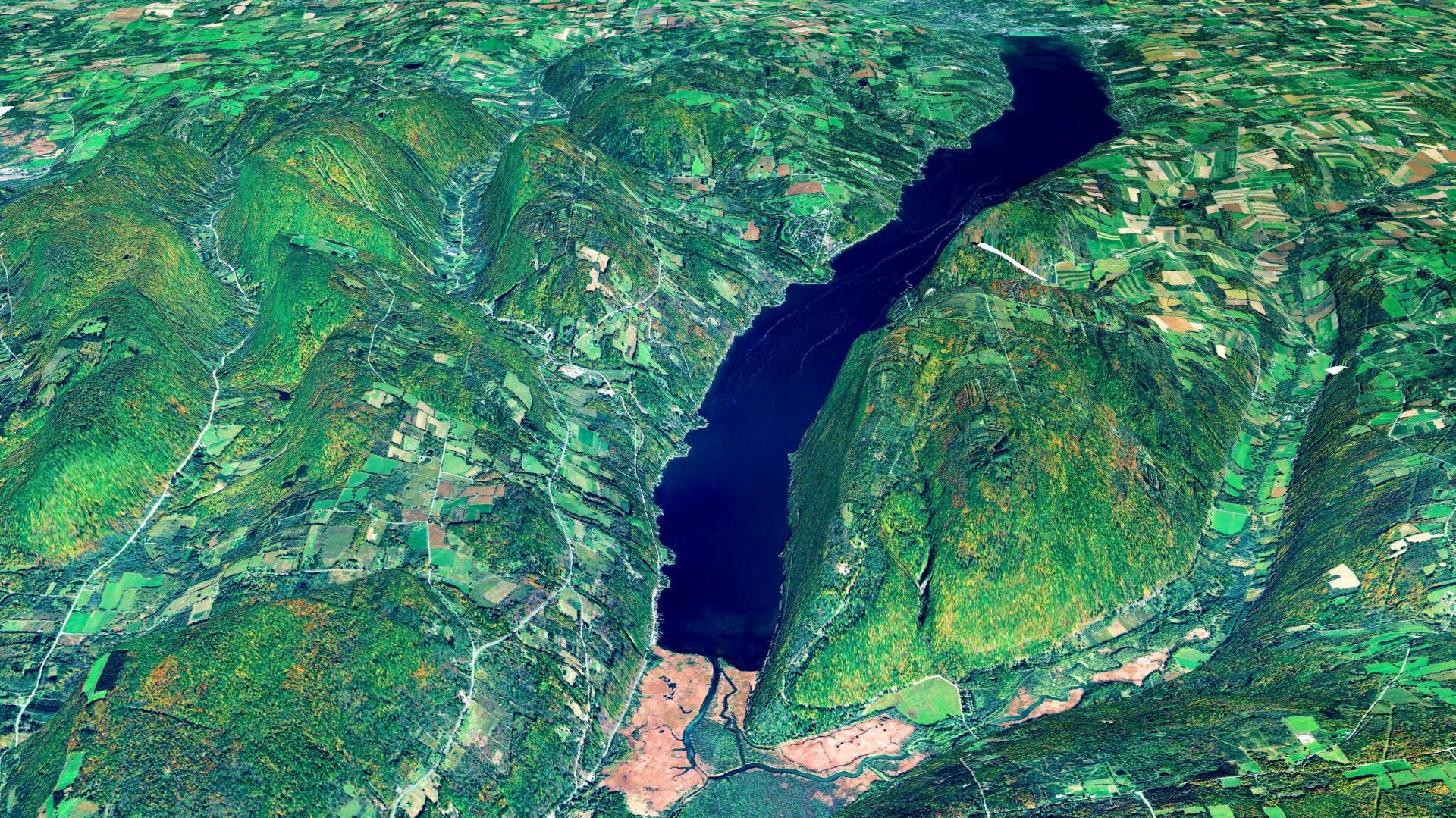
3D Rendering of Canandaigua Lake


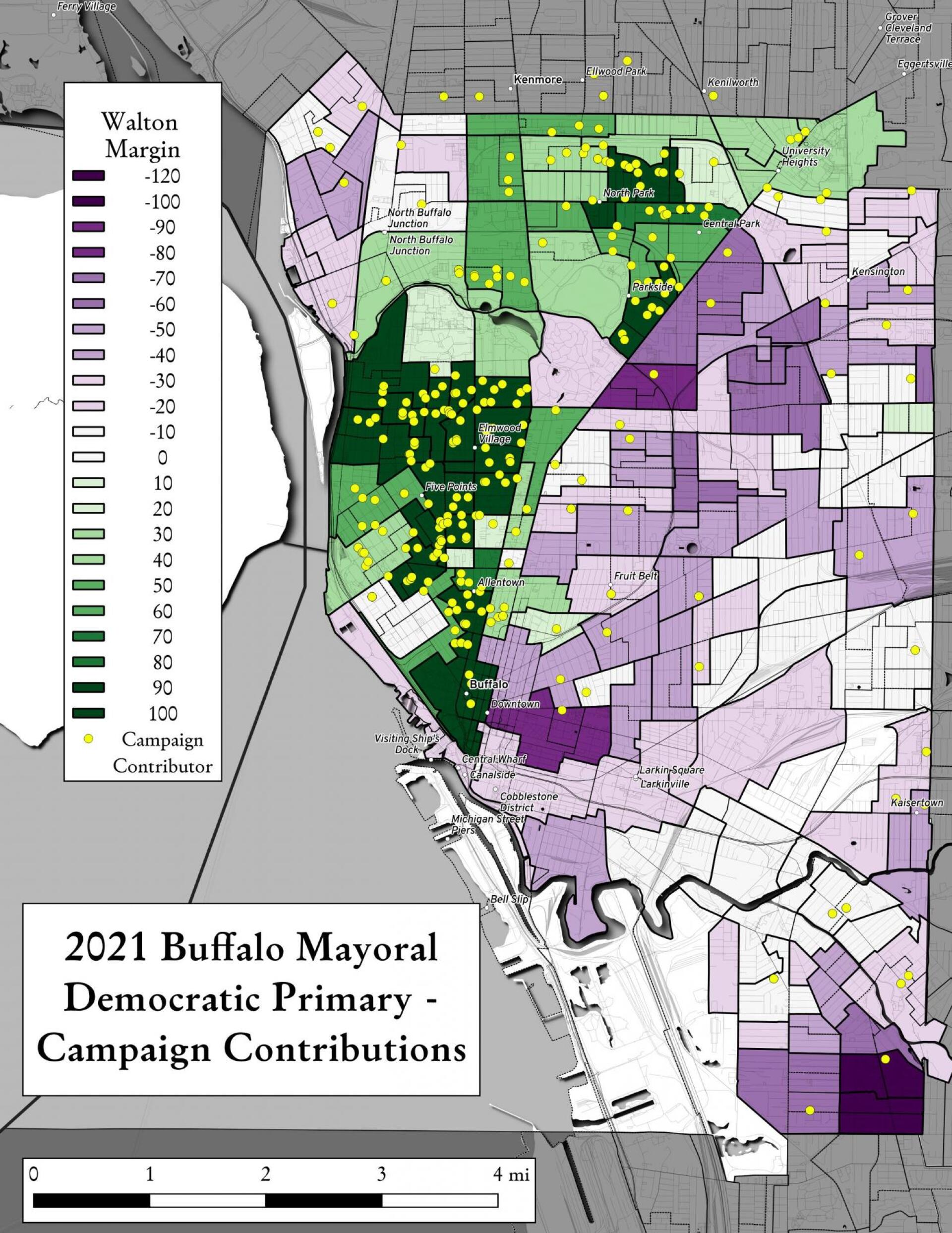
Map showing Buffalo Mayoral Primary results and campaign donors.


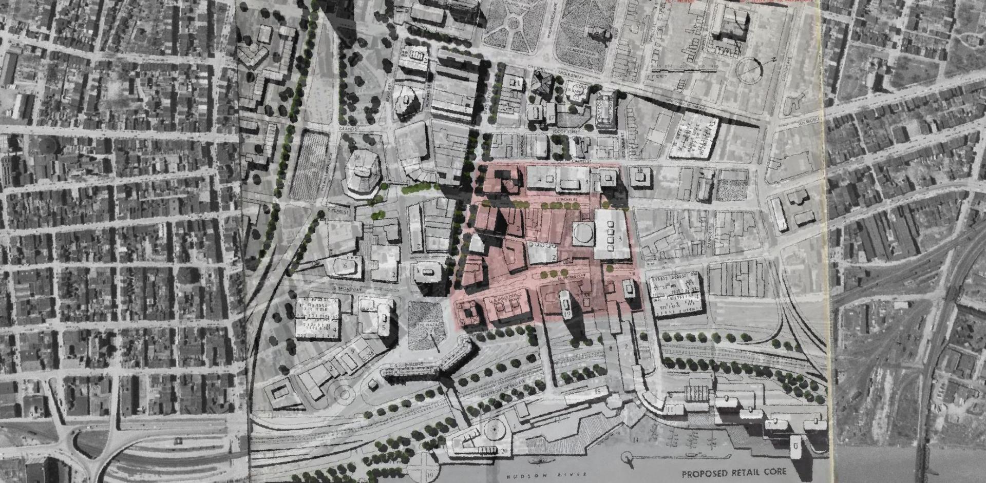
Overlay of Proposed Retail Core in 1963 Plan for the Capital City.


Map showing Local Area Unemployment Statistics – April 2020.


Interactive tax map in Delmar


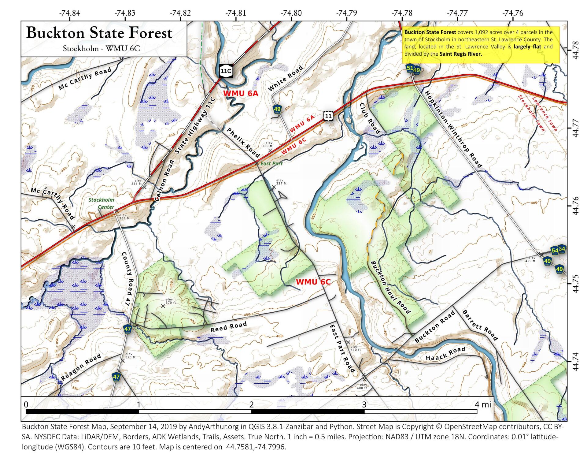
State Land in Stockholm, NY – Buckton State Forest.


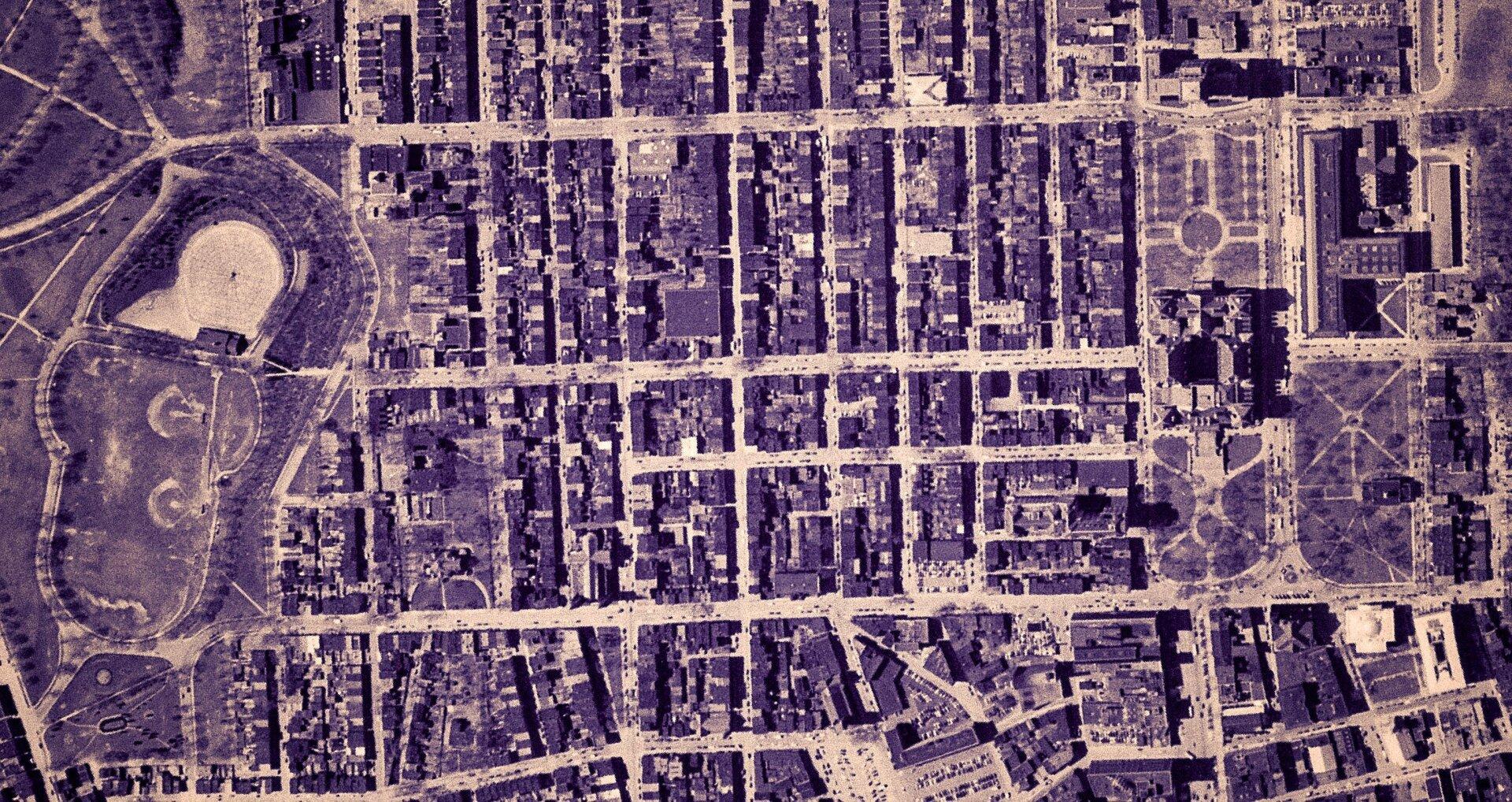
Empire State Plaza take area, 1952


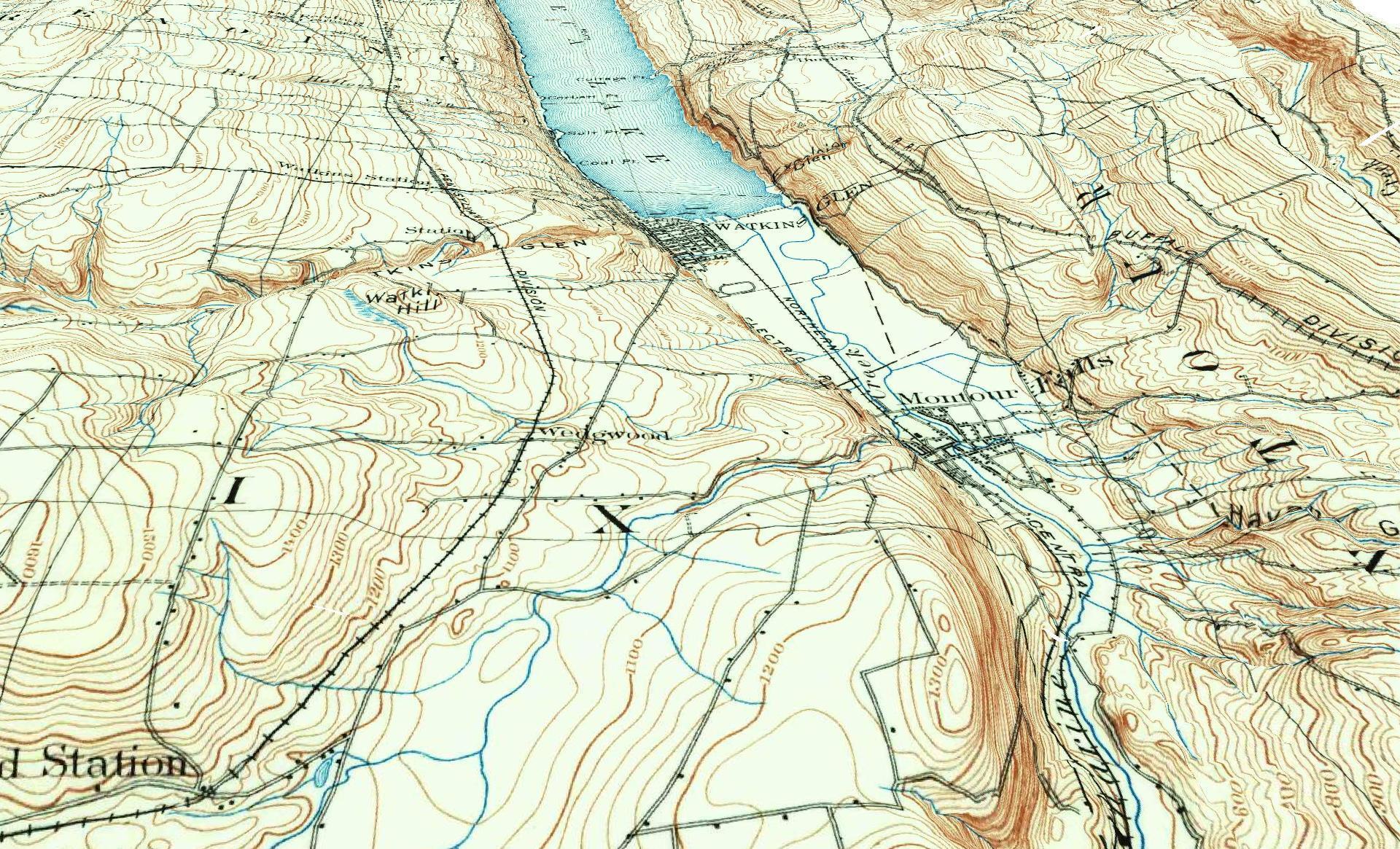
3D Rendering of the 1898 Watkins Glen Topographic Map

Examples of Data and Code

Properties in Albany Pine Bush Study Area,Excel Files: Various Tax Rolls,Find coordinates and political districts,Look Up State Tax Records and aScript for Processing RPTL 1520 PDFs.

Querying state property database, political enrollments, PL 94-171 Census files, calculating population statistics, what address is a district in, converting old districts to new districts.

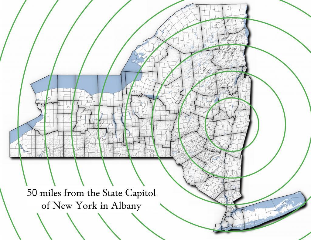
Miles from Albany millions population
50 1.002
100 1.750
150 3.511
200 17.102
250 17.725
300 18.699
350 19.411
400 20.187
450 20.201
import pandas as pd
import geopandas as gpd
 
# path to overlay shapefile
overlayshp = r'/tmp/dis_to_albany.gpkg'
 
# summary level -- 750 is tabulation block, 150 is blockgroup
# large areas over about 50 miles much faster to use bg
summaryLevel = 150
#summaryLevel = 750
 
# path to block or blockgroup file
if summaryLevel == 150:
    blockshp = r'/home/andy/Documents/GIS.Data/census.tiger/36_New_York/tl_2020_36_bg20.shp.gpkg'
else:
    blockshp = r'/home/andy/Documents/GIS.Data/census.tiger/36_New_York/tl_2020_36_tabblock20.shp.gpkg'
 
# path to PL 94-171 redistricting geoheader file
pl94171File = '/home/andy/Desktop/nygeo2020.pl'
 
# field to categorize on (such as Ward -- required!)
catField = 'Name'
 
# geo header contains 2020 census population in column 90 
# per PL 94-171 documentation, low memory chunking disabled 
# as it causes issues with the geoid column being mixed types
df=pd.read_csv(pl94171File,delimiter='|',header=None, low_memory=False )
 
# column 2 is summary level 
population=df[(df.iloc[:,2] == summaryLevel)][[9,90]]
 
# load overlay
overlay = gpd.read_file(overlayshp).to_crs(epsg='3857')
 
# shapefile of nys 2020 blocks, IMPORTANT (!) mask by output file for speed
blocks = gpd.read_file(blockshp,mask=overlay).to_crs(epsg='3857')
 
# geoid for linking to shapefile is column 9
joinedBlocks=blocks.set_index('GEOID20').join(population.set_index(9))
 
# store the size of unbroken blocks
# in case overlay lines break blocks into two
joinedBlocks['area']=joinedBlocks.area
 
# run union
unionBlocks=gpd.overlay(overlay, joinedBlocks, how='union')
 
# drop blocks outside of overlay
unionBlocks=unionBlocks.dropna(subset=[catField])
 
# create population projection when a block crosses
# an overlay line -- avoid double counting -- this isn't perfect
# as we loose a 0.15 percent due to floating point errors
unionBlocks['sublock']=unionBlocks[90]*(unionBlocks.area/unionBlocks['area'])
 
# sum blocks in category
unionBlocks=pd.DataFrame(unionBlocks.groupby(catField).sum()['sublock'])
 
# rename columns
unionBlocks=unionBlocks.rename({'sublock': '2020 Census Population'},axis=1)
 
# calculate cumulative sum as you go out each ring
unionBlocks['millions']=unionBlocks.cumsum(axis=0)['2020 Census Population']/1000000
 
# each ring is 50 miles
unionBlocks['miles']=unionBlocks.index*50
 
# output
unionBlocks

Land use in town of Berne (from 2016 National Land Cover Dataset)

Most highly assessed properties in Albany County …

from arcgis.features import FeatureLayer
lyr_url = 'https://gisservices.its.ny.gov/arcgis/rest/services/NYS_Tax_Parcel_Centroid_Points/MapServer/0'
layer = FeatureLayer(lyr_url)
query_result1 = layer.query(where="COUNTY_NAME='Albany' AND FULL_MARKET_VAL > 100000000", 
                                    out_fields='PARCEL_ADDR,CITYTOWN_NAME,FULL_MARKET_VAL,OWNER_TYPE', out_sr='4326')

df=query_result1.sdf.sort_values(by='FULL_MARKET_VAL', ascending=False)
df['Full Market Value'] = df['FULL_MARKET_VAL'].map('${:,.0f}'.format)

df
 OBJECTIDPARCEL_ADDRCITYTOWN_NAMEFULL_MARKET_VALOWNER_TYPESHAPEFull Market Value
112665264 Eagle StAlbany12042549252{β€œx”: -73.75980312511581, β€œy”: 42.650469918250…$1,204,254,925
391501200 Washington AveAlbany8862987152{β€œx”: -73.81092293494828, β€œy”: 42.679257168282…$886,298,715
4102081400 Washington AveAlbany6423982872{β€œx”: -73.82369286130952, β€œy”: 42.685845700657…$642,398,287
0885251 Fuller RdAlbany4400428272{β€œx”: -73.83559002316825, β€œy”: 42.690208093507…$440,042,827
518164632 New Scotland AveAlbany3775682018{β€œx”: -73.80381341626146, β€œy”: 42.655758957669…$377,568,201
1906141 Fuller RdAlbany3211991432{β€œx”: -73.83323986150171, β€œy”: 42.693189748928…$321,199,143
19108087See Card 1067Watervliet2808988761{β€œx”: -73.70670724174552, β€œy”: 42.719628647232…$280,898,876
1565380737 Alb Shaker RdColonie2639161003{β€œx”: -73.80365248218001, β€œy”: 42.747956678125…$263,916,100
921923304 Madison AveAlbany2342654182{β€œx”: -73.76227373289564, β€œy”: 42.648000674457…$234,265,418
2907201 Fuller RdAlbany2034261242{β€œx”: -73.83362605353057, β€œy”: 42.692609131686…$203,426,124
1669999515 Loudon RdColonie1660656008{β€œx”: -73.74958475282632, β€œy”: 42.719321807666…$166,065,600
72059247 New Scotland AveAlbany1622763388{β€œx”: -73.77597163421673, β€œy”: 42.653565689693…$162,276,338
620574132 S Lake AveAlbany1462963602{β€œx”: -73.77970918544908, β€œy”: 42.654390366929…$146,296,360
820597113 Holland AveAlbany1434985012{β€œx”: -73.77306688593143, β€œy”: 42.650762742870…$143,498,501
1778203MannsvilleColonie1425704001{β€œx”: -73.71245452369443, β€œy”: 42.718124477080…$142,570,400
18955091 Crossgates Mall RdGuilderland1305547008{β€œx”: -73.84702700595471, β€œy”: 42.687699053797…$130,554,700
102452186 S Swan StAlbany1284364032{β€œx”: -73.75980563770365, β€œy”: 42.653931892804…$128,436,403
13468831916 US 9WCoeymans1100000008{β€œx”: -73.83388475575597, β€œy”: 42.488730743021…$110,000,000
1235152380 River RdBethlehem1052631588{β€œx”: -73.76445503554325, β€œy”: 42.595925419330…$105,263,158
146509715 Wolf RdColonie1019672138{β€œx”: -73.81423716588279, β€œy”: 42.709939498581…$101,967,213
Categories:

Map and Coordinates List for NYS DEC Firetowers πŸ—Ό

Discover a wealth of information on this page about fire towers situated on state lands, accessible through invigorating hikes that lead to panoramic vistas. Interactive maps guide your exploration, offering insights into the locations and trails leading to these towering viewpoints. Additionally, find convenient links to other pages that delve deeper into fire towers across the entirety of New York State. Embark on a journey that combines outdoor adventure with breathtaking scenery, as you navigate the trails and pathways leading to these historic landmarks that have stood as guardians of the landscape. This resource opens doors to captivating experiences that allow you to savor the beauty of nature from elevated perspectives while providing avenues for further exploration of New York’s fire tower heritage.

Here is a list of Fire Towers on NYS DEC lands. You can get this also on Google Sheets. Does not include the Dickinson Hill Fire Tower in Grafton, which is part of the Grafton Lakes State Park. You might also be interested in nearby camping opportunities.

TowerState LandNotesCoordinates
Azure Mtn. Fire TowerDebar Mountain Wild ForestRelatively short hike.44.5412601955876,
-74.5007131438668
Balsam Lake MountainBalsam Lake Mountain Wild ForestLonger hike along old road.42.0453530369935,
-74.5943882522534
Belfry Mountain Fire TowerHammond Pond Wild ForestVery short hike up dirt road.44.0977783227959,
-73.5480575565177
Berry Hill FiretowerMcdonough State ForestOnly up to second level is open, no upper level access.42.5498033738312,
-75.6903147862666
Black Mountain Fire TowerLake George Wild ForestLonger hike up a snowmobile trail.43.6068253423597,
-73.5315598873687
Blue Mountain Fire TowerBlue Mountain Wild ForestVery popular, worn-down trail.43.8722986188442,
-74.4007350580445
Lowville Demostration Area
Fire Tower
Lowville Demonstration AreaNo access to tower, part of demonstration forest.43.8093267984132,
-75.4730800808841
Goodnow Mountain Fire TowerSuny Esf LandsOpen to public, SUNY ESF Lands43.9598725064095,
-74.2096091339017
Hadley Mountain Fire TowerWilcox Lake Wild ForestPopular hike in Southern Adirondacks.43.3769100935034,
-73.9709647959219
Hunter Mountain Fire TowerHunter-West Kill WildernessMultiple approaches to this fire tower offer different hikes with different amounts of work.42.1779299997605,
-74.2297619994181
Hurricane Mountain FiretowerHurricane Mountain Primitive AreaThe only fire tower remaining in the Adirondack High Peaks.44.2352949729449,
-73.7101070215222
Kane MountainShaker Mountain Wild ForestShort hike near Caroga Lake.43.1810788942093,
-74.5151618559196
Beebe Hill Fire TowerBeebe Hill State ForestShorter hike near Austerlitz and Massachussetts border.42.3361525194561,
-73.4862760091067
Leonard Hill Fire TowerLeonard Hill State ForestYou can drive to this tower. Bottom floors removed, no access to tower.42.4510039574136,
-74.3529141572996
Lyon Mountain Fire TowerChazy Highlands Wild ForestLonger hike, new trail avoids severely erroded old trail44.7048354583899,
-73.8627762019644
Mount Adam Fire TowerHigh Peaks WildernessJust south of main high peaks area.44.0874829962416,
-74.0228637207712
Mount Nimham Fire TowerNimham Mountain MuaNear Beacon41.4611546516545,
-73.72510657899
Mount TremperPhoenicia – Mt. Tobias Wild ForestFollow an old woods road to summit.42.0739476727477,
-74.2781528438603
Mt Arab Fire TowerHorseshoe Lake Wild ForestRelatively short hike outside of Tupper Lake.44.2046152316571,
-74.5879293129745
Overlook MountainOverlook Mountain Wild ForestPopular hike outside of Woodstock, follows a gated road.42.085023587202,
-74.0933592964641
Owls Head FiretowerSargent Ponds Wild ForestModerate hike outside of Long Lake.43.9542904615568,
-74.4984616500416
Pillsbury Mountain Fire TowerJessup River Wild ForestMile long hike to a firetower with views over Perkins Clearing and areas around Spectulator43.5807556043109,
-74.5118079500206
Poke-O-Moonshine Fire TowerTaylor Pond Wild ForestNew trail is less steep and follows old woods road.44.4019104158425,
-73.5130620065356
Red Hill Fire TowerSundown Wild Forest1 mile hike to a fairly remote firetower.41.9238122519417,
-74.5170620256067
Rondaxe Fire TowerFulton Chain Wild ForestQuick hike outside of Old Forge that is very popular.43.7385880495938,
-74.9129188420394
Roosa Gap FiretowerRoosa Gap State ForestFiretower on the Long Path in the Shawgunks.41.6176280752519,
-74.4267422878805
Snowy MtJessup River Wild ForestPopular hike, one of the more difficult towers to access.43.7003213769888,
-74.3866001142199
Spruce Mountain Fire TowerWilcox Lake Wild ForestTrail crosses private land, closed during hunting season.43.2163188109202,
-73.9061192265182
St. Regis Mtn. Fire TowerSaint Regis Canoe AreaCurrently closed to public use.44.4085838385311,
-74.3296128971506
Stillwater Mountain Fire TowerIndependence River Wild ForestNear the Stillwater Reservior.43.8618343053993,
-75.033327606033
Sugar Hill Fire TowerSugar Hill State ForestObservation tower in Finger Lakes, during summer months you can drive to it, part of Six Nations Horse Cap.42.3871467022238,
-77.0025364212371
Vanderwhacker Mountain Fire TowerVanderwhacker Mountain Wild ForestRough seasonal road then 2 Β½ mile hike.43.8982271055416,
-74.0959123515681
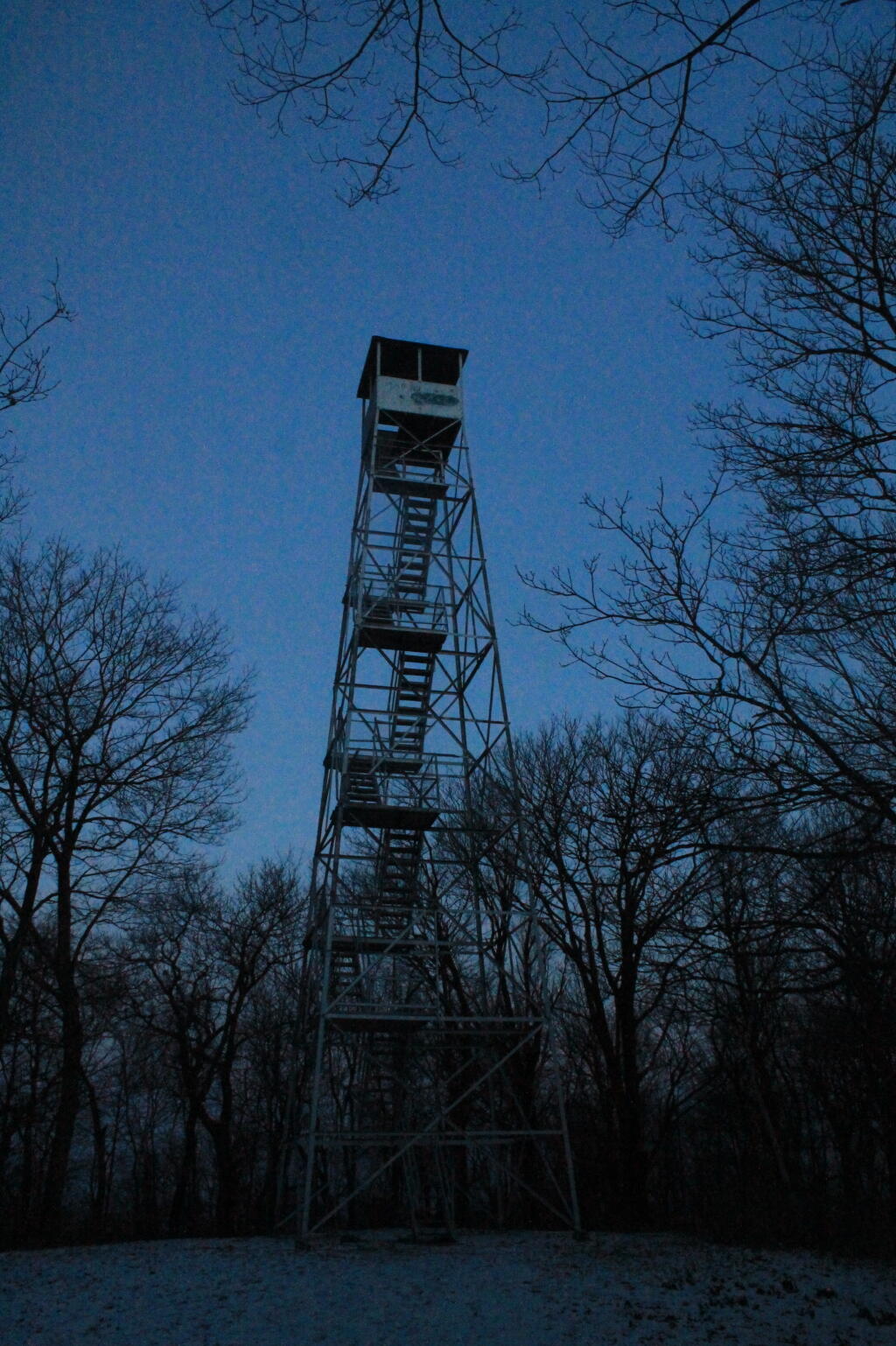
Wakely Mountain Fire TowerWakely Mountain Primitive AreaNear Cedar River Flow at Moose River Plains. Seasonal use road to access.43.7358887903725,
-74.515229327937
Woodhull Mountain Fire TowerBlack River Wild ForestOne of the longer hikes, part of the trail is an old railroad grade until you climb the peak.43.6230161401271,
-74.9615452951445

Fire Tower

Moose River Plains Campsites

Interactive Map of Lean-Tos and Campsites

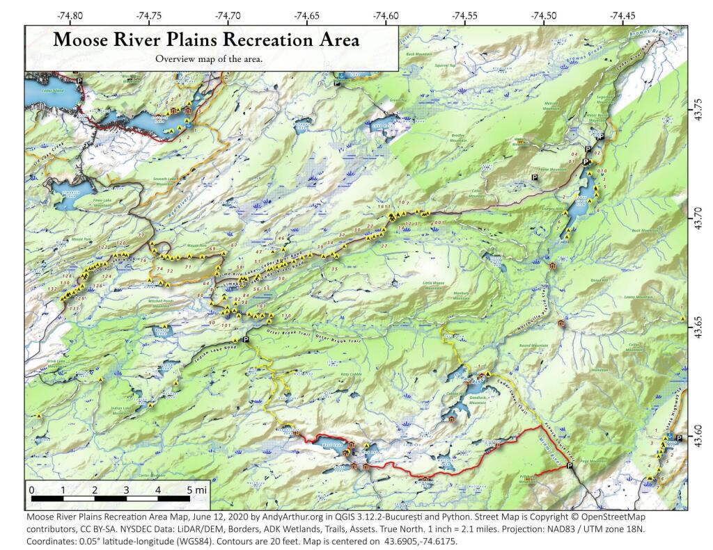
An overview map and list of campsites and their locations at the Moose River Recreation Area.

 Moose River Plains Recreation Area

Maps

Campsites

Milepoint Name Feature Notes Access Location
Cedar River Flow 1 Cedar River Flow Tent site on flow Boat 43.702924803151, -74.4871304116533
Cedar River Flow 2 Cedar River Flow Tent site on flow Boat 43.7104737708879, -74.4802343768254
Cedar River Flow 3 Cedar River Flow Tent site on flow Boat 43.7145237017622, -74.4679264444554
Cedar River Flow 5 Cedar River Flow Tent site on flow Boat 43.7111711590583, -74.4675178486588
Cedar River Flow 6 Cedar River Flow Tent site on flow Boat 43.7084767866376, -74.4717703157492
Beaver Lake Campsite Beaver Lake Site overlooks Beaver Lake Hike 43.6516613421651, -74.7407833400961
81 Icehouse Pond Accessible site at Icehouse Pond with privy Hike 43.6646602166505, -74.7029502913239
140A Indian Lake Campsite on Indian Lake, outhouse in bad condition Hike 43.6154753632731, -74.7499942080732
East of Muskrat Pond Indian Lake Trail Former roadside campsite, largely abandoned Hike 43.645116528704, -74.696221627206
46 Lost Ponds Trail Beyond the end of current Lost Ponds Road Hike 43.6868179572109, -74.6655581886723
47 Lost Ponds Trail Above Lost Ponds Hike 43.6859472953826, -74.6722052916864
Mitchell Pond 1 Mitchell Pond Tent site, bushwhack Hike 43.6729475881673, -74.7502538624373
Mitchell Pond 2 Mitchell Pond Tent site, bushwhack Hike 43.6716991892117, -74.7432124817486
64A Mitchell Pond (Accessible Campsite at End of Gravel Trail) Gravel path to site, wildrness privy Hike 43.6706136251028, -74.7387363015355
10 89 Beaver Lake Road Off Otter Brook Road, Sand Plains Vehicle 43.6583112347181, -74.7012491214803
11 90 Beaver Lake Road Off Otter Brook Road, Sand Plains Vehicle 43.6577446555162, -74.7038760912165
16 1 Cedar River – Limekiln Lake Road Driveway Along Tributary of Silver Run Vehicle 43.7033162602551, -74.5742148239156
16 3 Cedar River – Limekiln Lake Road Along Silver Run Vehicle 43.7027301523306, -74.5757742464803
16 4 Cedar River – Limekiln Lake Road Along Silver Run, driveway at Sharp S Turn Vehicle 43.7026421104662, -74.5769731929134
16 7 Cedar River – Limekiln Lake Road Along Silver Run Vehicle 43.7040070126376, -74.5809411044503
15 10 Cedar River – Limekiln Lake Road Old gravel pit, accessible Vehicle 43.7031498027862, -74.5893864145496
15 11 Cedar River – Limekiln Lake Road Across from 12 Vehicle 43.702458607149, -74.5926546451668
15 12 Cedar River – Limekiln Lake Road Across from 11 Vehicle 43.7028667147947, -74.5929833340894
15 13 Cedar River – Limekiln Lake Road Along Silver Run Vehicle 43.7010402113051, -74.5956355707995
15 14 Cedar River – Limekiln Lake Road Along Silver Run Vehicle 43.7010328498576, -74.597457469967
14 16 Cedar River – Limekiln Lake Road Access Road for 16/17/18 Group Vehicle 43.7025294616695, -74.5969885248639
14 17 Cedar River – Limekiln Lake Road Access Road for 16/17/18 Group Vehicle 43.7021028692463, -74.5966599329259
14 18 Cedar River – Limekiln Lake Road Access Road for 16/17/18 Group Vehicle 43.7023846304313, -74.5978818600647
14 19 Cedar River – Limekiln Lake Road Along Silver Run Vehicle 43.7003546491841, -74.5964872856253
14 21 Cedar River – Limekiln Lake Road Across road from Silver Run Vehicle 43.6957217888458, -74.6020563094081
13 22 Cedar River – Limekiln Lake Road Across road from Silver Run Vehicle 43.6935817523545, -74.6036764840587
13 27 Cedar River – Limekiln Lake Road Across road from Silver Run Vehicle 43.6926540634024, -74.6082201775478
13 30 Cedar River – Limekiln Lake Road Open Area in Woods Vehicle 43.6918525577623, -74.6118452191364
13 31 Cedar River – Limekiln Lake Road Near Marsh off Silver Run Vehicle 43.6881856235873, -74.6271629609656
12 34 Cedar River – Limekiln Lake Road Open Field Near Old Sly Pond Road Vehicle 43.6846954329325, -74.634678249126
12 35 Cedar River – Limekiln Lake Road Former Sly Pond Road Vehicle 43.6836690328942, -74.6318552827363
11 38 Cedar River – Limekiln Lake Road On Hill Overlooking Road, near start of Lost Ponds Area Vehicle 43.6836029270341, -74.6401393590772
11 39 Cedar River – Limekiln Lake Road Above CRLLR, start of Lost Ponds Area Vehicle 43.6841476346233, -74.6487511980121
11 40 Cedar River – Limekiln Lake Road Above CRLLR, start of Lost Ponds Area Vehicle 43.682942162164, -74.6537793571789
11 41 Cedar River – Limekiln Lake Road Above CRLLR, start of Lost Ponds Area Vehicle 43.681311345096, -74.6589116717693
10 42 Cedar River – Limekiln Lake Road Above CRLLR, start of Lost Ponds Area Vehicle 43.6799039050817, -74.6646031695507
10 43 Cedar River – Limekiln Lake Road Above CRLLR, start of Lost Ponds Area Vehicle 43.6793727911294, -74.6664156654099
10 44 Cedar River – Limekiln Lake Road West of Lost Ponds Road, Sand Plains Vehicle 43.678808787762, -74.6696555368193
10 50 Cedar River – Limekiln Lake Road West of Lost Ponds Road, Sand Plains Vehicle 43.677986610504, -74.6732025802129
10 51 Cedar River – Limekiln Lake Road Pull-Off, Small Site, Sand Plains Vehicle 43.6775108499728, -74.6750146421403
10 52 Cedar River – Limekiln Lake Road Old gravel pit, short loop below CRLLR Vehicle 43.6748840847288, -74.6815273754233
10 53 Cedar River – Limekiln Lake Road Access Road for 55/54/55 Group, Sand Plains Vehicle 43.6733317629897, -74.6820452615144
10 54 Cedar River – Limekiln Lake Road Access Road for 55/54/55 Group, Sand Plains Vehicle 43.673268538603, -74.6822820352903
9 55 Cedar River – Limekiln Lake Road Access Road for 55/54/55 Group, Sand Plains Vehicle 43.6733705968856, -74.6827076379887
9 56 Cedar River – Limekiln Lake Road Driveway, East of Former Dump, Sand Plains Vehicle 43.673126585883, -74.6891475571674
9 57 Cedar River – Limekiln Lake Road Has Trail to Moose River Vehicle 43.6736673106707, -74.6902687046523
8 64 Cedar River – Limekiln Lake Road Near Mitchell Pond Trail Vehicle 43.6757521870177, -74.707500815672
8 66 Cedar River – Limekiln Lake Road Near Pine Creek Vehicle 43.6784203854214, -74.7068492021325
7 67 Cedar River – Limekiln Lake Road Benedict Creek Road, Wooded Vehicle 43.6851041444828, -74.7031887110586
7 69 Cedar River – Limekiln Lake Road Remote site, perched over the road Vehicle 43.6834516958835, -74.7168906980223
6 70 Cedar River – Limekiln Lake Road Large loop off of CRLLR Vehicle 43.6839906014562, -74.7249870178447
6 71 Cedar River – Limekiln Lake Road Very sandy site near Mitchells Pond Upper Loop Vehicle 43.6833776353921, -74.7321947941391
5 72 Cedar River – Limekiln Lake Road At end of Bear Pond Loop Road (Accessable) Vehicle 43.6828956047277, -74.7359084701559
4 73 Cedar River – Limekiln Lake Road Very sandy site near Mitchells Pond Upper Loop Vehicle 43.6835777053685, -74.7387188889593
4 74 Cedar River – Limekiln Lake Road On a hill overlooking road and marshy area Vehicle 43.6839187521201, -74.742285779317
4 76 Cedar River – Limekiln Lake Road Very sandy site near Mitchells Pond Upper Loop Vehicle 43.6864452702399, -74.7471689344191
4 77 Cedar River – Limekiln Lake Road Near Red River, Bear Pond Loop, Sand Plains Vehicle 43.6897961458669, -74.7484803840413
10 58 Helldiver Pond Road Near Helldiver Pond Vehicle 43.6735979105991, -74.6920316000423
10 59 Helldiver Pond Road Near Helldiver Pond Vehicle 43.6723766419894, -74.6929318681131
10 60 Helldiver Pond Road Near Helldiver Pond Vehicle 43.6713193532923, -74.692758456613
10 61 Helldiver Pond Road Accessible site at end of Helldiver Pond Road Vehicle 43.6705019900204, -74.6921751440693
15 West of Brooktrout Trail Indian Lake Road Past Brooktrout Trail, on a hill over road Vehicle 43.6254538914434, -74.7337300739322
10 48 Lost Pond Road Sand Plains, Marshes Aroubnd Vehicle 43.6814268347573, -74.6667101324338
11 49 Lost Pond Road Sand Plains, Marshes Aroubnd Vehicle 43.6819456385478, -74.6670131106595
10 80 Otter Brook Road Has Trail to Moose River Vehicle 43.6620917920003, -74.7112181918076
11 98 Otter Brook Road Above Moose River on Hill Vehicle 43.6588725644731, -74.6966603409996
11 101 Otter Brook Road Sand Plains Vehicle 43.6564420559443, -74.6938956128147
11 103 Otter Brook Road Sand Plains Vehicle 43.657108724794, -74.6873446316172
12 104 Otter Brook Road Wooded Site Vehicle 43.6560617426567, -74.6832992891923
12 106 Otter Brook Road Wooded Site Vehicle 43.6565121581975, -74.6789913497265
13 110 Otter Brook Road Wooded Site Vehicle 43.6566072628101, -74.6733859460379
13 111 Otter Brook Road Near Otter Brook Bridge Vehicle 43.6539235327721, -74.6747718892435
23 1 Wakely Dam Camping Area Accessible site Vehicle (before gate) 43.7266767212397, -74.474100266424
23 2 Wakely Dam Camping Area Field Camping Vehicle (before gate) 43.7266515010084, -74.4733110730078
23 3 Wakely Dam Camping Area Field Camping Vehicle (before gate) 43.7259595122959, -74.473899965642
23 4 Wakely Dam Camping Area On Driveway to Lake Vehicle (before gate) 43.7260676922081, -74.4742326471903
23 5 Wakely Dam Camping Area On Driveway to Lake Vehicle (before gate) 43.7255637908987, -74.4741751228291
23 6 Wakely Dam Camping Area On Driveway to Lake Vehicle (before gate) 43.7252231337487, -74.4745830371916
23 9 Wakely Dam Camping Area Across bridge Vehicle (before gate) 43.726275356142, -74.4717840349063
23 10 Wakely Dam Camping Area Across bridge Vehicle (before gate) 43.7266308152758, -74.4712600272389
10 82 Otter Brook Road On Moose River Vehicle (driveway) 43.6603083771227, -74.7010353925305
11 84 Otter Brook Road On Moose River Vehicle (driveway) 43.6619962517853, -74.6957783254417
6 120 Natural Rock Dam Road Sand Plains near Red River Vehicle (Opens July) 43.6848543033273, -74.7664253595203
6 122 Natural Rock Dam Road Wooded Site Vehicle (Opens July) 43.684367353989, -74.7717171949716
6 123 Natural Rock Dam Road Wooded Site Vehicle (Opens July) 43.6804228755091, -74.7782951743141
6 124 Natural Rock Dam Road Wooded Site Vehicle (Opens July) 43.6792030487765, -74.7847972548314
7 125 Natural Rock Dam Road Wooded Site Vehicle (Opens July) 43.6783559964111, -74.7880327043169
7 126 Natural Rock Dam Road Wooded Site Vehicle (Opens July) 43.6748535298235, -74.790591643043
7 127 Natural Rock Dam Road Wooded Site Vehicle (Opens July) 43.6739776362472, -74.7910844137006
7 128 Natural Rock Dam Road Wooded Site Vehicle (Opens July) 43.6751413481917, -74.7924842843025
8 129 Natural Rock Dam Road Wooded Site Vehicle (Opens July) 43.6703784784539, -74.7926312803463
8 130 Natural Rock Dam Road Wooded Site Vehicle (Opens July) 43.6666270858056, -74.8019151989726
8 131 Natural Rock Dam Road Wooded Site Vehicle (Opens July) 43.6643581634434, -74.8054154753831
8 132 Natural Rock Dam Road Wooded Site Vehicle (Opens July) 43.6652083016168, -74.8036826184027
5 119A Natural Rock Dam Road Sand Plains near Red River Vehicle (Opens July) 43.6844716021433, -74.7646961785253
6 123A Natural Rock Dam Road Wooded Site Vehicle (Opens July) 43.6802422604152, -74.782965042166
6 124A Natural Rock Dam Road Wooded Site Vehicle (Opens July) 43.6785899888224, -74.7864319884685
6 125A Natural Rock Dam Road Wooded Site Vehicle (Opens July) 43.6776017274889, -74.7902229325712
7 126A Natural Rock Dam Road Wooded Site Vehicle (Opens July) 43.6756110574941, -74.7901645681643
8 129A Natural Rock Dam Road Wooded Site Vehicle (Opens July) 43.6689370211979, -74.7948887917477
8 129AA Natural Rock Dam Road Wooded Site Vehicle (Opens July) 43.6674497436753, -74.7980604042935
8 130A Natural Rock Dam Road Wooded Site Vehicle (Opens July) 43.6661052974262, -74.8016557609016
8 130AA Natural Rock Dam Road Wooded Site Vehicle (Opens July) 43.6669094078356, -74.8007390664074

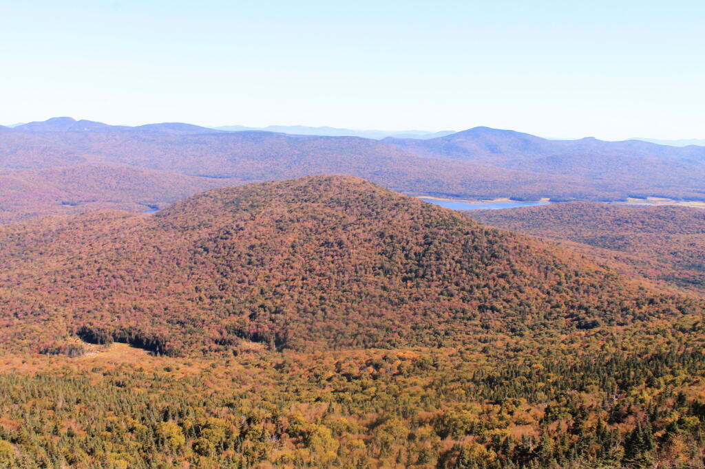
Payne Mountain with Cedar River Flow Beyond It

Delightful Fall Hikes

Pillsbury Mountain (Central Adirondacks).

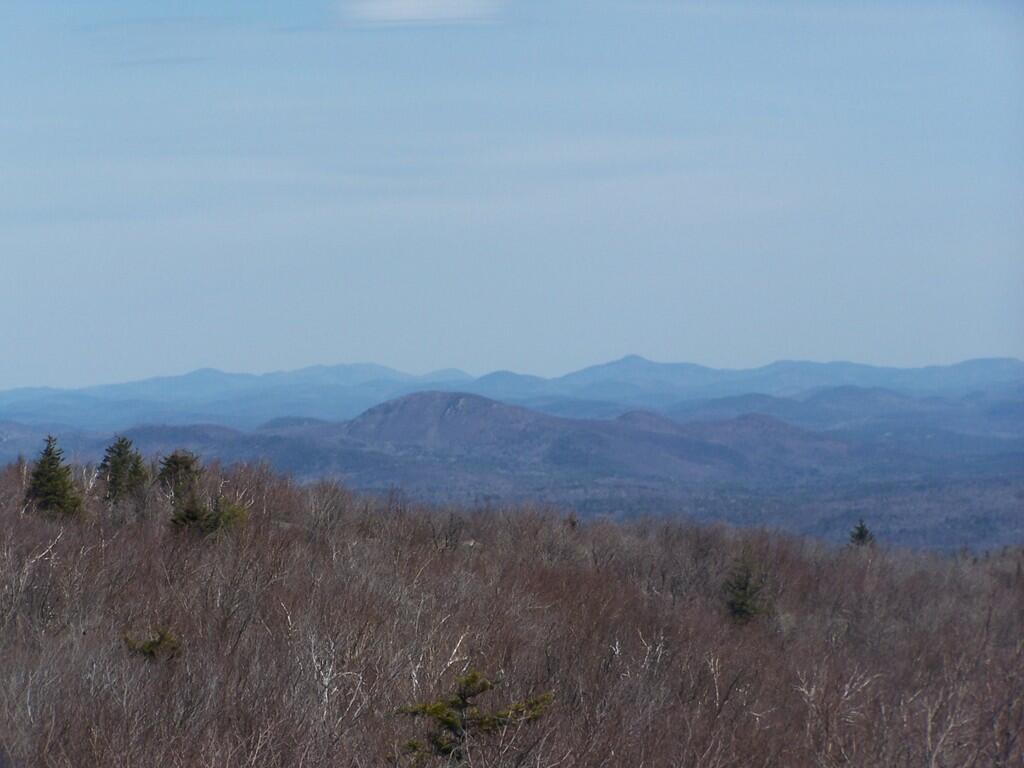
Located in the Jessup River Wild Forest, North of Spectulator, offers great views of West Canada Wilderness, Cedar River Flow, Moose River Plains, Spectulator Tree Farm, Siamese Pond Wilderness. Should be close to peak foliage now. Consider camping at the roadside/tent campsites along Mason Lake to the North on Jessup River Road / NY 30. Take NY 30 to Jessup River Road to Military Road to Parking Area to get there. You may want to park at the start of Military Road if you have a low-clearance vehicle.

Snowy Mountain

Click on map to download and print.

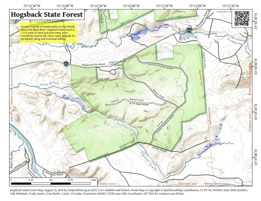
 Hogsback State Forest

Hadley Mountain (Southern Adirondacks).

Located near Stony Creek, NY, it offers some great views of the Wilcox Lake Wild Forest and the Great Scanadaga Lake. I’ve never been there in the fall, but I suspect it offers many great views this time of year, with peak foliage being not far away.

Looking North

Click on map to download and print.

Gully

Buck Mountain (West Shore Lake George, Adirondacks)

This is one of my most recent hikes, but definately offers really good views of Lake George and elsewheres, especially now that the fall colors are starting to set on in. One of the more difficult hikes on the list, it’s not really that difficult, but if you go from Pilot Knob, expect a 3.1 mile hike, and gaining around 2,100 feet in elevation. Regardless, a very nice hike.

2022 NY Congress Results Map

Click on map to download and print.

Route 9 & 20 in Rensselaer

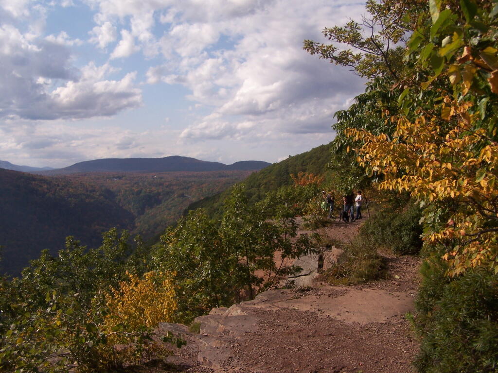
Kaaterskill Clove (Haines Falls, Catskills).

Located near the North South Lake Campground, offers great views of the Clove, Hunter Mountain, Palenville, Hudson River, and farms and other lands near Catskill. Park on Scutt Road for free, which is last right before campground. Take Escarpment Trail all the way around to the Catskill Mountain House Ruins, then walk past North-South Lake.

* Area may be temporarily be closed due to Irene.

Inspiration Point

Click on map to download and print.

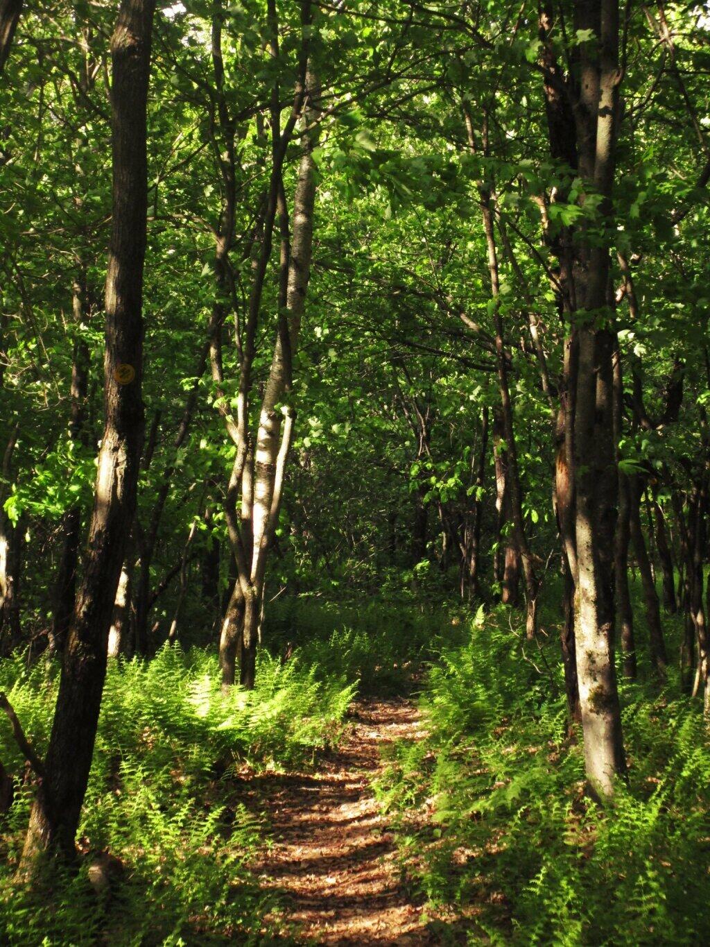
 Ferns Covered Woods

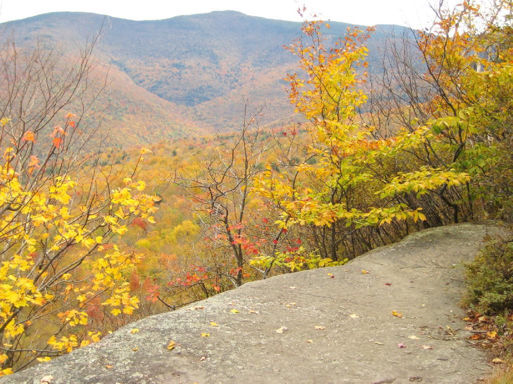
Giant Ledge (High Peaks, Catskills).

Located on the ledge between Slide Mountain and Panther Mountain, a relatively easy hike, with a relatively brief but not scary scramble onto the ledge that runs for 3/4 mile. Colorful views of vast Woodland Valley with Mount Tremper and other mountains in the distance, along with good views of Slide Mountain, Cornell Mountain, and other hike peaks.

* Slide Mountain Road was severely damaged by Irene. Area may be temporarily be closed due to Irene.

Untitled

Click on map to download and print.

When Thanksgiving Falls, 2000 to 2099