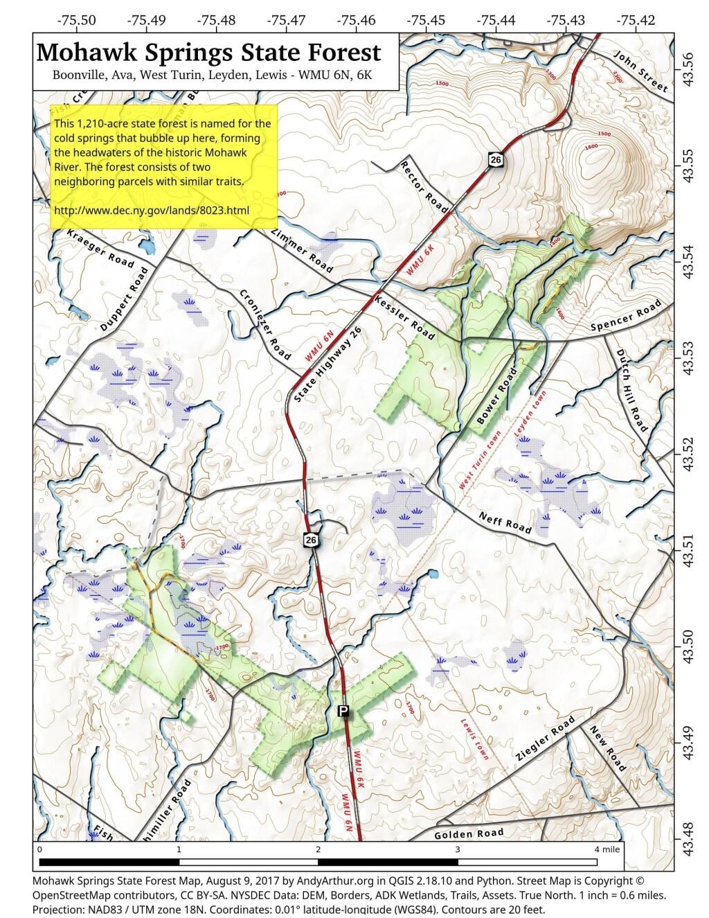
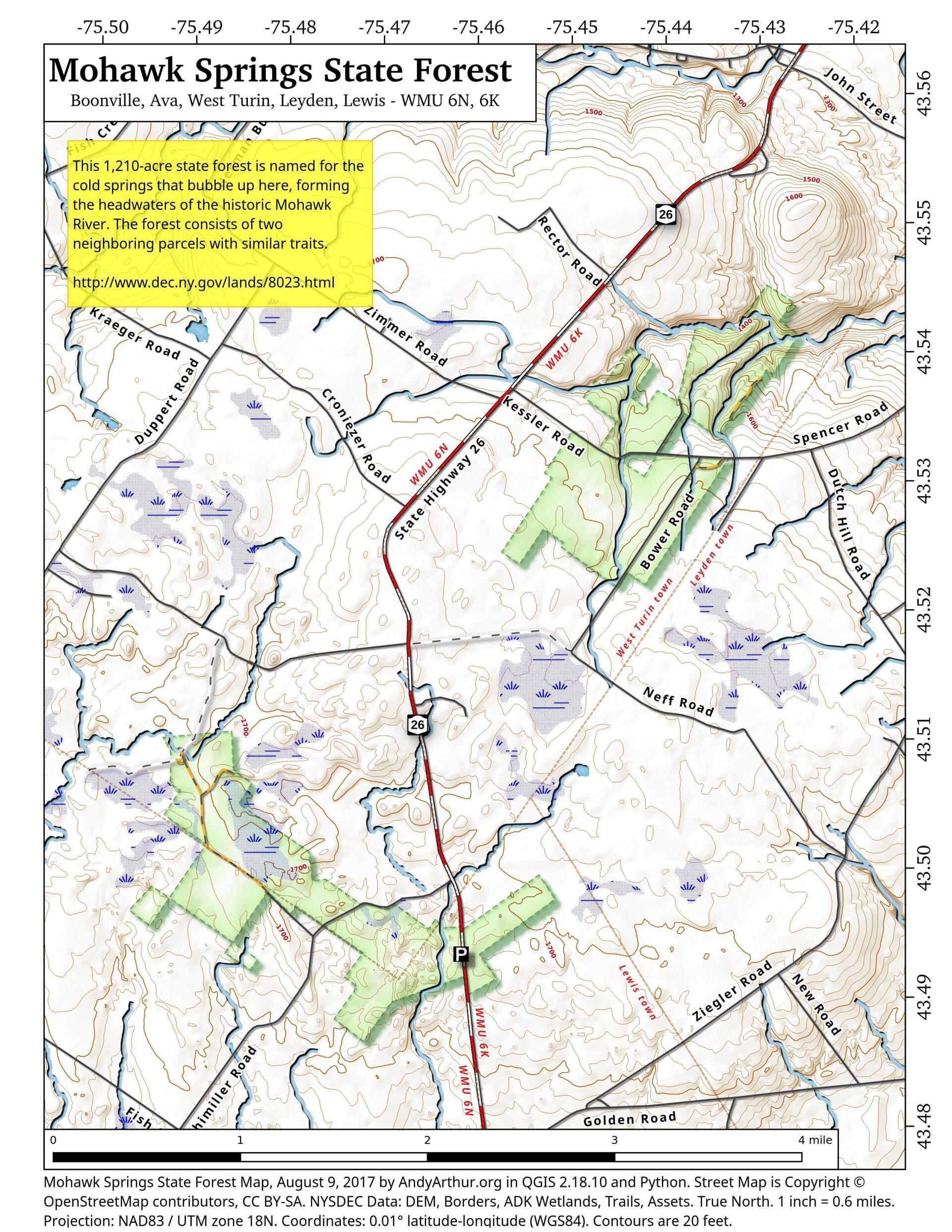
Map: Mohawk Springs State Forest
Download a High Resolution JPEG Image of the Mohawk Springs State Forest or an Adobe Acrobat Printable PDF of the Mohawk Springs State Forest.

Bookmark my free Interactive GPS Map for your phone:
https://andyarthur.org/ny
... shows your location as a blue dot in relationship to campsites, trails, state land. This online map requires cell service, won't work in remote country, so also bring a paper map.
Free Download of New & Historical USGS 1:24k Topograpic Maps
Interactive maps with backcountry and roadside camping: New York, Pennsylvania, West Virginia & Vermont. List of NYS DEC Lean-Tos and Firetowers.
Google Spreadsheet with Roadside, Primitive and Pay Campsites
More about Beartown State Forest...
The 7211 acre Beartown State Forest is named for its proximity to a former small pioneer settlement by that name. The main access road leading from the north into this forest also "bears" the same designation. Granite bedrock forms the base for the mostly shallow, poor soils found here. Rock outcrops are common, with beaver inundated wetlands occupying the low areas.
http://www.dec.ny.gov/lands/8062.html
Maps and Interactives
Corning Tower Shadow
Mohawk Springs State Forest
... photos, maps and other content from from Beartown State Forest.