Interactive Map of Lean-Tos and Campsites
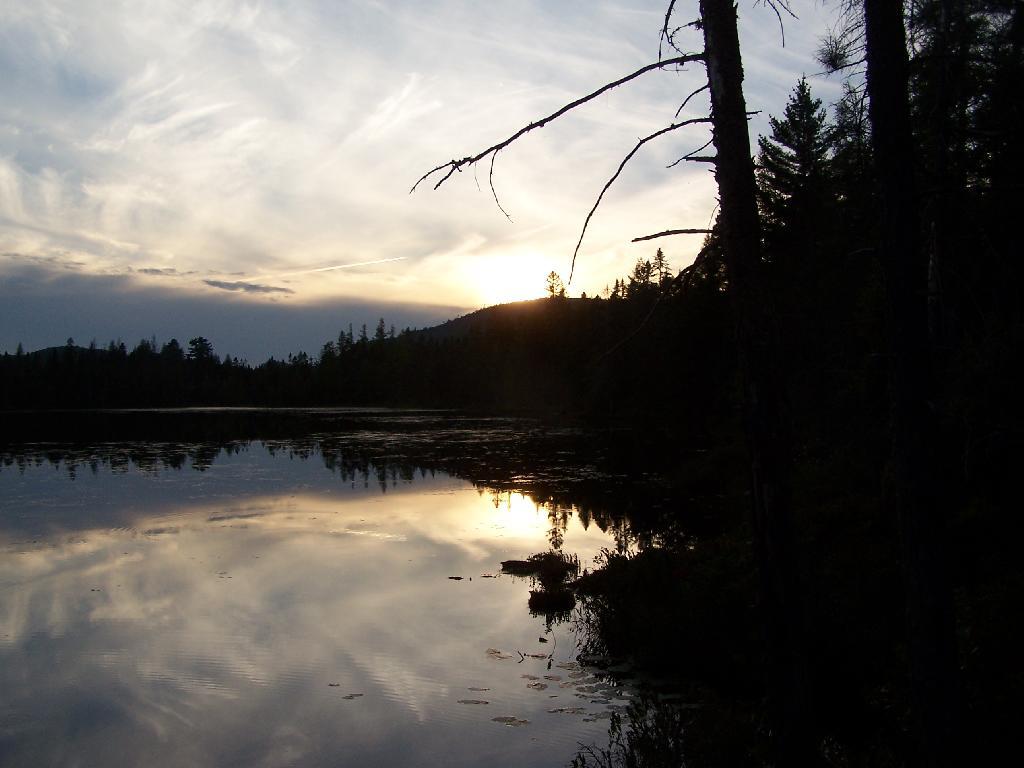
An overview map and list of campsites and their locations at the Moose River Recreation Area.
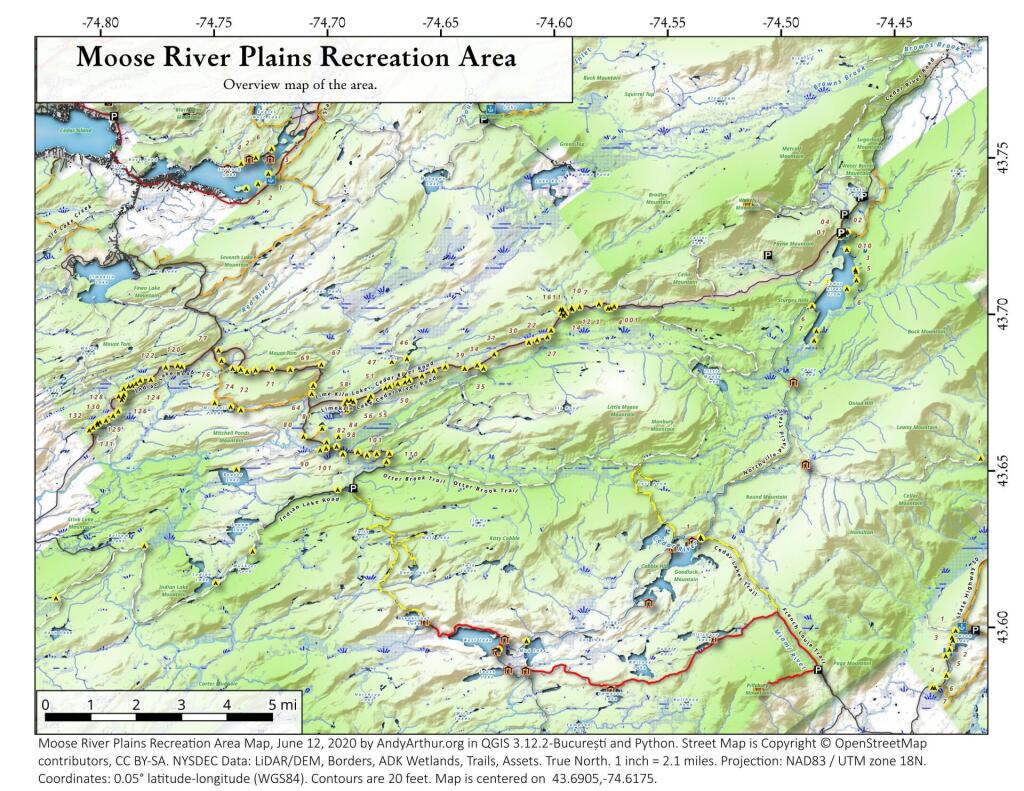
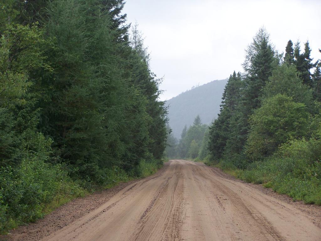
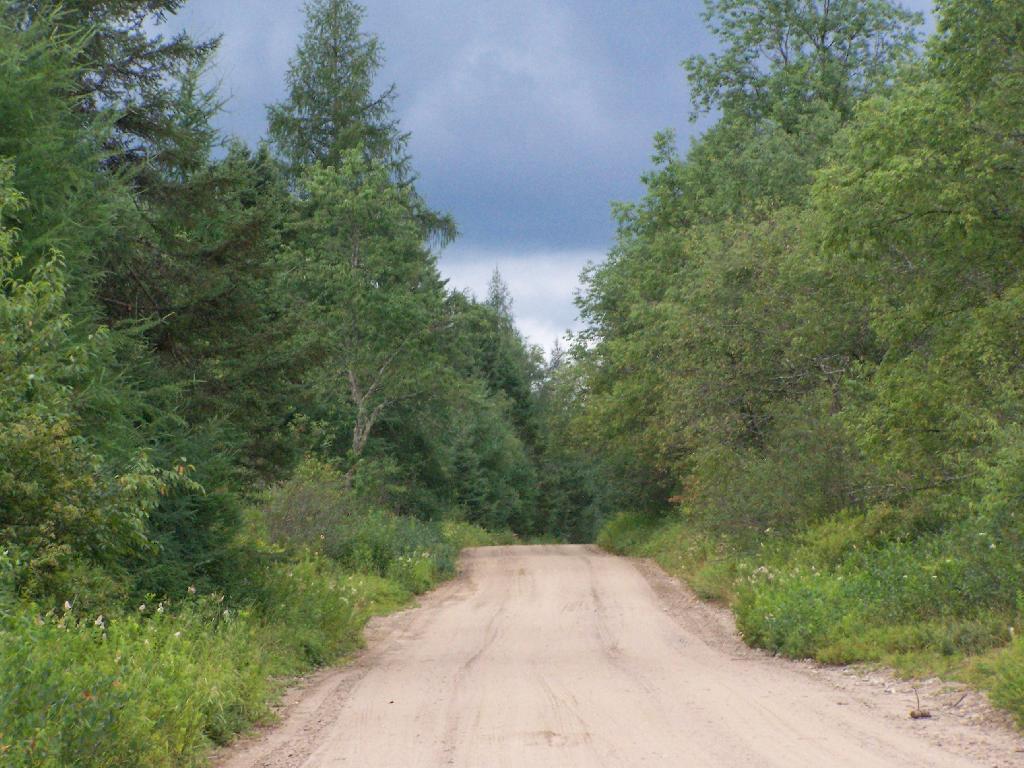
Maps
- Sprague Pond
- Wakley Pond (Before Gate)
- Wakely Mountain Firetower Trail (Before Gate)
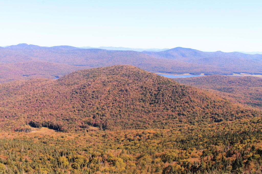
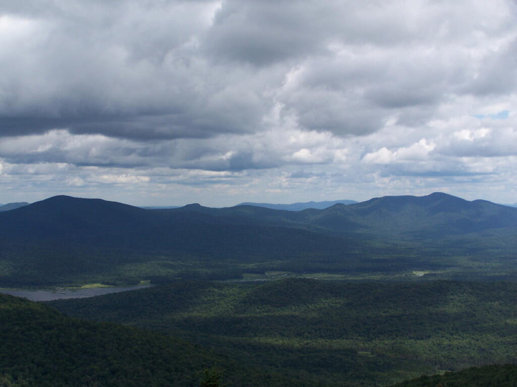
- Wakely Mountain – Points Visible from Firetower Tower
- Wakley Dam Entrance Camping Area (Before Gate)
- Cedar River Flow (Boat Access Sites)
- Campsites 1-30 (Silver Run)
- Campsites 30-40 (South Branch Moose River and Old Sly Pond Road)
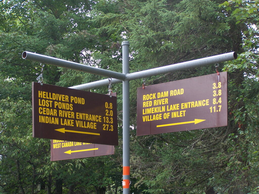
- Campsites 41-61 (Lost Ponds and Helldiver Pond)
- Mitchells Pond Trail and Campsites 64-74 (North of the Big T – Summer Stream)
- Mitchells Pond Loop (Snowmobile trail loop requires a bushwhack around a pond 3/4 mile from norhern approach)
- Ice House Pond (Also Campsites 80-82 Near Moose River Bridge)
- Beaver Lake Trail
- Campsites 71-77 and 119-123 (Red River Plains, Loop Road, Upper Natural Rock Dam Road)
- Camspties 123 – 131 (Lower Natural Rock Dam Road; Opens July)
- Bear Pond Trail (Loop Road)
- Falls Pond Trail
- Falls Pond – Wolf Pond – Deep Lake – Brook Trout Lakes Trail (West Canada Lake Wilderness)
- Squaw Lake Trail
- Indian Lake Trail (Follows former Indian Lake Road which was abandoned in 2011)
Campsites
| Milepoint | Name | Feature | Notes | Access | Location | |||
|---|---|---|---|---|---|---|---|---|
| Cedar River Flow 1 | Cedar River Flow | Tent site on flow | Boat | 43.702924803151, -74.4871304116533 | ||||
| Cedar River Flow 2 | Cedar River Flow | Tent site on flow | Boat | 43.7104737708879, -74.4802343768254 | ||||
| Cedar River Flow 3 | Cedar River Flow | Tent site on flow | Boat | 43.7145237017622, -74.4679264444554 | ||||
| Cedar River Flow 5 | Cedar River Flow | Tent site on flow | Boat | 43.7111711590583, -74.4675178486588 | ||||
| Cedar River Flow 6 | Cedar River Flow | Tent site on flow | Boat | 43.7084767866376, -74.4717703157492 | ||||
| Beaver Lake Campsite | Beaver Lake | Site overlooks Beaver Lake | Hike | 43.6516613421651, -74.7407833400961 | ||||
| 81 | Icehouse Pond | Accessible site at Icehouse Pond with privy | Hike | 43.6646602166505, -74.7029502913239 | ||||
| 140A | Indian Lake | Campsite on Indian Lake, outhouse in bad condition | Hike | 43.6154753632731, -74.7499942080732 | ||||
| East of Muskrat Pond | Indian Lake Trail | Former roadside campsite, largely abandoned | Hike | 43.645116528704, -74.696221627206 | ||||
| 46 | Lost Ponds Trail | Beyond the end of current Lost Ponds Road | Hike | 43.6868179572109, -74.6655581886723 | ||||
| 47 | Lost Ponds Trail | Above Lost Ponds | Hike | 43.6859472953826, -74.6722052916864 | ||||
| Mitchell Pond 1 | Mitchell Pond | Tent site, bushwhack | Hike | 43.6729475881673, -74.7502538624373 | ||||
| Mitchell Pond 2 | Mitchell Pond | Tent site, bushwhack | Hike | 43.6716991892117, -74.7432124817486 | ||||
| 64A | Mitchell Pond (Accessible Campsite at End of Gravel Trail) | Gravel path to site, wildrness privy | Hike | 43.6706136251028, -74.7387363015355 | ||||
| 10 | 89 | Beaver Lake Road | Off Otter Brook Road, Sand Plains | Vehicle | 43.6583112347181, -74.7012491214803 | |||
| 11 | 90 | Beaver Lake Road | Off Otter Brook Road, Sand Plains | Vehicle | 43.6577446555162, -74.7038760912165 | |||
| 16 | 1 | Cedar River – Limekiln Lake Road | Driveway Along Tributary of Silver Run | Vehicle | 43.7033162602551, -74.5742148239156 | |||
| 16 | 3 | Cedar River – Limekiln Lake Road | Along Silver Run | Vehicle | 43.7027301523306, -74.5757742464803 | |||
| 16 | 4 | Cedar River – Limekiln Lake Road | Along Silver Run, driveway at Sharp S Turn | Vehicle | 43.7026421104662, -74.5769731929134 | |||
| 16 | 7 | Cedar River – Limekiln Lake Road | Along Silver Run | Vehicle | 43.7040070126376, -74.5809411044503 | |||
| 15 | 10 | Cedar River – Limekiln Lake Road | Old gravel pit, accessible | Vehicle | 43.7031498027862, -74.5893864145496 | |||
| 15 | 11 | Cedar River – Limekiln Lake Road | Across from 12 | Vehicle | 43.702458607149, -74.5926546451668 | |||
| 15 | 12 | Cedar River – Limekiln Lake Road | Across from 11 | Vehicle | 43.7028667147947, -74.5929833340894 | |||
| 15 | 13 | Cedar River – Limekiln Lake Road | Along Silver Run | Vehicle | 43.7010402113051, -74.5956355707995 | |||
| 15 | 14 | Cedar River – Limekiln Lake Road | Along Silver Run | Vehicle | 43.7010328498576, -74.597457469967 | |||
| 14 | 16 | Cedar River – Limekiln Lake Road | Access Road for 16/17/18 Group | Vehicle | 43.7025294616695, -74.5969885248639 | |||
| 14 | 17 | Cedar River – Limekiln Lake Road | Access Road for 16/17/18 Group | Vehicle | 43.7021028692463, -74.5966599329259 | |||
| 14 | 18 | Cedar River – Limekiln Lake Road | Access Road for 16/17/18 Group | Vehicle | 43.7023846304313, -74.5978818600647 | |||
| 14 | 19 | Cedar River – Limekiln Lake Road | Along Silver Run | Vehicle | 43.7003546491841, -74.5964872856253 | |||
| 14 | 21 | Cedar River – Limekiln Lake Road | Across road from Silver Run | Vehicle | 43.6957217888458, -74.6020563094081 | |||
| 13 | 22 | Cedar River – Limekiln Lake Road | Across road from Silver Run | Vehicle | 43.6935817523545, -74.6036764840587 | |||
| 13 | 27 | Cedar River – Limekiln Lake Road | Across road from Silver Run | Vehicle | 43.6926540634024, -74.6082201775478 | |||
| 13 | 30 | Cedar River – Limekiln Lake Road | Open Area in Woods | Vehicle | 43.6918525577623, -74.6118452191364 | |||
| 13 | 31 | Cedar River – Limekiln Lake Road | Near Marsh off Silver Run | Vehicle | 43.6881856235873, -74.6271629609656 | |||
| 12 | 34 | Cedar River – Limekiln Lake Road | Open Field Near Old Sly Pond Road | Vehicle | 43.6846954329325, -74.634678249126 | |||
| 12 | 35 | Cedar River – Limekiln Lake Road | Former Sly Pond Road | Vehicle | 43.6836690328942, -74.6318552827363 | |||
| 11 | 38 | Cedar River – Limekiln Lake Road | On Hill Overlooking Road, near start of Lost Ponds Area | Vehicle | 43.6836029270341, -74.6401393590772 | |||
| 11 | 39 | Cedar River – Limekiln Lake Road | Above CRLLR, start of Lost Ponds Area | Vehicle | 43.6841476346233, -74.6487511980121 | |||
| 11 | 40 | Cedar River – Limekiln Lake Road | Above CRLLR, start of Lost Ponds Area | Vehicle | 43.682942162164, -74.6537793571789 | |||
| 11 | 41 | Cedar River – Limekiln Lake Road | Above CRLLR, start of Lost Ponds Area | Vehicle | 43.681311345096, -74.6589116717693 | |||
| 10 | 42 | Cedar River – Limekiln Lake Road | Above CRLLR, start of Lost Ponds Area | Vehicle | 43.6799039050817, -74.6646031695507 | |||
| 10 | 43 | Cedar River – Limekiln Lake Road | Above CRLLR, start of Lost Ponds Area | Vehicle | 43.6793727911294, -74.6664156654099 | |||
| 10 | 44 | Cedar River – Limekiln Lake Road | West of Lost Ponds Road, Sand Plains | Vehicle | 43.678808787762, -74.6696555368193 | |||
| 10 | 50 | Cedar River – Limekiln Lake Road | West of Lost Ponds Road, Sand Plains | Vehicle | 43.677986610504, -74.6732025802129 | |||
| 10 | 51 | Cedar River – Limekiln Lake Road | Pull-Off, Small Site, Sand Plains | Vehicle | 43.6775108499728, -74.6750146421403 | |||
| 10 | 52 | Cedar River – Limekiln Lake Road | Old gravel pit, short loop below CRLLR | Vehicle | 43.6748840847288, -74.6815273754233 | |||
| 10 | 53 | Cedar River – Limekiln Lake Road | Access Road for 55/54/55 Group, Sand Plains | Vehicle | 43.6733317629897, -74.6820452615144 | |||
| 10 | 54 | Cedar River – Limekiln Lake Road | Access Road for 55/54/55 Group, Sand Plains | Vehicle | 43.673268538603, -74.6822820352903 | |||
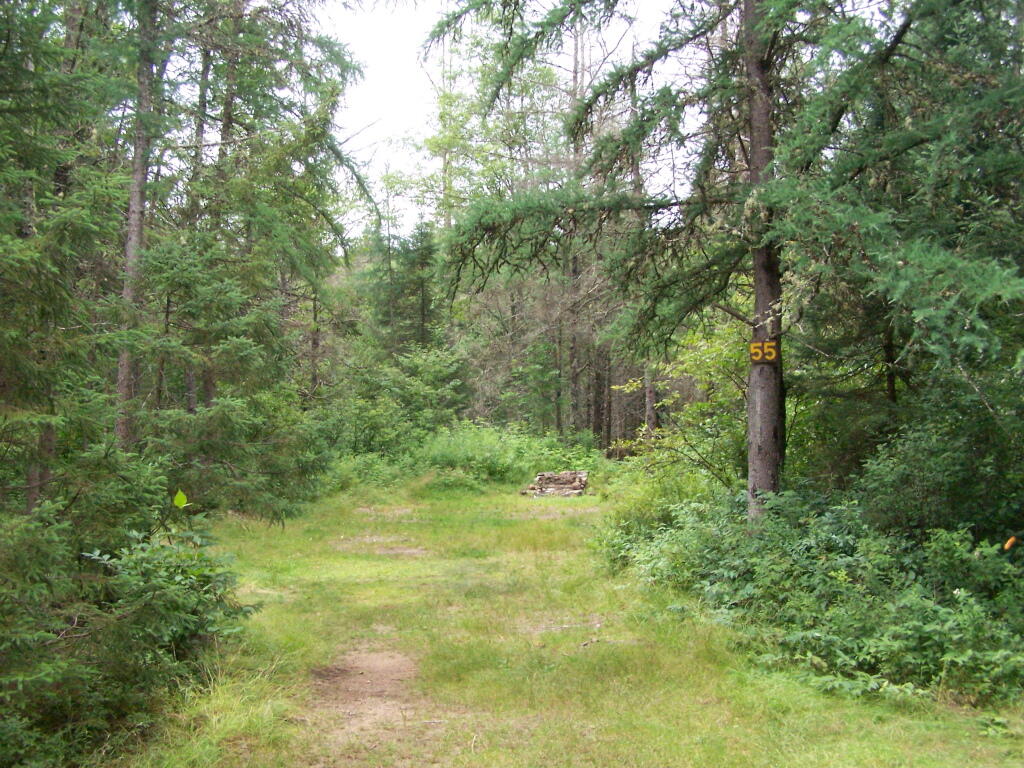
| 9 | 55 | Cedar River – Limekiln Lake Road | Access Road for 55/54/55 Group, Sand Plains | Vehicle | 43.6733705968856, -74.6827076379887 | |||
| 9 | 56 | Cedar River – Limekiln Lake Road | Driveway, East of Former Dump, Sand Plains | Vehicle | 43.673126585883, -74.6891475571674 | |||
| 9 | 57 | Cedar River – Limekiln Lake Road | Has Trail to Moose River | Vehicle | 43.6736673106707, -74.6902687046523 | |||
| 8 | 64 | Cedar River – Limekiln Lake Road | Near Mitchell Pond Trail | Vehicle | 43.6757521870177, -74.707500815672 | |||
| 8 | 66 | Cedar River – Limekiln Lake Road | Near Pine Creek | Vehicle | 43.6784203854214, -74.7068492021325 | |||
| 7 | 67 | Cedar River – Limekiln Lake Road | Benedict Creek Road, Wooded | Vehicle | 43.6851041444828, -74.7031887110586 | |||
| 7 | 69 | Cedar River – Limekiln Lake Road | Remote site, perched over the road | Vehicle | 43.6834516958835, -74.7168906980223 | |||
| 6 | 70 | Cedar River – Limekiln Lake Road | Large loop off of CRLLR | Vehicle | 43.6839906014562, -74.7249870178447 | |||
| 6 | 71 | Cedar River – Limekiln Lake Road | Very sandy site near Mitchells Pond Upper Loop | Vehicle | 43.6833776353921, -74.7321947941391 | |||
| 5 | 72 | Cedar River – Limekiln Lake Road | At end of Bear Pond Loop Road (Accessable) | Vehicle | 43.6828956047277, -74.7359084701559 | |||
| 4 | 73 | Cedar River – Limekiln Lake Road | Very sandy site near Mitchells Pond Upper Loop | Vehicle | 43.6835777053685, -74.7387188889593 | |||
| 4 | 74 | Cedar River – Limekiln Lake Road | On a hill overlooking road and marshy area | Vehicle | 43.6839187521201, -74.742285779317 | |||
| 4 | 76 | Cedar River – Limekiln Lake Road | Very sandy site near Mitchells Pond Upper Loop | Vehicle | 43.6864452702399, -74.7471689344191 | |||
| 4 | 77 | Cedar River – Limekiln Lake Road | Near Red River, Bear Pond Loop, Sand Plains | Vehicle | 43.6897961458669, -74.7484803840413 | |||
| 10 | 58 | Helldiver Pond Road | Near Helldiver Pond | Vehicle | 43.6735979105991, -74.6920316000423 | |||
| 10 | 59 | Helldiver Pond Road | Near Helldiver Pond | Vehicle | 43.6723766419894, -74.6929318681131 | |||
| 10 | 60 | Helldiver Pond Road | Near Helldiver Pond | Vehicle | 43.6713193532923, -74.692758456613 | |||
| 10 | 61 | Helldiver Pond Road | Accessible site at end of Helldiver Pond Road | Vehicle | 43.6705019900204, -74.6921751440693 | |||
| 15 | West of Brooktrout Trail | Indian Lake Road | Past Brooktrout Trail, on a hill over road | Vehicle | 43.6254538914434, -74.7337300739322 | |||
| 10 | 48 | Lost Pond Road | Sand Plains, Marshes Aroubnd | Vehicle | 43.6814268347573, -74.6667101324338 | |||
| 11 | 49 | Lost Pond Road | Sand Plains, Marshes Aroubnd | Vehicle | 43.6819456385478, -74.6670131106595 | |||
| 10 | 80 | Otter Brook Road | Has Trail to Moose River | Vehicle | 43.6620917920003, -74.7112181918076 | |||
| 11 | 98 | Otter Brook Road | Above Moose River on Hill | Vehicle | 43.6588725644731, -74.6966603409996 | |||
| 11 | 101 | Otter Brook Road | Sand Plains | Vehicle | 43.6564420559443, -74.6938956128147 | |||
| 11 | 103 | Otter Brook Road | Sand Plains | Vehicle | 43.657108724794, -74.6873446316172 | |||
| 12 | 104 | Otter Brook Road | Wooded Site | Vehicle | 43.6560617426567, -74.6832992891923 | |||
| 12 | 106 | Otter Brook Road | Wooded Site | Vehicle | 43.6565121581975, -74.6789913497265 | |||
| 13 | 110 | Otter Brook Road | Wooded Site | Vehicle | 43.6566072628101, -74.6733859460379 | |||
| 13 | 111 | Otter Brook Road | Near Otter Brook Bridge | Vehicle | 43.6539235327721, -74.6747718892435 | |||
| 23 | 1 | Wakely Dam Camping Area | Accessible site | Vehicle (before gate) | 43.7266767212397, -74.474100266424 | |||
| 23 | 2 | Wakely Dam Camping Area | Field Camping | Vehicle (before gate) | 43.7266515010084, -74.4733110730078 | |||
| 23 | 3 | Wakely Dam Camping Area | Field Camping | Vehicle (before gate) | 43.7259595122959, -74.473899965642 | |||
| 23 | 4 | Wakely Dam Camping Area | On Driveway to Lake | Vehicle (before gate) | 43.7260676922081, -74.4742326471903 | |||
| 23 | 5 | Wakely Dam Camping Area | On Driveway to Lake | Vehicle (before gate) | 43.7255637908987, -74.4741751228291 | |||
| 23 | 6 | Wakely Dam Camping Area | On Driveway to Lake | Vehicle (before gate) | 43.7252231337487, -74.4745830371916 | |||
| 23 | 9 | Wakely Dam Camping Area | Across bridge | Vehicle (before gate) | 43.726275356142, -74.4717840349063 | |||
| 23 | 10 | Wakely Dam Camping Area | Across bridge | Vehicle (before gate) | 43.7266308152758, -74.4712600272389 | |||
| 10 | 82 | Otter Brook Road | On Moose River | Vehicle (driveway) | 43.6603083771227, -74.7010353925305 | |||
| 11 | 84 | Otter Brook Road | On Moose River | Vehicle (driveway) | 43.6619962517853, -74.6957783254417 | |||
| 6 | 120 | Natural Rock Dam Road | Sand Plains near Red River | Vehicle (Opens July) | 43.6848543033273, -74.7664253595203 | |||
| 6 | 122 | Natural Rock Dam Road | Wooded Site | Vehicle (Opens July) | 43.684367353989, -74.7717171949716 | |||
| 6 | 123 | Natural Rock Dam Road | Wooded Site | Vehicle (Opens July) | 43.6804228755091, -74.7782951743141 | |||
| 6 | 124 | Natural Rock Dam Road | Wooded Site | Vehicle (Opens July) | 43.6792030487765, -74.7847972548314 | |||
| 7 | 125 | Natural Rock Dam Road | Wooded Site | Vehicle (Opens July) | 43.6783559964111, -74.7880327043169 | |||
| 7 | 126 | Natural Rock Dam Road | Wooded Site | Vehicle (Opens July) | 43.6748535298235, -74.790591643043 | |||
| 7 | 127 | Natural Rock Dam Road | Wooded Site | Vehicle (Opens July) | 43.6739776362472, -74.7910844137006 | |||
| 7 | 128 | Natural Rock Dam Road | Wooded Site | Vehicle (Opens July) | 43.6751413481917, -74.7924842843025 | |||
| 8 | 129 | Natural Rock Dam Road | Wooded Site | Vehicle (Opens July) | 43.6703784784539, -74.7926312803463 | |||
| 8 | 130 | Natural Rock Dam Road | Wooded Site | Vehicle (Opens July) | 43.6666270858056, -74.8019151989726 | |||
| 8 | 131 | Natural Rock Dam Road | Wooded Site | Vehicle (Opens July) | 43.6643581634434, -74.8054154753831 | |||
| 8 | 132 | Natural Rock Dam Road | Wooded Site | Vehicle (Opens July) | 43.6652083016168, -74.8036826184027 | |||
| 5 | 119A | Natural Rock Dam Road | Sand Plains near Red River | Vehicle (Opens July) | 43.6844716021433, -74.7646961785253 | |||
| 6 | 123A | Natural Rock Dam Road | Wooded Site | Vehicle (Opens July) | 43.6802422604152, -74.782965042166 | |||
| 6 | 124A | Natural Rock Dam Road | Wooded Site | Vehicle (Opens July) | 43.6785899888224, -74.7864319884685 | |||
| 6 | 125A | Natural Rock Dam Road | Wooded Site | Vehicle (Opens July) | 43.6776017274889, -74.7902229325712 | |||
| 7 | 126A | Natural Rock Dam Road | Wooded Site | Vehicle (Opens July) | 43.6756110574941, -74.7901645681643 | |||
| 8 | 129A | Natural Rock Dam Road | Wooded Site | Vehicle (Opens July) | 43.6689370211979, -74.7948887917477 | |||
| 8 | 129AA | Natural Rock Dam Road | Wooded Site | Vehicle (Opens July) | 43.6674497436753, -74.7980604042935 | |||
| 8 | 130A | Natural Rock Dam Road | Wooded Site | Vehicle (Opens July) | 43.6661052974262, -74.8016557609016 | |||
| 8 | 130AA | Natural Rock Dam Road | Wooded Site | Vehicle (Opens July) | 43.6669094078356, -74.8007390664074 |