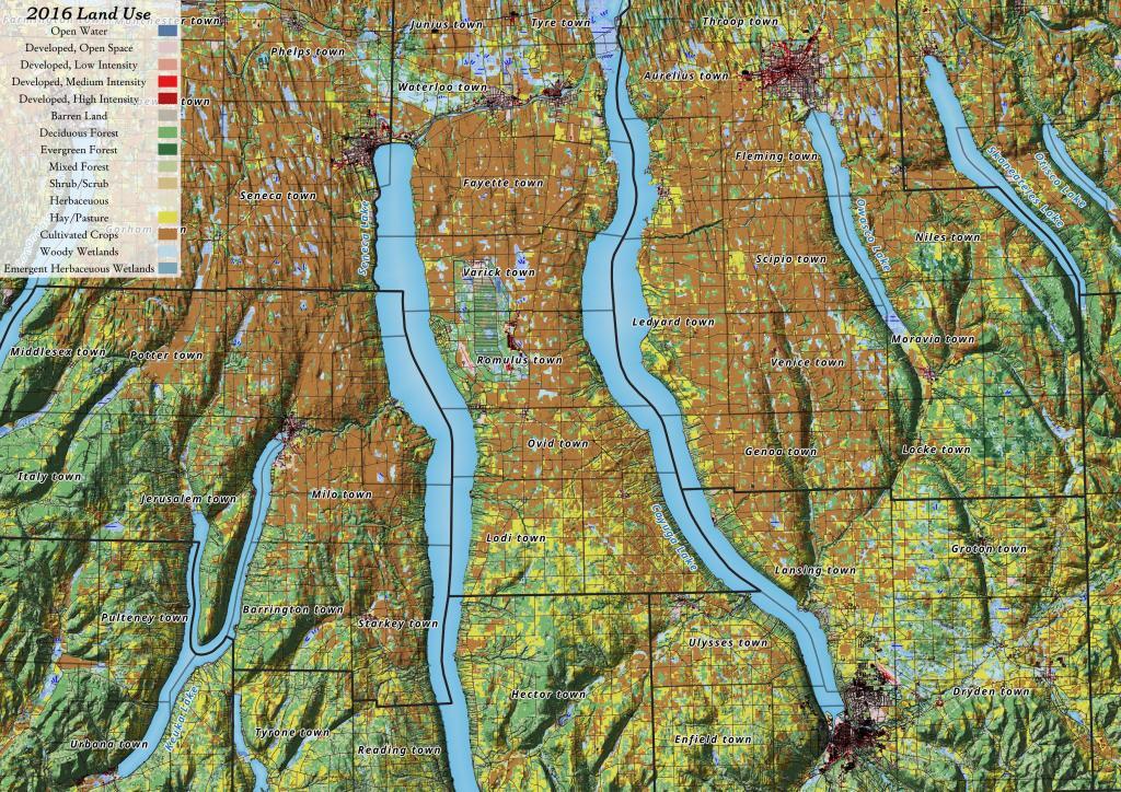
Yesterday, I downloaded the National Land Cover Data for 2016. I had some older data but I hadn't updated it in years, but soon realized I could make some very interesting maps and graphics with this data. The Finger Lakes are kind of interesting to look at in particular as you can see the Northern Finger Lakes have a lot of cultivated lands -- mostly corn and soybeans -- for feeding dairy cattle, while the more upland and rocky lands in the Southern Finger Lakes are either wooded or pasture.
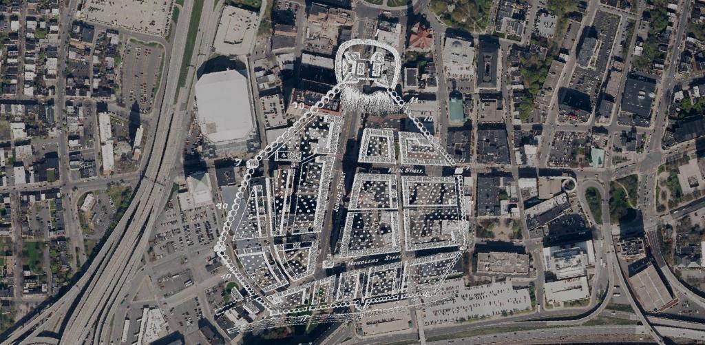
Here is a Map of Albany showing the stockade in 1695, overlaying the contemporary arerial photo of Albany. At the top of the hill, was Fort Frederick sitting atop State Street Hill (Capitol Hill) it replaced the earlier Fort Orange along the Hudson River, offering protection for Pearl Street and lands below it. John Wolcott told me that Pearl Street was likely a corruption of "Peril Street" due to the risk of being shot by invaders down from the top of the hill.
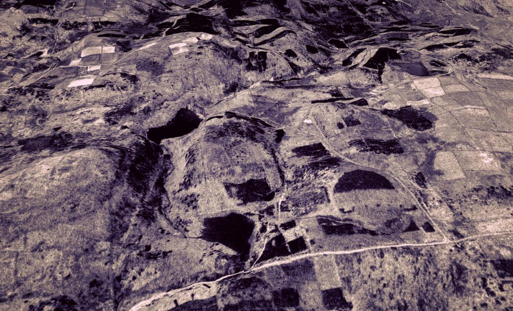
I've always been impressed by the size of this interchange and the long abandoned but still remaining connections to Crouse Road.
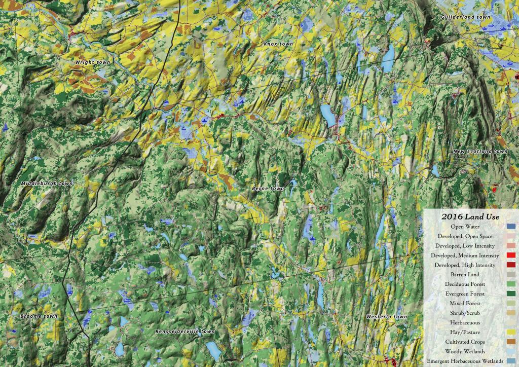
While Berne has quite a bit of farming going on in the valleys, there is less agriculture going on there then to the north in Knox. A lot of the hillsides and upper elevation areas aren't great for farming, and even in the valleys, more of the land is used for pasture and hay production.
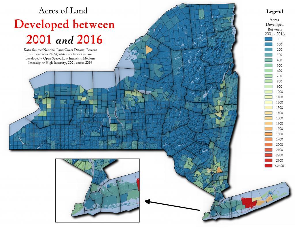
Playing around with MLCD I made up these maps. I am not sure if these are the reprocessed, EVA versions of the map, so there could be distorations in the data that shouldn't be there. I'll have to look at the data more.
A series of aerial photos showing the various expansions of the Bryants Plaza.