Search Results for: map map 10
Railroad Mileage Map 1910 – Rand McNally and Company
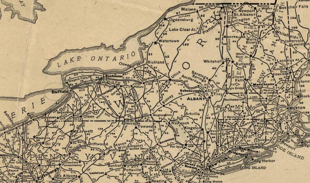
There used to be an impressive amount of railroad mileage in New York State in 1910, as seen in on this old Rand McNally map of railroads in the state.
Karner East 10 Foot Elevation
This map shows highly detailed contours for the East Barrens of the Albany Pine Bush.
Data Source: NYS GIS Program Office. NYS LIDAR Coverage. http://gis.ny.gov/elevation/lidar-coverage.htm
Within a 10 Minute Walk to a Supermarket
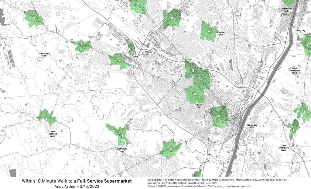
If you don't own a car, there is only a few parts of Albany where you can walk a short distance to get to a supermarket.
Green areas are those within a 10 minute walk of a major supermarket -- Price Chopper, Hannaford, Tops, Shop-Rite, or Walmart.
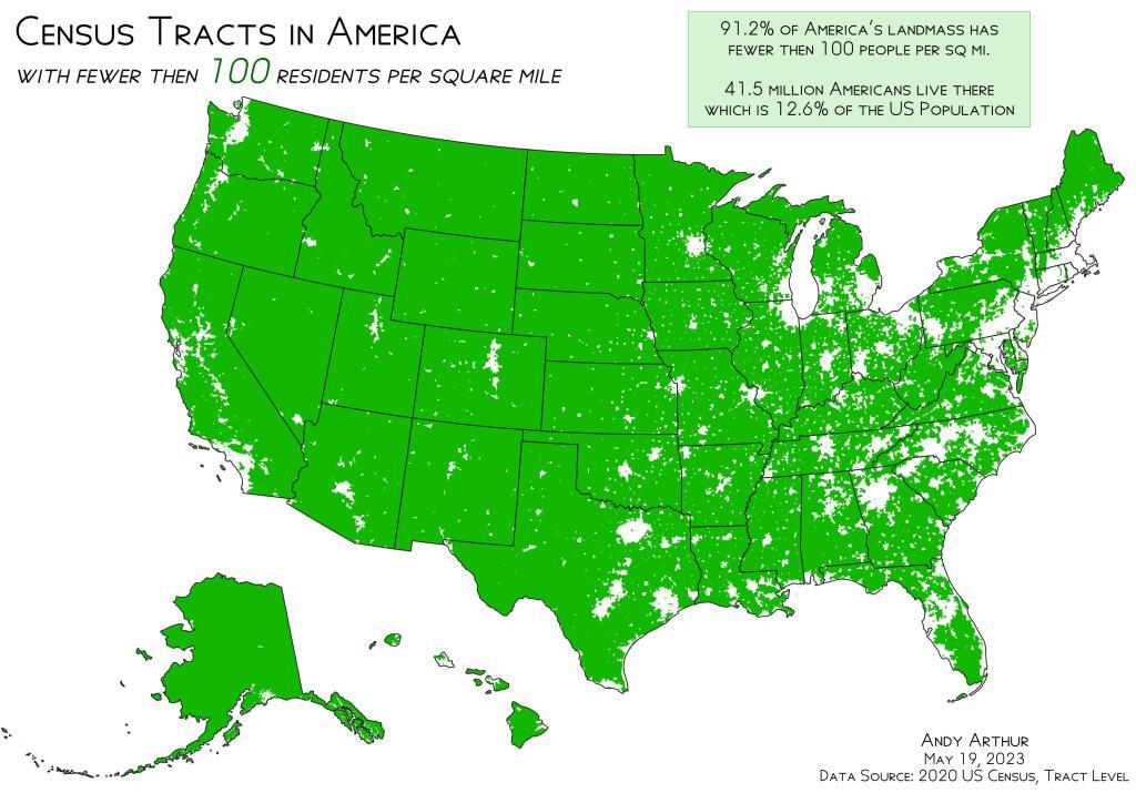
Census Tracts in America with Fewer then 100 People Per Square Mile
Cancers Per 100,000 Persons
Incidence Rate Report for United States by County
All Cancer Sites, 2009-2013
All Races (includes Hispanic), Both Sexes, All Ages
Forked Mountain – 1907/1910
Prior to the 1920s, there was no road developed along the east side of the Scanadaga River north of wells heading up to Speculator, just a foot path. What would become NY 8 would run along the south-east side of East Branch of the Scanadaga River, and Gilmantown Road was the main route from Wells to Spectulator.