Mid-Madison County
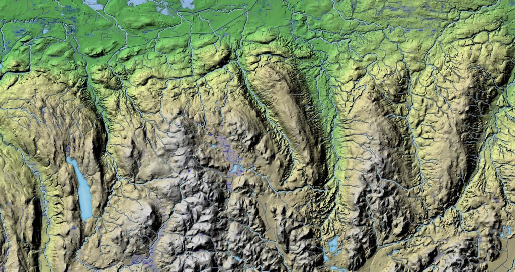
The hills and hollows of Southern Madison County come to an as the escarpment drops down to the Mohawk Valley in Mid-Madison County.
The hills and hollows of Southern Madison County come to an as the escarpment drops down to the Mohawk Valley in Mid-Madison County.
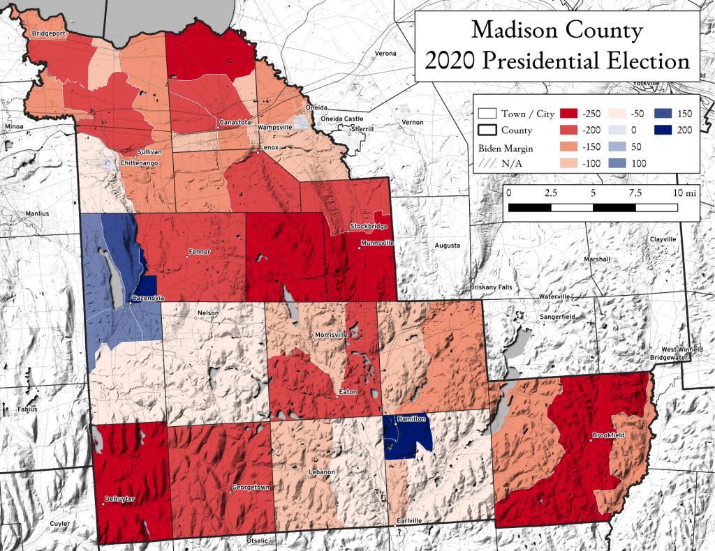
Madison County, NY went pretty red during the 2020 Presidential Election, which is not uncommon for rural counties across America. Notable exceptions is the area around Cazenovia and Hamilton (home to Colgate College) and the newer, wealthier election district on the outskirts of the City of Oneida.
Madison County is home to 8 bridges that are from the 1800s, with four of them crossing the Old Erie Canal.
The northern part of the county has a lot of crop land, while the more southernly part of the county is more pasture and forested.
A look at these old villages in Northern Madison County crossed by the Old Erie Canal.
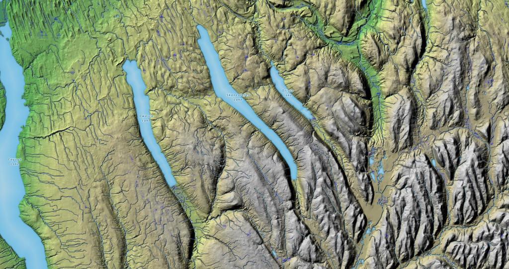
I've always been fascinated by the terrain as you drive from the hill and holler country of Southern Madison and Onondaga County, into the rolling country of the Finger Lakes, along US 20. This relief map of this region shows the change in the landscape, along with the dunes sculpted by the glaciers as you head out into the Finger Lakes.
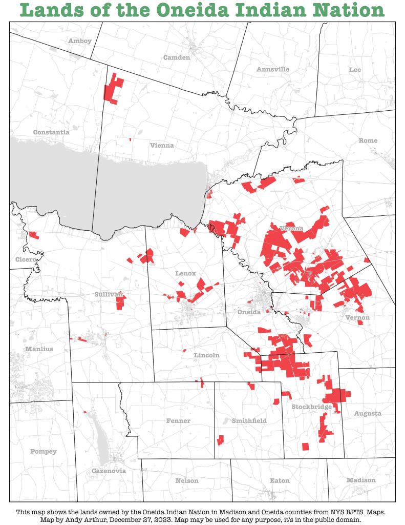
I was curious about the contemporary lands of the Oneida Indian Nation while I was out in Madison County during the Christmas holiday. I thought it would be an interesting map, querying it from the state tax maps.