Map: Klipnocky State Forest
Download a High Resolution JPEG Image of the Klipnocky State Forest or an Adobe Acrobat Printable PDF of the Klipnocky State Forest.

Bookmark my free Interactive GPS Map for your phone:
https://andyarthur.org/ny
... shows your location as a blue dot in relationship to campsites, trails, state land. This online map requires cell service, won't work in remote country, so also bring a paper map.
Free Download of New & Historical USGS 1:24k Topograpic Maps
Interactive maps with backcountry and roadside camping: New York, Pennsylvania, West Virginia & Vermont. List of NYS DEC Lean-Tos and Firetowers.
Google Spreadsheet with Roadside, Primitive and Pay Campsites
More about Klipnocky State Forest...
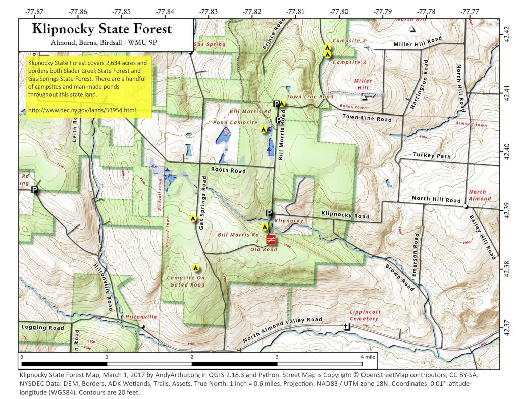
Klipnocky State Forest covers 2,634 acres and borders both Slader Creek State Forest and Gas Springs State Forest.
The origin of the name "Klipnocky" is uncertain. Local folklore includes stories about a race of Bigfoot-like creatures known as "The Hairy Women of Klipnocky". What is certain is that Klipnocky State Forest occupies some extremely rocky and remote country. Several old stone quarries can be found on the area. The most recent quarrying was during the construction of the Almond Dam in the 1940s. Several of the old quarries have been converted to wildlife ponds.
This state land is crossed by the North Country Trail and is home to several campsites along the back roads that cross this land.
http://www.dec.ny.gov/lands/53954.html
... photos, maps and other content from from Klipnocky State Forest.