Explore this page for comprehensive maps and campsite listings along the stunning Bog River Flow, also referred to as Lows and Hitchens Pond, nestled in the Adirondacks. Equipped with coordinates and interactive maps, this valuable resource aids in locating free camping spots within this scenic region. Discover more about the Lows Lake area, adjacent to Horsehoe Pond, situated off NY 3 and NY 421, approximately ten miles south of Tupper Lake.
Interactive map of campsites along Bog River Flow.
Here is a downloadable map.
Here is a list of the campsites in the Bog River Flow – Hitchens Pond and Lows Lake. You can download this on Google Sheets.
Name
Notes
coord
Big Deer Pond Campsite
Campsite 2 on Oswegatchie River Canoe Carry
44.07066499203909,-74.83562688410296
Bog Lake Campsite
Campsite on knoll under hemlocks. No obvious privy
44.04597400340542,-74.76877997265527
Bog River Primitive Campsite 1
Designated campsite
44.11498202693457,-74.62835933121629
Bog River Primitive Campsite 2
Designated campsite
44.112697282644255,-74.63814827173313
Bog River Primitive Campsite 3
Designated campsite
44.11709452942677,-74.6416450967812
Bog River Primitive Campsite 4
Designated campsite. With short privy
44.11703559376099,-74.66030250230646
Bog River Primitive Campsite 5
Designated campsite. With short privy
44.11438984664461,-74.66461339832713
Bog River Primitive Campsite 6
Designated campsite with pit privy. Full sized privy
44.11147789052526,-74.66585509269002
Bog River Primitive Campsite 7
Designated campsite. With short privy
44.11022932303285,-74.66826136834727
Bog River Primitive Campsite 8
Designated campsite. With short privy
44.10742088225655,-74.6691164912543
Bog River Primitive Campsite 9
Designated campsite. With short privy
44.10503371724627,-74.67884988872132
Bog River Primitive Campsite 10
Designated campsite with pit privy. Full sized privy
44.10140804214472,-74.69038422222768
Bog River Primitive Campsite 11
Designated campsite. With short privy
44.099078711392714,-74.6930712072797
Bog River Primitive Campsite 12
Designated campsite. With short privy
44.0978314008462,-74.69999139028391
Boone’s Landing Primitive Campsite
Deisgnated campsite with short privy. Checked 04/2016.
44.07626703407614,-74.77451394551568
Clear Pond Campsite
Primitive campsite with short privy
44.04310127384352,-74.76343793716421
Grass Pond Primitive Campsite 31
Designated campsite with pit privy
44.092147034884384,-74.79863219015742
Lows Lake Primitive Campsite 13
Designated campsite. Poor condition and overused. With short privy.
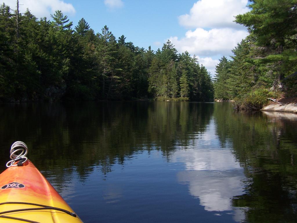
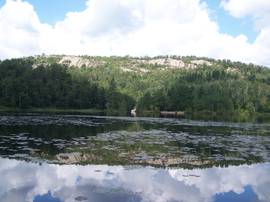
The Bog River Flow, also known as Lows Lake is a spectacular wilderness/primitive area located in South-East Saint Lawerence County. It consists of two dams, Lows Upper and Lows Lower, that create to massive man-made lakes. It is home to over 100 paddle in campsites along with some amazing views and wildlife.
Here is a downloadable map.
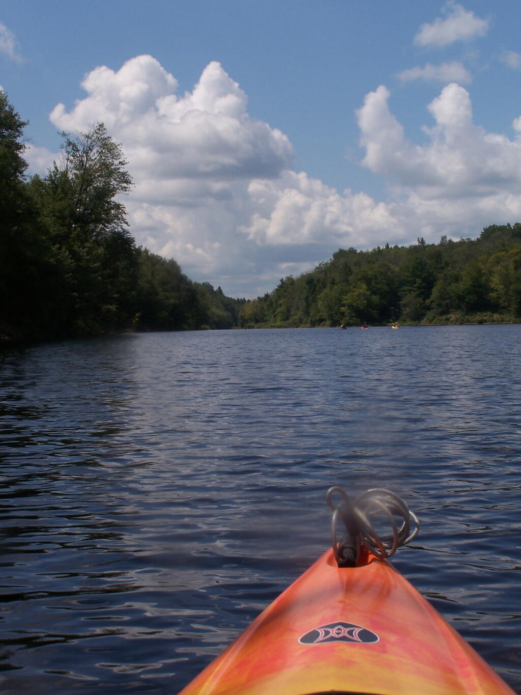
Above Lower Lows Dam. Paddling up the “flooded” Bog River, in the lower portion of Bog River flow, right above the Lower Lows Dam. If this area was not flooded by dams, it would be rapids, unaccessible by canoe or kayak.
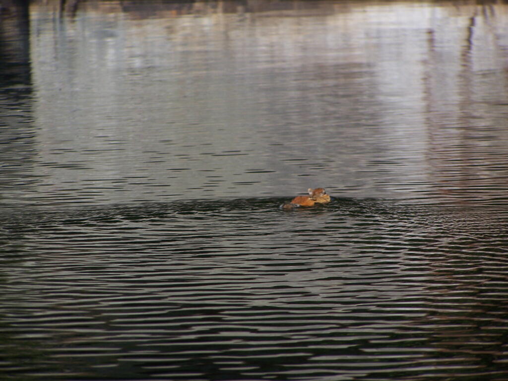
Chimpmunk Swims. This was taken about a mile above the Lower Lows Dam.
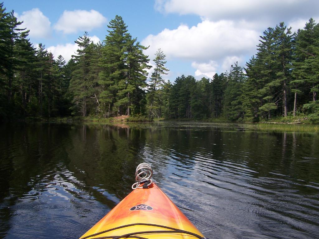
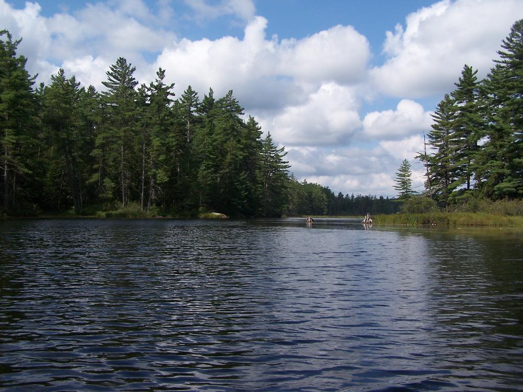
Bog River Flow Narrows. The Lower portion of the Bog River, is pretty narrow in part, due to the rocky terrain that it covers. You can easily bottom out a canoe or kayak in these parts, and other parts appear quite deep. There are a couple of paddle-in campsites along here.
Bog River Open Up A Little Bit. The first mile or so of the Bog River Flow is mostly flooded stream. But as you get closer to Hitchens Pond, it starts to widen a bit.
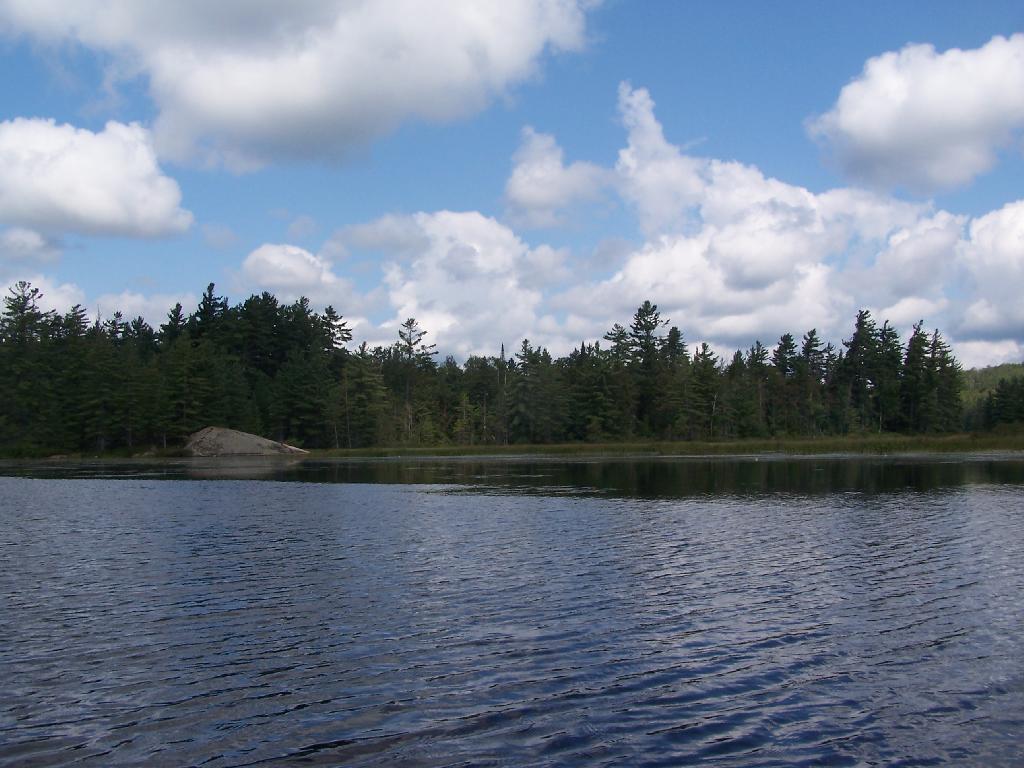
Entering Hitchens Pond. Just past here, is a hairpin turn, as the flooded River, winds a bit, and becomes a much larger lake, in the form of a series of bays and marshes.
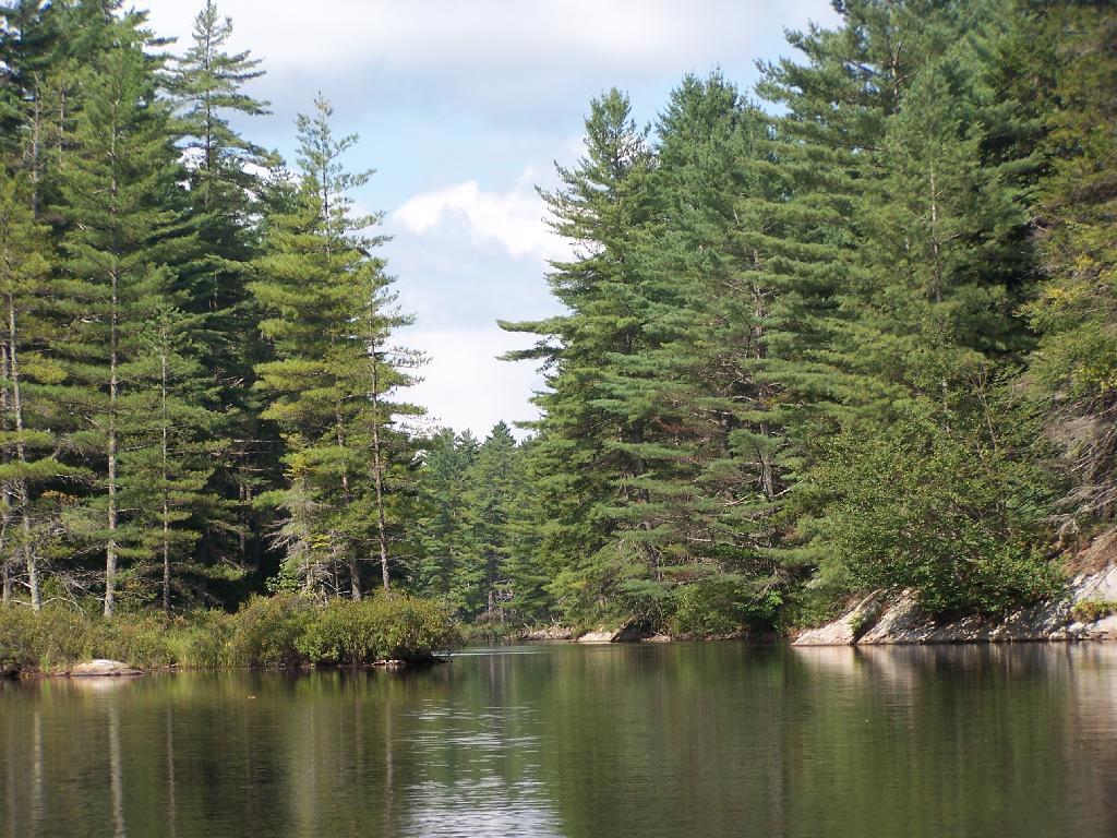
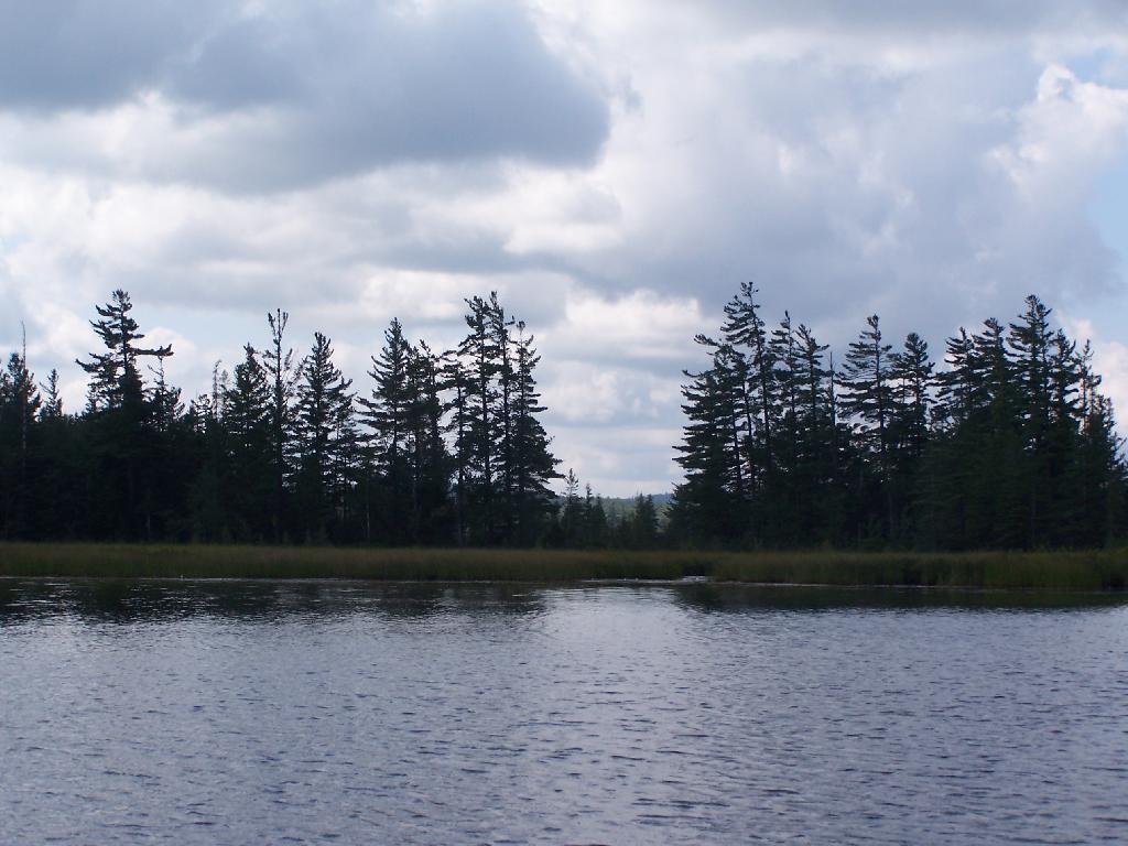
Hitchens Pond. Here things open up quite bit.
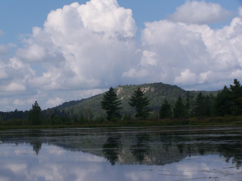
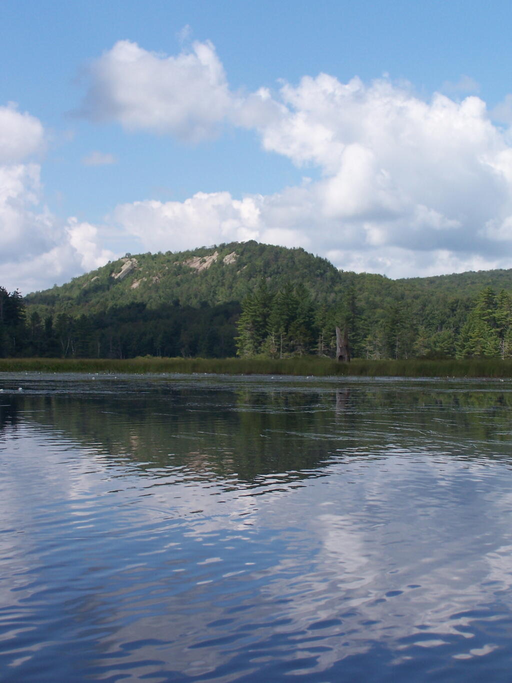
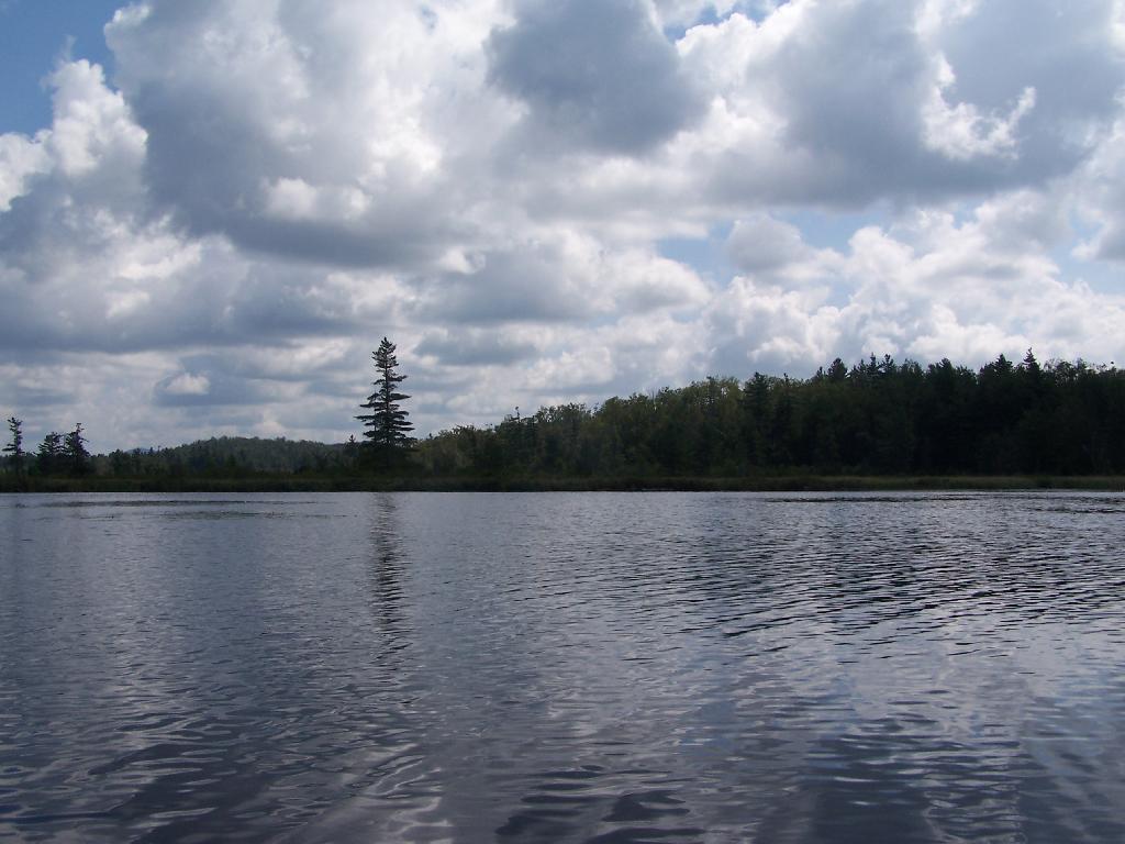
Lows Ledge. Here is Lows Ledge reflecting into Hitchins Pond. It’s much larger in person then it appears in this picture, unless you have a very big computer monitor.
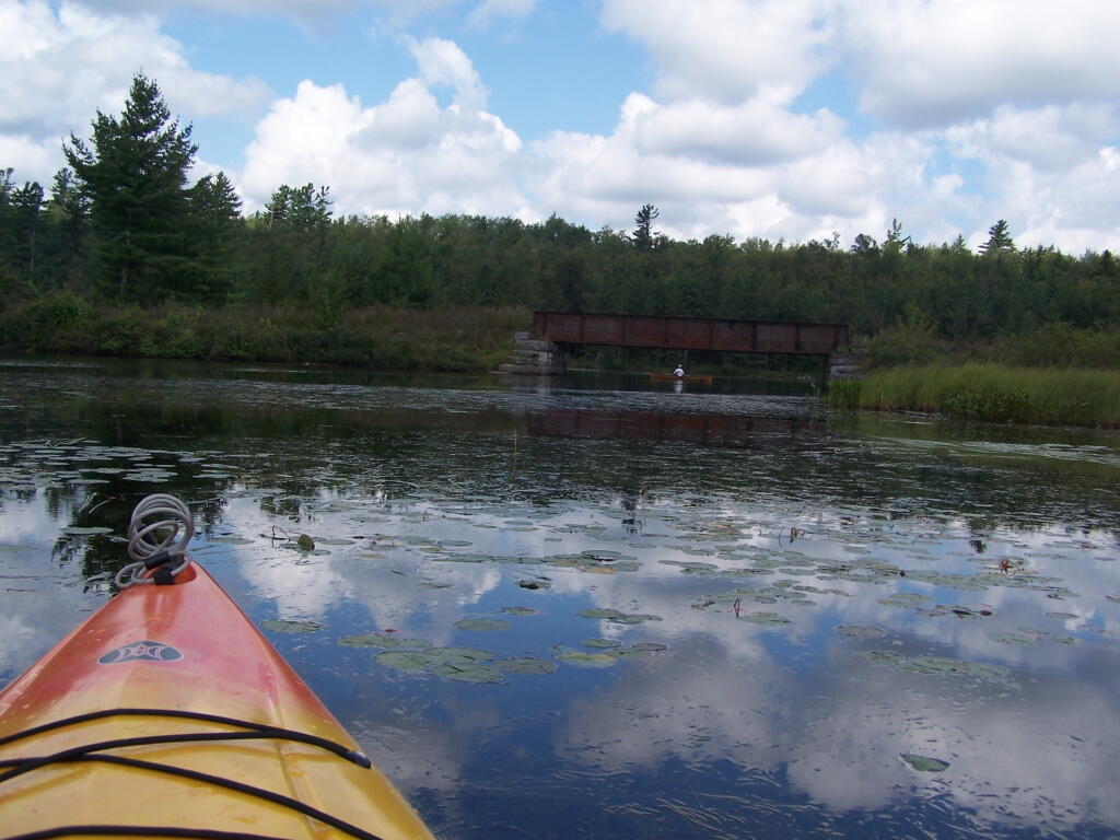
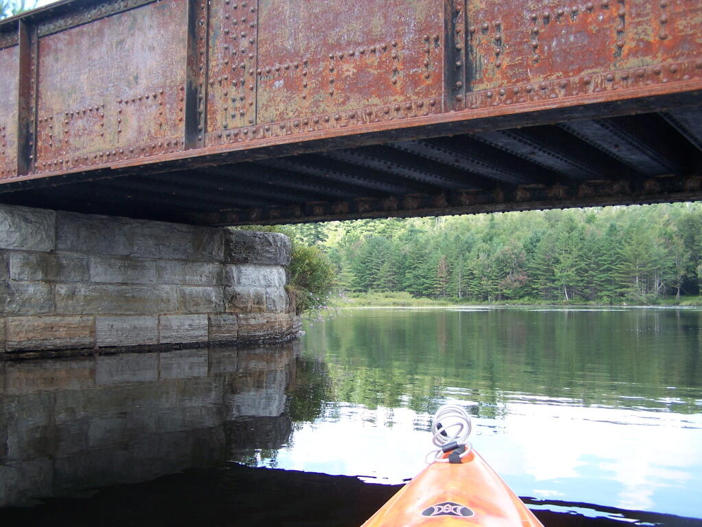
Railroad Bridge. About two miles into Bog River Flow, you cross under a relatively low railroad bridge. It’s actually about 5 or 6 feet above the flow, and doesn’t feel at all cramped in a canoe or kayak.
Under the Railroad Bridge. This shouldn’t be too bad to clear.
Trees Along Hitchens Pond. This picture can’t even reflect the beauty of this portion of Bog River Flow.
Break Time. Drinking all that beer, meant I had to find a place along the Flow to get out, stretch, and take a piss. Things being so boggy and soft in parts, meant there wasn’t a lot of open area to take a break.
Lows Ledge. I’m now about halfway between Lows Lower Dam and Lows Upper Dam, as the ledge reflects beautifully into the lake. It’s a very spiritual thing for sure, paddling along through this lake.
Clouds Rolling Out. To the south, it looked still quite cloudy. But there was something quiet spiritual about the area, and quiet vast. Something also spoke to me as being Saint Lawrence County, and as vast as one would expect the biggest county in the state to be.
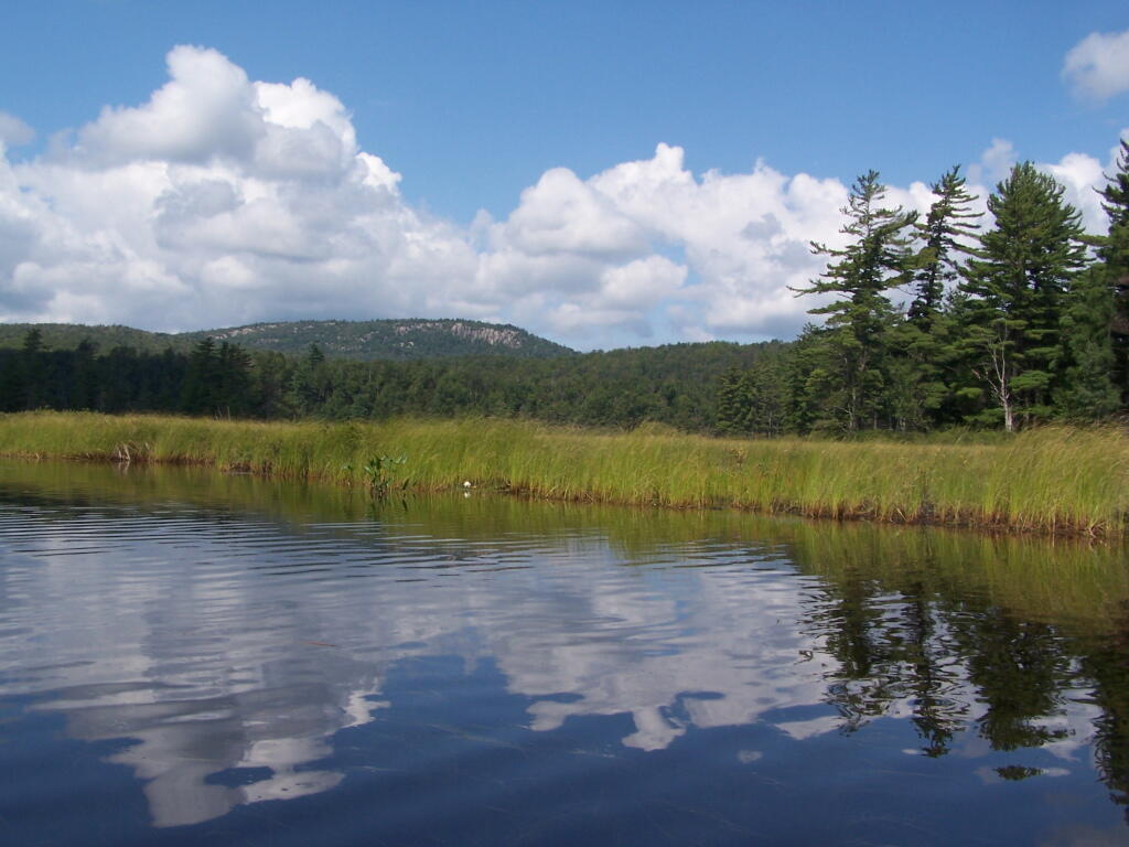
The Channel. The lake turns once again, with beautiful marsh lands along the edge of the lake.
Marshy. Portions of Hitchens Pond are quite marshy, and can be tough going, especially if one gets out of the channel.
Trees. These trees line the last big turn at Hitchens Pond, where you finally get into the main bay, as you head towards the Upper Lows Dam.
Marshland. Along Hitchens Pond as we get closer to Lows Upper Dam.
Lows Ledge. Now we are almost up to the portage for Lows Upper Dam. Quite purty I must say.
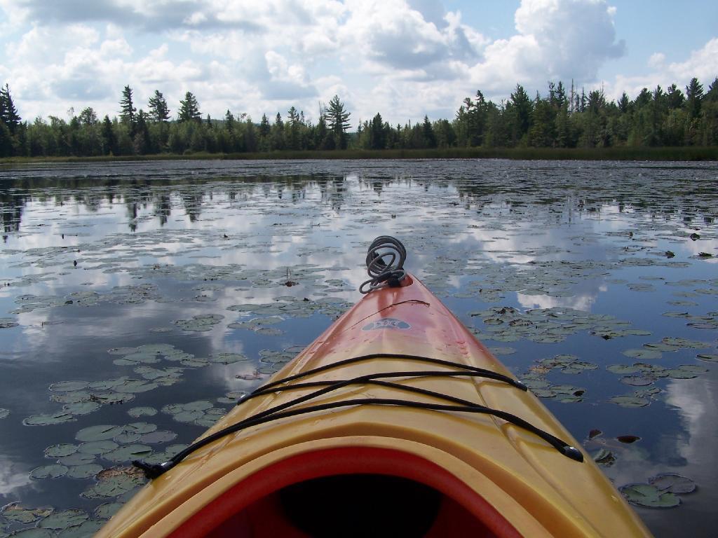
Kayakers Pull Out. You have to pull your boat out of the water, and carry it over the Lows Lake Upper Dam, about a 10 feet elevation, and maybe a 50 foot portage.
Bog River Area Pull Off. A lot of people pull out here, for lunch. Or they can be fools, and not use the channel to bottom of the dam, and carry their canoes, an additional 1/4 mile for no real purpose, to get it over the Lows Upper Dam. Not like I would be that stupid, now right? Of course, I just covered my camera with beer, so I shouldn’t be opening my mouth.
Lows Upper Dam. This is the last picture I got for the day, because I dropped the camera in a pool of beer in kayak, and things go wet. Eventually the camera dried out and started to work fine, but for now, we have to go pictureless. From here, the bottom portion of Lows Lake proper, above the Upper Lows dam, is much like the bottom part of Hitchens Pond, narrow, deep channel, that widens up.
Above Upper Lows Dam. This is the channel above the Upper Lows Dam, which technically is Lows Lake now. About a mile up from here, the lake gets shallow, and you must portage up into the more open Lows Lake main section. Yes, the camera lens has beer in it, that now has to dry out before I can take any more pictures. Nothing until tomorrow. It’s my Friday the 13th luck and stupidity of leaving the camera in the kayak, not in it’s protective case, as I pull out, and spilled beer soaks everything.
I’m a big of farmers who are essentially Living Off the Earth and think Rednecks are Noble Savages. Dairy Farming are key to our rural landscape. I’d trust a farmer or a hunter in a pile of guts he’s butchered over any ivory-tower scientist.
Bog River Flow – Popular canoe area that is popular for camping and paddling. Short portage between Hitchens Pond and Lows Lake. Lows Ledge is a 1 mile hike from the portage up to a ledge with expansive views of lakes and surrounding locations. Good to no cell service depending on location.
Brasher State Forest – Roughly 10 miles south of Malone, this expansive state forest is home to the Walter Pratt Camping Area on Red River Pond. Part of Saint Lawrence Flatlands, this area is largely sandy remote country with vast pine forest. Good cell service.
Chazy Lake – There are two campsites along the end of Wildfred Kingdom Road on Chazy Lake. The end of the road to the campsites is gated, and at times the campsites are marshy, but the views from the campsites are amazing.
Deer River State Forest – The “rough” country just north of Adirondack Park in Franklin County, that has camping in a wild environment that is the transition from the Adirondacks to the Saint Lawrence Flatland, about 10 miles outside of Malone. Limited cell service.
Franklin Falls Pond – There are several tent sites along the shore of Franklin Falls Pond that are a short hike down from the road and right along a popular canoe route. No cell service.
Floodwood Road (St Regis Canoe Area) – A very popular and packed in camping area is along Floodwood Road. I camped there once, I don’t recommend it.
Lake Kushaqua – A very scenic lake with a few campsites along it’s shore, near the Buck Pond Campground. I’ve been told these sites are too good to put out on the Internet and can be very hard to get in season. This lake connects with Rainbow Lake under a culvert, however to reach the upper part of Rainbow Lake you must portage.
Horsehoe Lake – Horseshoe Lake in Franklin County, is located about 15 miles south west of Tupper Lake. There are 6 campsites along the lake, plus 4 others on roads nearby. Near the Hitchens Pond put-in for Lows Lake, a popular spot for camping and paddling. Good to no cell service depending on location.
Mountain Pond – Old routing of NY 30 north of the Paul Smith VIC. Rough asphalt road. Near Barnum Pond which is very scenic for paddling, and rather rough Slush Pond Road which offers additonal campsites. No cell service.
Jones Pond – Three campsites located along a rough dirt road along with several tent sites along the north shore of this small lake about 10 miles from Saranac Lake.
Streeter Lake – Old railroad grade with 8 roadside campsites spread out along it’s way, along with a few campsites around the lake and an lean-to.
Union Falls Pond – One drive in site and a few tent sites along the reservoir just north of Franklin Falls Pond. Great views of Whiteface Mountain from this reservoir. No cell service.
Good evening! I was sitting out back for a while looking at the stars but it started to get cold. Now I’m back inside, in my bedroom next to my American flag lit by camp lamp. That flag is enormous in my apartment. It looks nice but will be even nicer in the woods next week. I’m a Proud American. Partly clear and 49 degrees in Delmar, NY. There is a west-northwest breeze at 8 mph.
Tonight will be mostly clear, with a low of 35 degrees at 5am. Two degrees below normal. Northwest wind 3 to 8 mph. In 2016, it got down to 31 degrees under clear skies. The record low of 19 occurred back in 1973.
Waning Gibbous Moon tonight with 82% illuminated. The Last Quarter Moon is on Wednesday night with chance of showers expected. The Full “Flower” Moon is in 4 weeks. The sun will rise at 6:15 am with the first light at 5:46 am, which is one minute and 38 seconds earlier than yesterday. Tonight will have 10 hours and 37 minutes of darkness, a decrease of 2 minutes and 46 seconds over last night.
Tomorrow, Good Friday, will be sunny, with a high of 64 degrees at 4pm. Six degrees above normal. Calm wind becoming north around 5 mph in the afternoon. Sounds like it’s going to be a pretty nice day. A year ago, we had sunny skies and a high of 58 degrees. The record high of 83 was set in 1968. 1.4 inches of snow fell back in 1950.
For Saturday, a chance of showers and thunderstorms between 2pm and 5pm, then a chance of showers after 5pm. Increasing clouds, with a high near 63. Light south wind increasing to 11 to 16 mph in the morning. Winds could gust as high as 26 mph. Chance of precipitation is 40%. New rainfall amounts of less than a tenth of an inch, except higher amounts possible in thunderstorms. Maximum dew point of 44 at 9pm.
On Easter, a slight chance of showers, then scattered showers and thunderstorms after 2pm. Partly sunny, with a high near 81. Chance of precipitation is 30%. New rainfall amounts of less than a tenth of an inch, except higher amounts possible in thunderstorms. Maximum dew point of 55 at 8pm.
Typical average high for the weekend is 58 degrees.
It wasn’t a terrible day but it was rather chaotic at times. I think I made it through the day okay but there was a few brushes against disaster but I think I’ll be fine. I need to push back politely with people when they become too demanding on things. I don’t always have to take calls too or answer emails right away.
I have Good Friday off which is good because I’m tired after this week. I want to work on wiring up the truck cap and the rest of the things set up and tested for camping this week. I will probably go grocery shopping on Monday and maybe leave Tuesday after work or maybe hold off for Wednesday. I’m undecided.
I was noticing how green the grass has gotten in both Delmar and in the city. Some trees are starting to blossom, but no leaves except on some of that awful, invasive honeysuckle that tends to take over in all scrubby places in the woods along the roadsides. Spring will come to the Albany-area eventually. We had some sun for a while, then it clouded up and cleared for dusk.
While models of the Southern Adirondack snow pack show significant snow in parts of the Southern Adirondacks, with the weekends rains and warmer temperatures, it’s expected to be almost entirely gone. That said, already the North Country is free of snow, and most of the Adirondacks should be melted by the time I get up there. But I don’t want to get far off blacktop this time of year, especially with the rain, as everything is probably mud and muck. April camping kind of sucks this time of year, with all of the mud. Plus I expect it to be fairly cold and wet at least from Thursday into Friday. Well, I know to proceed slowly, and get out and walk the road before I drive it if there is any question. I’m not getting stuck in the mud. Buck no!
I’m thinking on Wednesday or Thursday, hitting up Horseshoe Lake for a night, and maybe hiking back to Lows Ledge. The rough but asphalt NY 421 is plowed all the way back to Horseshoe Lake, although the road to Hitchens Pond is closed for the spring mud season. The snow is gone up there from the map but you never know with drifts. It’s been a number of years since I’ve been up that way, and it would be fun to explore. Off-season I probably have my choice of sites on Hitchens Pond, and if I paddle from Horseshoe Outlet to Hitchens Pond, it could be quite nice. But it might also have things blocking the way, so I might avoid it due to water that is still pretty cold.
Later in the week into the weekend I’m thinking about the Deer River area in Malone if the road is passable. I don’t remember it being soft but if it looks risky I’m not going to try it. There are other places to explore and fish. Fishing the Deer River though kind of excites me. Such a beautiful part of the state, mostly unknown around here. As I noted yesterday, might camp at the Walter Pratt area. I think I would prefer that as I have better cell reception there and those campsites have outhouses and picnic tables. There are some state forests like Wolf Lake State Forest, I’d love to see in St. Lawrence County. The power project and paddling part of the St. Lawrence River might be fun too. Then maybe come back through the Black River Valley and camp in the Otter Creek area, assuming the road is open this time of year. I should call the DEC in Lowville on Monday to find out. I’m thinking that Eatonville Road is probably still very soft this time of year if it’s open at all. Maybe I should plan to come back through the Adirondacks and camp somewhere there like Jones Pond.
In four weeks on May 11 the sun will be setting at 8:07 pm, which is 31 minutes and 26 seconds later then tonight. In 2016 on that day, we had mostly sunny skies and temperatures between 75 and 40 degrees. Typically, you have temperatures between 68 and 46 degrees. The record high of 90 degrees was set back in 1911.
Looking ahead, the Start of June is in 7 weeks. Lots of weeks of Black Fly Season ahead.

 Bicycle Trails and “Blackie” My Mountain Bike


 R Statistical Programming


 Python and Pandas


 Politics

 The Earth


 Saving Money


 Mission Fifty & Being Healthier


 / Enjoying Life

