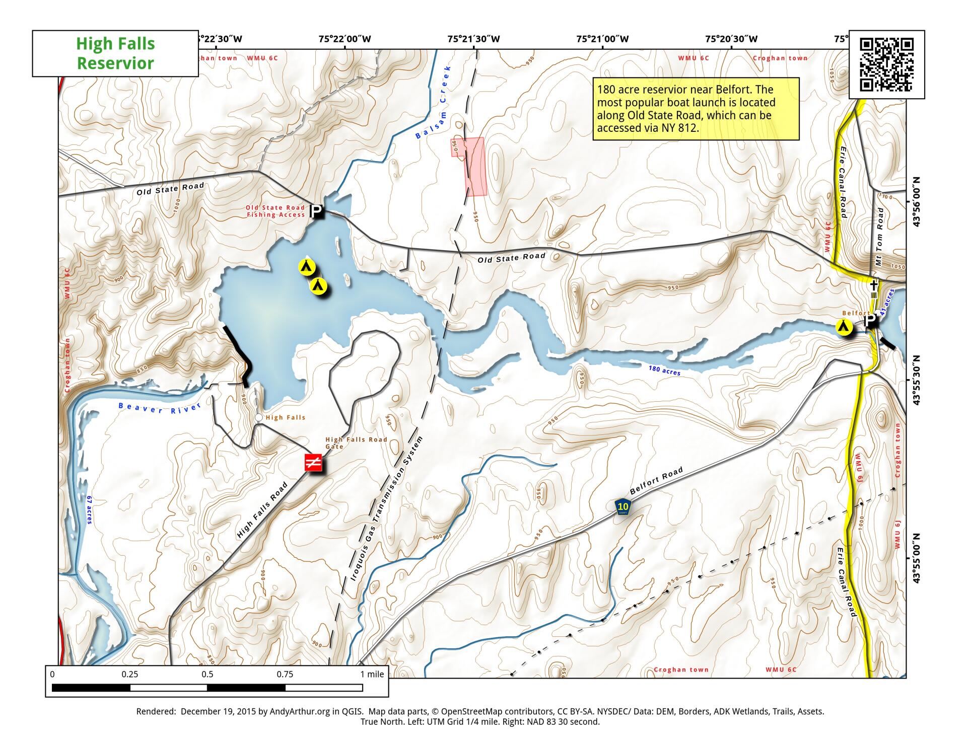
Map: High Falls Reservior

Download a High Resolution JPEG Image of the High Falls Reservior or an Adobe Acrobat Printable PDF of the High Falls Reservior.

Bookmark my free Interactive GPS Map for your phone:
https://andyarthur.org/ny
... shows your location as a blue dot in relationship to campsites, trails, state land. This online map requires cell service, won't work in remote country, so also bring a paper map.
Free Download of New & Historical USGS 1:24k Topograpic Maps
Interactive maps with backcountry and roadside camping: New York, Pennsylvania, West Virginia & Vermont. List of NYS DEC Lean-Tos and Firetowers.
Google Spreadsheet with Roadside, Primitive and Pay Campsites
More about High Falls Pond...
118 acre man-made hydropower lake, just west of Belfort. There are a few campsites and lots of good fishing here.
http://www.dec.ny.gov/docs/fish_marine_pdf/hfalpdmap.pdf
... photos, maps and other content from from High Falls Pond.