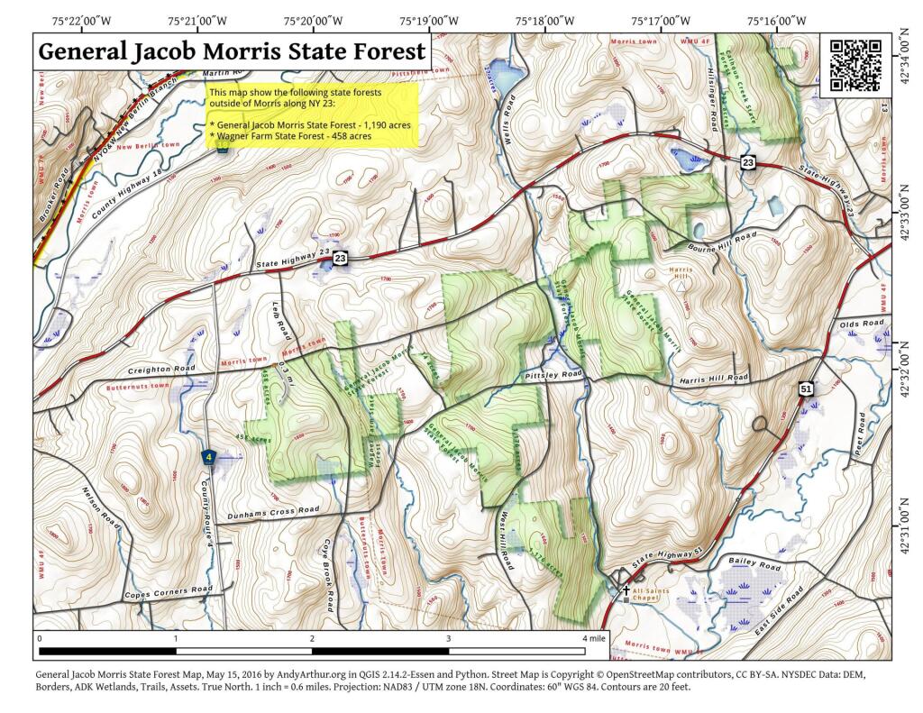
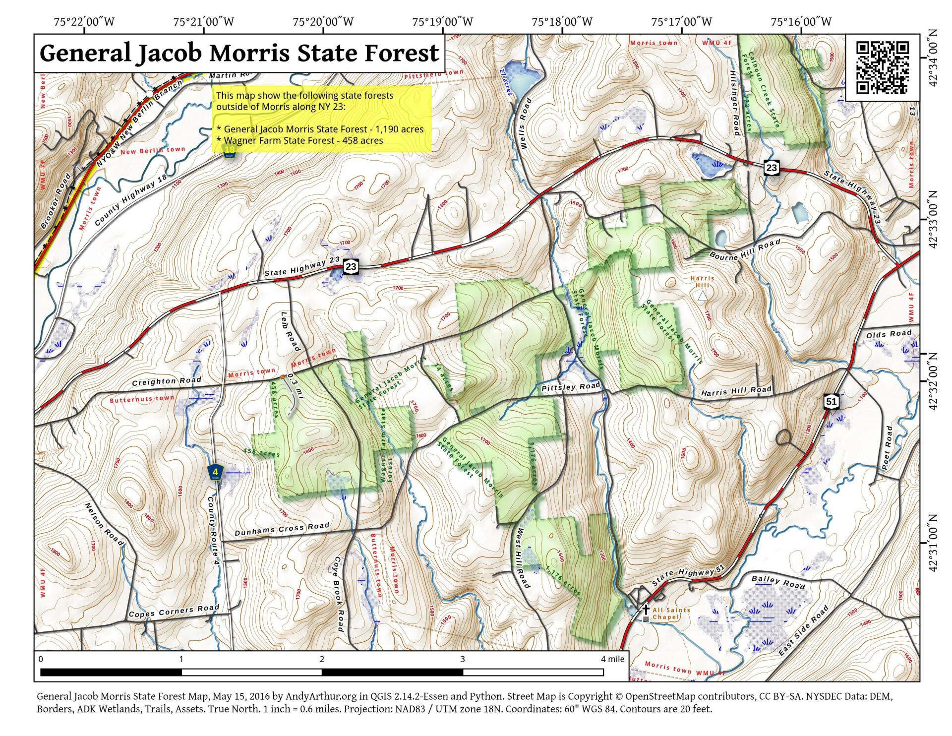
Map: General Jacob Morris State Forest
Download a High Resolution JPEG Image of the General Jacob Morris State Forest or an Adobe Acrobat Printable PDF of the General Jacob Morris State Forest.

Bookmark my free Interactive GPS Map for your phone:
https://andyarthur.org/ny
... shows your location as a blue dot in relationship to campsites, trails, state land. This online map requires cell service, won't work in remote country, so also bring a paper map.
Free Download of New & Historical USGS 1:24k Topograpic Maps
Interactive maps with backcountry and roadside camping: New York, Pennsylvania, West Virginia & Vermont. List of NYS DEC Lean-Tos and Firetowers.
Google Spreadsheet with Roadside, Primitive and Pay Campsites
More about General Jacob Morris and Wagner State Forests...
The 463-acre Wagner Farm and the 1,190-acre General Jacob Morris State Forests are best used for hunting trapping and nature observation. There is only one 0.4-mile trail on the property.
http://www.dec.ny.gov/lands/104834.html
... photos, maps and other content from from Otsego County.