Map: Gee Brook State Forest

Download a High Resolution JPEG Image of the Gee Brook State Forest or an Adobe Acrobat Printable PDF of the Gee Brook State Forest.

Bookmark my free Interactive GPS Map for your phone:
https://andyarthur.org/ny
... shows your location as a blue dot in relationship to campsites, trails, state land. This online map requires cell service, won't work in remote country, so also bring a paper map.
Free Download of New & Historical USGS 1:24k Topograpic Maps
Interactive maps with backcountry and roadside camping: New York, Pennsylvania, West Virginia & Vermont. List of NYS DEC Lean-Tos and Firetowers.
Google Spreadsheet with Roadside, Primitive and Pay Campsites
More about Gee Brook State Forest...
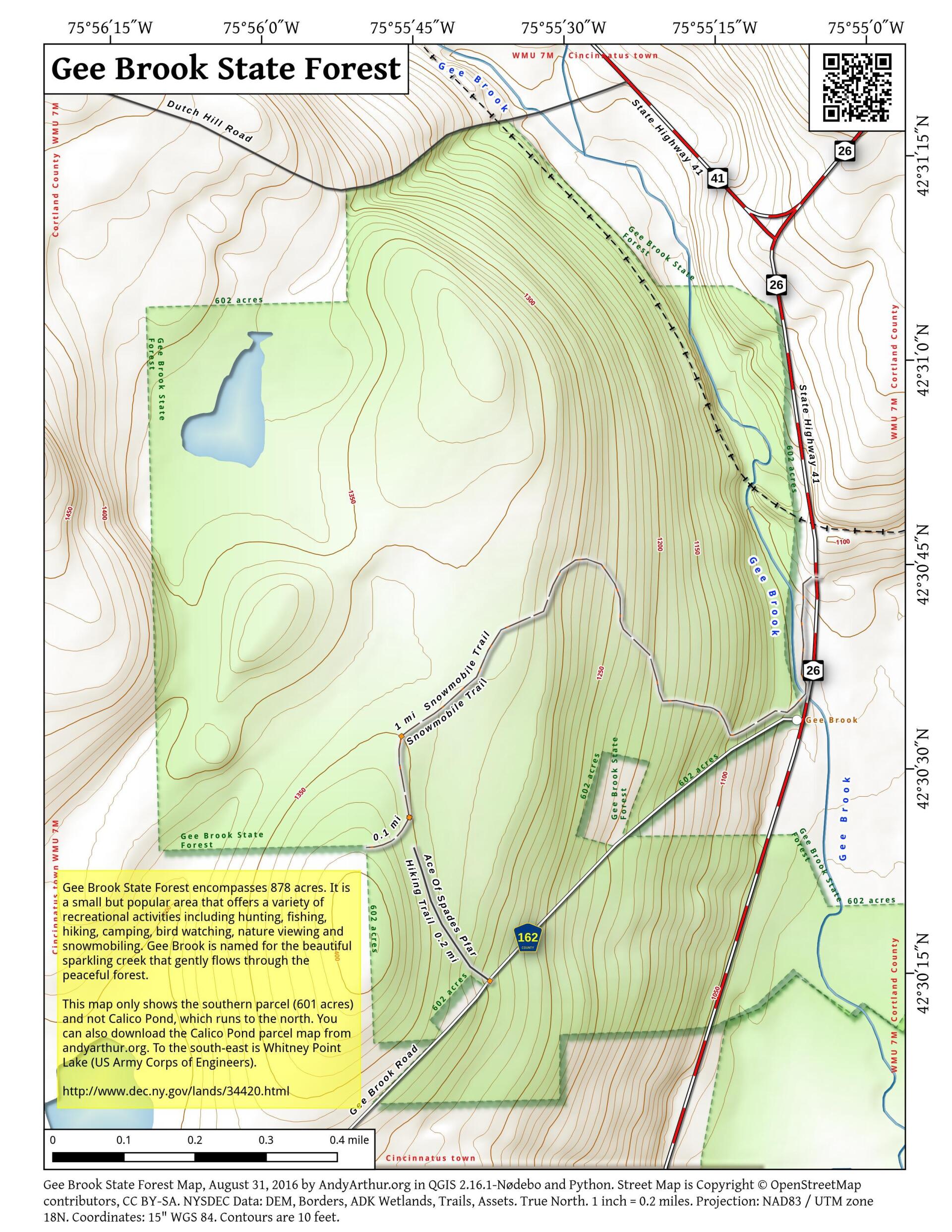
Gee Brook State Forest encompasses 878 acres. It is a small but popular area that offers a variety of recreational activities including hunting, fishing, hiking, camping, bird watching, nature viewing and snowmobiling. Gee Brook is named for the beautiful sparkling creek that gently flows through the peaceful forest.
Informal foot trails are located along the stream and ponds. There are also two Public Forest Access Roads (Ace of Spades Rd. and Calico Pond Rd.) that provide entry into each of the respective north and south portions of the property. Nature observers and hunters can also enjoy the many species of plants and animals throughout this heavily forested area.
Camping is allowed at Calico Pond at designated sites, by permit only. Permits are available through the forest ranger or the Cortland DEC office, call 607-674-4017. The access bridge leading to Calico Pond over Gee Brook no longer provides vehicular access, although it is maintained as a foot bridge. An informational map of the camping area and its three camping sites is available.
http://www.dec.ny.gov/lands/37042.html
Maps and Interactives
Gee Brook State Forest
Calico Pond
... photos, maps and other content from from Gee Brook State Forest.