Map: Franklin Falls Pond
Download a High Resolution JPEG Image of the Franklin Falls Pond or an Adobe Acrobat Printable PDF of the Franklin Falls Pond.

Bookmark my free Interactive GPS Map for your phone:
https://andyarthur.org/ny
... shows your location as a blue dot in relationship to campsites, trails, state land. This online map requires cell service, won't work in remote country, so also bring a paper map.
Free Download of New & Historical USGS 1:24k Topograpic Maps
Interactive maps with backcountry and roadside camping: New York, Pennsylvania, West Virginia & Vermont. List of NYS DEC Lean-Tos and Firetowers.
Google Spreadsheet with Roadside, Primitive and Pay Campsites
More about Franklin Falls Pond...
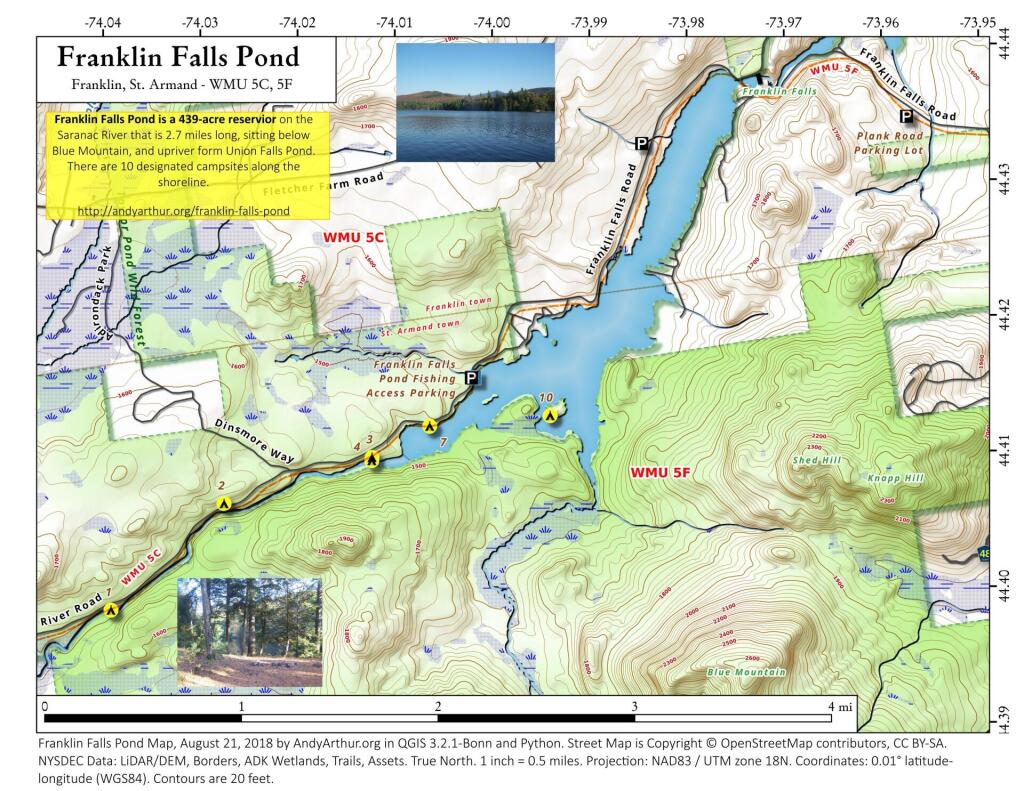
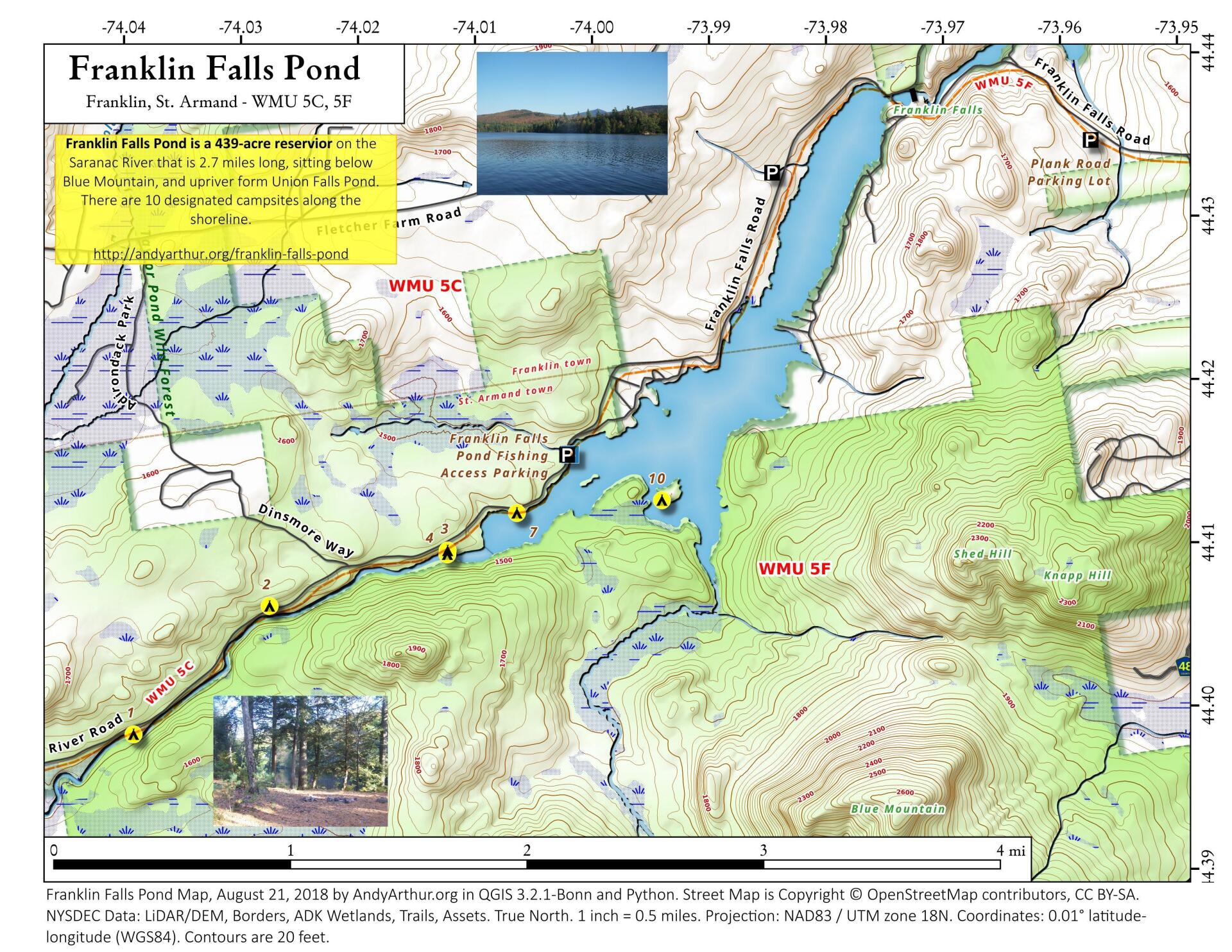
Franklin Falls Pond is a 439-acre (178 ha), 2.7-mile (4.3 km) long pond created by damming the Saranac River three miles (5 km) northeast of Saranac Lake in the Adirondack Mountains of northern New York State, USA.
http://en.wikipedia.org/wiki/Franklin_Falls_Pond
Maps and Interactives
Franklin Falls Reservior
Franklin Falls Pond – Saranac River Campsites
Franklin Falls Pond
... photos, maps and other content from from Franklin Falls Pond.
1 Comment
Would you happen to know the name of the boat livery that was on Franklin in 1950? It was down a steep, deeply ruttted road.