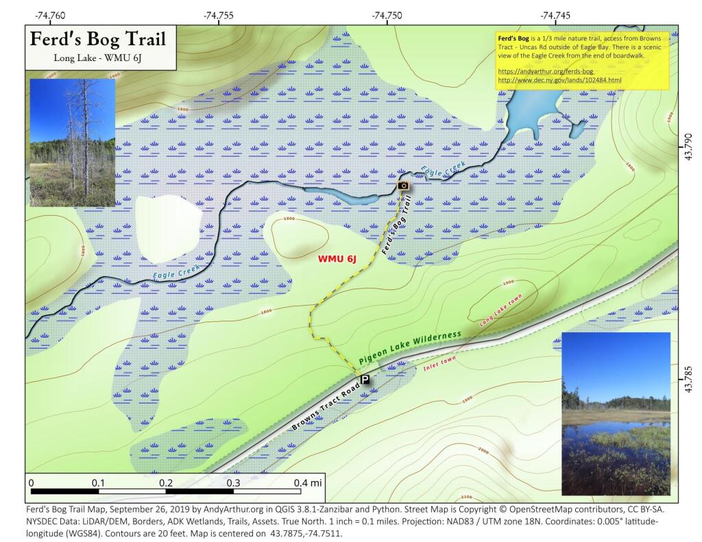
Map: Ferd's Bog Trail
Download a High Resolution JPEG Image of the Ferd's Bog Trail or an Adobe Acrobat Printable PDF of the Ferd's Bog Trail.
About Map: Ferd's Bog Trail ....
Ferd’s Bog is a 1/3 mile nature trail, access from Browns Tract - Uncas Rd outside of Eagle Bay. There is a scenic view of the Eagle Creek from the end of boardwalk.
https://andyarthur.org/ferds-bog
http://www.dec.ny.gov/lands/102484.html

Bookmark my free Interactive GPS Map for your phone:
https://andyarthur.org/ny
... shows your location as a blue dot in relationship to campsites, trails, state land. This online map requires cell service, won't work in remote country, so also bring a paper map.
Free Download of New & Historical USGS 1:24k Topograpic Maps
Interactive maps with backcountry and roadside camping: New York, Pennsylvania, West Virginia & Vermont. List of NYS DEC Lean-Tos and Firetowers.
Google Spreadsheet with Roadside, Primitive and Pay Campsites
More about Ferd's Bog...
A 50-acre black spruce bog, stream, and bog pond surrounded by 50 acres of boreal forest with a representative bird community including ...Three-toed Woodpecker, Black-backed Woodpecker, Olive-sided Flycatcher, Yellow-bellied Flycatcher, Gray Jay, Boreal Chickadee, and Lincoln's Sparrows.
... photos, maps and other content from from Ferd's Bog.