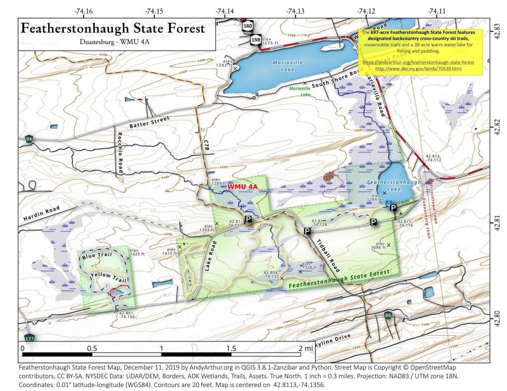
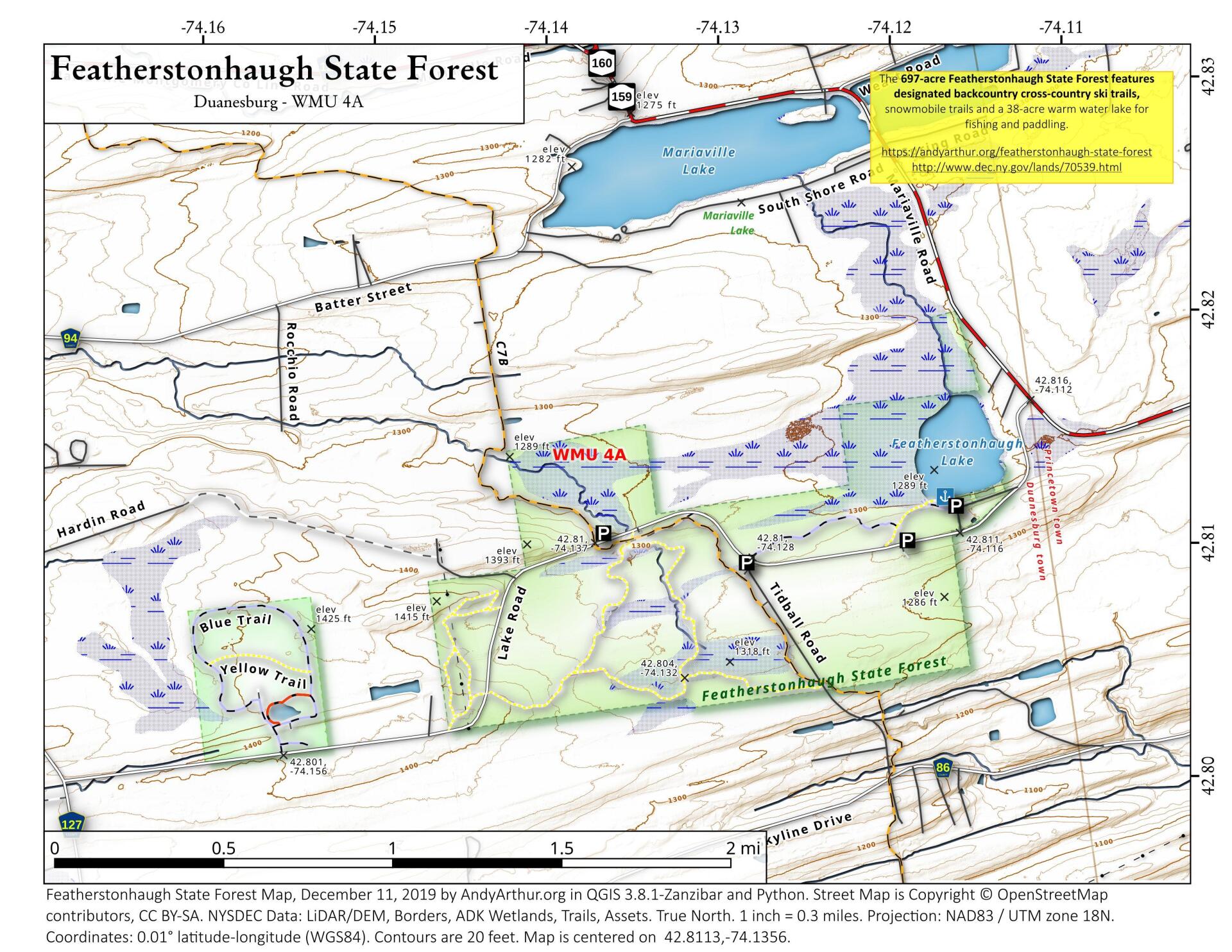
Map: Featherstonhaugh State Forest
Download a High Resolution JPEG Image of the Featherstonhaugh State Forest or an Adobe Acrobat Printable PDF of the Featherstonhaugh State Forest.

Bookmark my free Interactive GPS Map for your phone:
https://andyarthur.org/ny
... shows your location as a blue dot in relationship to campsites, trails, state land. This online map requires cell service, won't work in remote country, so also bring a paper map.
Free Download of New & Historical USGS 1:24k Topograpic Maps
Interactive maps with backcountry and roadside camping: New York, Pennsylvania, West Virginia & Vermont. List of NYS DEC Lean-Tos and Firetowers.
Google Spreadsheet with Roadside, Primitive and Pay Campsites
More about Featherstonhaugh State Forest...
History
This 697-acre State Forest was named after George W. Featherstonhaugh, a British gentleman who moved to the area and married Sarah Duane, the youngest daughter of James Duane, the patron of Duanesburg. Featherstonhaugh practiced scientific farming, crop rotation, held county fairs with agricultural competitions and served as the first US geologist and agricultural commissioner. He is also considered the father of the steam railroad.
Forest Management
Featherstonhaugh State Forest is managed for multiple uses, including timber production, watershed protection, wildlife habitat and recreation. Recreational opportunities include hiking, snowmobiling, cross-country skiing, hunting, fishing, trapping and wildlife viewing.
Trails
1.4 miles of designated snowmobile trails
3.7 miles of designated cross country ski/hiking trails
0.2 miles of graveled access trail specifically designated for mobility impaired use
Featherstonhaugh Lake is a 38-acre warm water lake approximately 9.5 feet deep on average. Fish species include largemouth bass, black crappie, bluegill, brown bullhead, pumpkinseed and golden shiners.
... photos, maps and other content from from Featherstonhaugh State Forest.