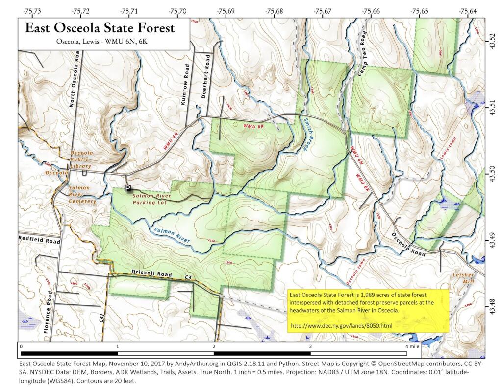
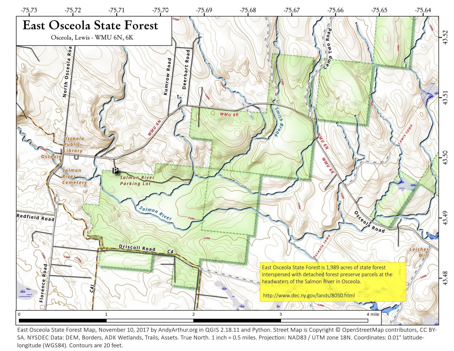
Map: East Osceola State Forest
Download a High Resolution JPEG Image of the East Osceola State Forest or an Adobe Acrobat Printable PDF of the East Osceola State Forest.

Bookmark my free Interactive GPS Map for your phone:
https://andyarthur.org/ny
... shows your location as a blue dot in relationship to campsites, trails, state land. This online map requires cell service, won't work in remote country, so also bring a paper map.
Free Download of New & Historical USGS 1:24k Topograpic Maps
Interactive maps with backcountry and roadside camping: New York, Pennsylvania, West Virginia & Vermont. List of NYS DEC Lean-Tos and Firetowers.
Google Spreadsheet with Roadside, Primitive and Pay Campsites
More about East Osceola State Forest...
The 1,975-acre state forest is managed for the purpose of reforestation, wildlife management, timber production, recreation and watershed protection. Early settlers to the area named the bustling crossroads community after the famous Seminole Chieftain Osceola, which in turn, is how the property received its name. There are also three detached forest preserve parcels adjacent to the property that allow public usage but have limited access.
http://www.dec.ny.gov/lands/8050.html
... photos, maps and other content from from Lewis County.