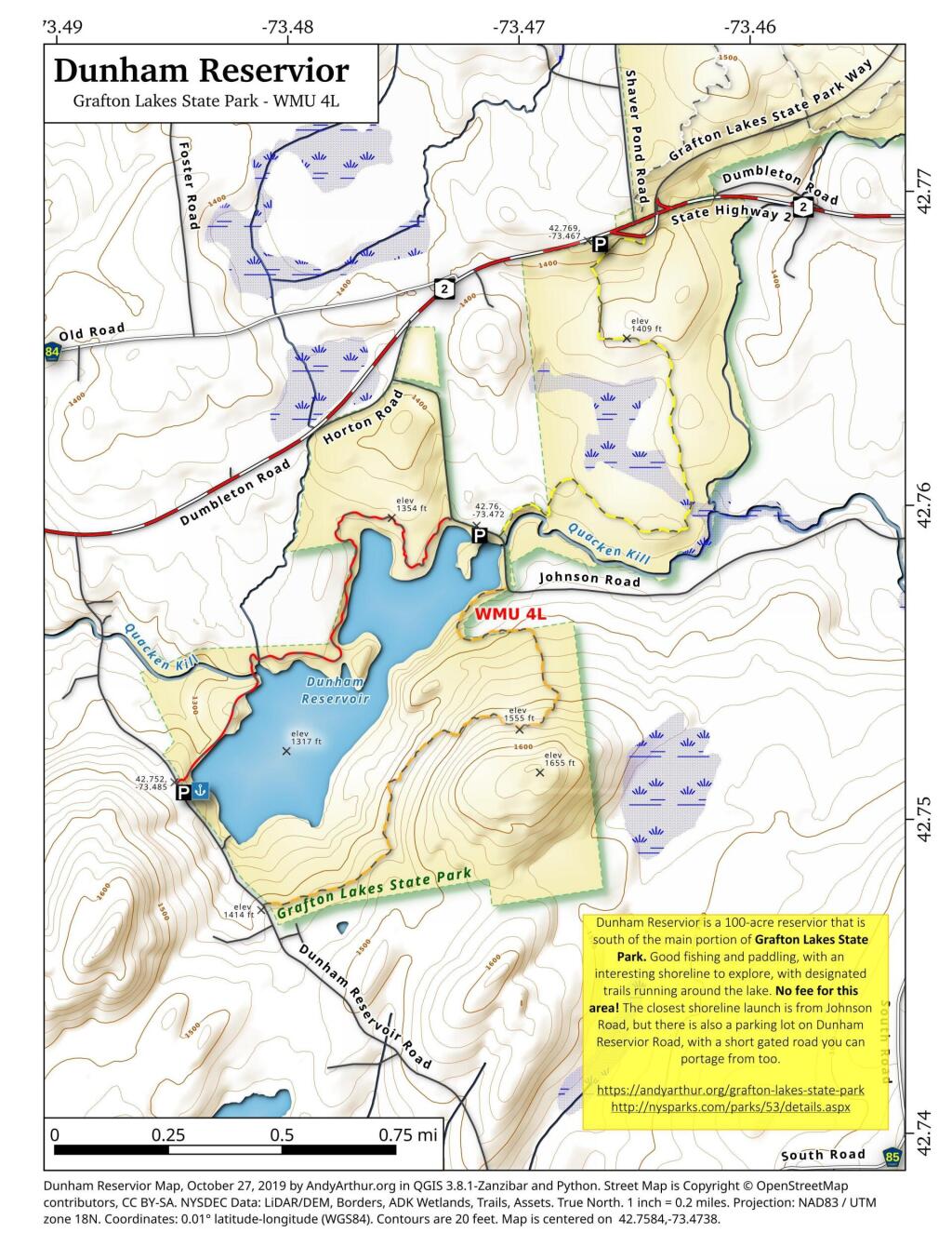
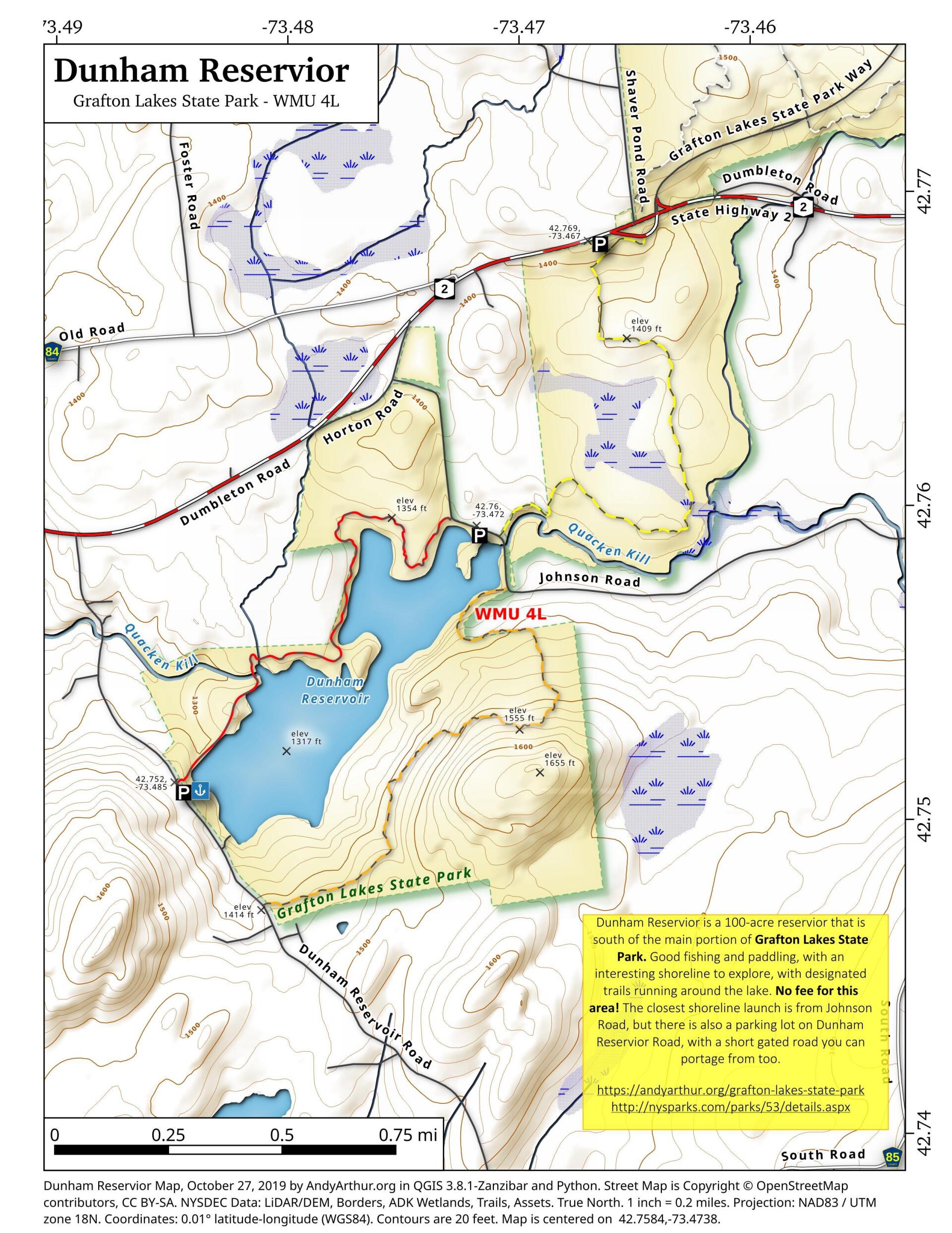
Map: Dunham Reservior
Download a High Resolution JPEG Image of the Dunham Reservior or an Adobe Acrobat Printable PDF of the Dunham Reservior.
About Map: Dunham Reservior ....
42.758391264632024,-73.4737565362454
Dunham Reservior is a 100-acre reservior that is south of the main portion of Grafton Lakes State Park. Good fishing and paddling, with an interesting shoreline to explore, with designated trails running around the lake. No fee for this area! The closest shoreline launch is from Johnson Road, but there is also a parking lot on Dunham Reservior Road, with a short gated road you can portage from too.
https://andyarthur.org/grafton-lakes-state-park
http://nysparks.com/parks/53/details.aspx

Bookmark my free Interactive GPS Map for your phone:
https://andyarthur.org/ny
... shows your location as a blue dot in relationship to campsites, trails, state land. This online map requires cell service, won't work in remote country, so also bring a paper map.
Free Download of New & Historical USGS 1:24k Topograpic Maps
Interactive maps with backcountry and roadside camping: New York, Pennsylvania, West Virginia & Vermont. List of NYS DEC Lean-Tos and Firetowers.
Google Spreadsheet with Roadside, Primitive and Pay Campsites
More about Grafton Lakes...
... photos, maps and other content from from Grafton Lakes.