Map: Coyote Flats State Forest
Download a High Resolution JPEG Image of the Coyote Flats State Forest or an Adobe Acrobat Printable PDF of the Coyote Flats State Forest.

Bookmark my free Interactive GPS Map for your phone:
https://andyarthur.org/ny
... shows your location as a blue dot in relationship to campsites, trails, state land. This online map requires cell service, won't work in remote country, so also bring a paper map.
Free Download of New & Historical USGS 1:24k Topograpic Maps
Interactive maps with backcountry and roadside camping: New York, Pennsylvania, West Virginia & Vermont. List of NYS DEC Lean-Tos and Firetowers.
Google Spreadsheet with Roadside, Primitive and Pay Campsites
More about Coyote Flats State Forest...
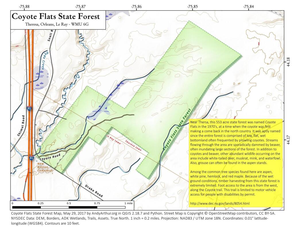
Near Thersa, this 553 acre state forest was named Coyote Flats in the 1970's, at a time when the coyote was first making a come back in the north country. It was aptly named since the entire forest is comprised of low, flat, wet bottomland often frequented by prowling coyotes. Streams flowing through the area are sporadically dammed by beaver, often inundating large sections of the forest. In addition to coyotes and beaver, other abundant wildlife occurring on the area include white-tailed deer, muskrat, mink, and waterfowl. Also, grouse can often be found in the aspen stands.
Among the common tree species found here are aspen, white pine, hemlock, and red maple. Because of the wet ground conditions, timber harvesting from this state forest is extremely limited. Foot access to the area is from the west, along the Coyote trail. This trail is limited to motor vehicle access for people with disabilities by permit.
http://www.dec.ny.gov/lands/8054.html
... photos, maps and other content from from Coyote Flats State Forest.