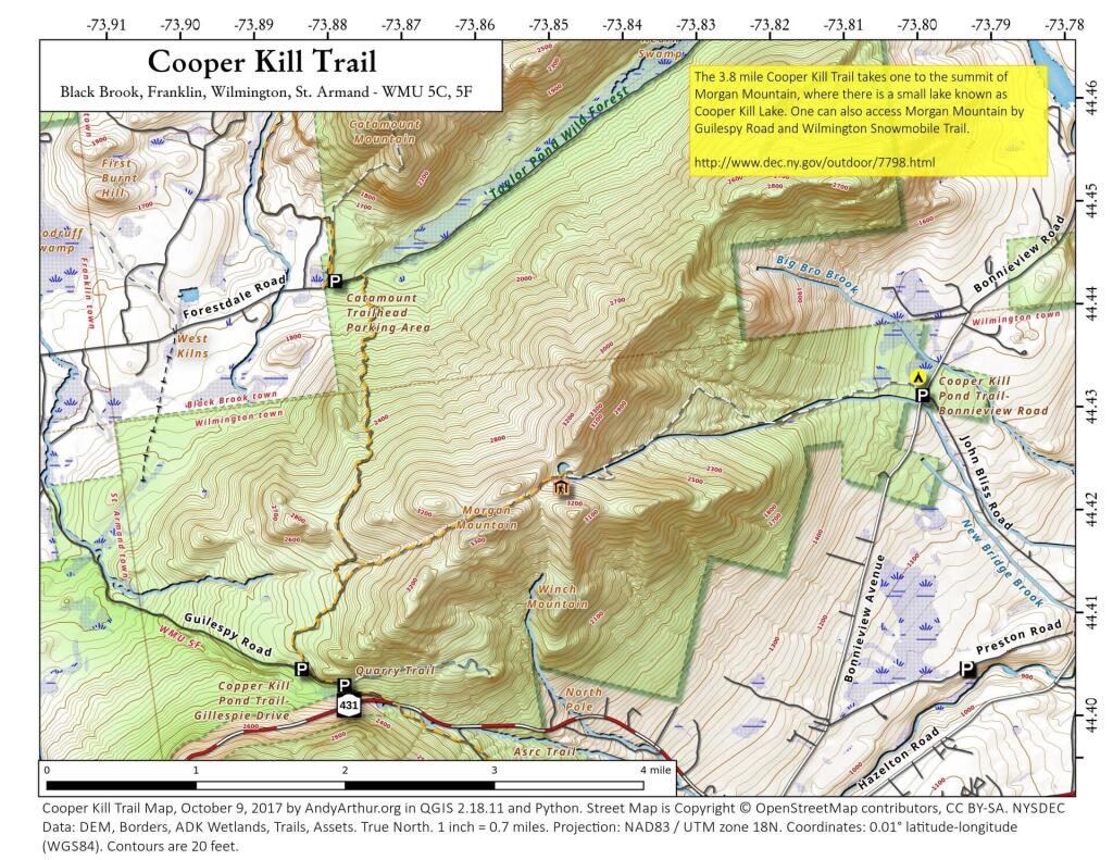
Map: Cooper Kill Trail
Download a High Resolution JPEG Image of the Cooper Kill Trail or an Adobe Acrobat Printable PDF of the Cooper Kill Trail.

Bookmark my free Interactive GPS Map for your phone:
https://andyarthur.org/ny
... shows your location as a blue dot in relationship to campsites, trails, state land. This online map requires cell service, won't work in remote country, so also bring a paper map.
Free Download of New & Historical USGS 1:24k Topograpic Maps
Interactive maps with backcountry and roadside camping: New York, Pennsylvania, West Virginia & Vermont. List of NYS DEC Lean-Tos and Firetowers.
Google Spreadsheet with Roadside, Primitive and Pay Campsites
More about Wilmington Wild Forest...
The Wilmington Wild Forest (WWF), formerly a sub-unit of the much larger Taylor Pond Wild Forest, consists of 14,000 acres of state forest preserve lands in Towns of Wilmington, Jay and Keene in Essex County and the Town of Black Brook in Clinton County. The core area of the Wilmington Wild Forest is located on the east-facing slopes of Whiteface Mountain between the Whiteface Mountain Ski Center, the Whiteface Veterans' Memorial Highway, Route 431 and Route 86. Another large segment - the Stephenson Range Tract - lies north of Route 431 and Gillespie Drive and south of the Forestdale Road. Smaller, isolated segments include the Hamlin Mountain, Clements Mountain, and Beaver Brook Tracts, as well as a segment near the hamlet of Black Brook. The area offers numerous recreational opportunities, including hiking, camping, mountain biking, rock climbing, fishing and hunting in the warmer months, and cross country skiing, ice climbing, trapping and snowmobiling in the winter months. The West Branch AuSable River - world renowned for trout fishing - runs adjacent to portions of the wild forest.
http://www.dec.ny.gov/lands/22585.html
Maps and Interactives
Copperas And Owen Pond Trail
Cooper Kill Trail
Cobble Knob Trail in Wilmington
Beaver Brook Tract
... photos, maps and other content from from Wilmington Wild Forest.