Map: Cobb Creek State Forest
Download a High Resolution JPEG Image of the Cobb Creek State Forest or an Adobe Acrobat Printable PDF of the Cobb Creek State Forest.

Bookmark my free Interactive GPS Map for your phone:
https://andyarthur.org/ny
... shows your location as a blue dot in relationship to campsites, trails, state land. This online map requires cell service, won't work in remote country, so also bring a paper map.
Free Download of New & Historical USGS 1:24k Topograpic Maps
Interactive maps with backcountry and roadside camping: New York, Pennsylvania, West Virginia & Vermont. List of NYS DEC Lean-Tos and Firetowers.
Google Spreadsheet with Roadside, Primitive and Pay Campsites
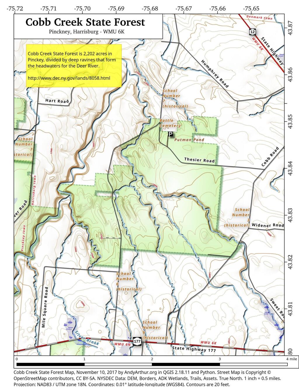
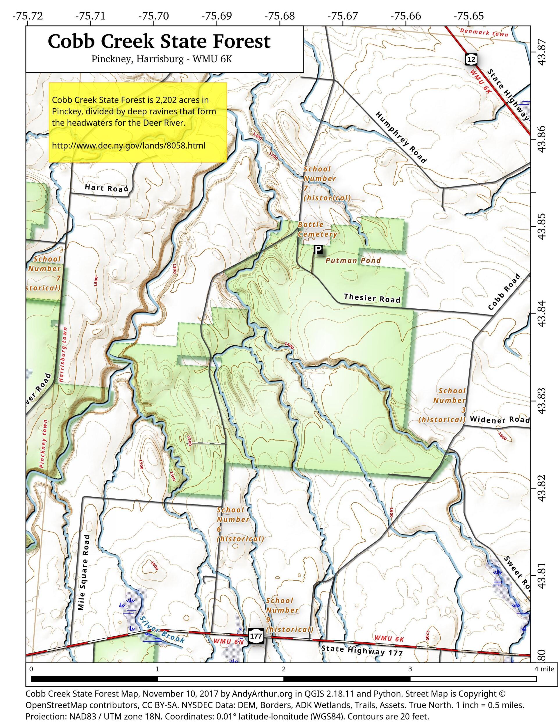
More about Cobb Creek State Forest...
This 2,185-acre state forest is named for a major stream, Cobb Creek, which, over the millennia, has cut a deep gulf through the native limestone underlying the property. This area, consisting of undulating ridges and deep creek beds, is quite typical of the Tug Hill Plateau. In addition to Cobb Creek, two other streams, Mud Creek and Silver Brook help to drain the seasonal rains and deep winter snow.
http://www.dec.ny.gov/lands/8058.html
... photos, maps and other content from from Lewis County.