Map: Carry Falls Reservior

Download a High Resolution JPEG Image of the Carry Falls Reservior or an Adobe Acrobat Printable PDF of the Carry Falls Reservior.

Bookmark my free Interactive GPS Map for your phone:
https://andyarthur.org/ny
... shows your location as a blue dot in relationship to campsites, trails, state land. This online map requires cell service, won't work in remote country, so also bring a paper map.
Free Download of New & Historical USGS 1:24k Topograpic Maps
Interactive maps with backcountry and roadside camping: New York, Pennsylvania, West Virginia & Vermont. List of NYS DEC Lean-Tos and Firetowers.
Google Spreadsheet with Roadside, Primitive and Pay Campsites
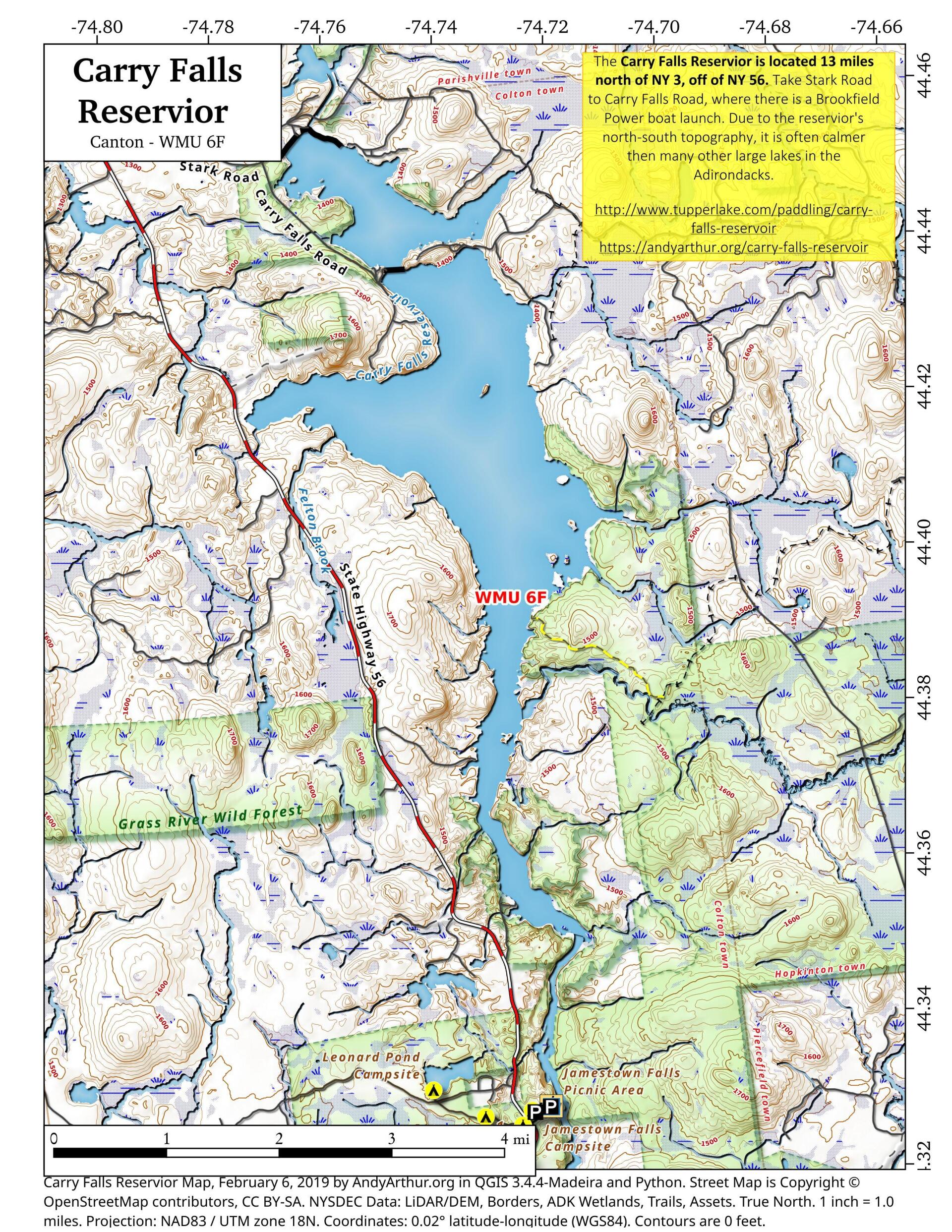
More about Carry Falls Reservior...
The dammed up part of the Raquette River, off of NY Route 56 north of Sevey, has public access, boat launch and campsites at the Carry Falls-Parmenter Site.
The 3,170 acre Carry Falls Reservoir averages 18 feet deep and has a maximum depth of 50 feet. Its shoreline is almost entirely forested and there are many sandy beaches. A DEC boat ramp and launch area is on the far northwest corner of the reservoir.
http://www.adirondackscenicbyways.org/resource/carry-falls-boat-launch-near-colton.html
... photos, maps and other content from from Grasse River Wild Forest.