Map: Canaseraga State Forest

Download a High Resolution JPEG Image of the Canaseraga State Forest or an Adobe Acrobat Printable PDF of the Canaseraga State Forest.

Bookmark my free Interactive GPS Map for your phone:
https://andyarthur.org/ny
... shows your location as a blue dot in relationship to campsites, trails, state land. This online map requires cell service, won't work in remote country, so also bring a paper map.
Free Download of New & Historical USGS 1:24k Topograpic Maps
Interactive maps with backcountry and roadside camping: New York, Pennsylvania, West Virginia & Vermont. List of NYS DEC Lean-Tos and Firetowers.
Google Spreadsheet with Roadside, Primitive and Pay Campsites
More about Canaseraga State Forest...
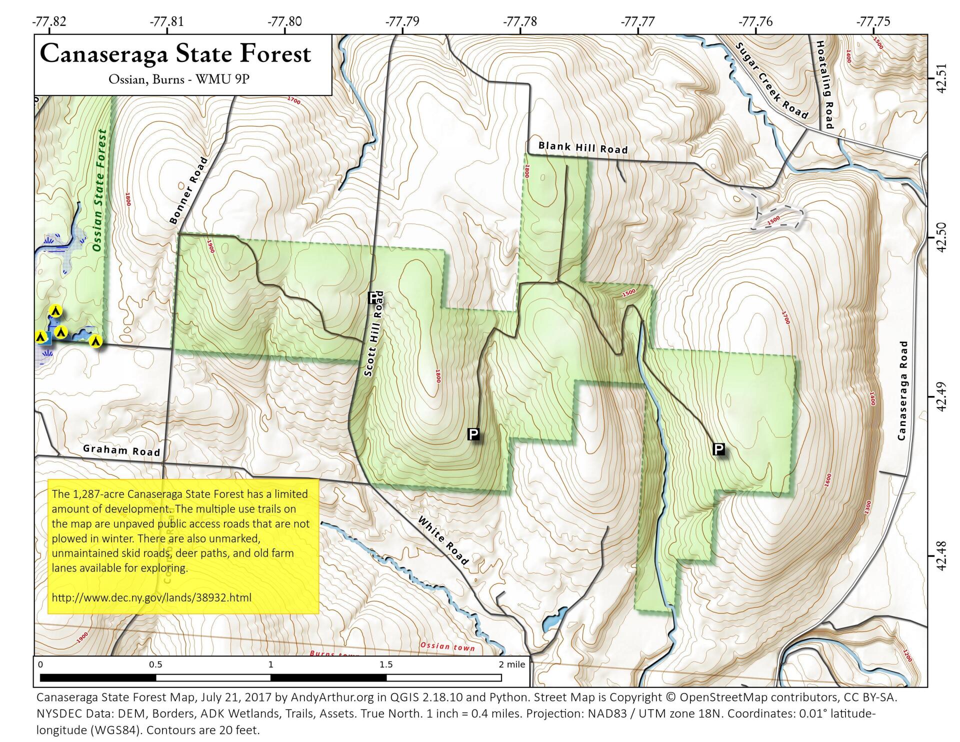
The 1,287-acre Canaseraga State Forest has a limited amount of development. The multiple use trails on the map are unpaved public access roads that are not plowed in winter. There are also unmarked, unmaintained skid roads, deer paths, and old farm lanes available for exploring.
http://www.dec.ny.gov/lands/38932.html
... photos, maps and other content from from Livingston County.