Search Results for: map canada lake
Canadarago Lake
Northampton Campground Beach
On the Great Sacanadaga Lake. A winter photo, at normal water elevation.
Sly Pond
The remote Sly Pond is one of the highest bodies of water in Adirondack Park at an elevation of 2,872 feet. It was once infamous for being a marker of how acidic Adirondack lakes had become by the eighties, with the DEC recording in 1980 the pond having an acidity of 3.54 which is about as "acidic as a dill pickle".
Fort Cassin
Deep Pond Trail
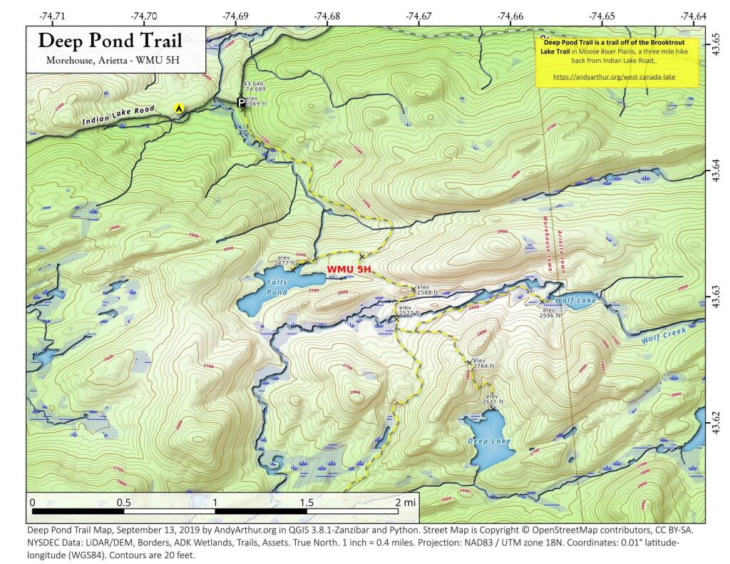
Deep Pond Trail is located off of the Brooktrout Lake Trail in Moose River Plainss (technically West Canada Lake Wilderness), and is a three mile hike back from Idnain Lake Road.
Island Line Trail
The Island Line Trail, also known as the Colchester Causeway, is a 14-mile (23 km) rail trail located in northwest Vermont. It comprises the Burlington Bike Path (Burlington), Colchester Park (Colchester) and the Allen Point Access Area (South Hero).
There was little on-line traffic left on that portion of the route and freight for Canada could be routed from Burlington north to Montreal over the somewhat longer Central Vermont Railway through St. Albans, Vermont. After several years of inactivity, restoring service on the Island Line would have required extensive rebuilding, and renovations of the three swing bridges on the line, over various bays of Lake Champlain. Ultimately all of the bridges on the route were removed, but the roadbed on the causeway across the lake survived, as it was heavily built with much use of granite. The alignment along the shores of Lake Champlain from Burlington Union Station north to the causeway was converted to form the Burlington Bike Path, and later took the Island Line name when the causeway was reopened, with a seasonal bike-ferry replacing the swing bridge in the northern portion of the causeway alignment. Due to a 200-foot (61 m) gap in the causeway, the organization Local Motion operates the Island Line Bike Ferry to shuttle cyclists across the gap.
https://en.wikipedia.org/wiki/Island_Line_Trail
https://www.localmotion.org/island_line_trail_map