Map: Bobell State Forest

Download a High Resolution JPEG Image of the Bobell State Forest or an Adobe Acrobat Printable PDF of the Bobell State Forest.

Bookmark my free Interactive GPS Map for your phone:
https://andyarthur.org/ny
... shows your location as a blue dot in relationship to campsites, trails, state land. This online map requires cell service, won't work in remote country, so also bring a paper map.
Free Download of New & Historical USGS 1:24k Topograpic Maps
Interactive maps with backcountry and roadside camping: New York, Pennsylvania, West Virginia & Vermont. List of NYS DEC Lean-Tos and Firetowers.
Google Spreadsheet with Roadside, Primitive and Pay Campsites
More about Bobell Hill State Forest...
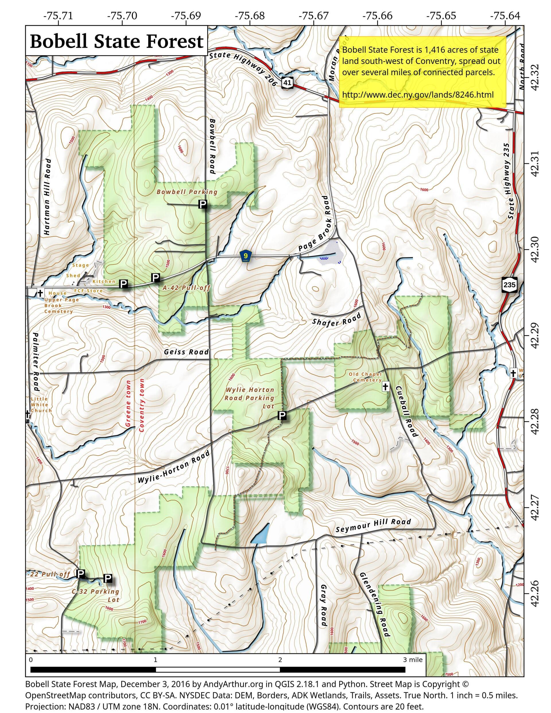
Bobell State Forest, also known as Chenango Reforestation Areas #10 & 30, is located in the Towns of Coventry and Greene in Chenango County. The two adjacent forests contain 2156 acres. The areas are soon to be included with nearby forests in the development of a draft unit management plan. The forests were purchased with Hewitt Amendment funds in the 1930's and most of the trees were planted by the Civil Conservation Corps during the 1930's.
The forests were named after early settlers named Bobell or Bowbell. The soils proved to be somewhat poor for farming, having shallow depths to hard pan and a tendency to be seasonably wet. These soil characteristics still present challenges to some forest management and recreational activities.
http://www.dec.ny.gov/lands/8246.html
... photos, maps and other content from from Broome County.