Search Results for: map blue mountain lake
Onteora Lake
"Located at one of the most popular gateways to the Catskill Forest Preserve, just three miles west of historic Kingston, the 3,000-acre Bluestone Wild Forest, has something for everyone. Its lake, ponds, trails, old quarries, hemlock and oak forests on gently rolling hills - and an occasional cliff- are ideal for hiking, mountain biking, fishing, hunting, trapping, snowshoeing and cross-country skiing. There is developed access to Onteora Lake off State Route 28, one of the few publicly accessible lakes in the Catskills." https://www.dec.ny.gov/lands/75323.html
Center Of The Adirondack Park
The absolute center of the Adirondack Park (centroid) is 43.95039680083595, -74.283820885915 according to the shapefile put out by the Adirondack Park Agency of the Blue Line, which is on the northern shoulder of Fishing Brook Mountain, south of Winfall Mountain in the Town of Minerva (barely, just the corner that reaches up there).
https://mapper.acme.com/?ll=43.95039680083595,%20-74.283820885915
The point of inaccessibility (greatest distance from any part of the border) is about 3 miles south-west of that point at 43.88007470563294, -74.32116420377541, which is the about 1/3rd of the way up the south flank of Dun Brook Mountain in Town of Blue Mountain Lake.
https://mapper.acme.com/?ll=43.88007470563294,%20-74.32116420377541
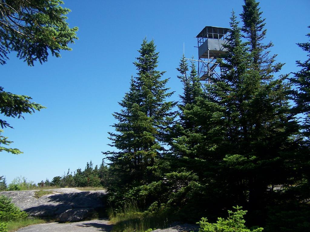
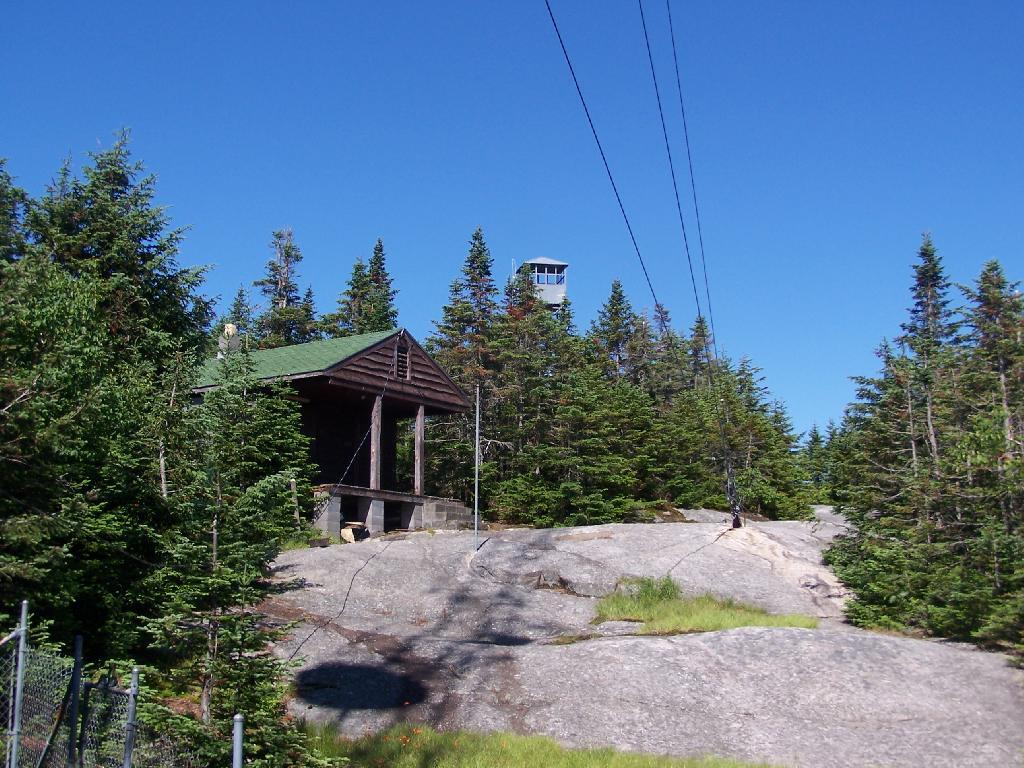
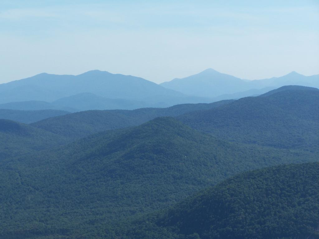
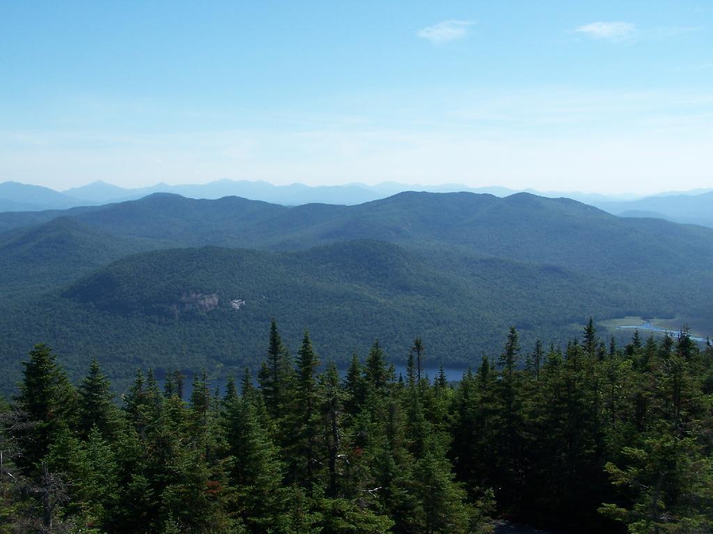
Blue Mountain Fire Tower
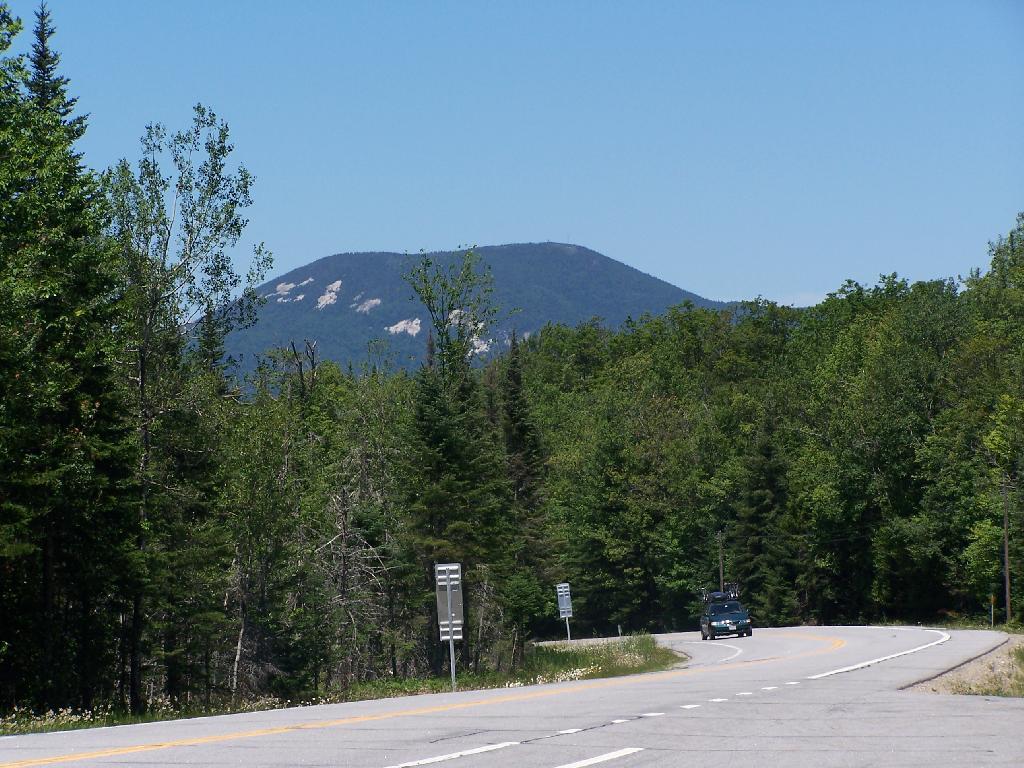
There is a fire tower on the mountain overlooking Blue Mountain Lake. It has some interesting views, and can be checked out by driving just north of Blue Mountain Lake on NY 30. It is one of the most popular hikes in the Adirondacks, and many people also visit Moose River Plains or the Adirondack Museum after hiking the tower.
Here is Blue Mountain heading North on NY 28.
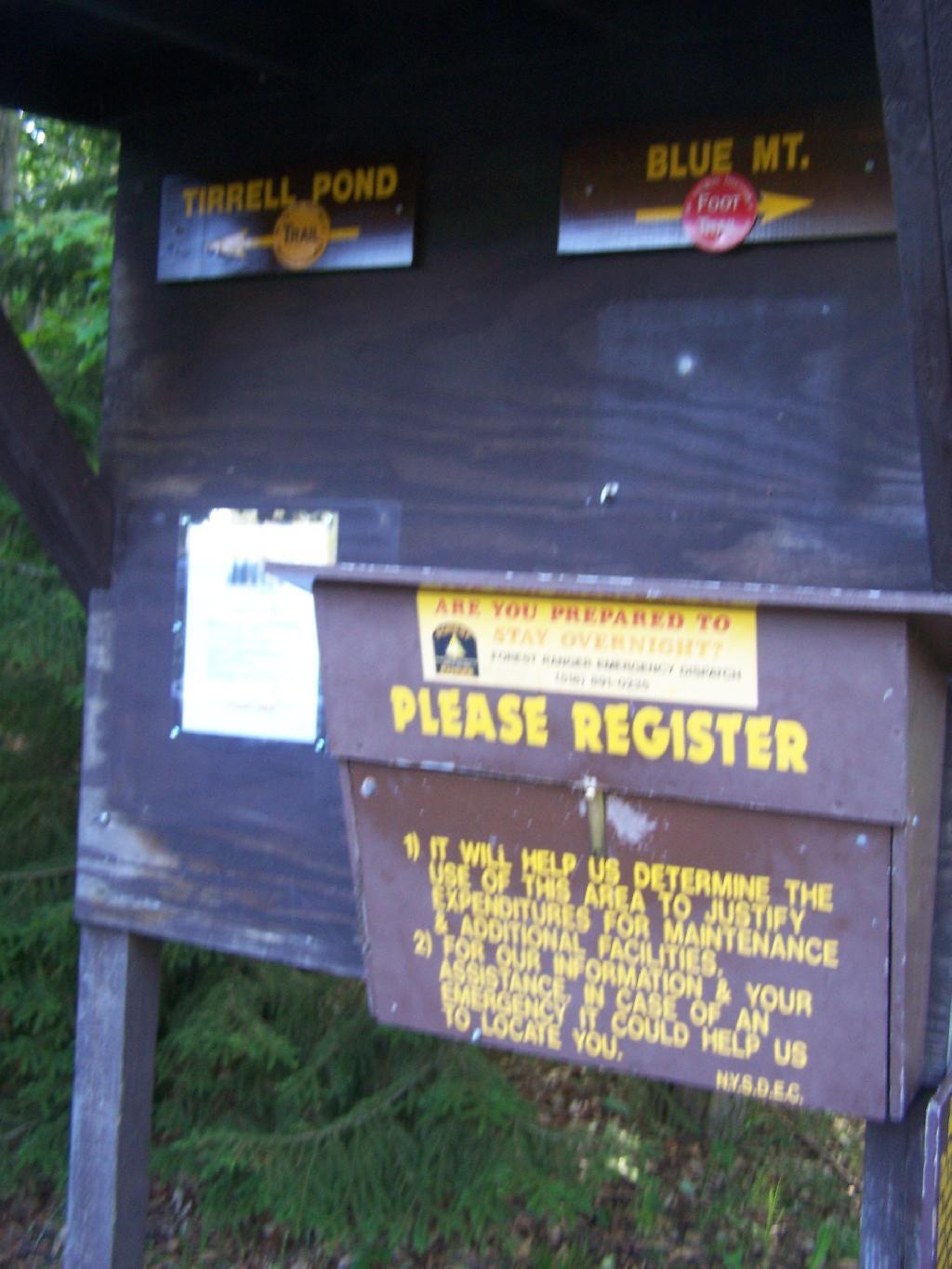
The registration box at the bottom of the mountain.
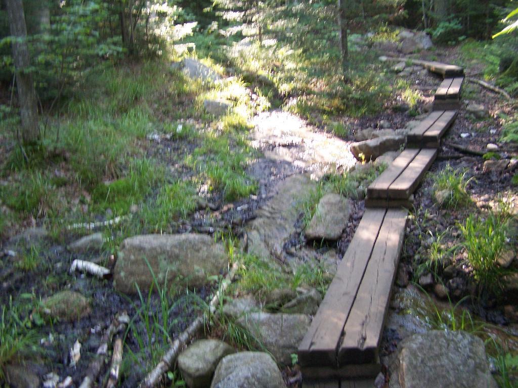
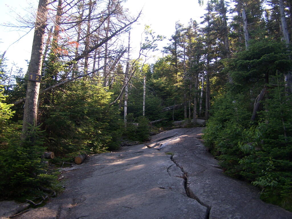
The trail is well maintained, despite it’s extensive use, with board walks across muddy locations.
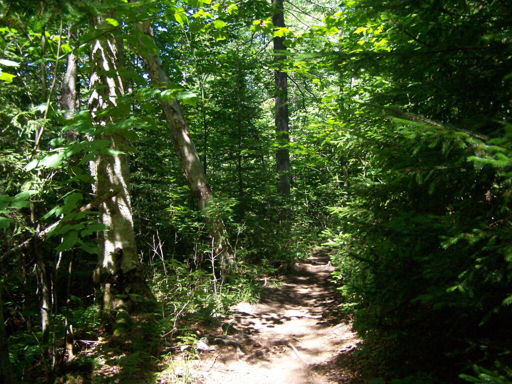
The first part of the trail is relatively flat for a while, then gets steep for a bit.
A lot of the lower part of the mountain was rocky with lots little rocks to step over.
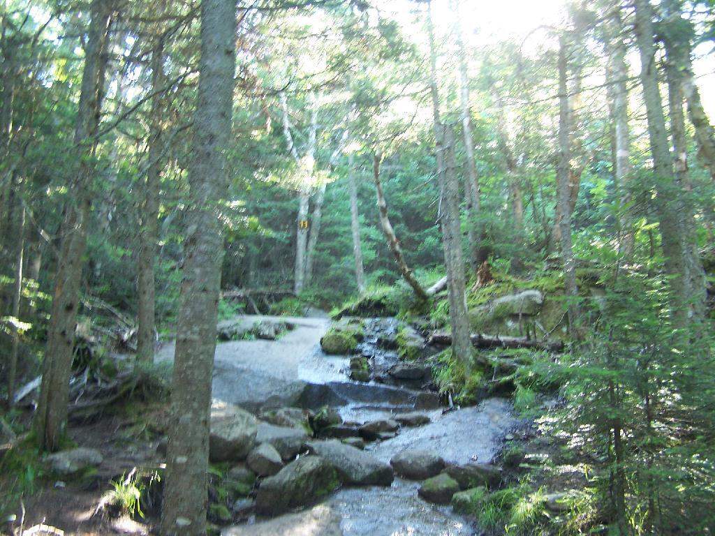
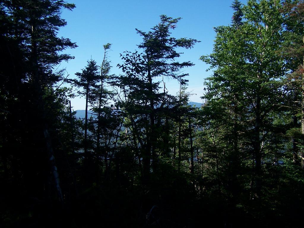
About halfway up the mountain you get partial views down the mountain.
Eventually the mountain opens up a little, and your walking on exposed granite, steep, but not too steep.
Once your almost to the top, you can look back and see Blue Mountain Lake through the trees.
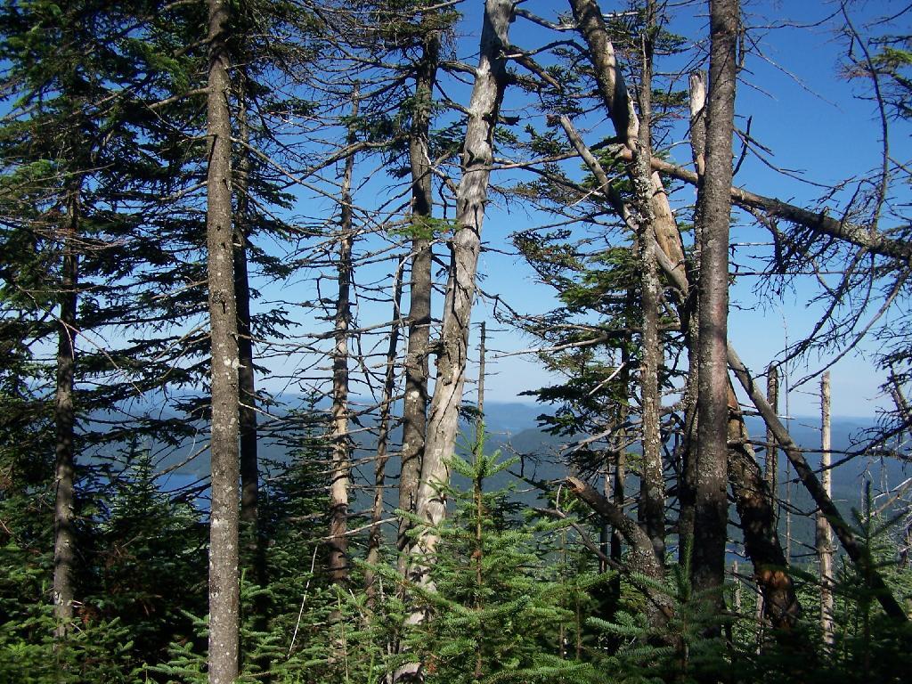
You reach the top of the mountain, and there is a gradual ascent, as you cross to the eastern side of the mountain, where the summit and the tower is located. Finally, you see the tower through the trees.
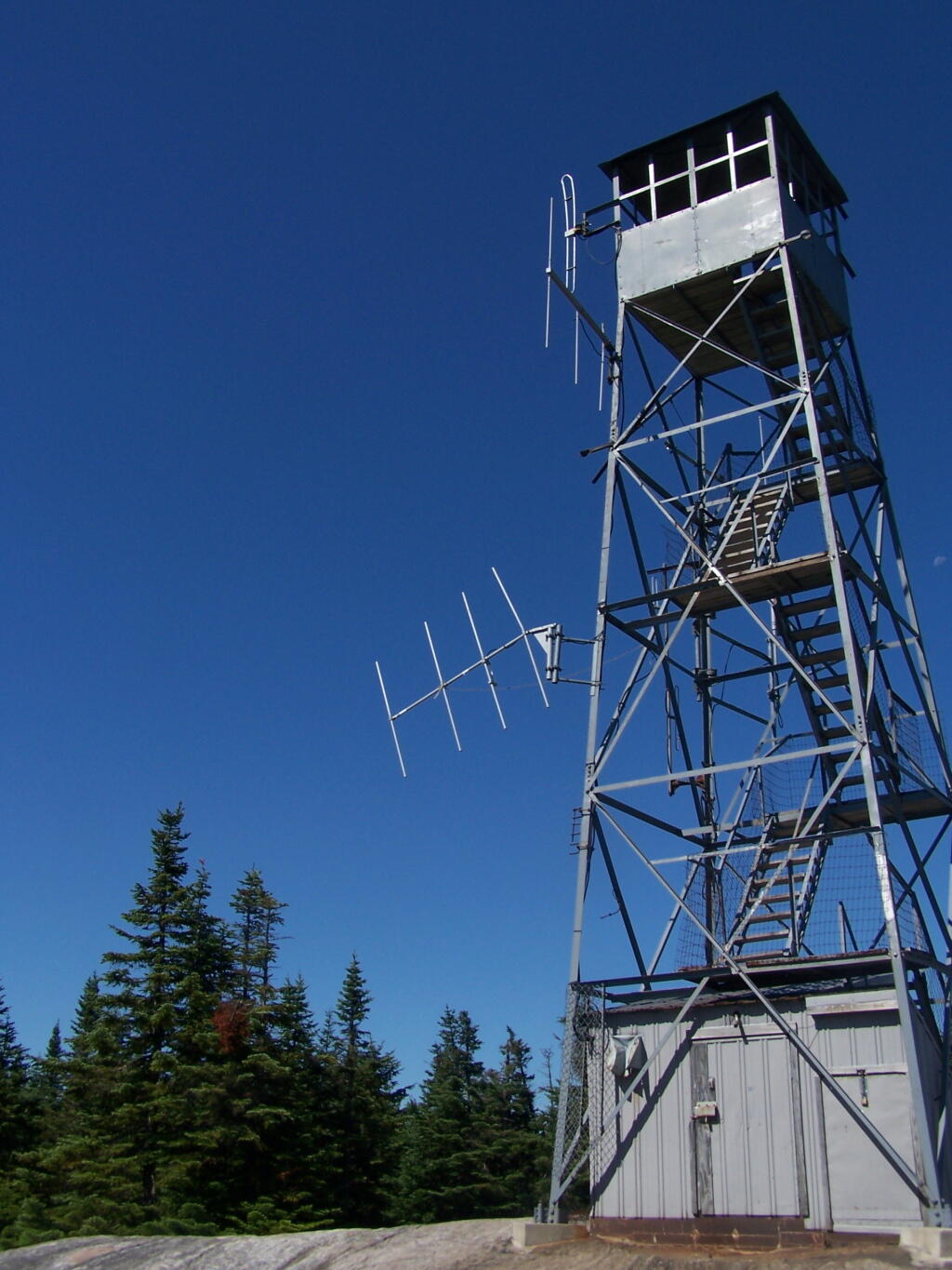
The tower is a relatively short 50 or 60 foot, but it’s plenty high to get good views of the surrounding landscape.
Looking out to the Tower windows.
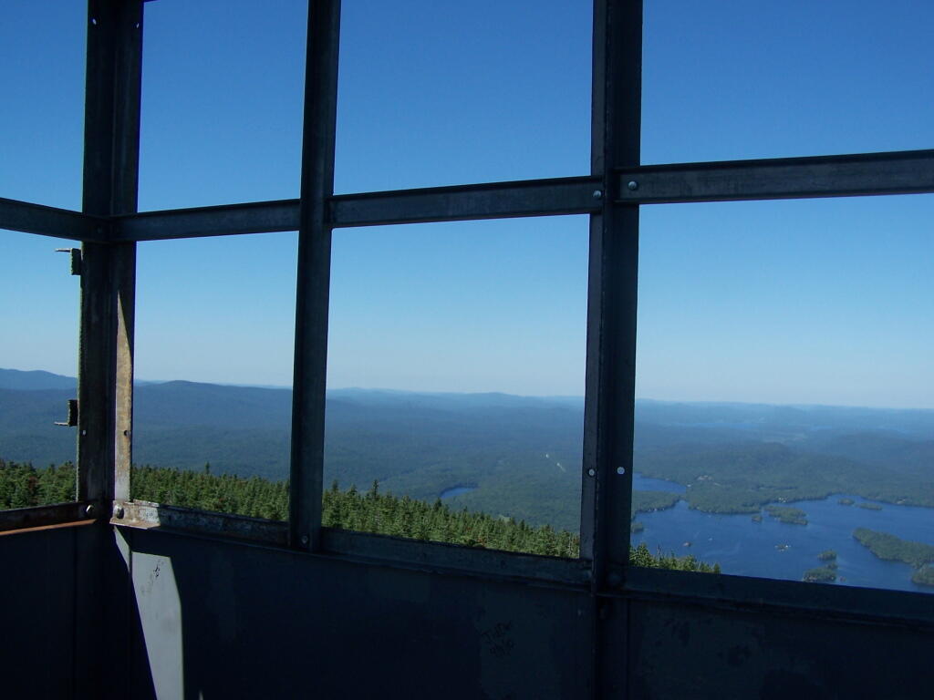
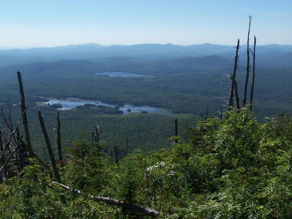
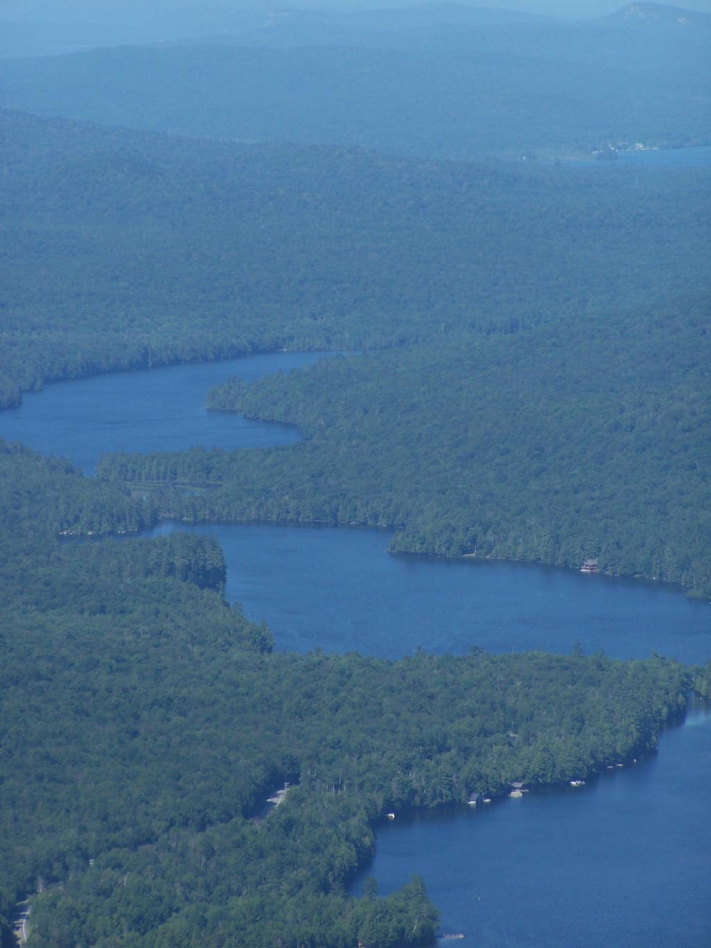
Blue Mountain Lake from the fire tower.
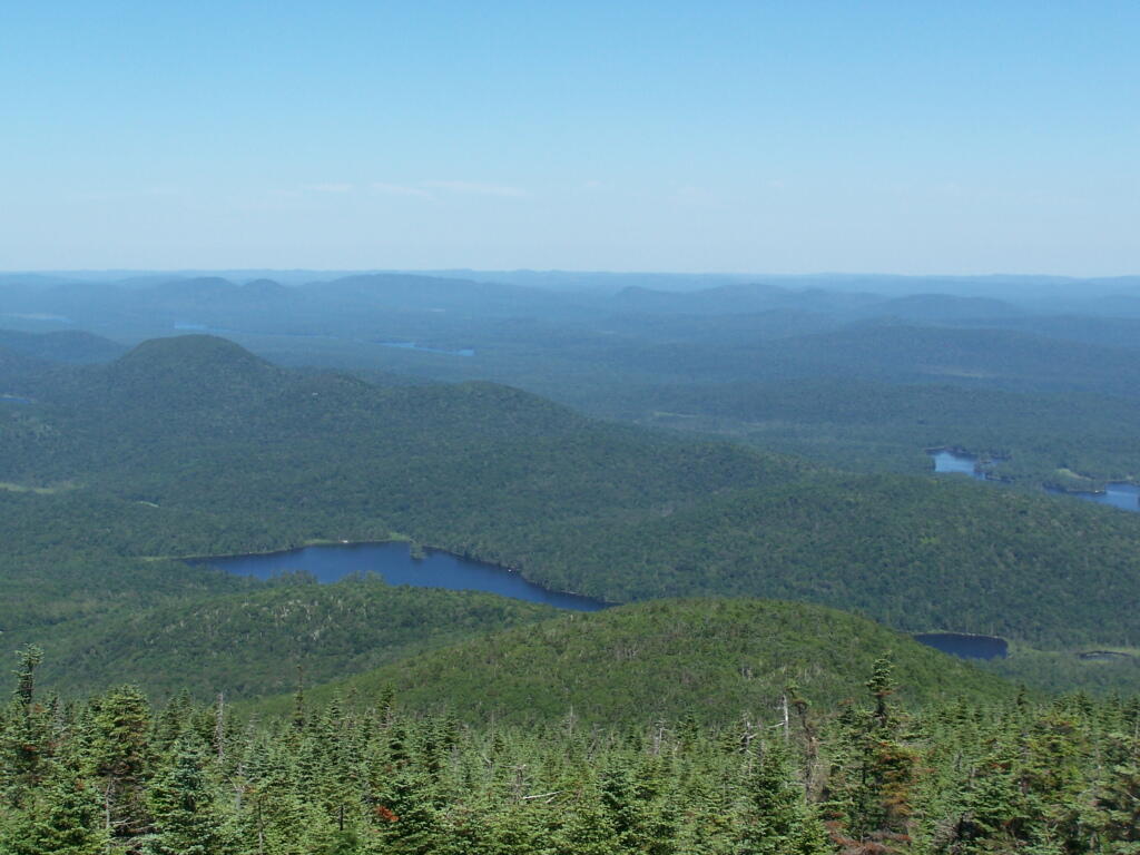
Moose River Plains to the south-west of the tower.
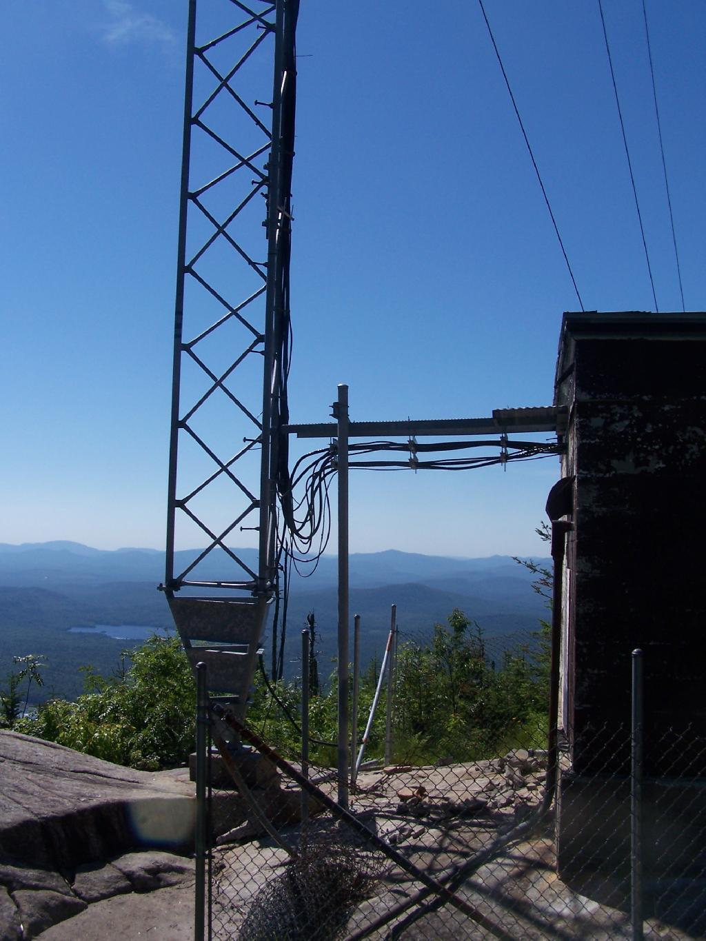
On the eastern side of the mountain, there is a radio tower and the old ranger’s cabin.
From the eastern side, their is a ledge, where you can see and look down towards like Lake Durant and Moose River Plains.
The radio tower up close, with the fence broken down around it. I didn’t hear radio signals in my ears, despite being so close to this big radio tower.
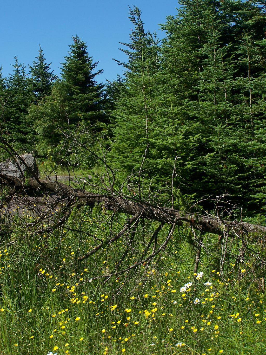
Flowers on the top of the mountain.
To the north-east there are views of the High Peaks Mountains. They probably woudln’t be as clear on a hazy day.
Tirnell Mountain is privately owned to the east, and you can see some active logging on it.
Seventh and Eight Lake as seen from Blue Mountain.
Here is a map of the hike.
USGS Topographic Maps – Dutchess to Livingston Counties
Counties: Albany to Delaware / Dutchess to Livingston / Madison to Otsego / Putnam to Suffolk / Sullivan to Yates
Browse Topographic Maps: Full State / Historical USGS Topographic Maps
Dutchess County


Erie County


Essex County


Franklin County


Fulton County


Genesee County


Greene County


Hamilton County


Herkimer County


Jefferson County


Kings County


Lewis County


Livingston County


USGS Topographic Maps – Sullivan to Yates County
Counties: Albany to Delaware / Dutchess to Livingston / Madison to Otsego / Putnam to Suffolk / Sullivan to Yates
Browse Topographic Maps: Full State / Historical USGS Topographic Maps
Sullivan County


Tioga County


Tompkins County


Ulster County


Warren County


Washington County


Wayne County


Westchester County


Wyoming County


Yates County


Locations and Maps of Lean-Tos in NYS
Interactive Map of Lean-Tos
You can get a downloadable, more detailed map with campsites, lean-tos, scenic vistas and trails.
Note: This list is sorted from North to South, and West to East in New York, therefore the farthest North Lean-To in NY State is in the Debar Mountain Wild Forest, and the farthest south one is in David A. Sarnoff Pine Barrens Preserve in Long Island. Location links take you to aerial photos of the Lean-Tos on the free ACME Mapper.
Download or View this Chart on Google Sheets
| State Forest Land | Name | Type | Description | Location |
|---|---|---|---|---|
| Debar Mtn. Wild Forest | Debar Mountian Lean-To | Lean-To | 44.598926, -74.228592 | |
| Debar Mtn. Wild Forest | Grass Pond Lean-To | Lean-To | 44.493389, -74.251194 | |
| Taylor Pond Wild Forest | North Shore Taylor Pond Lean-To | Lean-To | Managed By Operations | 44.4897, -73.861427 |
| Taylor Pond Wild Forest | South East Taylor Pond Lean-To | Lean-To | Managed By Operations | 44.482888, -73.853777 |
| Taylor Pond Wild Forest | Northwest Shore Taylor Pond Lean-To | Lean-To | Managed By Operations | 44.477689, -73.881283 |
| Taylor Pond Wild Forest | Poke-O-Moonshine Summit Lean-To | Lean-To | 44.399797, -73.514557 | |
| Saint Regis Canoe Area | Fish Pond Campsite 2 | Lean-To | 44.396133, -74.370421 | |
| Saint Regis Canoe Area | Fish Pond Campsite 5 | Lean-To | 44.391301, -74.365807 | |
| Saint Regis Canoe Area | St. Regis Pond South Shore Lean-To | Lean-To | Within The Adopt A Lean-To System | 44.380642, -74.320299 |
| Saint Regis Canoe Area | St. Regis Pond Campsite 19 | Lean-To | 44.380626, -74.320423 | |
| Wolf Lake State Forest | Beaver Flow Lean-To | Lean-To | 44.357822, -75.316001 | |
| Mckenzie Mtn. Wilderness | Loch Bonnie Lean-To | Lean-To | 44.347347, -73.995669 | |
| Mckenzie Mtn. Wilderness | White Face Brook Lean-To | Lean-To | 44.344217, -73.928647 | |
| Wolf Lake State Forest | Wolf Lake Lean-To | Lean-To | 44.336323, -75.313886 | |
| Saranac Lakes Wild Forest | Lake Placid Campsite 3 | Lean-To | 44.332595, -73.95668 | |
| Saranac Lakes Wild Forest | Lake Placid Campsite 2 | Lean-To | 44.332296, -73.956626 | |
| Wolf Lake State Forest | Moon Pond Lean-To | Lean-To | 44.332276, -75.321172 | |
| Saranac Lakes Wild Forest | Follensby Clear | Lean-To | 44.325095, -74.349897 | |
| Wolf Lake State Forest | Huckleberry Lake Lean-To | Lean-To | 44.324272, -75.333738 | |
| Mckenzie Mtn. Wilderness | Placid Lean-To | Lean-To | 44.321456, -74.030786 | |
| Saranac Lakes Wild Forest | Lean-To | 44.309124, -74.18053 | ||
| Saranac Lakes Wild Forest | Lean-To | 44.302887, -74.302634 | ||
| Saranac Lakes Wild Forest | Lean-To | 44.289835, -74.216869 | ||
| Saranac Lakes Wild Forest | Lean-To | 44.286942, -74.289775 | ||
| Saranac Lakes Wild Forest | Lean-To | 44.286657, -74.162602 | ||
| Saranac Lakes Wild Forest | Lean-To | 44.271712, -74.273283 | ||
| Saranac Lakes Wild Forest | Lean-To | 44.265599, -74.24293 | ||
| Hurricane Mountain Primitive Area | Lost Pond/Biesemeyer | Lean-To | 44.26073, -73.710011 | |
| Hurricane Mountain Primitive Area | Gulf Brook Lean-To | Lean-To | 44.253097, -73.71796 | |
| Saranac Lakes Wild Forest | Lean-To | 44.228772, -74.375533 | ||
| High Peaks Wilderness | Lean-To | 44.198805, -74.31831 | ||
| Horseshoe Lake Wild Forest | Eagle Landing Lean-To | Lean-To | 44.19683, -74.512309 | |
| High Peaks Wilderness | Lean-To | 44.177317, -74.321808 | ||
| Giant Mountain Wilderness | Giant Mtn. Lean-To | Lean-To | 44.175641, -73.722171 | |
| Giant Mountain Wilderness | Giant Mtn. Lean-To | Lean-To | 44.175641, -73.722171 | |
| Horseshoe Lake Wild Forest | Lean-To | 44.158907, -74.560725 | ||
| High Peaks Wilderness | Lean-To | 44.15683, -74.313308 | ||
| Cranberry Lake Wild Forest | Lean-To | 44.1534, -74.884029 | ||
| High Peaks Wilderness | Lean-To | 44.147236, -74.318105 | ||
| Dix Mountain Wilderness | Bouquet Lean-To | Lean-To | 44.110904, -73.774043 | |
| High Peaks Wilderness | Lean-To | 44.105829, -74.312037 | ||
| Sargent Ponds Wild Forest | Lean-To | 44.102744, -74.321863 | ||
| Sargent Ponds Wild Forest | Lean-To | 44.082504, -74.333915 | ||
| Sargent Ponds Wild Forest | Lean-To | 44.081407, -74.335829 | ||
| High Peaks Wilderness | Lean-To | 44.065927, -74.326697 | ||
| Dix Mountain Wilderness | Lilian Brook Lean-To | Lean-To | 44.058989, -73.806533 | |
| Dix Mountain Wilderness | Slide Brook Lean-To | Lean-To | 44.044126, -73.805858 | |
| High Peaks Wilderness | Lean-To | 44.042977, -74.349335 | ||
| High Peaks Wilderness | Lean-To | 44.041409, -74.350149 | ||
| High Peaks Wilderness | Lean-To | 44.02862, -74.366763 | ||
| High Peaks Wilderness | Lean-To | 44.002655, -74.38648 | ||
| William C. Whitney Wilderness | Lake Lila # 7 | Lean-To | 44.002145, -74.775682 | |
| High Peaks Wilderness | Lean-To | 43.998164, -74.392741 | ||
| Independence River Wild Forest | Trout Pond Lean To | Lean-To | 43.928489, -74.94487 | |
| Independence River Wild Forest | Trout Pond Lean To | Lean-To | 43.928489, -74.94487 | |
| Sargent Ponds Wild Forest | Deerland Carry Lean-To 2 | Lean-To | Fair Condition | 43.926218, -74.475396 |
| Sargent Ponds Wild Forest | Deerland Carry Lean-To 1 | Lean-To | Fair Condition | 43.925781, -74.475846 |
| Sargent Ponds Wild Forest | Pinebrook Lean-To | Lean-To | Fair Condition | 43.906646, -74.50259 |
| Sargent Ponds Wild Forest | Lean-To | 43.902847, -74.548063 | ||
| Blue Mountain Wild Forest | North End Tirrel Pond Lean-To | Lean-To | 43.887378, -74.377739 | |
| Sargent Ponds Wild Forest | Lean-To | 43.879414, -74.606052 | ||
| Blue Mountain Wild Forest | O’neil Lean-To | Lean-To | 43.875096, -74.367316 | |
| Sargent Ponds Wild Forest | Lean-To | 43.871006, -74.628108 | ||
| Sargent Ponds Wild Forest | Lean-To | 43.870772, -74.628507 | ||
| Sargent Ponds Wild Forest | Lean-To | 43.87072, -74.629172 | ||
| Sargent Ponds Wild Forest | Lower Sargents Pond Lean-To | Lean-To | Fair Condition | 43.859331, -74.562695 |
| Blue Ridge Wilderness | Boulder | Lean-To | 43.841564, -74.472689 | |
| Sargent Ponds Wild Forest | Lean-To | 43.836898, -74.535266 | ||
| Moose River Plains Wild Forest | Lean-To | 43.831671, -74.661756 | ||
| Moose River Plains Wild Forest | Lean-To | 43.831605, -74.661511 | ||
| Moose River Plains Wild Forest | Lean-To | 43.831434, -74.660902 | ||
| Blue Ridge Wilderness | Cascade Pond Lean-To | Lean-To | 43.829744, -74.436618 | |
| Independence River Wild Forest | Panther Pond Lean-To | Lean-To | 43.823535, -75.169312 | |
| Blue Ridge Wilderness | Wilson Pond | Lean-To | 43.820192, -74.46868 | |
| Blue Ridge Wilderness | Stephens Pond | Lean-To | 43.818674, -74.420524 | |
| Blue Ridge Wilderness | Stephens Pond | Lean-To | 43.818674, -74.420524 | |
| Blue Ridge Wilderness | Stephens Pond | Lean-To | 43.818674, -74.420524 | |
| Blue Ridge Wilderness | Stephens Pond | Lean-To | 43.818674, -74.420524 | |
| Blue Ridge Wilderness | Stephens Pond | Lean-To | 43.818674, -74.420524 | |
| Blue Ridge Wilderness | Stephens Pond | Lean-To | 43.818674, -74.420525 | |
| Sargent Ponds Wild Forest | Lean-To | 43.817134, -74.64378 | ||
| Sargent Ponds Wild Forest | Lean-To | 43.81709, -74.643251 | ||
| Sargent Ponds Wild Forest | Lean-To | 43.8162, -74.644668 | ||
| Blue Ridge Wilderness | Blue Ridge Lean-To | Lean-To | 43.80014, -74.610139 | |
| Moose River Plains Wild Forest | 8thlake East Shore Lean-To | Lean-To | 43.789783, -74.698592 | |
| Moose River Plains Wild Forest | 8th Lake North Shore Lean-To | Lean-To | 43.780115, -74.704439 | |
| Moose River Plains Wild Forest | 8th Lake Island Lean-To | Lean-To | 43.779025, -74.704429 | |
| Moose River Plains Wild Forest | Lean-To | 43.75639, -74.717817 | ||
| Moose River Plains Wild Forest | Lean-To | 43.750767, -74.734643 | ||
| Moose River Plains Wild Forest | Lean-To | 43.747805, -74.744199 | ||
| Independence River Wild Forest | Pine Lake Lean-To | Lean-To | 43.708394, -75.146453 | |
| Haderondah | Middle Branch Lake | Lean-To | 43.702926, -75.096002 | |
| Siamese Ponds Wilderness | Hour Pond Lean-To | Lean-To | 43.70112, -74.158221 | |
| Haderondah | Cedar Pond Lean To | Lean-To | 43.69597, -75.082602 | |
| Haderondah | Middle Settlement Lake | Lean-To | 43.685949, -75.098614 | |
| West Canada Lakes Wilderness | Colvin Brook Lean-To | Lean-To | 43.652414, -74.49038 | |
| Lake George Wild Forest | Five Mile Mountain Lean-To | Lean-To | Lean-To W/ Privy And Firering | 43.647336, -73.574534 |
| Black River Wild Forest | Remsen Falls Lean-To | Lean-To | 43.629925, -75.036288 | |
| Lake George Wild Forest | Fifth Peak Lean-To | Lean-To | Lean-To W/ Privy And Firering | 43.619313, -73.584112 |
| Black River Wild Forest | Woodhull Lake Lean-To | Lean-To | 43.599885, -75.020382 | |
| Lake George Wild Forest | Black Mountain Ponds Lean-To | Lean-To | Lean-To With Privy And Firering | 43.59966, -73.533064 |
| West Canada Lakes Wilderness | Pillsbury Lake Lean-To | Lean-To | 43.596898, -74.531665 | |
| Lake George Wild Forest | Lean-To | Campsite With Lean-To 13-27 | 43.595821, -73.517951 | |
| Lake George Wild Forest | Lean-To | Campsite With Lean-To 5-10 | 43.587168, -73.527759 | |
| Lake George Wild Forest | Greenland Pond Leanto | Lean-To | Leanto With Privy, Picnic Table And Fire Ring | 43.577804, -73.51684 |
| Lake George Wild Forest | Fishbrook Pond North Leanto | Lean-To | Leanto With Privy, Picnic Table And Fire Ring | 43.576039, -73.536103 |
| Lake George Wild Forest | Fishbrook Pond South Leanto | Lean-To | Leanto With Privy, Picnic Table And Fire Ring | 43.573872, -73.538477 |
| Black River Wild Forest | Sand Lake Falls Lean-To | Lean-To | 43.558914, -75.003058 | |
| Black River Wild Forest | Gull Lake Lean-To | Lean-To | 43.553747, -75.059378 | |
| Black River Wild Forest | Chub Pond Lean-To #2 | Lean-To | 43.529823, -75.042494 | |
| Black River Wild Forest | Chub Pond Lean-To #1 | Lean-To | 43.524598, -75.043801 | |
| West Canada Lakes Wilderness | T Lake Leant-To | Lean-To | 43.452718, -74.582282 | |
| Silver Lake Wilderness | Hamilton Lake Stream Lean-To 1 | Lean-To | 43.39716, -74.455046 | |
| Silver Lake Wilderness | Hamilton Lake Stream Lean-To 2 | Lean-To | 43.397156, -74.455065 | |
| Cobb Brook State Forest | Leanto | Lean-To | 43.344545, -75.67222 | |
| Silver Lake Wilderness | Mud Lake Lean-To | Lean-To | 43.342671, -74.456291 | |
| Deruyter State Forest | Deruyter Lean-To | Lean-To | 42.820185, -75.859105 | |
| Morgan Hill State Forest | Morgan Hill Lean-To | Lean-To | 42.767202, -76.011256 | |
| Perkins Pond State Forest | Flt Lean-To | Lean-To | 42.642307, -75.743766 | |
| Dutch Settlement State Forest | Lean-To | Lean-To | 42.629438, -74.267543 | |
| Whaupaunaucau State | Leanto | Lean-To | 42.606063, -75.467114 | |
| Burnt-Rossman Hills State Forest | Eminence Lean-To | Lean-To | 42.543304, -74.488595 | |
| Clapper Hollow State Forest | Clapper Hollow Lean-To | Lean-To | 42.528201, -74.642004 | |
| Tuller Hill State Forest | Tuller Hill Lean-T0 | Lean-To | Rebuilt In 2002 From Local State Forest Red Pine, Built By Volunteers From Suny Cortland | 42.512201, -76.120824 |
| Kennedy State Forest | Foxfire Leanto | Lean-To | 42.472853, -76.178732 | |
| Ludlow Creek State Forest | Ludlow Creek Lean-To | Lean-To | 8′ X 10′ | 42.445802, -75.701507 |
| Genegantslet State Forest | Top Ten Lean-To | Lean-To | 20′ X 20′ | 42.422887, -75.767435 |
| Robinson Hollow State Forest | Kimme Lean-To | Lean-To | 42.390596, -76.271801 | |
| Sugar Hill State Forest | Vanzandt Lean-To | Lean-To | 42.389935, -76.972601 | |
| Sugar Hill State Forest | The Twin Lean-To’s | Lean-To | Two Lean-To At This Location | 42.382253, -77.00268 |
| Sugar Hill State Forest | Templar Rd Lean-To | Lean-To | 42.373082, -76.95548 | |
| Sugar Hill State Forest | Parks Hollow Lean-To | Lean-To | 42.369463, -77.012608 | |
| Huntersfield State Forest | Lean-To | Lean-To | 42.355041, -74.346067 | |
| Beebe Hill State Forest | Beebe Hill Lean-To | Lean-To | 42.335425, -73.484181 | |
| Shindagin Hollow State Forest | Shindagin Lean-T0 | Lean-To | Scheduled For Replacement In 2004 | 42.327644, -76.329036 |
| Danby State Forest | Bald Hill Lean-To | Lean-To | 42.327042, -76.490061 | |
| Danby State Forest | Travor Rd Lean-To | Lean-To | 42.317642, -76.422544 | |
| Harvey Mountain State Forest | Harvey Mountain Lean-To | Lean-To | 42.313988, -73.441495 | |
| Burt Hill State Forest | On Finger Lake Trail Lean-To | Lean-To | 42.313213, -77.566373 | |
| Elm Ridge Wild Forest | On Elm Ridge Trail Lean-To | Lean-To | 42.306134, -74.173598 | |
| South Bradford State Forest | Moss Hill Lean-To | Lean-To | 42.289116, -77.118881 | |
| Windham Blackhead Range Wilderness | Batavia Kill Lean-To | Lean-To | 42.278839, -74.102579 | |
| Rusk Mountain Wild Forest | John Robb Leanto Lean-To | Lean-To | 42.189374, -74.238696 | |
| Rusk Mountain Wild Forest | Diamond Notch Lean-To | Lean-To | 42.16917, -74.256848 | |
| Hunter-West Kill Mountain Wilderness | Devil’s Acre Lean-To | Lean-To | Good Condition | 42.165955, -74.229624 |
| Arctic China State Forest | A-40 Lean-To | Lean-To | 42.158491, -75.362027 | |
| Barbour Brook State Forest | A-41 Lean To | Lean-To | 42.152807, -75.31021 | |
| Lean-To | 42.135655, -74.16269 | |||
| Dry Brook Ridge Wild Forest | German Hollow Road Lean-To | Lean-To | 42.134527, -74.616198 | |
| Lean-To | 42.119518, -74.086575 | |||
| Lean-To | 42.117719, -74.503199 | |||
| Lean-To | 42.115031, -74.49075 | |||
| Lean-To | 42.102787, -74.394826 | |||
| Lean-To | 42.098467, -74.09079 | |||
| Big Indian Wildernes Area | Rider Hollow Lean-To | Lean-To | 42.092012, -74.505713 | |
| Lean-To | 42.082185, -74.586611 | |||
| Big Indian Wildernes Area | Mckinly Hollow Lean-To | Lean-To | 42.075339, -74.485857 | |
| Lean-To | 42.071935, -74.28035 | |||
| Lean-To | 42.069751, -74.287449 | |||
| Lean-To | 42.067368, -74.586988 | |||
| Lean-To | 42.066913, -74.654635 | |||
| Big Indian Wildernes Area | Shandaken Brook Lean-To | Lean-To | 42.050274, -74.5106 | |
| Delaware Wild Forest | Campbell Mountain Trail Lean-To | Lean-To | 42.048989, -74.927363 | |
| Lean-To | 42.048641, -74.645056 | |||
| Lean-To | 42.039437, -74.594017 | |||
| Lean-To | 42.027316, -74.335645 | |||
| Delaware Wild Forest | Trout Pond Trail North Lean-To | Lean-To | Built For Ada | 42.012942, -74.946392 |
| Delaware Wild Forest | Trout Pond Trail South Lean-To | Lean-To | Built For Ada | 42.011758, -74.947566 |
| Big Indian Wildernes Area | Biscuit Brook Lean-To | Lean-To | 42.009105, -74.483852 | |
| Delaware Wild Forest | Pelnor Hollow Trail Lean-To | Lean-To | 42.005744, -74.867403 | |
| Big Indian Wildernes Area | Fall Brook Lean-To | Lean-To | 41.998075, -74.560392 | |
| Lean-To | 41.959182, -74.406877 | |||
| Lean-To | 41.94006, -74.632055 | |||
| David A. Sarnoff Pine Barrens Preserve | Interior Lean- To | Lean-To | 40.89774, -72.660615 |
