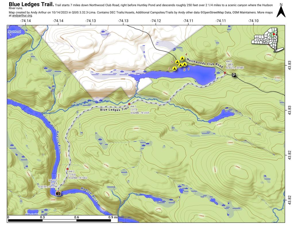
Map: Blue Ledges Trail
Download a High Resolution JPEG Image of the Blue Ledges Trail or an Adobe Acrobat Printable PDF of the Blue Ledges Trail.

Bookmark my free Interactive GPS Map for your phone:
https://andyarthur.org/ny
... shows your location as a blue dot in relationship to campsites, trails, state land. This online map requires cell service, won't work in remote country, so also bring a paper map.
Free Download of New & Historical USGS 1:24k Topograpic Maps
Interactive maps with backcountry and roadside camping: New York, Pennsylvania, West Virginia & Vermont. List of NYS DEC Lean-Tos and Firetowers.
Google Spreadsheet with Roadside, Primitive and Pay Campsites
More about Blue Ledges...
The trail to the Blue Ledges ends up at a beautiful spot on the Hudson River on the bank opposite the tall cliffs called the Blue Ledges. The cliffs rise over 300 feet and are spectacular! The river makes a right angle bend at this location and is filled with big boulders which, depending on water levels, may be well above the flow or part of a huge white water. There is also a section of sandy bank shore for those who like to wade. At the trailhead, follow the Blue DEC trail markers.
Maps and Interactives
Rift Mountain – Blue Ledges
Northwood Club Road
Huntley Pond
Blue Ledges Trail
Northwoods Club Road Campsites
... photos, maps and other content from from Blue Ledges.