Map: Black Creek State Forest
Download a High Resolution JPEG Image of the Black Creek State Forest or an Adobe Acrobat Printable PDF of the Black Creek State Forest.

Bookmark my free Interactive GPS Map for your phone:
https://andyarthur.org/ny
... shows your location as a blue dot in relationship to campsites, trails, state land. This online map requires cell service, won't work in remote country, so also bring a paper map.
Free Download of New & Historical USGS 1:24k Topograpic Maps
Interactive maps with backcountry and roadside camping: New York, Pennsylvania, West Virginia & Vermont. List of NYS DEC Lean-Tos and Firetowers.
Google Spreadsheet with Roadside, Primitive and Pay Campsites
More about Black Creek State Forest (Esopus)...
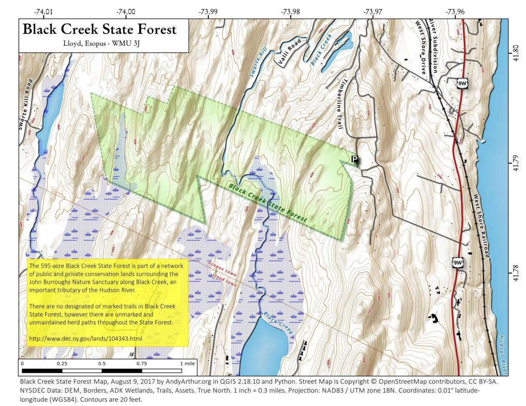
The 595-acre Black Creek State Forest is part of a network of public and private conservation lands surrounding the John Burroughs Nature Sanctuary along Black Creek, an important tributary of the Hudson River.
There are no designated or marked trails in Black Creek State Forest, however there are unmarked and unmaintained herd paths throughout the State Forest.
http://www.dec.ny.gov/lands/104343.html
Maps and Interactives
Black Creek State Forest (Town of Northway)
Black Creek State Forest
... photos, maps and other content from from Black Creek State Forest (Esopus).