Search Results for: map bear mountain
Bearpen Mountain Trail
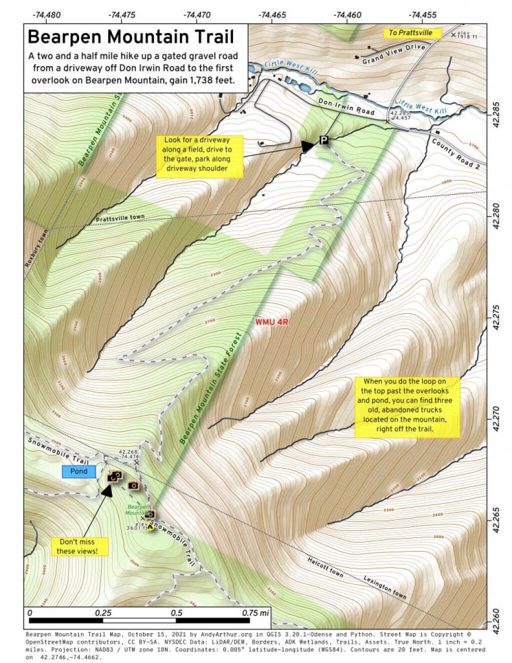
A two and a half mile hike up a gated gravel road from a driveway off Don Irwin Road to the first overlook on Bearpen Mountain, gain 1,738 feet.
Bear Mountain Bridge
Black Bear Mountain
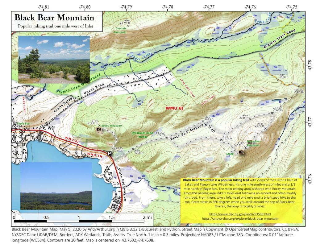
43.76917976445229,-74.7697504393449
Black Bear Mountain is a popular hiking trail with views of the Fulton Chain of Lakes and Pigeon Lake Wilderness. It's one mile south-west of Inlet and a 1/2 mile north of Eagle Bay. The main parking area is shared with Rocky Mountain. From the parking area, hike 1 miles east following an eroded and often muddy dirt road. From there, take a left, head one mile until a brief steep hike to the top. Great views in 360 degrees when you walk around the top of Black Bear. Overall, the loop is roughly 5 miles.
https://www.dec.ny.gov/lands/53596.html
https://andyarthur.org/explore/black-bear-mountain
The section of Cedar River – Limekiln Lake Road along the Silver River didn’t used to exist
There was no connection between Cellar Mountain Road and Moose River Road along the Silver River until the Conservation Department built the connection in the late 1950s before acquiring the lands due to the parcels being owned by different companies.