Map: Bars In New York State

Download a High Resolution JPEG Image of the Bars In New York State or an Adobe Acrobat Printable PDF of the Bars In New York State.
About Map: Bars In New York State ....
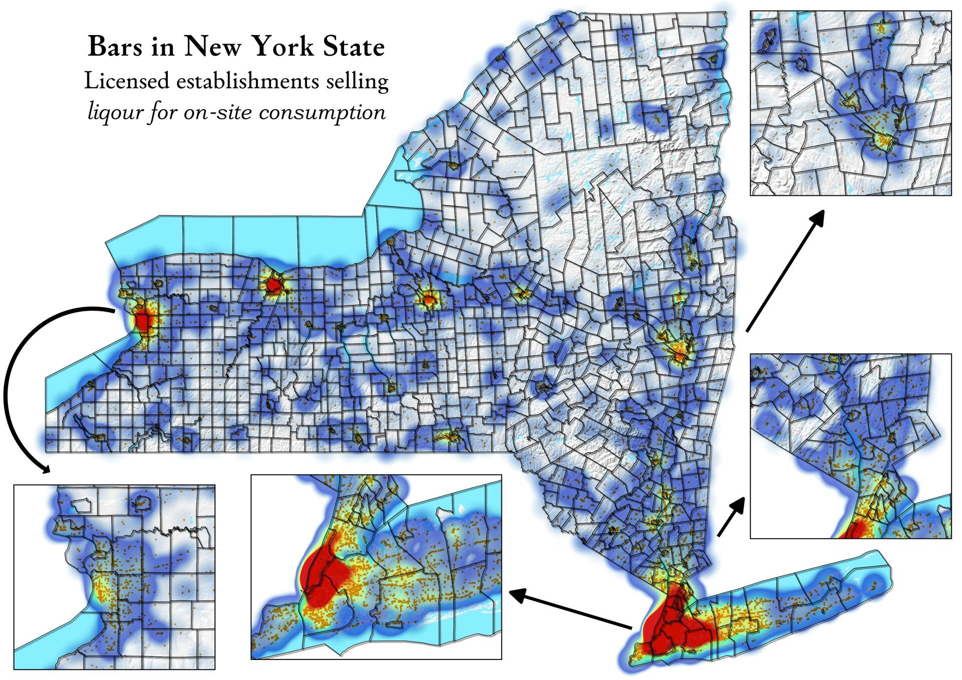
Most of the watering holes in New York State are located in populated areas. I guess that is not real surprising, as that's where the people is and that's where you would build a business. Some of the rural towns in upstate are dry. This might be a more interesting map if I had done bars per capita -- maybe that's a project for a future date. Map shows density of licensed establishments selling liqour for on-site consumption.
Data Source: https://data.ny.gov/Economic-Development/Liquor-Authority-Quarterly-List-of-Active-Licenses/hrvs-fxs2

Bookmark my free Interactive GPS Map for your phone:
https://andyarthur.org/ny
... shows your location as a blue dot in relationship to campsites, trails, state land. This online map requires cell service, won't work in remote country, so also bring a paper map.
Free Download of New & Historical USGS 1:24k Topograpic Maps
Interactive maps with backcountry and roadside camping: New York, Pennsylvania, West Virginia & Vermont. List of NYS DEC Lean-Tos and Firetowers.
Google Spreadsheet with Roadside, Primitive and Pay Campsites
More about Alcohol...
... photos, maps and other content from from Alcohol.
2 Comments
HI How can I get the raw data by county?
You can get the data here: https://data.ny.gov/widgets/hrvs-fxs2?
To get county totals, you could load it into Excel and do a pivot table or use Python and create a pandas data frame and use groupby on the county column.