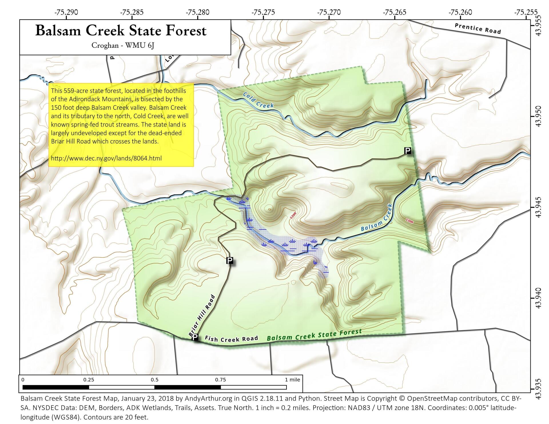
Map: Balsam Creek State Forest

Download a High Resolution JPEG Image of the Balsam Creek State Forest or an Adobe Acrobat Printable PDF of the Balsam Creek State Forest.

Bookmark my free Interactive GPS Map for your phone:
https://andyarthur.org/ny
... shows your location as a blue dot in relationship to campsites, trails, state land. This online map requires cell service, won't work in remote country, so also bring a paper map.
Free Download of New & Historical USGS 1:24k Topograpic Maps
Interactive maps with backcountry and roadside camping: New York, Pennsylvania, West Virginia & Vermont. List of NYS DEC Lean-Tos and Firetowers.
Google Spreadsheet with Roadside, Primitive and Pay Campsites
More about Elm Ave Park and Ride...
Maps and Interactives
Southern Erie County is Quite Agriculutral
North Chatham 1952
Mid Atlantic Snowstorm – January 4, 2022
Lock 2 of the Oswego Canal
First Prize Slaughterhouse in 1952
Onjebonge State Forest
Goulds Corners State Forest
Condon Hollow Trail – Halcott Mountain Lean To
Balsam Creek State Forest
... photos, maps and other content from from Elm Ave Park and Ride.