Search Results for: lake durant
Lake Durant
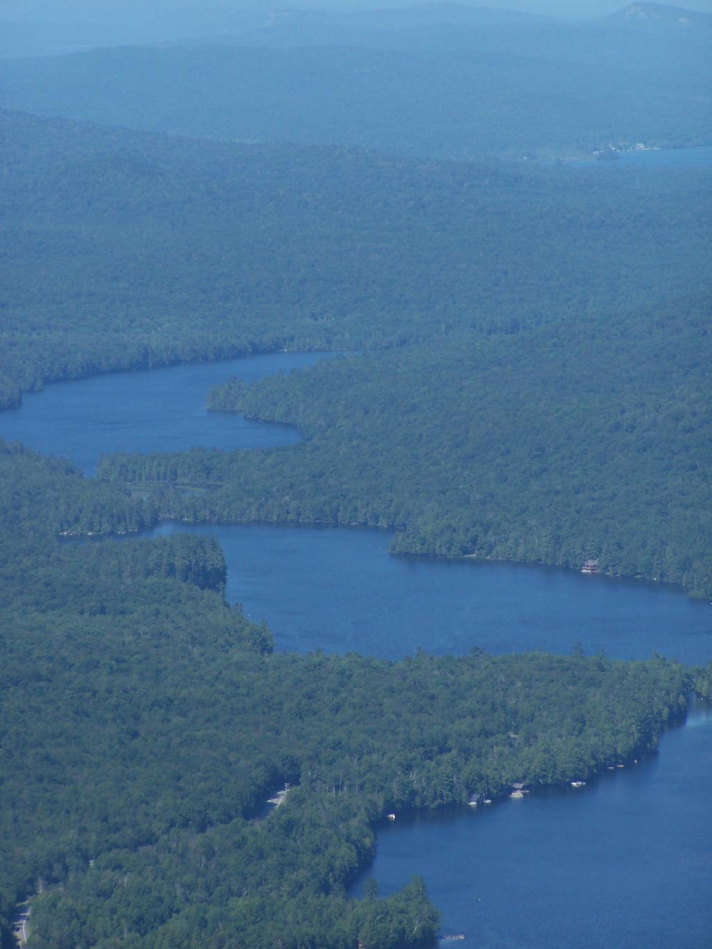
Lake Durant and Moose River Plains
Route 28 paving project to begin this month
"The state has yet to begin a $6.6 million paving project on state Route 28 announced last month with an anticipated starting date only given as “April.”
"The Indian Lake Highway Department confirmed the road reconstruction work, which was the subject of a March 27 public meeting, had not begun as of April 17."
"Gov. Andrew Cuomo’s office announced the paving project, which included rehabilitating 10.5 miles of Route 28 between Indian Lake and Blue Mountain Lake. "
“This key project will help restore a critical North Country corridor, smoothing the ride for tourists and residents while strengthening the roadway for the future,” Cuomo said in a statement.
"Route 28 links the Cedar River Golf Course in Indian Lake with the Lake Durant State Campground and the Adirondack Experience in Blue Mountain Lake. "
Below is a list of lean-tos, campsites, parking areas, and other assets along the Northville – Placid Trail 🏕️
Link to an Interactive Map of the Northville Placid Trail.
| Type | Name | Description | Coordinates |
| Hand Launch | Ceder River Flow Boat Ramp | Hand Carry Launch, Ramp | 43.725826369700904, -74.47289916126694 |
| Lean-To | Beaver Pond (Aka Cedar Lakes Lean-To #2) | 43.625969396804386, -74.54927150370021 | |
| Lean-To | Carry Lean-To | 43.67874488347091, -74.49549821879448 | |
| Lean-To | Catlin Bay #1 Lean-To | 43.99801269269887, -74.39278456108421 | |
| Lean-To | Cedar Lakes #1 Lean-To | 43.628125665037935, -74.54047323992656 | |
| Lean-To | Cold River #2 Lean-To | 44.14251664317184, -74.13035824291548 | |
| Lean-To | Cold River #3 Lean-To | 44.091459278051204, -74.25764175084498 | |
| Lean-To | Cold River #4 Lean-To | 44.09139025333258, -74.25573480252505 | |
| Lean-To | Cold River Lean-To #1 Lean-To | 44.14272737628489, -74.12984021065587 | |
| Lean-To | Duck Hole #1 Lean-To | 44.14162687400988, -74.10693734676616 | |
| Lean-To | Duck Hole #2 Lean-To | 44.14167686466829, -74.10654354672256 | |
| Lean-To | Hamilton Lake Stream #1 Lean-To | 43.39741359517532, -74.45529759002217 | |
| Lean-To | Hidden Cove Lean-To | 44.00265528819394, -74.38648026325164 | |
| Lean-To | Kelly Point #1 Lean-To | 44.02880023617087, -74.36730798599064 | |
| Lean-To | Kelly Point #2 Lean-To | 44.02870256717196, -74.36713034867948 | |
| Lean-To | Moose Pond Lean-To | 44.182843382402666, -74.07364102375995 | |
| Lean-To | Mud Lake Lean-To | 43.342671073157994, -74.45629078563864 | |
| Lean-To | O’neill Flow Lean-To | 43.875596840936154, -74.36642623697053 | |
| Lean-To | Ouluska Pass Brook Lean-To | 44.120221281603584, -74.18744717390932 | |
| Lean-To | Plumley Point #2 Lean-To | 44.06559891610762, -74.32761224546002 | |
| Lean-To | Rodney Point #1 Lean-To | 44.04140938489936, -74.35014909639557 | |
| Lean-To | Rodney Point #2 Lean-To | 44.042976745412616, -74.34933464753136 | |
| Lean-To | Seward Lean-To | 44.106244137686204, -74.2091536427719 | |
| Lean-To | Silver Lake Lean-To | 43.29193545679836, -74.4237351676776 | |
| Lean-To | South Lake Lean-To | 43.58724480971, -74.62157883837274 | |
| Lean-To | Spruce Lake #1 Lean-To | 43.52728411257782, -74.6099246975027 | |
| Lean-To | Spruce Lake #2 Lean-To | 43.53463062983387, -74.60808580306896 | |
| Lean-To | Spruce Lake #3 Lean-To | 43.53712972792447, -74.60820962802477 | |
| Lean-To | Stephens Pond Lean-To | 43.818673668554965, -74.42052487172707 | |
| Lean-To | Tirrel Pond North Lean-To | 43.887344477557306, -74.37880062606054 | |
| Lean-To | West Canada Creek Lean-To | 43.58698761405157, -74.61399797100106 | |
| Lean-To | West Lake #1 Lean-To | 43.59316222884976, -74.62688668431306 | |
| Lean-To | West Stony Creek Lean-To | 43.22474428954461, -74.26933345717664 | |
| Paved Parking Lot | Lake Durant Northville Placid Trail Parking Lot | Paved, 12 Vehicle Capacity | 43.84219550506574, -74.3862742856788 |
| Paved Parking Lot | Northville Lake Placid Trail Parking Lot | Paved, Good Condition | 43.84213270187873, -74.38656792328511 |
| Primitive Tent Site | Canary Pond Campsite | 43.30513256312245, -74.4472062440692 | |
| Primitive Tent Site | Cedar Lake Dam 1 | 43.62894580965635, -74.53639939387939 | |
| Primitive Tent Site | Cedar Lake Dam Tentsite | 43.62937624507422, -74.53679785644344 | |
| Primitive Tent Site | Cedar River Flow Tentsite | 43.70292480315104, -74.48713041165333 | |
| Primitive Tent Site | Fall Stream Tentsites | 43.49661052800474, -74.53713112743992 | |
| Primitive Tent Site | Jessup River Tentsites | 43.51246207852797, -74.57229710138834 | |
| Primitive Tent Site | Kelly Point Tentsites | 44.02910364406153, -74.36670207204214 | |
| Primitive Tent Site | Moose Pond Tentsites | 44.18274441156179, -74.07408240028583 | |
| Primitive Tent Site | Moose River Plains Campsite 01 | Live | 43.72667672123972, -74.47410026642402 |
| Primitive Tent Site | Moose River Plains Campsite 02 | Live | 43.72665150100841, -74.47331107300782 |
| Primitive Tent Site | Moose River Plains Campsite 03 | Live | 43.725959512295866, -74.47389996564202 |
| Primitive Tent Site | Moose River Plains Campsite 04 | Live | 43.726067692208126, -74.47423264719026 |
| Primitive Tent Site | Moose River Plains Campsite 05 | Live | 43.725563790898704, -74.47417512282912 |
| Primitive Tent Site | Moose River Plains Campsite 06 | Live | 43.72522313374867, -74.47458303719159 |
| Primitive Tent Site | Mud Lake Tentsites | 43.59647433847274, -74.61354076182431 | |
| Primitive Tent Site | O’neill Flow Tentsite | 43.87567135918534, -74.3666467203306 | |
| Primitive Tent Site | Rock Lake Campsite | 43.265591839994535, -74.41543516012669 | |
| Primitive Tent Site | Salmon River Tentsites | 43.907925071619914, -74.38530801916977 | |
| Primitive Tent Site | Shattuck Clearing Tentsites | 44.08679657756681, -74.26368397541134 | |
| Primitive Tent Site | Silver Lake Tent Site | 43.29112770008321, -74.4240469986026 | |
| Primitive Tent Site | Spruce Lake Tentsite | 43.53695545329776, -74.60818912022354 | |
| Primitive Tent Site | Tirrell Pond North Tentsites | 43.88594343639596, -74.37834897628142 | |
| Primitive Tent Site | Trailside Campsite | 43.2716741112023, -74.43107546264162 | |
| Primitive Tent Site | Wanika Falls Tentsites | 44.19944690357389, -74.05663862305364 | |
| Primitive Tent Site | West Lake Former Caretaker Clearing Tentsites | 43.59389874347195, -74.62560220247346 | |
| Primitive Tent Site | Whitehouse Campsite | 43.373430193527696, -74.43578942968477 | |
| Primitive Tent Site | Whitehouse Campsite | 43.37406302094423, -74.43516794694158 | |
| Primitive Tent Site | Woods Lake Campsite #2 | Fire Pit, Water Front Campsite | 43.25071034607129, -74.31177480398298 |
| Primitive Tent Site | Woods Lake Campsite #3 | Fire Ring, Water Front Tentsite, Scenic View | 43.250888826581715, -74.31104030228295 |
| Primitive Tent Site | Woods Lake Campsite #4 | Fire Place, Water Front Campsite, Nice View | 43.251811433787196, -74.3092782205918 |
| Unpaved Parking Lot | Benson Road Parking Area | 8 Vehicle Capacity | 43.24745928673895, -74.31187044250609 |
| Unpaved Parking Lot | Chubb River Bridge | 44.2628824981147, -74.01364844250504 | |
| Unpaved Parking Lot | Moose River Recrieation Area | Northville-Placid And Cedar River Trails | 43.726457025366315, -74.47386984656715 |
| Unpaved Parking Lot | Norhtville Placid Parking-Haskells Rd | 43.45841038153893, -74.52201705350714 | |
| Unpaved Parking Lot | Northville Placid Trail Parking Area | 6 Car Interior Parking Area | 43.21330828950083, -74.2083824784703 |
| Unpaved Parking Lot | Northville Placid Trail Route 28n Parking Lot | 43.97584466308438, -74.39296138679799 | |
| Unpaved Parking Lot | Tarbell Road Shoulder Parking Lot | 43.984346733793245, -74.39813014848872 | |
| Unpaved Parking Lot | Wakely Dam | 43.72640808237045, -74.47425964611213 | |
| Unpaved Parking Lot | Wakely Mountain Trailhead Parking Lot | 1250 Sq Feet | 43.732197733217824, -74.47253968128065 |
| Unpaved Parking Lot | Wakely Pond Accessible Fishing Dock | 43.737643556916666, -74.46542853470272 | |
| Unpaved Parking Lot | Wakely Pond Accessible Launch | 43.738042554833534, -74.46399313053813 |
Blue Mountain Fire Tower
There is a fire tower on the mountain overlooking Blue Mountain Lake. It has some interesting views, and can be checked out by driving just north of Blue Mountain Lake on NY 30. It is one of the most popular hikes in the Adirondacks, and many people also visit Moose River Plains or the Adirondack Museum after hiking the tower.
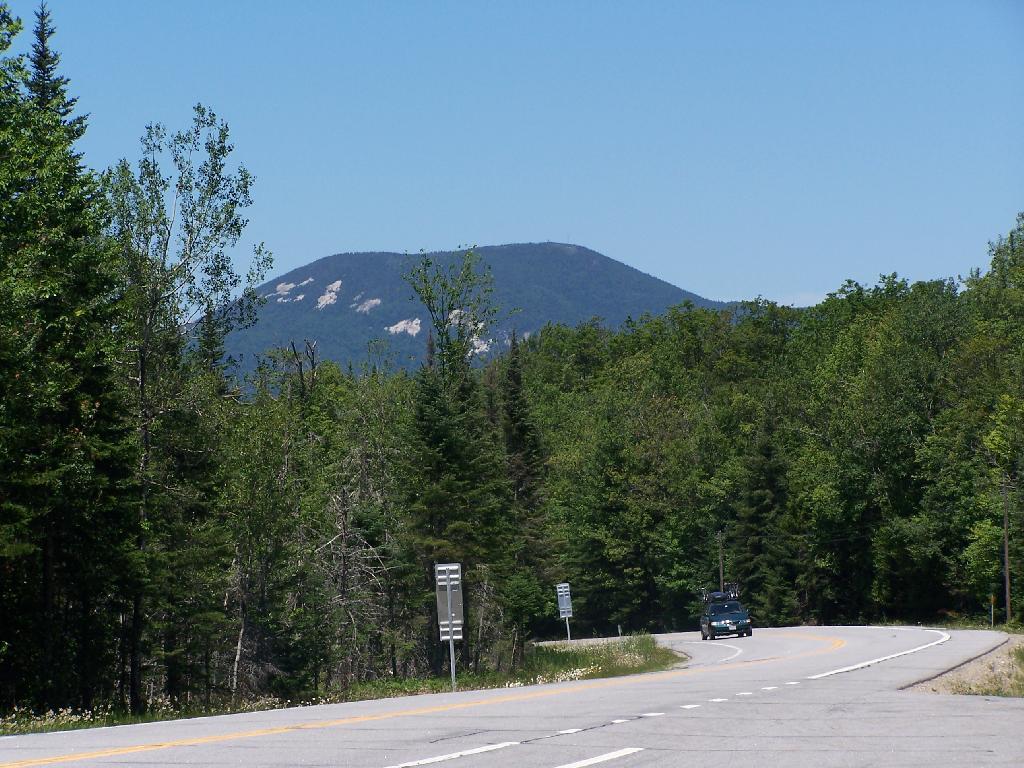
Here is Blue Mountain heading North on NY 28.
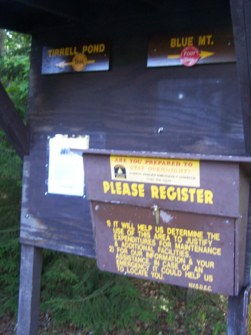
The registration box at the bottom of the mountain.
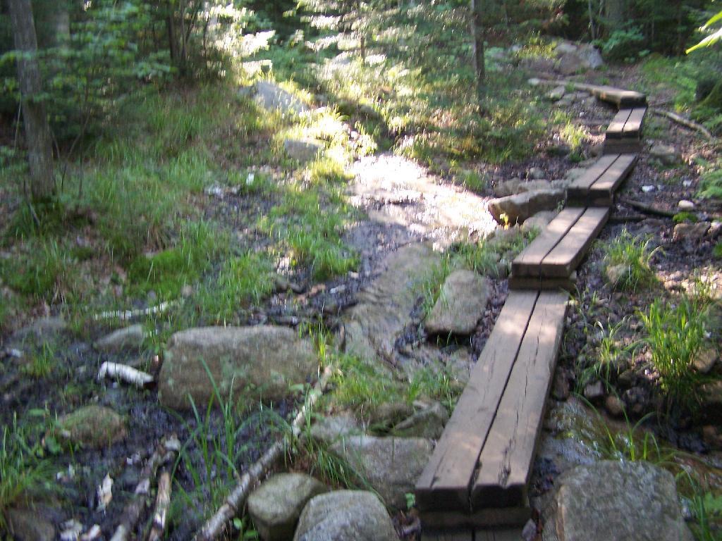
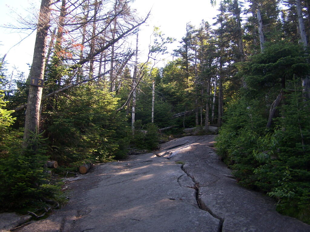
The trail is well maintained, despite it’s extensive use, with board walks across muddy locations.
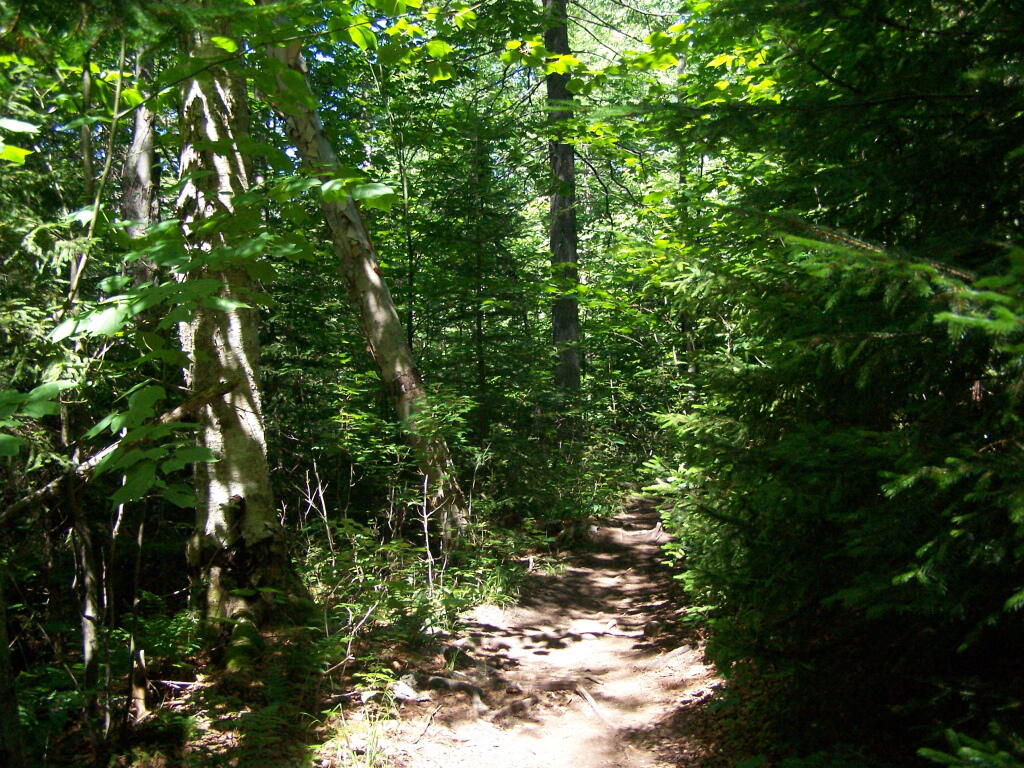
The first part of the trail is relatively flat for a while, then gets steep for a bit.
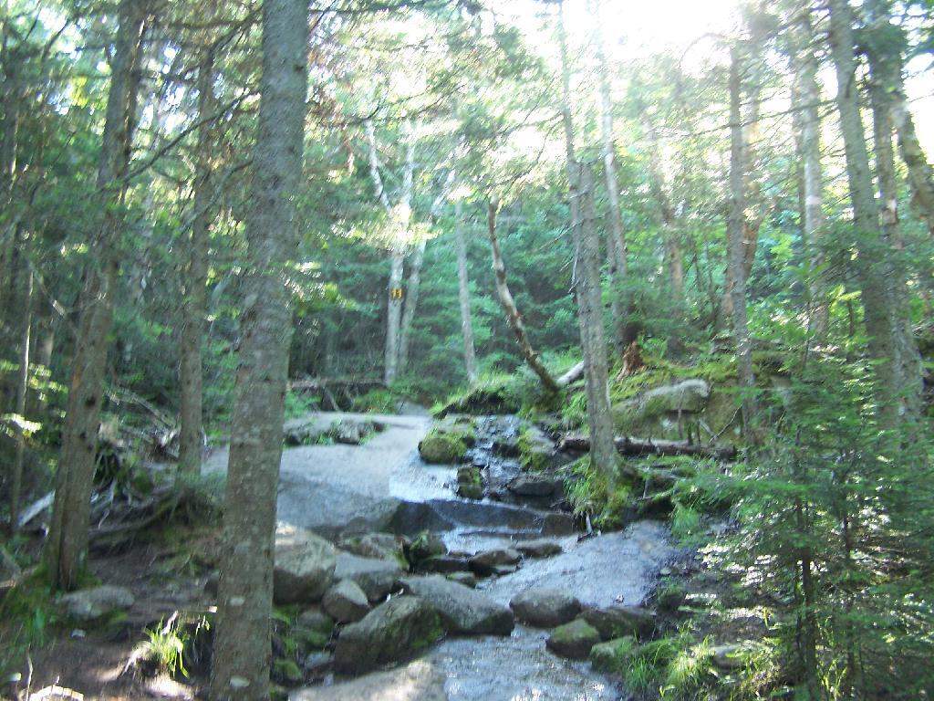
A lot of the lower part of the mountain was rocky with lots little rocks to step over.
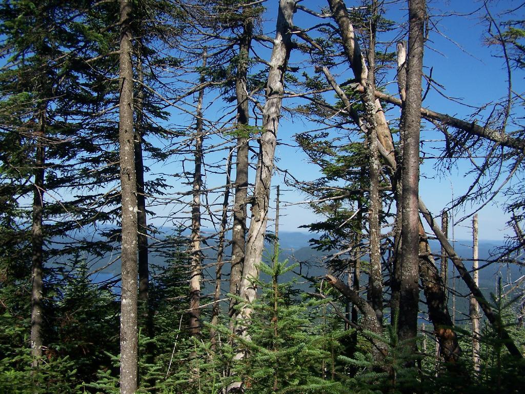
About halfway up the mountain you get partial views down the mountain.
Eventually the mountain opens up a little, and your walking on exposed granite, steep, but not too steep.
Once your almost to the top, you can look back and see Blue Mountain Lake through the trees.
You reach the top of the mountain, and there is a gradual ascent, as you cross to the eastern side of the mountain, where the summit and the tower is located. Finally, you see the tower through the trees.
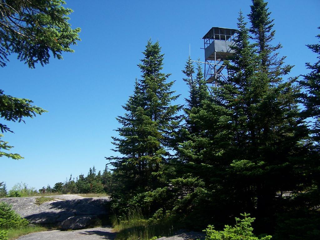
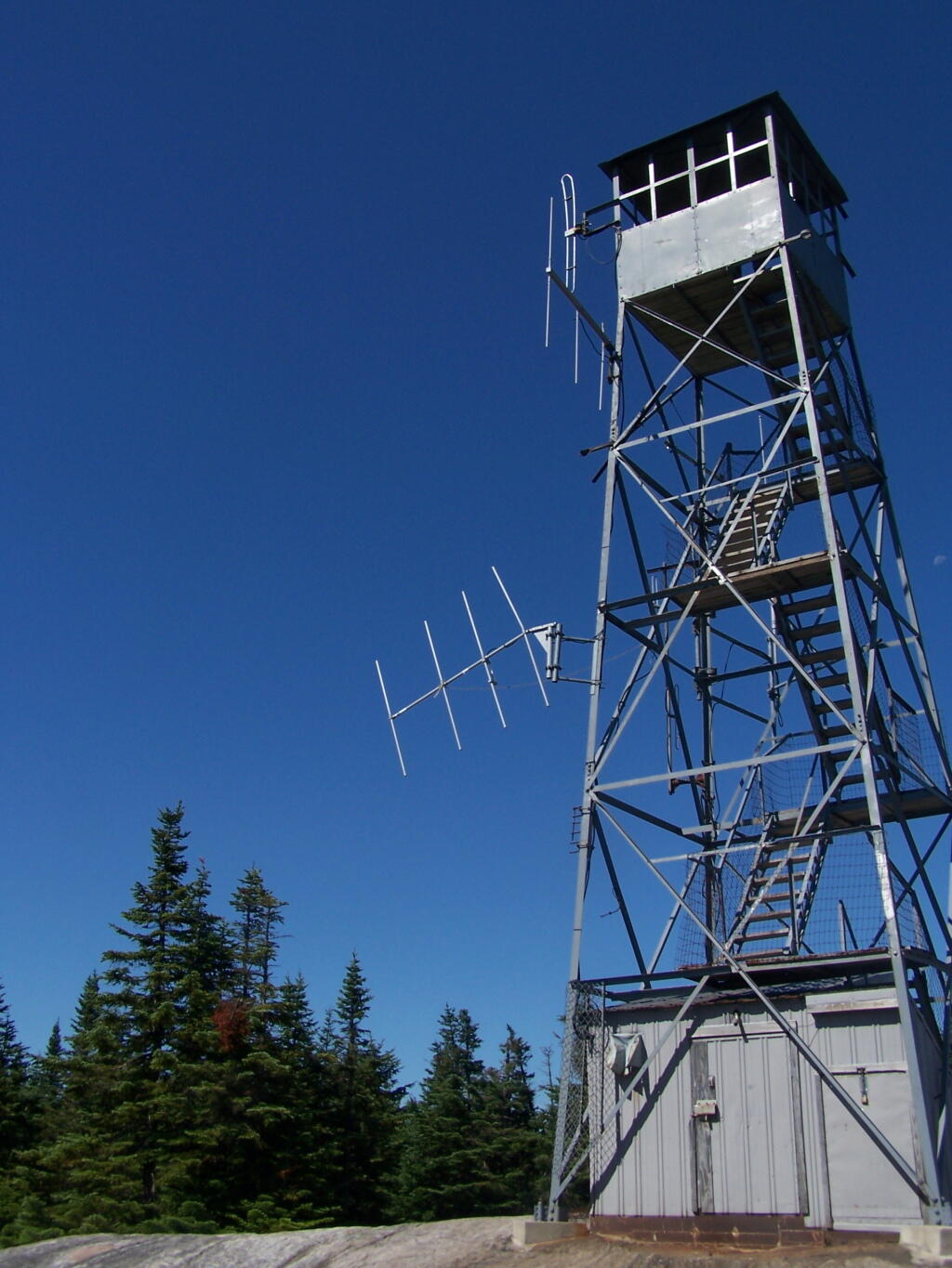
The tower is a relatively short 50 or 60 foot, but it’s plenty high to get good views of the surrounding landscape.
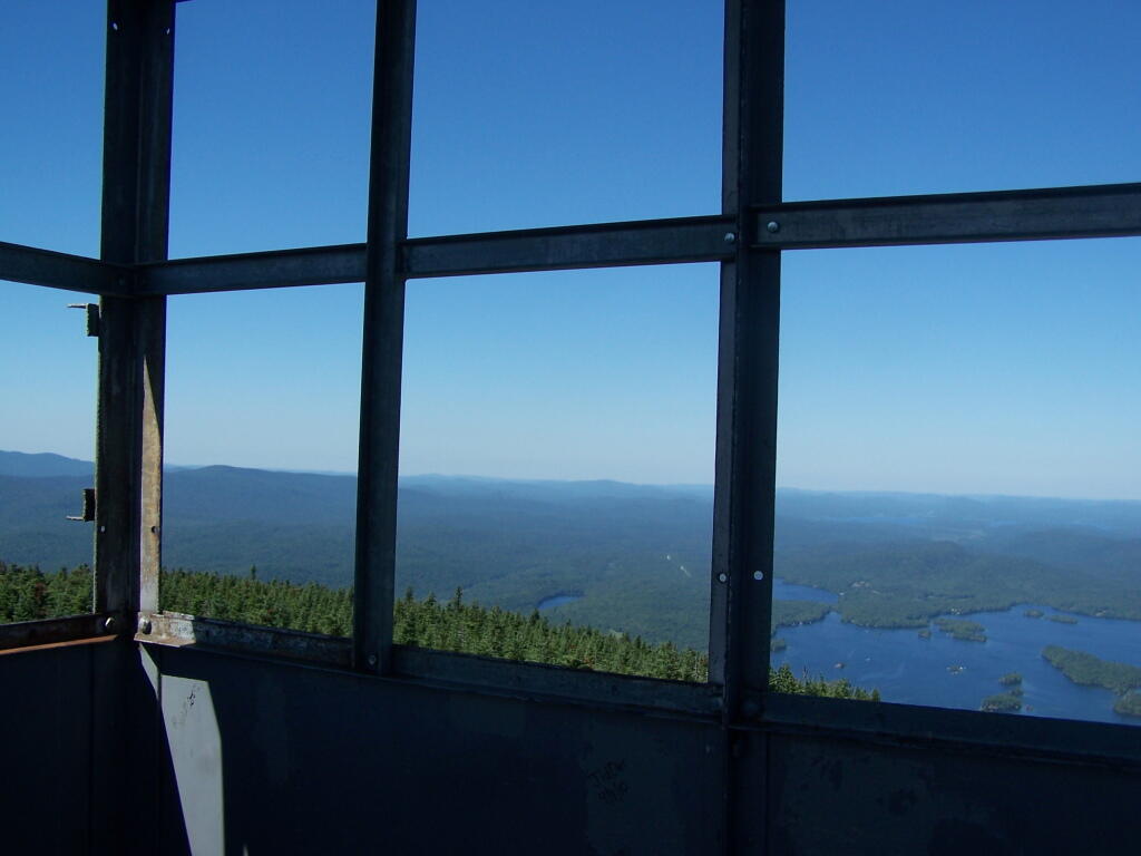
Looking out to the Tower windows.
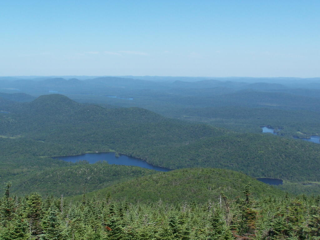
Blue Mountain Lake from the fire tower.
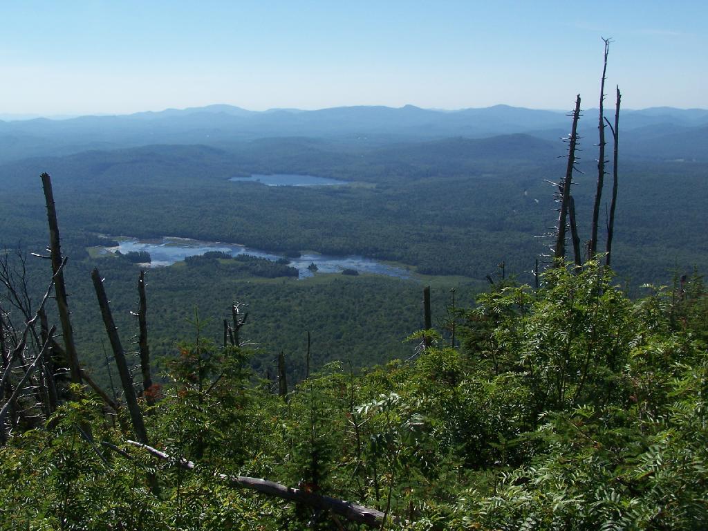
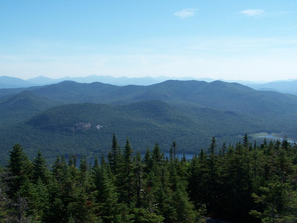
Moose River Plains to the south-west of the tower.
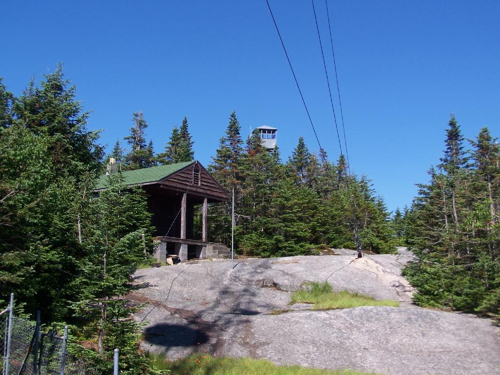
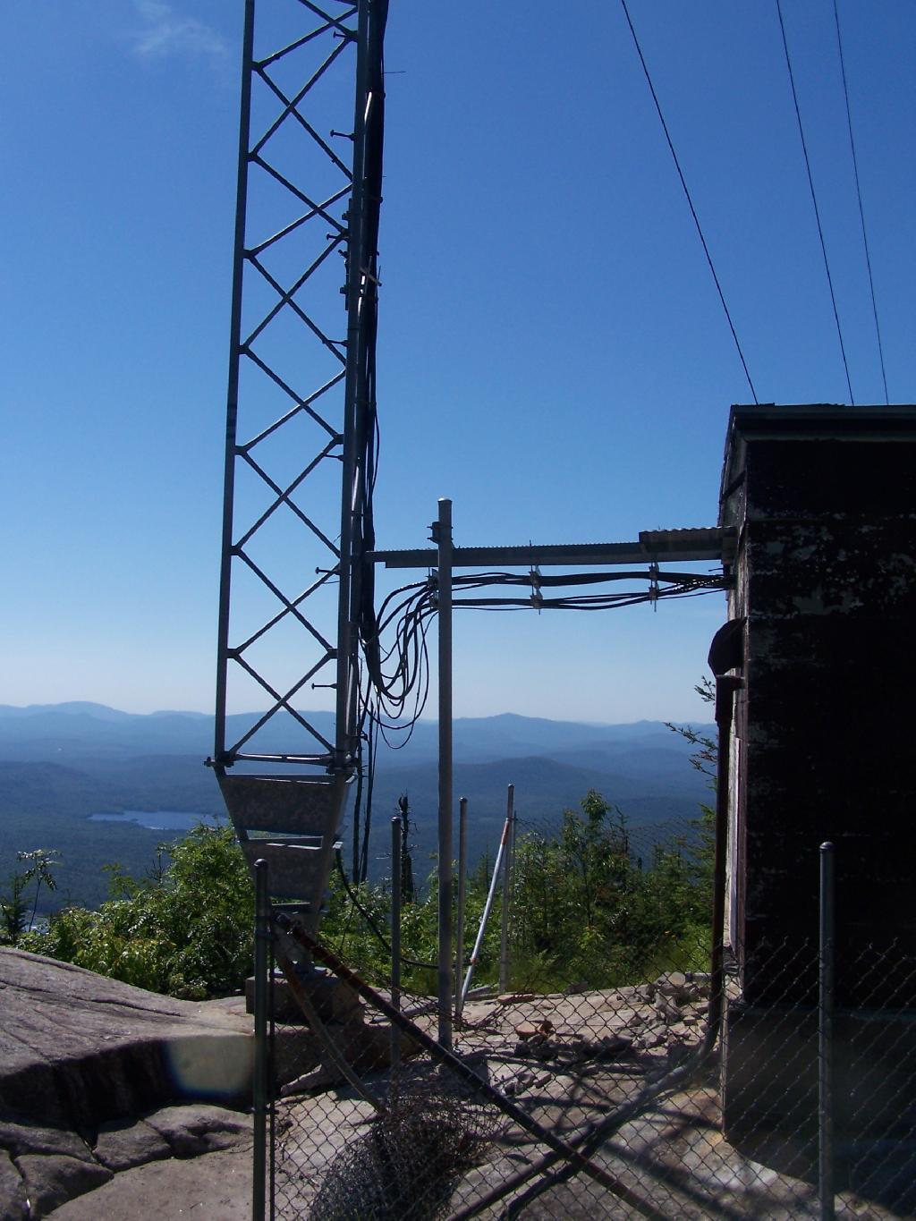
On the eastern side of the mountain, there is a radio tower and the old ranger’s cabin.
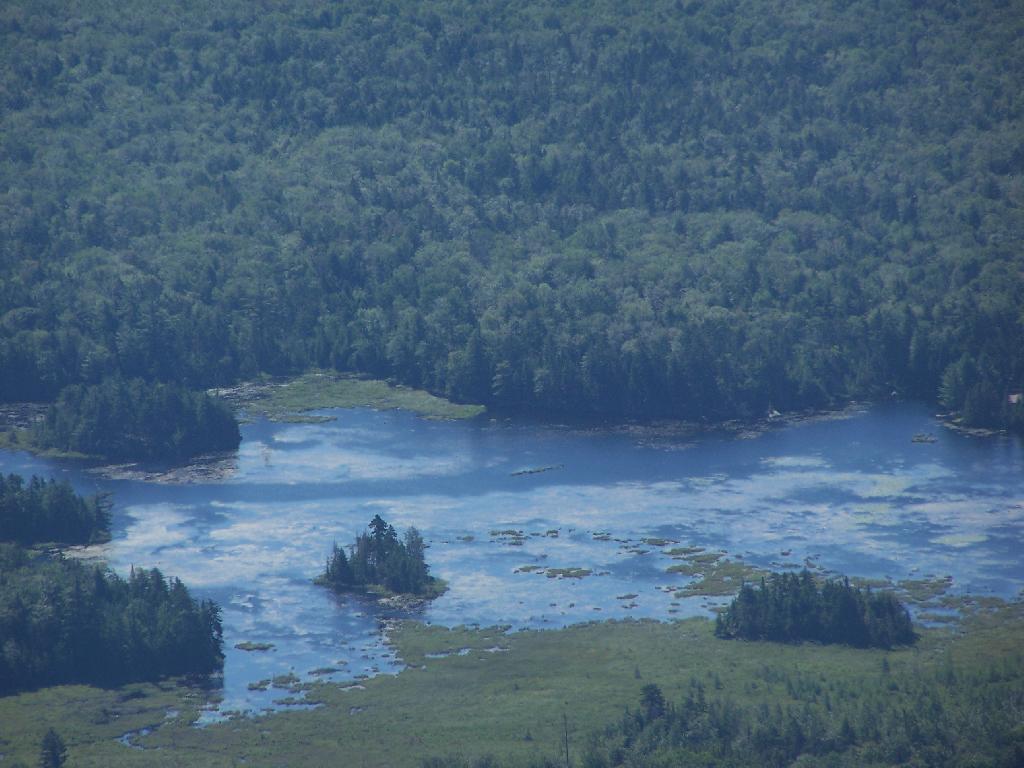
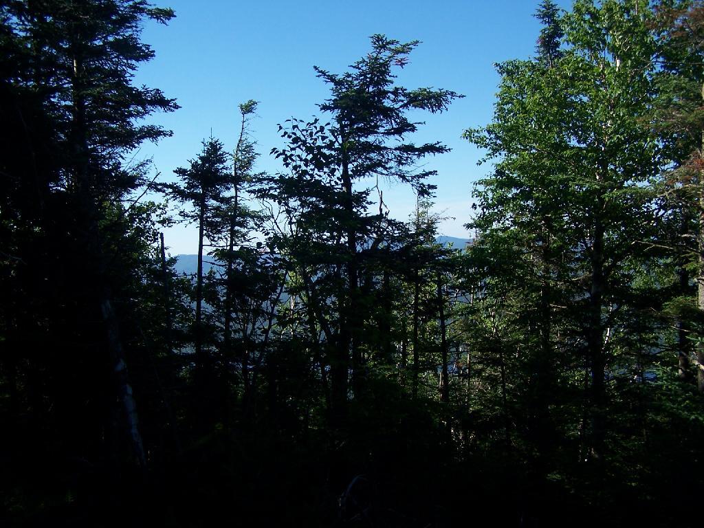
From the eastern side, their is a ledge, where you can see and look down towards like Lake Durant and Moose River Plains.

The radio tower up close, with the fence broken down around it. I didn’t hear radio signals in my ears, despite being so close to this big radio tower.
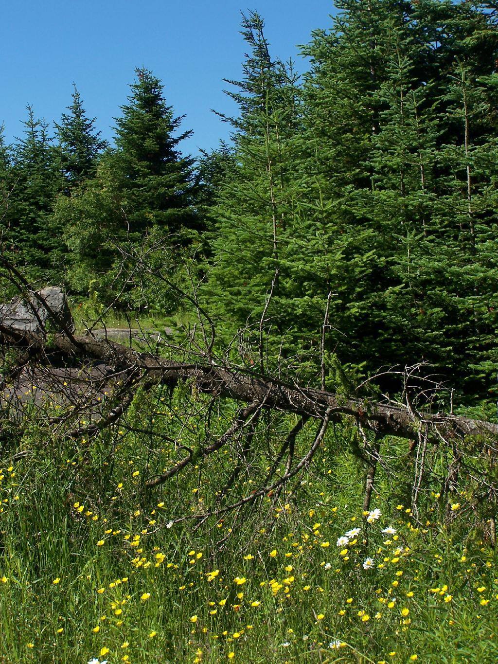
Flowers on the top of the mountain.
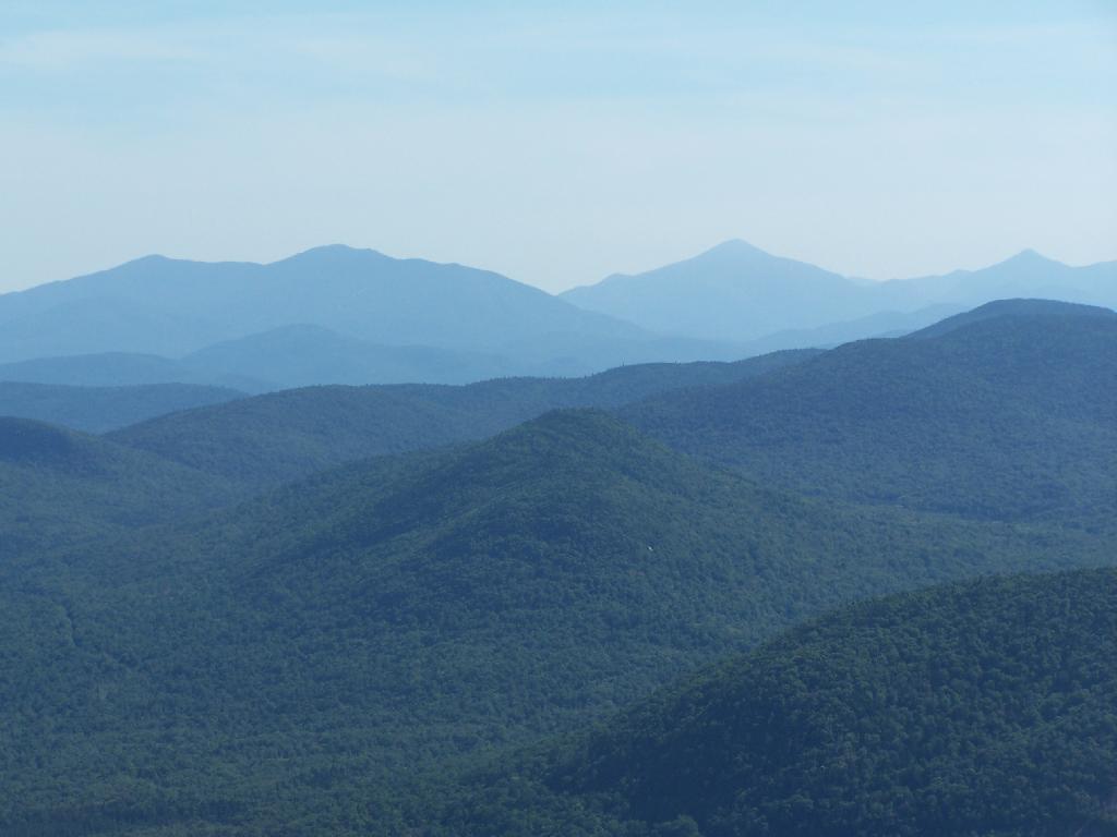
To the north-east there are views of the High Peaks Mountains. They probably woudln’t be as clear on a hazy day.
Tirnell Mountain is privately owned to the east, and you can see some active logging on it.
Seventh and Eight Lake as seen from Blue Mountain.
Here is a map of the hike.
USGS Topographic Maps – Dutchess to Livingston Counties
Counties: Albany to Delaware / Dutchess to Livingston / Madison to Otsego / Putnam to Suffolk / Sullivan to Yates
Browse Topographic Maps: Full State / Historical USGS Topographic Maps


