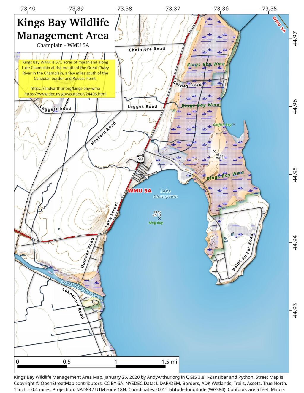
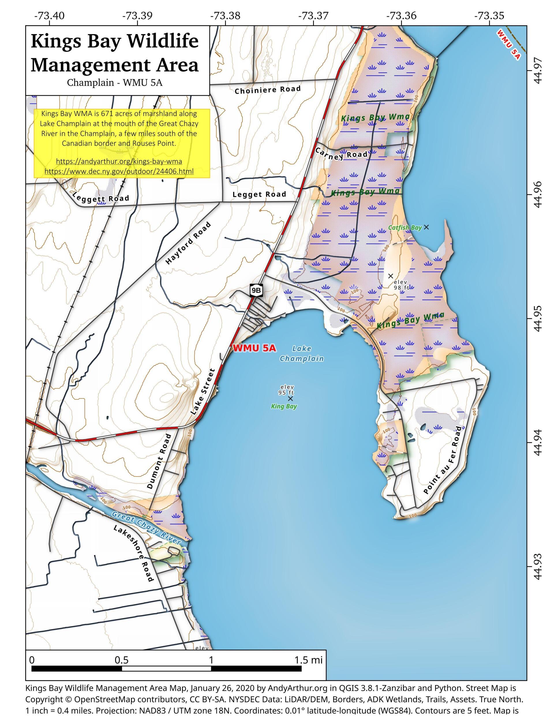
Map: Kings Bay Wildlife Management Area
Download a High Resolution JPEG Image of the Kings Bay Wildlife Management Area or an Adobe Acrobat Printable PDF of the Kings Bay Wildlife Management Area.
About Map: Kings Bay Wildlife Management Area ....
44.9476247151871,-73.37497692301642
Kings Bay WMA is 671 acres of marshland along Lake Champlain at the mouth of the Great Chazy River in the Champlain, a few miles south of the Canadian border and Rouses Point.
https://andyarthur.org/kings-bay-wma
https://www.dec.ny.gov/outdoor/24406.html

Bookmark my free Interactive GPS Map for your phone:
https://andyarthur.org/ny
... shows your location as a blue dot in relationship to campsites, trails, state land. This online map requires cell service, won't work in remote country, so also bring a paper map.
Free Download of New & Historical USGS 1:24k Topograpic Maps
Interactive maps with backcountry and roadside camping: New York, Pennsylvania, West Virginia & Vermont. List of NYS DEC Lean-Tos and Firetowers.
Google Spreadsheet with Roadside, Primitive and Pay Campsites
More about Kings Bay WMA...
Kings Bay Wildlife Management Area is 683 acres in size and is located on the western shore of the northernmost reach of Lake Champlain, in the Town of Champlain in Clinton County, N.Y. The land was acquired by the state in the 1960's, primarily for waterfowl habitat enhancement.
http://www.dec.ny.gov/outdoor/24406.html
... photos, maps and other content from from Clinton County.